
El Centro, California facts for kids
Quick facts for kids
El Centro, California
|
||
|---|---|---|
| City of El Centro | ||
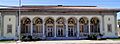
  Top: U.S. Post Office;
Bottom: Imperial County Superior Courthouse |
||
|
||

Location of El Centro in Imperial County, California
|
||

El Centro, California
Location in southern California

El Centro, California
Location in California

El Centro, California
Location in the United States
|
||
| Country | ||
| State | ||
| County | ||
| Incorporated | April 16, 1908 | |
| Area | ||
| • Total | 11.86 sq mi (30.72 km2) | |
| • Land | 11.84 sq mi (30.67 km2) | |
| • Water | 0.02 sq mi (0.05 km2) 0.16% | |
| Elevation | -42 ft (-12 m) | |
| Population
(2020)
|
||
| • Total | 44,322 | |
| • Density | 3,722.26/sq mi (1,437.12/km2) | |
| Time zone | UTC-8 (Pacific (PST)) | |
| • Summer (DST) | UTC-7 (PDT) | |
| ZIP codes |
92243-92244
|
|
| Area codes | 442/760 | |
| FIPS code | 06-21782 | |
| GNIS feature IDs | 1656501, 2410409 | |

El Centro is a city in Imperial County, California, United States. Its name means "The Center" in Spanish. It is the biggest city in the Imperial Valley. El Centro is also the largest U.S. city that is completely below sea level.
The city is in southeastern California. It is about 113 miles (182 km) from San Diego. It is also less than 20 miles (32 km) from Mexicali, a city in Mexico.
El Centro was started in 1906 by W. F. Holt and C.A. Barker. They bought the land and invested money to build the city. Today, El Centro is known for its shops, transportation, and farming. There are also two border crossings nearby that connect to Mexico. In 2020, about 44,322 people lived in El Centro.
Contents
History of El Centro
.jpg)
Spanish explorers were some of the first Europeans to visit the El Centro area. Melchor Díaz came in 1540. Later, Juan Bautista de Anza explored the area in 1776. An elementary school in El Centro is named after him.
After the Mexican–American War, the northern part of the valley became part of the U.S. The southern part stayed with Mexico. People started settling in the area in the early 1800s. But most permanent settlements began after 1900.
The Imperial Valley was originally part of San Diego County. Farmers moved here when water from the Colorado River was brought in. Canals, like the Alamo Canal, helped irrigate the desert land.
In 1906, W. F. Holt and C.A. Barker bought the land that became El Centro. The next year, in 1907, Imperial County was created from San Diego County. By then, much of the valley had enough water for farming.
Before El Centro was a town, the railroad had a station there called Cabarker. This name honored C.A. Barker. The first post office in El Centro opened in 1905.
The city grew very quickly. By 1910, 1,610 people lived there. By 1920, the population was 5,646. El Centro became the county seat of Imperial County. This helped it grow faster.
In 1940, El Centro had a strong earthquake. It was a 7.1 magnitude earthquake. The city's population kept growing through the 1940s. By the mid-1940s, about 11,000 people lived in El Centro. It became the second-largest city in the Imperial Valley.
Farming has always been important in El Centro. Many growers and shippers still work here. This is because of the city's location near rail lines and highways. By the 1980s, government jobs and retail became very important too. El Centro became a main center for business and administration in the region.
The Imperial Valley Mall opened in 2005. It is on the southeast side of the city.
Fun Places to Visit

The Algodones Dunes are nearby. They are the biggest sand dunes in the U.S. Thousands of people visit them each year. They mainly come for off-road driving.
The Salton Sea is about 30 miles (48 km) north of El Centro. If you like water sports, the Colorado River is about 50 miles (80 km) to the east.
The Naval Air Facility El Centro is 10 miles (16 km) west. It hosts the yearly Blue Angels flight show. This is a famous air show with amazing stunts.
You can also visit Mexicali, Baja California, Mexico. It is only 10 miles (16 km) away. Mexicali has museums, a zoo, and a sports center.
Geography and Climate
Where is El Centro?

El Centro is in the Imperial Valley. The city is about 50 feet (15 m) below sea level. This makes it the largest U.S. city below sea level. The Imperial Valley is part of the Colorado Desert. This desert is an extension of the larger Sonoran Desert.
Farms in the area get their water from canals. These canals bring water from the nearby Colorado River. The Salton Sea was formed after a big flood from the Colorado River in 1905.
The 1940 El Centro earthquake was very strong. It was a 6.9 magnitude earthquake. This earthquake was important because it was the first major one recorded by special equipment. Scientists studied it a lot. The area around El Centro has many earthquakes. This is because it is where different parts of the Earth's crust meet.
What is the Weather Like?
El Centro has a very hot desert climate. It has long, extremely hot summers. The winters are mild. El Centro gets over 350 days of sunshine each year. It receives less than 3 inches (76 mm) of rain annually.
In winter, temperatures are usually in the 60s °F (10s °C). Nights can drop to the low 40s °F (0s °C). June is usually the driest month with no rain. Summer days can get well above 100 °F (38 °C). Nights stay warm, in the high 70s °F (20s °C).
Sometimes, humid air from the Gulf of California comes into the valley. This makes the summer heat feel even stronger. It can also cause daily thunderstorms. These storms can bring hail, heavy rain, lightning, and dust storms called Haboob.
During hurricane season, leftover storms from the Pacific Ocean can bring heavy thunderstorms. This can cause more rain than usual. For example, Hurricane Hilary (2023) brought a lot of rain.
Winter rain usually comes from occasional storms. These storms can bring cold temperatures to El Centro. They also bring snow to the nearby mountains.
Snow is very rare in El Centro. But on December 12, 1934, a big winter storm brought snow to the desert floor. About 1 to 4 inches (25 to 102 mm) of snow fell. Another time, in December 1967, there was a mix of sleet and hail.
| Climate data for El Centro, California, 1991–2020 normals, extremes 1932–present | |||||||||||||
|---|---|---|---|---|---|---|---|---|---|---|---|---|---|
| Month | Jan | Feb | Mar | Apr | May | Jun | Jul | Aug | Sep | Oct | Nov | Dec | Year |
| Record high °F (°C) | 90 (32) |
93 (34) |
102 (39) |
109 (43) |
116 (47) |
121 (49) |
122 (50) |
122 (50) |
120 (49) |
113 (45) |
98 (37) |
95 (35) |
122 (50) |
| Mean maximum °F (°C) | 80.1 (26.7) |
83.7 (28.7) |
91.9 (33.3) |
98.9 (37.2) |
104.7 (40.4) |
111.8 (44.3) |
115.0 (46.1) |
114.2 (45.7) |
110.6 (43.7) |
102.6 (39.2) |
90.8 (32.7) |
79.6 (26.4) |
116.4 (46.9) |
| Mean daily maximum °F (°C) | 71.0 (21.7) |
74.0 (23.3) |
80.3 (26.8) |
86.4 (30.2) |
93.8 (34.3) |
102.9 (39.4) |
106.9 (41.6) |
106.7 (41.5) |
102.2 (39.0) |
91.7 (33.2) |
79.2 (26.2) |
69.6 (20.9) |
88.7 (31.5) |
| Daily mean °F (°C) | 57.2 (14.0) |
60.3 (15.7) |
65.9 (18.8) |
71.5 (21.9) |
78.6 (25.9) |
86.8 (30.4) |
92.5 (33.6) |
93.0 (33.9) |
87.6 (30.9) |
76.7 (24.8) |
64.9 (18.3) |
56.2 (13.4) |
74.3 (23.5) |
| Mean daily minimum °F (°C) | 43.4 (6.3) |
46.7 (8.2) |
51.6 (10.9) |
56.7 (13.7) |
63.3 (17.4) |
70.7 (21.5) |
78.0 (25.6) |
79.3 (26.3) |
73.0 (22.8) |
61.7 (16.5) |
50.7 (10.4) |
42.8 (6.0) |
59.8 (15.4) |
| Mean minimum °F (°C) | 34.5 (1.4) |
37.6 (3.1) |
41.9 (5.5) |
47.7 (8.7) |
53.7 (12.1) |
61.4 (16.3) |
70.2 (21.2) |
70.1 (21.2) |
63.4 (17.4) |
51.1 (10.6) |
40.2 (4.6) |
33.6 (0.9) |
32.2 (0.1) |
| Record low °F (°C) | 14 (−10) |
22 (−6) |
21 (−6) |
33 (1) |
36 (2) |
42 (6) |
52 (11) |
54 (12) |
48 (9) |
33 (1) |
24 (−4) |
22 (−6) |
14 (−10) |
| Average precipitation inches (mm) | 0.39 (9.9) |
0.43 (11) |
0.29 (7.4) |
0.07 (1.8) |
0.04 (1.0) |
0.00 (0.00) |
0.08 (2.0) |
0.23 (5.8) |
0.25 (6.4) |
0.21 (5.3) |
0.17 (4.3) |
0.37 (9.4) |
2.53 (64) |
| Average precipitation days (≥ 0.01 in) | 1.7 | 2.5 | 1.7 | 0.6 | 0.3 | 0.1 | 0.6 | 1.1 | 0.9 | 0.7 | 0.9 | 1.9 | 13.0 |
| Source 1: NOAA | |||||||||||||
| Source 2: National Weather Service | |||||||||||||
Economy and Jobs

Many people in El Centro work for the local, state, and federal governments. There are also two prisons nearby that provide jobs. The U.S. Border Patrol station also employs many people.
El Centro is surrounded by many farms. They grow carrots, lettuce, and other crops. This makes farming a very important part of El Centro's economy. The area produces over $1 billion in crops each year. Farming accounts for almost half of all jobs in Imperial County.
Because El Centro is the main business center of Imperial County, many jobs are in service and retail. This includes jobs in stores and other businesses that serve people.
The Imperial County area is also becoming popular for filming movies. Its desert environment and closeness to Los Angeles make it a good spot. Movies like Return of the Jedi and American Sniper have filmed scenes in the sand dunes outside the city.
Parks and Fun Activities
City Parks
El Centro has many parks where you can play and relax:
- Bucklin Park
- Swarthout Field
- Stark Field
- Countryside Park
- Legacy Park
- Farmers Park
- Lotus Park
- Plank Park
- First Responders Park
- Sunflower Park
- Carlos Aguilar Park
- Debbie Pitman Park
- Gomez Park
- McGee Park
Culture and Community

Most people in El Centro are of Hispanic background. But the city has a diverse population with many different interests.
In winter, people enjoy racing four-wheel-drive vehicles on the nearby sand dunes. In the hot summer, people often stay indoors. Spanish is a common language spoken by residents and on the radio. Many people in the area live in both the United States and Mexico. They often cross the border to visit family or for work.
Education in El Centro
El Centro has several school districts. These include McCabe Union Elementary School District, El Centro School District, and Central Union High School District.
The city has many schools for different age groups:
Elementary Schools
- De Anza Magnet School
- Desert Gardens Elementary School
- Harding Elementary School
- Hedrick Elementary School (named after Margaret Hedrick, a teacher for 55 years)
- King Elementary School
- Lincoln Elementary School
- McCabe Elementary School
- McKinley Elementary School
- Meadows Elementary School
- Sunflower Elementary
- Washington Elementary School
- St. Mary's Catholic School
Middle and Junior High Schools
- Corfman Middle School (Grades 4–8)
- Kennedy Middle School
- Wilson Junior High
- St. Mary's Catholic School
High Schools
The Central Union High School District has two main high schools and one alternative school. About 3,450 students attend these schools.
- Central Union High School (This school is very old, celebrating its 100th birthday in 2008.)
- Desert Oasis High School
- Southwest High School (Its theater is named after Jimmie Cannon, a local musician.)
Colleges and Universities
For college, students can go to Imperial Valley College. This is a two-year college. There is also a branch of San Diego State University in nearby Calexico. This campus offers bachelor's and master's degrees.
Getting Around El Centro
Highways
Three main highways serve El Centro:
- Interstate 8 connects El Centro to San Diego in the west and Yuma, Arizona in the east.
- State Route 86 and State Route 111 go north to Brawley. They then run along the Salton Sea on their way to the Coachella Valley.
- Going south from El Centro, State Route 86 ends at State Route 111. State Route 111 goes to Calexico and Mexicali, Mexico.
Public Transportation

Imperial Valley Transit (IVT) provides public bus service in the area. IVT started in 1989 with only a few buses. Now, it serves over 73,000 people each month.
You can also take a bus from El Centro to Winterhaven, California and Yuma, Arizona. This service is part of a partnership between different transportation groups.
Greyhound Lines also offers bus service to other cities from El Centro.
Airports
- Imperial County Airport is in nearby Imperial.
- Naval Air Facility El Centro is an airport used by the U.S. Navy.
- Douthitt Strip Airport is a private airport that used to be a military airfield.
Famous People from El Centro
Many notable people have lived in El Centro:
- Walter Beasley (born 1961), a jazz musician and professor.
- Glenn Cadrez (born 1970), a football player for the Denver Broncos.
- Dino Cazares (born 1966), a heavy metal musician.
- Cher (born 1946), a famous pop musician and actress.
- Roscoe Cook (1939–2011), a track athlete who held world records.
- Doug Harvey (1930–2018), a Major League Baseball Hall of Fame umpire.
- Ken Howard (1944–2016), an actor.
- Donal Logue (born 1966), an actor.
- Emmy Lou Packard (1914–1998), a fine artist and printmaker.
Images for kids
-
U.S. Post Office in El Centro.
-

Imperial County Superior Courthouse at night.
-
Seal of El Centro, California.
-
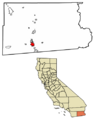
Map showing El Centro's location in Imperial County.
See also
 In Spanish: El Centro (California) para niños
