Gold Coast Broadwater facts for kids
Quick facts for kids Gold Coast Broadwater |
|
|---|---|
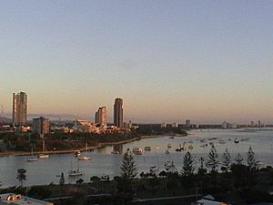
| Southport Broadwater, Gold Coast Harbour, and The Broadwater |
|
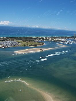
View from a helicopter over Southport across the Broadwater to Main Beach and the Pacific Ocean beyond, 2006
|
|
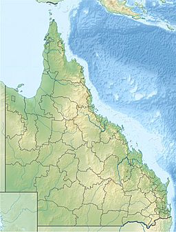
| Location | Gold Coast, South East Queensland |
| Coordinates | 27°57′57″S 153°25′16″E / 27.96583°S 153.42111°E |
| Part of | Moreton Bay Marine Park |
| River sources | Coomera, Nerang, and Pimpama Rivers; Loders, Biggera, Behm, and Wasp Creeks |
| Primary outflows |
|
| Ocean/sea sources | |
| Basin countries | Australia |
| Average depth | 1.74 m (5 ft 9 in) |
| Max. depth | 9 m (30 ft) |
| Salinity | 33 ppt |
| Surface elevation | 2 m (6 ft 7 in) |
| Frozen | never |
| Islands | Crab, Ephraim, Wave Break |
| Settlements | Gold Coast |
The Gold Coast Broadwater is a big, shallow area of water in the Gold Coast, Australia. It's also called the Southport Broadwater or just the Broadwater. This special water area is an estuary, which means it's where a river meets the sea.
The Broadwater connects directly to the Coral Sea through an artificial channel called the Gold Coast Seaway. This seaway helps keep the water flowing smoothly. The Broadwater stretches from Southport in the south all the way up to the southern part of Moreton Bay. Moreton Bay is a UNESCO World Heritage Listed area. The Broadwater is separated from the open ocean by South Stradbroke Island and Southport Spit. It was originally a lagoon formed by the Nerang River. Part of this important water body is protected within the Moreton Bay Marine Park.
Contents
Discover the Gold Coast Broadwater
The Nerang River used to flow into the ocean at Main Beach a long time ago. But by the 1980s, its entrance had moved about 6 kilometers (3.7 miles) north. To fix this, the Gold Coast Seaway was built in 1986. This made the river entrance stable.
The seaway also allows more ocean water to flow in and out with the tides. This means the water level in the Broadwater changes more, with lower low tides. Further north, the Pimpama River also flows into the Broadwater. This large water area is home to many different kinds of marine animals. You can even take Gold Coast Ferries to travel across it. Curlew Island, a home for birds like the Far Eastern curlew, has grown out of the Broadwater over the last 40 years.
The Broadwater has changed a lot since the 1970s. Many artificial waterways and canals have been built around it. These canals make up a huge part of Australia's canal systems. The Gold Coast is growing very fast, and more buildings are expected around the Broadwater.
This area is very important for nature. Some parts of the Broadwater are recognized internationally as a Ramsar site. This means they are important wetlands for birds and other wildlife. It's also a key spot for many migratory birds. The Broadwater provides safe places for important fish species to feed, lay eggs, and grow up.
Many rivers and creeks flow into the Broadwater. These include the Logan, Albert, Coomera, Pimpama, and Nerang Rivers. Smaller creeks like Loders, Biggera, Behm, and Wasp also add water to the estuary.
The most common type of seagrass found here is Zostera muelleri. It grows in the shallower parts of the Broadwater. Other seagrasses, Halophila ovalis and Halophila spinulosa, can be found in the deeper waters.
A Look Back: Broadwater's History
Captain Patrick Logan was the first European to find this southern entrance to Moreton Bay. In the early 1880s, the first Southport Pier opened for people to use. Later, on November 26, 1925, the Jubilee Bridge opened. It was the first bridge in the Broadwater area.
This bridge made it easier to travel between Southport and Main Beach. It replaced the ferry services that used to carry people across the water. In 1966–1967, the Jubilee Bridge was replaced by the Gold Coast Bridge. People often called it the Sundale Bridge because it was near the Sundale Shopping Centre.
The two bridges were built in slightly different places. For a while, both bridges were standing until the older Jubilee Bridge was taken down. The Jubilee Bridge went from Queen Street in Southport to the Southport Yacht Club at Main Beach. The Gold Coast Bridge followed the path of the Gold Coast Highway. Today, the Gold Coast Bridge has a light rail bridge next to it on one side and a pedestrian bridge on the other.
The Gold Coast Seaway was built between 1984 and 1986. In 2015, plans for a large cruise ship terminal and resort on Wave Break Island were not approved by the Queensland Government.
On January 2, 2023, two helicopters carrying tourists had an accident over the Broadwater.
Exploring the Broadwaterway
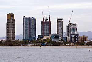
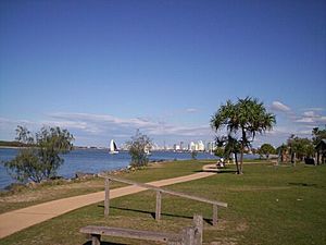
The Broadwaterway is a 19-kilometer (12-mile) path along the edges of the Gold Coast Broadwater. It's a great place to walk, bike, and enjoy the views.
The Broadwaterway includes:
- The Spit arm
- The Marine Stadium
- The western Spit foreshores, which have places like Sea World, the Fishing fleet, Marina Mirage, Water Police, Sea Scouts, and the Southport Yacht Club
- Pelican Beach at Main Beach
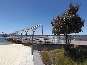
- Southport Broadwater Parklands
- Marine Parade and Harley Park Labrador
- The Broadwater Esplanades of Biggera Waters, Runaway Bay, and Hollywell
- Paradise Point Broadwater Parklands
Fisherman's Wharf was once a popular place for food and fun. It was located where the Versace Hotel is today. It opened in 1983 and closed in 1998.
See also
- List of rivers of Queensland
- Southern Moreton Bay Islands
- Southern Moreton Bay Islands National Park
- Sports on the Gold Coast, Queensland
 | Kyle Baker |
 | Joseph Yoakum |
 | Laura Wheeler Waring |
 | Henry Ossawa Tanner |


