Habitats of the Indiana Dunes facts for kids
The Indiana Dunes are a special place in Northwest Indiana with ten different natural areas, called habitats. Each habitat is home to its own unique mix of plants and animals. You can find these amazing habitats along the southern shore of Lake Michigan.
For a long time, people thought of the Indiana Dunes as just a narrow strip of land along the lake. This includes places like Marquette Park in Gary, the Indiana Dunes State Park, and the Indiana Dunes National Park. These parks help protect the different habitats. But the Indiana Dunes region actually stretches further south, covering a larger area that has been shaped by sand dunes for over 114,000 years!
Contents
What is a Prairie?
A prairie is a wide-open area mostly covered by grasses, with very few trees. In the Indiana Dunes, there are different kinds of prairies. Some are wet, like Hoosier Prairie, and some are dry. The soil can be sandy or silty.
You might spot an eastern bluebird flying over a prairie. Look for beautiful flowers like blazing star and plants like lead plant.
Exploring the Dunes
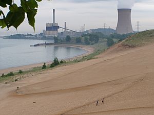
The most famous part of the Indiana Dunes is, of course, the dunes themselves! These are big hills and ridges made of sand. They were formed by the wind blowing and piling up sand along the southern edge of Lake Michigan.
The dunes are home to many different plant communities. You can explore them at places like the West Beach area of the national park (on the Dunes Succession Trail). You can also visit Tremont’s Trail in Indiana Dunes State Park or climb Mt. Baldy in the eastern part of the national park.
Some special animals and plants you might find in the dunes include the spotted sandpiper, the unique pitcher's thistle, and the olympia marblewing butterfly.
Dune and Swale Areas
In the western part of the Indiana Dunes, especially near Gary, you'll find a special landscape called "dune and swale." This area has long, low sand ridges that run parallel to the Lake Michigan shoreline. Between these ridges are lower, wet areas like marshes or ponds.
The sandy ridges have plants and animals similar to prairies and savannas. The wet areas are home to marsh and pond creatures. The best place to see this unique landscape is in the Miller Woods area of the park.
Keep an eye out for the common yellowthroat bird, the Blanding's turtle, and pretty bluehearts flowers in these areas.
Rivers of the Dunes
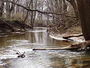
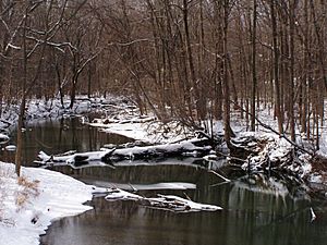
The main river in the dunes area is the Calumet River. It used to be one long river that flowed parallel to Lake Michigan. Today, it's broken into three parts. One part is Trail Creek in Michigan City, Indiana.
You can visit the Calumet River at several spots. The upper part can be seen in the Heron Rookery. A middle section runs alongside the Calumet Trail in the national park. The historic end of the river is now part of the lakes in Marquette Park in Gary.
Look for the red-shouldered hawk, the colorful Baltimore oriole, and small fish like the bluntnose minnow near the rivers.
Swamp Habitats
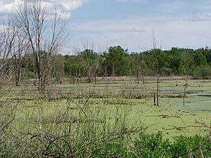
Swamps are wetlands where woody plants and trees are the main type of plant life. Swamps stretch almost the entire length of the dunes. The widest swamps are in the west, in Lake County, Indiana, running next to the Calumet River. Narrower swamps are found between the dune ridges.
You can explore swamps at Inland Marsh in the western part of the national park. In Beverly Shores, the restored Great Marsh has a trail you can walk. In the State Park, Trail #10 goes around a large wetland.
Some animals that live in swamps include the gray tree frog, the wood duck, and the barred owl.
Lake Michigan's Shoreline
Lake Michigan is the second largest of the Great Lakes in North America. The Indiana Dunes are on its southernmost shore. This southern location means it supports certain fish and birds that can't handle the very cold winters further north.
The lake's currents move sand and sometimes pollution along the shoreline. The winds usually blow from the northwest, which creates a "snow belt" along the eastern Indiana shoreline.
The dunes area also has several smaller lakes. These include the Wolf Lake complex in Hammond and the Miller Woods ponds. The Marquette Lakes are in Marquette Park. Long Lake is at the West Beach facility of the national park.
You might find fish like the lake trout and smallmouth bass in the lake. The common tern is a bird often seen near the water.
Bogs and Fens
Bogs and fens are two types of wetlands that can be a bit confusing. A bog usually forms in a low spot left by glaciers, where water can't drain out. They often have a floating mat of peat moss on the surface. Small shrubs grow on this mat, and older bogs might even have trees. You can visit Pinhook Bog in LaPorte with a park ranger.
A fen is another type of wetland that gets its water from underground seeps. This water often contains calcium. Fens are usually found near glacial hills called moraines. They can have grassy plants or be heavily forested. The most famous fen in the dunes is called Cowles Bog, but it's actually a fen!
Look for the unique pitcher plant, the swamp sparrow, and the Ohio goldenrod in bogs and fens.
Forests of the Dunes
The Indiana Dunes have three different kinds of forests. Forests are areas with many mature trees that form a thick roof, or canopy, in the summer. These include upland forests, floodplain forests, and flatwoods forests.
You can see upland forests at Pinhook Bog or in the Hobart Prairie Grove near Hobart. A great example of a floodplain forest is along the Calumet Trail, which you can reach from the Bailly/Chellberg Historic area parking lot.
In the forests, you might hear the red-eyed vireo or the ovenbird. Look for beautiful flowers like the large-flowered trillium.
Savanna Landscapes
A savanna is a natural area that looks like a prairie with grasses and shrubs, but it also has a good number of trees. The trees cover between 10% and 80% of the area.
If the soil is sandy, you'll often see black oak and white oak trees. If the soil is silty, burr oak and other oaks are common. Savannas begin south of the Tinley Moraine and continue onto the Valparaiso Moraine.
Animals like the red-headed woodpecker and the Karner blue butterfly live in savannas. You might also see pretty lupine flowers.
Marsh Wetlands
A marsh is another type of wetland. It's mostly covered by sedges and grasses. Marshes usually have water at or above the surface for most of the year.
The large marsh in Beverly Shores is easy to see. You can drive along Beverly Drive from U.S. 12 at Mt. Baldy to the end of East State Park Road to view it.
In a marsh, you might hear the call of a sora bird. Look for plants like the marsh fern and colorful insects like the calico pennant dragonfly.
 | William Lucy |
 | Charles Hayes |
 | Cleveland Robinson |


