La Pacana facts for kids
Quick facts for kids Pacana Caldera |
|
|---|---|

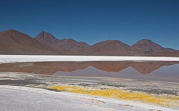
Viewing from inside the caldera towards the western margin
|
|
| Highest point | |
| Elevation | 4,500 m (14,800 ft) |
| Listing | List of volcanoes in Chile |
| Geography | |
| Geology | |
| Mountain type | Caldera |
| Volcanic arc/belt | Altiplano–Puna volcanic complex |
| Last eruption | 2 mya |
La Pacana is a huge caldera (a large, bowl-shaped hollow formed after a volcano erupts and collapses) in northern Chile. It formed millions of years ago during the Miocene epoch. This caldera is part of the Altiplano–Puna volcanic complex, which is a big area with many calderas and ignimbrites (rock formed from hot ash and gas flows). This volcanic area is in a remote spot where Chile, Bolivia, and Argentina meet.
La Pacana and other volcanoes in the area were created when the Nazca Plate (a large piece of Earth's crust) slid under the South American Plate. This process is called subduction. La Pacana sits on older rock layers and other volcanoes. Several large cracks in the Earth, called faults, cross the La Pacana region. These faults have affected how the volcanoes erupted.
La Pacana is a supervolcano. It caused one of the biggest explosive eruptions ever known! This eruption created the massive Atana ignimbrite, which is about 2,500 to 3,500 cubic kilometers in size. This makes it the fifth-largest explosive eruption we know about. The Atana ignimbrite erupted about 3.8 to 4.2 million years ago. Around the same time, a smaller ignimbrite called Toconao (about 180 cubic kilometers) also erupted. Before these, La Pacana erupted the Pujsa ignimbrite. After them, it erupted the Filo Delgado and Pampa Chamaca/Talabre ignimbrites.
Contents
Where is La Pacana?
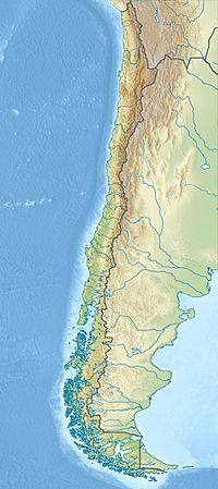
La Pacana is located in the Antofagasta Region of Chile. It's in the Andes mountains, just north of the Tropic of Capricorn. It's also near the Paso de Jama, a mountain pass between Chile and Argentina. Part of the caldera even crosses the border into Bolivia. The area around La Pacana is mostly empty. There are small towns like Socaire, Talabre, and Toconao closer to the Salar de Atacama. Here, streams flow down from the mountains to the salt flat. Scientists discovered the caldera between 1980 and 1985 while mapping the region.
La Pacana is part of the Central Volcanic Zone. This is one of four main volcanic areas in the Andean Volcanic Belt. Many stratovolcanoes (cone-shaped volcanoes) and ignimbrite-forming centers have erupted here for millions of years. About 50 of these are still considered active today. The biggest eruption in the Andes happened in 1600 at Huaynaputina in Peru. The most active volcano in Chile's Central Volcanic Zone is Láscar.
How Big is La Pacana?
La Pacana is about 60 kilometers long and 35 kilometers wide. It stretches from north to south. It's one of the largest and most visible calderas in the world! For comparison, the largest known caldera is Lake Toba in Sumatra, which is about 100 kilometers long. Some scientists think La Pacana might actually be two separate collapse areas, especially in its northern parts.
The bottom of the caldera is about 4,200 to 4,500 meters high. The central uplifted area and the caldera rim (edge) are even higher, reaching about 5,200 meters. The caldera's edge is easy to see, except in the north and west where newer volcanoes have covered it. After the caldera formed, the ground inside it rose up. This created a 1-kilometer-high resurgent dome called Cordón La Pacana. This dome has many faults (cracks) in it.
Around the resurgent dome, there's a wide, lower area called a moat. This moat is 2 to 10 kilometers wide and covers about two-thirds of the caldera's surface. It's filled with sediments from erosion, as well as evaporites (salt deposits) and lacustrine sediments (from old lakes).
The caldera's collapse cut through older volcanoes, showing their inner parts. After the caldera formed, new volcanic activity started inside it and around the resurgent dome. This created lava domes (mound-shaped volcanoes) between 4.1 and 1.6 million years ago. These include the Corral de Coquena crater and lava domes like Morro Negro east and Cerros de Guayaques north of the resurgent dome. Other volcanoes inside the caldera include Cerro Incaguasi and Cerros Negros.
Some hot springs still exist within the caldera. This suggests there might still be some geothermal heat underground, but it's not very strong as the water is cool (less than 25°C). A few lakes, like Laguna de Chivato Muerto, and salt pans, like Salar de Pujsa, have formed in the moat. The water in the southern lakes seems connected underground. The western caldera rim stops groundwater from flowing out of the caldera. Rivers like Río de Pili also flow through the caldera.
Scientists have studied La Pacana using gravity measurements. A large "negative anomaly" (meaning less mass than expected) is found over the caldera. This might be because the caldera is filled with lighter materials. "Positive anomalies" (more mass than expected) are found around the caldera and in small spots inside it. These might be denser rock from the Earth's deeper layers or magma intrusions.
How La Pacana Formed
In the Peru-Chile Trench, the Nazca Plate is sliding under the South American Plate at about 7 to 9 centimeters per year. This causes volcanic activity about 130 to 160 kilometers away from the trench.
Scientists believe this sliding has been happening for about 200 million years. About 26 million years ago, it sped up. After a period of andesitic volcanism (volcanoes erupting a certain type of lava), huge ignimbrite eruptions began about 23 million years ago and are still happening. The oldest volcanic rocks at La Pacana are between 11 and 7.5 million years old. Large ignimbrite eruptions continued until about 2 million years ago.
The Altiplano-Puna Volcanic Complex
The Central Andes region has many huge ignimbrites that erupted from large calderas. These calderas are usually found in the nearby Altiplano (a high plateau). Many of these calderas are part of the Altiplano-Puna volcanic complex. This is a very large volcanic area, covering about 70,000 square kilometers, with about 30,000 cubic kilometers of ignimbrites. La Pacana is the largest caldera in this complex. The ignimbrites form a surface that is about 4,000 meters high. Many stratovolcanoes have grown on top of these ignimbrite layers. Some of them are over 6,000 meters tall. Because the climate is very dry, signs of volcanic activity can be seen for a very long time.
The Altiplano-Puna volcanic complex sits on top of a huge area about 20 kilometers deep where the rock is partly melted (10-20% molten). This might be the largest such area on Earth! This melted zone formed when hot, liquid rock (mafic magmas) pushed into the lower crust. Magma from this melted zone rose into the upper crust and changed, forming the magmas that created the ignimbrites. Today, the edge of this partly melted zone matches a "negative gravity anomaly" (less mass than expected) that is found where Argentina, Bolivia, and Chile meet.
Local Geology
The rock layers beneath La Pacana are made of old sediments and other rock types. Most of these older rocks are covered by ignimbrites from volcanoes that might have been part of the La Pacana caldera.
La Pacana, along with the Cerro Guacha and Purico Complex calderas, forms the La Pacana Complex. Guacha had two big eruptions, one about 4.1 million years ago. The Purico complex started erupting 1.3 million years ago and is the youngest part of this complex. Other volcanoes west and southwest of La Pacana include Acamarachi and Láscar.
Many faults (cracks in the Earth's crust) cross the La Pacana region. These faults have affected where volcanoes and vents appeared.
What La Pacana's Rocks are Made Of
The Toconao and Atana ignimbrites are made of rhyolite and dacite-rhyodacite rock. They are rich in potassium. Both contain pumice (light, porous volcanic rock). They also contain various crystals like plagioclase, biotite, and quartz.
The magmas (molten rock) at La Pacana came from deep within the Earth's mantle. They mixed with different crustal rocks in the partly melted zone found about 20 kilometers beneath the Altiplano-Puna volcanic complex.
Scientists can estimate the temperature of the magma. The Toconao ignimbrite was cooler (about 730-750°C) than the Atana ignimbrite (about 750-790°C). The Atana ignimbrite formed at a depth of about 7 to 8.5 kilometers. This depth is similar to where other large magma systems, like Yellowstone, formed.
Climate and Animals
Weather records from the Salar de Aguas Calientes show an average temperature of 1°C and about 150 millimeters of rain per year.
There isn't much plant life in the dry Altiplano. However, many animals live there, such as rheas (large birds), vicuñas (wild relatives of llamas), and vizcachas (rodents). Ducks, geese, and flamingos are often seen in the lakes and salt flats.
How La Pacana Erupted
La Pacana had two main ignimbrite eruptions that were different in composition and happened close together: the dacitic Atana ignimbrite and the rhyolitic Toconao ignimbrite. Scientists used to think some of these ignimbrites came from other volcanoes, but now they know they came from La Pacana.
Before these two big eruptions, La Pacana first erupted the Pujsa ignimbrite about 5.7 to 5.8 million years ago. It also formed some stratovolcanoes and other rock types that are now visible in the caldera walls.
The first large eruption, which formed the Toconao ignimbrite, happened between 4 and 5.3 million years ago. This ignimbrite is about 180 cubic kilometers in volume. It has a lower, softer layer and an upper, harder layer.
The formation of the caldera happened at the same time as the eruption of the Atana ignimbrite. The ground sank 2 to 3 kilometers during this eruption. The Atana ignimbrite erupted about 3.8 to 4.2 million years ago. This timing is very close to the Toconao eruption, suggesting there wasn't a long pause between them. The Atana ignimbrite is much larger than the Toconao, with a volume of 2,500 to 3,500 cubic kilometers. It had a volcanic explosivity index (VEI) of 8, which means it was an extremely powerful eruption. This makes the Atana eruption the fifth-largest explosive eruption known, and La Pacana a supervolcano.
The Atana ignimbrite forms a thick layer, about 30 to 40 meters thick, that spread out from inside the caldera. It probably covered about 7,700 square kilometers originally, but some of it has worn away. The Atana ignimbrite is very dense and contains many crystals. After it erupted, wind and water carved valleys into it.
Scientists believe that both the Atana and Toconao ignimbrites came from the same magma chamber (an underground pool of molten rock). The Toconao magma was likely a lighter, more liquid part of the magma that erupted first in a Plinian eruption (a very powerful, column-shaped eruption). Then, a fault (crack in the Earth) moving probably caused the Atana ignimbrite to rise and erupt. After the caldera collapsed, some of the same magma that created the Atana ignimbrite continued to erupt, forming new lava domes like Corral de Coquena.
Ignimbrite eruptions continued even after the caldera formed. The Filo Delgado ignimbrite erupted from the Huailitas volcano during the Pliocene epoch. It was about 0.1 cubic kilometers in volume. About 2.4 million years ago, the Pampa Chamaca ignimbrite filled the moat (the low area) between the resurgent dome and the caldera rim. This ignimbrite was about 0.5 cubic kilometers in volume. The Tara Ignimbrite, from the Cerro Guacha caldera, also reached the northern part of La Pacana about 3.49 million years ago.
See also
 In Spanish: Caldera La Pacana para niños
 | Valerie Thomas |
 | Frederick McKinley Jones |
 | George Edward Alcorn Jr. |
 | Thomas Mensah |


