
Laurens County, South Carolina facts for kids
Quick facts for kids
Laurens County
|
|||
|---|---|---|---|

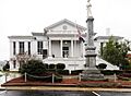
Laurens County Courthouse and Confederate Monument
|
|||
|
|||
| Motto(s):
"A Great Place In South Carolina"
|
|||

Location within the U.S. state of South Carolina
|
|||
 South Carolina's location within the U.S. |
|||
| Country | |||
| State | |||
| Founded | 1785 | ||
| Named for | Henry Laurens | ||
| Seat | Laurens | ||
| Largest community | Laurens | ||
| Area | |||
| • Total | 722.93 sq mi (1,872.4 km2) | ||
| • Land | 712.87 sq mi (1,846.3 km2) | ||
| • Water | 10.06 sq mi (26.1 km2) 1.39% | ||
| Population
(2020)
|
|||
| • Total | 67,539 | ||
| • Estimate
(2023)
|
68,873 |
||
| • Density | 93.4240/sq mi (36.0712/km2) | ||
| Time zone | UTC−5 (Eastern) | ||
| • Summer (DST) | UTC−4 (EDT) | ||
| Congressional district | 3rd | ||

Laurens County is a county located in the state of South Carolina. It's a place where many people live and work. In 2020, about 67,539 people called Laurens County home. The main town, or county seat, is Laurens. This county is part of a larger area called the Greenville-Anderson-Greer Metropolitan Statistical Area.
Contents
History of Laurens County
Laurens County was officially created on March 12, 1785. It was named after Henry Laurens. He was an important leader during the American Revolution. Henry Laurens was the fifth president of the Continental Congress. This was a group of delegates from the Thirteen Colonies that became the first government of the United States.
Laurens County was part of the old Ninety-Six District. It saw more battles during the American Revolution than many other places. One famous battle was the Battle of Musgrove Mill. This was a key moment when American militia soldiers defeated British regular soldiers. It showed that the local fighters could win against trained armies.
Geography of Laurens County
Laurens County covers a total area of about 723 square miles. Most of this area, about 713 square miles, is land. The rest, about 10 square miles, is water.
Protected Natural Areas
- Sumter National Forest (part of it is in Laurens County)
Local Parks and Sites
- Cliff Pitts Wildlife Management Area
- Clinton Reservoir Tract
- Gray Court Tract Wildlife Management Area
- Lake Rabon Park
- Laurens County Park
- Musgrove Mill State Historic Site
Major Rivers and Lakes
- Bush River
- Enoree River
- Lake Greenwood
- Lake Rabon
- Saluda River
Neighboring Counties
Laurens County shares borders with several other counties:
- Spartanburg County to the north
- Union County to the northeast
- Newberry County to the southeast
- Greenwood County to the south
- Abbeville County to the southwest
- Anderson County to the west
- Greenville County to the northwest
Main Roads and Transportation
Many important highways pass through Laurens County, connecting it to other parts of South Carolina and beyond.
 I-26
I-26 I-385
I-385 US 25
US 25
US 25 Bus. US 76
US 76
US 76 Bus. US 221


US 221 Truck SC 14
SC 14 SC 39
SC 39 SC 49
SC 49 SC 56
SC 56
SC 56 Bus. SC 66
SC 66
SC 66 Conn. SC 72
SC 72
SC 72 Bus. SC 101
 SC 127
 SC 252
SC 252 Truck SC 418
 SC 560
The county also has its own airport, the Laurens County Airport.
Population of Laurens County
| Historical population | |||
|---|---|---|---|
| Census | Pop. | %± | |
| 1790 | 9,337 | — | |
| 1800 | 12,809 | 37.2% | |
| 1810 | 14,982 | 17.0% | |
| 1820 | 17,682 | 18.0% | |
| 1830 | 20,863 | 18.0% | |
| 1840 | 21,584 | 3.5% | |
| 1850 | 23,407 | 8.4% | |
| 1860 | 23,858 | 1.9% | |
| 1870 | 22,536 | −5.5% | |
| 1880 | 29,444 | 30.7% | |
| 1890 | 31,610 | 7.4% | |
| 1900 | 24,311 | −23.1% | |
| 1910 | 26,650 | 9.6% | |
| 1920 | 42,560 | 59.7% | |
| 1930 | 42,094 | −1.1% | |
| 1940 | 44,185 | 5.0% | |
| 1950 | 46,974 | 6.3% | |
| 1960 | 47,609 | 1.4% | |
| 1970 | 49,713 | 4.4% | |
| 1980 | 52,214 | 5.0% | |
| 1990 | 58,092 | 11.3% | |
| 2000 | 69,567 | 19.8% | |
| 2010 | 66,537 | −4.4% | |
| 2020 | 67,539 | 1.5% | |
| 2023 (est.) | 68,873 | 3.5% | |
| U.S. Decennial Census 1790–1960 1900–1990 1990–2000 2010 2020 |
|||
In 2020, Laurens County had 67,539 people living there. There were about 25,901 households. Most people identified as White (about 65.68%) or Black/African American (about 23.6%). About 6.14% of the population was Hispanic or Latino.
In 2010, the population was 66,537. The average household had about 2.51 people. The average age of people in the county was around 39.9 years old.
Economy of Laurens County
In 2022, the total value of all goods and services produced in Laurens County was about $2.7 billion. This is called the GDP.
Many companies provide jobs in Laurens County. Some of the largest employers include:
- CeramTec
- National Healthcare
- Presbyterian College
- Shaw Industries
- Sterilite
- Walmart
Education in Laurens County
Laurens County has several public school districts. Laurens County District 55 covers the northeastern part of the county. District 56 covers the southwestern part. Part of the county is also served by Greenwood County District 51 and the Greenville County School District.
There are two public high schools in the county:
- Laurens District 55 High School
- Clinton High School
Other public schools for younger students include:
- M. S. Bailey Child Development Center
- Clinton Elementary
- Eastside Elementary
- E.B. Morse Elementary
- Ford Elementary
- Hickory Tavern Elementary
- Joanna-Woodson Elementary
- Gray Court-Owings Elementary & Middle
- Clinton Middle
- Hickory Tavern Middle
- Laurens Middle
- Sanders Middle
For private education, students can attend:
- Laurens Academy
- Summit Classical Charter School
- Thornwell Charter School
Presbyterian College is a four-year college located in Clinton. It was founded in 1880.
Communities in Laurens County
Laurens County has several cities, towns, and smaller communities.
Cities
- Clinton
- Fountain Inn (mostly in Greenville County)
- Laurens (This is the main town and county seat)
Towns
- Cross Hill
- Gray Court
- Ware Shoals (mostly in Greenwood County; partly in Abbeville County)
- Waterloo
Census-designated places
These are areas that are like towns but not officially incorporated as one.
Unincorporated communities
These are smaller communities without their own local government.
- Barksdale
- Hickory Tavern
- Kinards (partly in Newberry County)
- Madden
- Owings
Famous People from Laurens County
- James Adair (c. 1709–1783), a historian who lived in Laurens County later in his life.
- Andrew Johnson, who later became the 17th president of the United States, worked as a tailor in Laurens during the 1820s.
- William Dunlap Simpson, who was the 78th governor of South Carolina and a chief justice.
- Pat Cannon, a former representative for Florida's 4th congressional district.
Images for kids
-
Laurens County Courthouse and Confederate Monument
See also
 In Spanish: Condado de Laurens (Carolina del Sur) para niños
