List of National Natural Landmarks in Massachusetts facts for kids
The National Park Service has named eleven special places in Massachusetts as National Natural Landmarks. These landmarks are often unique bogs, swamps, wetlands, or very old forests. They are protected because they show important parts of nature's history and beauty.
| Name | Image | Date | Location | County | Ownership | Description |
|---|---|---|---|---|---|---|
| Acushnet Cedar Swamp | 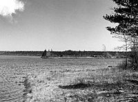 |
June 1972 | New Bedford
41°41′32″N 70°57′35″W / 41.692222°N 70.959722°W |
Bristol | state | This is one of Massachusetts' biggest and wildest swamps. It shows how many different plants and animals can live in a forest area that was shaped by glaciers. |
| Bartholomew's Cobble | 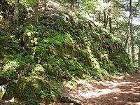 |
October 1971 | Ashley Falls
42°03′26″N 73°21′03″W / 42.057222°N 73.350833°W |
Berkshire | private (The Trustees of Reservations) | This spot is home to over 800 types of plants. It has the most different kinds of ferns in all of North America. |
| Cold River Virgin Forest | April 1980 | Mohawk Trail State Forest
42°38′48″N 72°56′47″W / 42.646667°N 72.946389°W |
Berkshire, Franklin | state | This forest is likely the only untouched hemlock and northern hardwood forest in New England. Some of its hemlock and sugar maple trees are over 400 years old. | |
| Fannie Stebbins Refuge | 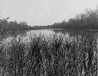 |
June 1972 | Longmeadow
42°02′22″N 72°36′09″W / 42.039468°N 72.602584°W |
Hampden | municipal | This area protects the only large example of a Connecticut River flood plain. It has many different natural areas, like forests, swamps, marshes, ponds, and meadows. |
| Gay Head Cliffs | 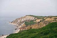 |
October 1975 | Aquinnah
41°20′04″N 70°47′45″W / 41.334444°N 70.795833°W |
Dukes | native lands (Wampanoag Tribe of Gay Head) | These cliffs show unusual layers of rock from the Cretaceous period (when dinosaurs lived). They also have fossils from later times. The cliffs rise up to 150 feet (46 meters) above the sea. This place is also very important to the Wampanoag people. |
| Hawley Bog | 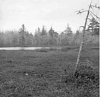 |
May 1974 | Hawley
42°34′33″N 72°53′26″W / 42.575807°N 72.890564°W |
Franklin | private | This is a natural, cold northern bog. It sits in an old, shallow lake basin left by a glacier. It shows how a bog slowly changes from open water to a forest of spruce and fir trees. |
| Mt. Greylock Old Growth Spruce | 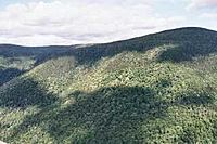 |
November 1987 | Adams
42°38′15″N 73°09′58″W / 42.637455°N 73.166216°W |
Berkshire | state | This site has three untouched areas of very old red spruce trees. They are on the northwest side of Mount Greylock, which is the highest mountain in Massachusetts. These trees have been growing undisturbed for at least 150 to 180 years. |
| Muskeget Island | 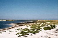 |
April 1980 | west of Tuckernuck and Nantucket Islands
41°20′07″N 70°18′15″W / 41.335278°N 70.304167°W |
Nantucket | municipal, private | This island is the only place where the Muskeget beach vole lives. It is also the southernmost place where the gray seal has its babies. Many herring gulls and black-backed gulls also nest here. |
| North and South Rivers | 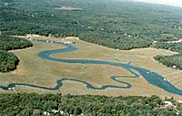 |
May 1977 | Norwell
42°09′37″N 70°42′51″W / 42.1604°N 70.7141°W |
Plymouth | state, municipal, private | These rivers are great examples of estuaries, which are places where river water mixes with ocean water. They are home to at least 45 types of fish and many kinds of birds. The area includes salt marshes, brackish marshes (mix of salt and fresh), and freshwater marshes. |
| Poutwater Pond | 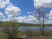 |
June 1972 | Holden
42°25′29″N 71°50′18″W / 42.424722°N 71.83825°W |
Worcester | state | This is a natural sphagnum-heath bog in southern New England. It shows how a glacial lake slowly changes from open water to an upland forest. |
| Reedy Meadow (was Lynnfield Marsh) | 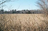 |
June 1972 | Between Wakefield and South Lynnfield | Essex | municipal, | This is the largest freshwater cattail marsh in Massachusetts. It provides a home for many bird species. It is also a breeding ground for the king rail and least bittern, which are rare birds in this area. |
See also
 | Dorothy Vaughan |
 | Charles Henry Turner |
 | Hildrus Poindexter |
 | Henry Cecil McBay |

