List of castles in Somerset facts for kids
Castles are strong, fortified homes built for lords or nobles. In Somerset, England, many castles were built after the Norman Conquest of England in 1066. Before this, there were other fortified places like burhs and hill forts.
After winning the Battle of Hastings in 1066, William the Conqueror sent his half-brother, Robert of Mortain, to take control of southwest England. Robert and other leaders like Walter of Douai and William de Moyon built castles to protect the coast and key areas. These early castles, like Neroche, Montacute, and Dunster, were made of timber. They often used a motte-and-bailey or ringwork design.
During a civil war in the 1100s, called the Anarchy, new castles appeared. Some older ones, like Neroche, were used again. Later, from the 12th to 14th centuries, many castles fell out of use. Newer castles, such as Nunney and Farleigh Hungerford, were built more for show than for fighting. They looked impressive with square shapes and corner towers.
In 1642, the English Civil War began. Castles like Taunton and Dunster were used for military purposes again. After the war, many castles were deliberately damaged so they couldn't be used for fighting anymore. Over time, some castles became grand houses or romantic ruins. Today, many are protected as historic sites by groups like English Heritage and the National Trust.
Contents
Castles in Somerset: A Historical Overview
Castles in Somerset have a rich history, changing from strongholds to grand homes. Let's explore how these amazing structures developed over time.
Early Norman Castles (After 1066)
After the Norman Conquest, new lords needed to control the land. They built castles to protect important towns, rivers, and roads. These first castles were usually made of wood. They were quick to build and offered good protection.
- Motte-and-bailey castles: These had a large mound (motte) with a tower on top. A fenced yard (bailey) was at the bottom.
- Ringwork castles: These were circular enclosures with strong banks and ditches.
Some early castles, like Montacute, faced attacks soon after they were built. However, many smaller castles were abandoned by the early 1100s.
Castles During The Anarchy (Mid-1100s)
The 12th century saw a civil war between King Stephen and the Empress Matilda. This period was known as the Anarchy. During this time, new motte-and-bailey castles were built for defense. Castles like Bury and Fenny were likely built then. Some older castles, like Neroche, were used again. Castles such as Cary and Richmont even saw battles.
Later Medieval Castles (12th to 14th Centuries)
As time went on, many older castles, including Cary, Fenny, and Montacute, were no longer used. By the 14th century, castles in Somerset changed. They became more about showing off wealth and power. Castles like Nunney and Farleigh Hungerford were impressive homes. They were built with square shapes, corner towers, and courtyards. Newton St Loe is a good example of this style. In the 15th century, fancy gatehouses became popular. These were often used as stylish homes, like at Dunster Castle.
Castles in the English Civil War (1600s)
The English Civil War broke out in 1642. This was a fight between King Charles I's supporters (Royalists) and Parliament's supporters. Somerset mostly supported the Royalists. Several castles, including Taunton and Dunster, were used for fighting again. After the war, Parliament ordered many castles to be damaged. This was called "slighting." Castles like Bridgwater, Dunster, and Taunton were partly destroyed.
Castles in Modern Times
After the Civil War, architectural styles changed. By the 1700s, some castles were turned into grand houses. Their grounds were used for new mansions, as seen at Stogursey. The ruins of Newton St Loe were kept as interesting old sights. Later, places like Bridgwater were completely rebuilt, and the castle remains disappeared.
In the late 1800s and early 1900s, laws were made to protect Somerset's castles. They became scheduled monuments and listed buildings. Today, English Heritage looks after Nunney and Farleigh Hungerford Castles. The National Trust owns Dunster Castle. Other castles, like Stogursey, have been restored for new uses, such as holiday homes.
List of Castles in Somerset
Here is a list of important castles found in Somerset.
| Site Name Alternative name(s) |
Constructed | Scheduling Number | Listed building grade | Plan | Image | Location or parish | Description |
|---|---|---|---|---|---|---|---|
| Ballands Castle | After 1066 | 202580 | – | – | – | Penselwood 51°04′42″N 2°21′12″W / 51.0782°N 2.3533°W |
This was a motte and bailey castle. It was likely built after the Norman conquest of England in 1066. It might have been part of a group of forts. These forts helped control the area. The motte is about 5 meters (16 feet) high. It is surrounded by ditches. |
| Bishop's Palace | c. 1210 | – | I | – | 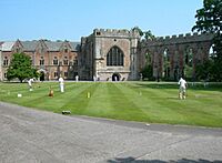 |
Wells 51°12′33″N 2°38′33″W / 51.2093°N 2.6426°W |
Building started around 1210 by Bishop Jocelin of Wells. Most of it dates from 1230. It was repaired and changed many times over the centuries. The north wing was added in the 15th century. |
| Bridgwater Castle | 1202 | 190958 | II* | – | 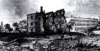 |
Bridgwater 51°08′09″N 2°59′54″W / 51.1357°N 2.9983°W |
Bridgwater Castle was a very large building. It covered about 8 or 9 acres (32,000 to 36,000 square meters). It had a wide moat filled by a stream. |
| Bury Castle | Late 1130s | 36765 | – | 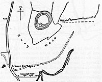 |
– | Brompton Regis 51°01′56″N 3°30′55″W / 51.0321°N 3.5152°W |
A motte and bailey castle was built here. This happened during the Anarchy civil war. It was likely built by William de Say. The motte is 23 meters (75 feet) high. |
| Cary Castle | 200127 | – | – | 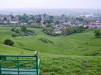 |
Castle Cary 51°05′17″N 2°30′50″W / 51.0880°N 2.5140°W |
This motte and bailey castle was built by Walter of Douai or his son. King Stephen attacked it during The Anarchy. By 1468, the castle was no longer used. A manor house was built nearby later. | |
| Castle Batch | – | 192666 | – | – | 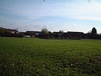 |
Weston-super-Mare 51°22′08″N 2°55′06″W / 51.3688°N 2.9182°W |
Castle Batch was a motte built by the Normans. This happened in the 11th or 12th century. It sits on a ridge. The mound is 3 meters (10 feet) high. It is surrounded by a ditch. |
| Castle Neroche | 11th century | 190295 | – | 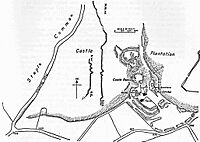 |
 |
Curland 50°56′11″N 3°02′10″W / 50.9365°N 3.0362°W |
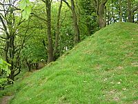
This motte-and-bailey castle was built on an older hill fort. It was probably built by Robert, Count of Mortain. It was built in stages. The motte is 20 feet (6 meters) high. |
| Cockroad Wood Castle | After 1066 | 202650 | – | – |  |
Charlton Musgrove 51°05′17″N 2°21′48″W / 51.0881°N 2.3633°W |
This motte and bailey castle was likely built after 1066. It was part of a group of forts. These forts helped control the area. The castle had a motte and two baileys. The motte is 7.5 meters (25 feet) high. |
| Crewkerne Castle Castle Hill Croft Castle Crow Castle |
Norman motte or 13th century manor house | – | – | – | 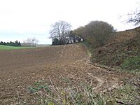 |
Crewkerne 50°53′34″N 2°49′29″W / 50.89287°N 2.8246°W |
This might be a Norman motte and bailey castle. It sits on a 450-foot (137-meter) high hill. Some think it was a 13th-century manor house. Others believe it was just a local decorative building. |
| Culverhay Castle Englishcombe Castle |
Late 11th century to the early 13th century | 204528 | – | – | 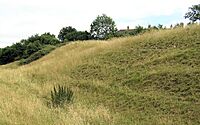 |
Englishcombe 51°21′57″N 2°24′13″W / 51.3658°N 2.4037°W |
This was a ringwork castle with a ditch and bank. The bank was 5 feet (1.5 meters) deep. A stone circular keep was added in the 13th century. There might have been a medieval deer park nearby. |
| Down End Castle Downend Castle Chisley Mount Chidley Mount |
– | 192333 | – | – | – | Down End, Dunball, Puriton 51°10′03″N 2°59′32″W / 51.1674°N 2.9921°W |
This was probably a motte-and-bailey castle. The motte has two baileys to the north. Norman pottery was found here. The mound is 30 meters (98 feet) wide at the top. |
| Dunster Castle | – | 36863 | I | 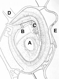 |
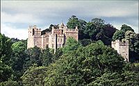 |
Dunster 51°10′53″N 3°26′40″W / 51.1814°N 3.4444°W |
This castle has been fortified since Saxon times. It is the historic home of the Luttrell family. It survived a siege in 1138. It was changed into a fortified manor house. Today, the National Trust owns it as a tourist attraction. |
| Farleigh Hungerford Castle Farleigh Castle Farley Castle |
c. 1370 | 207732 | I | 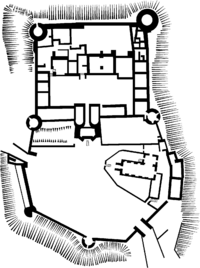 |
 |
Farleigh Hungerford 51°19′02″N 2°17′05″W / 51.3172°N 2.2847°W |
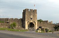
Built in the 14th century, this was first a manor house. It was later fortified over many years. It played a part in the English Civil War. Now, it is a ruin. |
| Fenny Castle | 197243 | – | – | 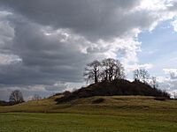 |
Wookey 51°11′22″N 2°42′19″W / 51.1894°N 2.7053°W |
These are the remains of a motte and bailey castle. It sits on a natural hill. The hill is about 20 meters (66 feet) above the flat land. Not much of the stone remains. | |
| Hales Castle | – | 202864 | – | 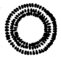 |
 |
Selwood 51°11′50″N 2°17′28″W / 51.1971°N 2.2910°W |
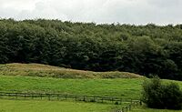
This is a circular ringwork. It is 120 feet (37 meters) across. It has a bank and an outer ditch. There is also an unfinished bailey. |
| Locking Castle | – | – | – | – | – | Locking 51°20′36″N 2°54′53″W / 51.3434°N 2.9147°W |
This is a motte and bailey castle on Carberry Hill. Its exact origin is not clear. It might have been part of the manor of Kewstoke. It lost its military importance by 1214. |
| Montacute Castle | After 1066 | 193150 | – | 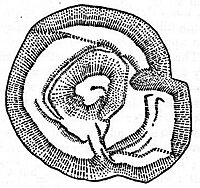 |
 |
Montacute (St Michael's Hill) 50°56′59″N 2°43′21″W / 50.9497°N 2.7224°W |
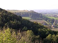
Montacute Castle was built after 1066 by Robert, Count of Mortain. It used the hill's natural shape. It had an oval motte and inner bailey. A hunting park was also set up. Rebels attacked it in 1068 but were defeated. |
| Newton St Loe Castle | 12th century | – | I | – | 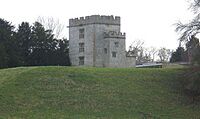 |
Newton St Loe 51°22′22″N 2°26′23″W / 51.3728°N 2.4397°W |
This was first a fortified manor house. It was probably built in the 12th century. A keep was added in the 14th century. Today, only the renovated keep and gatehouse remain. It is now leased by Bath Spa University. |
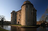
| Nunney Castle | 14th century | 202784 | – | 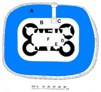 |
 |
Nunney 51°12′37″N 2°22′43″W / 51.2103°N 2.3786°W |
Built in the late 14th century by Sir John Delamare. Its design might have been inspired by French castles. It was damaged during the English Civil War. Now, it is a ruin. English Heritage maintains it as a tourist attraction. |
| Richmont Castle | After 1066 | 197292 | – | – | 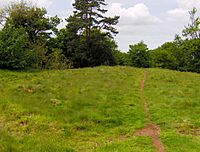 |
East Harptree 51°17′57″N 2°37′42″W / 51.2991°N 2.6283°W |
Built soon after the Norman conquest of England in 1066. It might have used an old Iron Age fort. It had an inner bailey and a circular keep. It was involved in the Anarchy civil war. By the 1540s, it was ruined. |
| Stogursey Castle | Late 11th or early 12th century | – | II* | – |  |
Stogursey 51°10′32″N 3°08′30″W / 51.1756°N 3.1417°W |
This motte-and-bailey castle was built by the De Courcy family. It had a wide motte and two baileys. It was surrounded by a water-filled moat. King John of England ordered it destroyed in 1215, but it survived. It was ruined in the 1450s during the War of the Roses. A house was built in its grounds later. |
| Stowey Castle | 11th century | 189462 | – | 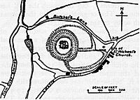 |
 |
Nether Stowey 51°08′55″N 3°09′45″W / 51.1485°N 3.1625°W |
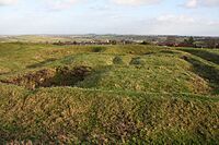
This Norman motte-and-bailey castle sits on a small hill. It had a square keep and two baileys. The mount is 29 feet (9 meters) above its ditch. The castle was destroyed in the 15th century. Some of its stone was used to build Stowey Court. |
| Taunton Castle | 1107-1129 | – | I | – | 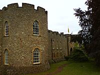 |
Taunton 51°00′55″N 3°06′50″W / 51.0153°N 3.1138°W |
This castle has Anglo Saxon origins. It was once a priory site. Between 1107 and 1129, it was turned into a castle. It was repaired during the Civil War. Today, it houses the county museum. |
| Wimble Toot | Bronze Age, or between 1067 and 1069 | 1015279 | – | – | 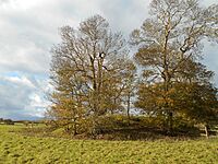 |
Babcary 51°03′00″N 2°37′42″W / 51.0501°N 2.6284°W |
Wimble Toot is usually seen as a Bronze Age burial mound. But some think it might be a motte built between 1067 and 1069. It is a circular earthwork. It is 27.47 meters (90 feet) across and 2.74 meters (9 feet) high. |
See also
 | DeHart Hubbard |
 | Wilma Rudolph |
 | Jesse Owens |
 | Jackie Joyner-Kersee |
 | Major Taylor |

