Crewkerne facts for kids
Quick facts for kids Crewkerne |
|
|---|---|
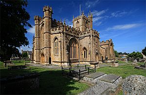 Church of St Bartholomew, Crewkerne |
|
| Population | 7,000 (2011) |
| OS grid reference | ST441093 |
| Civil parish |
|
| Unitary authority |
|
| Ceremonial county | |
| Region | |
| Country | England |
| Sovereign state | United Kingdom |
| Post town | CREWKERNE |
| Postcode district | TA18 |
| Dialling code | 01460 |
| Police | Avon and Somerset |
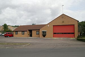
| Fire | Devon and Somerset |
| Ambulance | South Western |
| EU Parliament | South West England |
| UK Parliament |
|
Crewkerne (pronounced KROO-kurn) is a town in Somerset, England. It is about 9 miles (14 km) southwest of Yeovil. The town is located on the main source of the River Parrett. It is also near the A30 road and a railway line.
Crewkerne's history goes back a long way. It was first mentioned in the will of Alfred the Great in 899. After the Norman conquest in 1066, William the Conqueror owned the town. The town grew in the Middle Ages because of its textile industry. This wealth is shown in the beautiful 15th-century Church of St Bartholomew. Later, in the 18th and 19th centuries, people in Crewkerne made cloth and sails for the Royal Navy.
Today, Crewkerne has nature spots like Bincombe Beeches Local Nature Reserve. It also has a railway station, shops, and local businesses. Many famous people were born here. The town offers different cultural and sports activities, including those at Wadham Community School.
Contents
History of Crewkerne
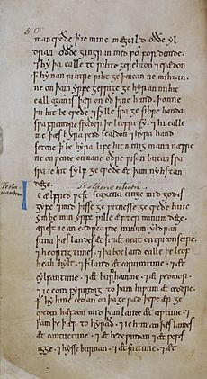
The name Crewkerne likely comes from old words meaning "hill spur" and "storehouse." In 899, Alfred the Great left the town, then called Crocern, to his son. By 1066, King Harold's partner, Edith Swanneck, owned the land.
After the Normans took over England, William the Conqueror owned Crewkerne. This was recorded in the Domesday Survey of 1086. The church land was given to a French abbey.
In 1499, a man named John de Combe started Crewkerne Grammar School. This school taught students for many years until 1904.
There might have been a Crewkerne Castle, a type of Norman castle called a "motte castle." It was on a hill northwest of the town. Crewkerne grew into a busy town in the late Middle Ages. This was thanks to its textile industry, which made the town rich. The beautiful parish church shows how wealthy the town was. Later, in the Georgian period, it became a popular stop for coaching services.
In the 17th century, the Manor Farmhouse in Henley was built from local stone. During the 18th and 19th centuries, the main work in Crewkerne was making cloth. This included webbing and sails for the Royal Navy.
How Crewkerne is Governed
The town council helps manage local issues. It sets a local tax to cover its costs. The council also looks at plans for new buildings. It works with the police and local groups to keep the town safe and manage traffic. The council also helps keep local facilities in good shape. It talks with the district council about roads, drainage, footpaths, and public transport. Looking after trees and historic buildings is also part of their job.
Crewkerne is part of the South Somerset area. This district council handles things like building rules, local roads, and collecting rubbish. They also look after parks and promote tourism.
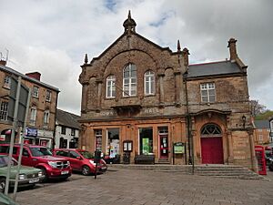
Crewkerne Town Hall is in the Market Square. It was rebuilt around 1742 and changed over the years. Today, it is a historic building.
Somerset County Council manages bigger services. These include education, social services, and libraries. They also look after major roads and public transport. Fire, police, and ambulance services are shared with other areas.
Crewkerne is part of the Yeovil area for the UK Parliament. This means people in Crewkerne vote for one Member of Parliament (MP) to represent them.
Geography and Climate
Crewkerne is located west of the River Parrett. The main living areas are around the town centre. Kithill and Park View are to the south, and Wadham Park is to the north.
On the edge of town is the Bincombe Beeches Local Nature Reserve. This is a 5-hectare (12-acre) area with old beech trees. The town council looks after it. Grants have helped improve paths and plant new trees there.
The Millwater biological Site of Special Scientific Interest is another important nature spot. It has different types of land, like pasture, wet grassland, and areas with alder and willow trees.
Weather in Crewkerne
Crewkerne has a mild and often wet climate. This is typical for South West England. The average yearly temperature is about 10°C (50°F). Summers are warmest in July and August, with temperatures around 21°C (70°F). In winter, temperatures can drop to 1°C or 2°C (34-36°F).
The area gets about 700 mm (28 inches) of rain each year. Most rain falls in autumn and winter. Snowfall happens about 8 to 15 days a year. Winds are usually strongest from November to March.
Getting Around Crewkerne
You can reach Crewkerne by several main roads:
- The A356 goes north towards London.
- The A356 also goes south to Dorchester.
- The A30 goes west to Exeter.
- The A30 also goes east to Yeovil and Salisbury.
- The B3165 goes south to Lyme Regis.
The closest major motorway is the M5 at Taunton.
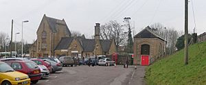
Crewkerne railway station is in nearby Misterton. Trains run to London Waterloo (about 2.5 hours away) and to Exeter St Davids (less than an hour). There is also a service to London Paddington. The station opened in 1860 and is a historic building.
Buses connect Crewkerne to nearby towns like Yeovil, Chard, and Taunton.
The town is also on the Monarch's Way. This is a 615-mile (990 km) long walking path. It follows the route King Charles II took to escape after a battle in 1651.
Economy and Shops
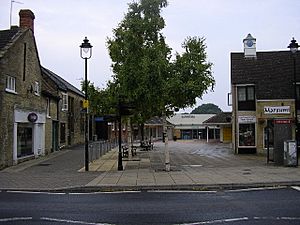
Crewkerne has a small town centre with many cafes, shops, and supermarkets. There are also several local pubs. The largest supermarket is Waitrose, which opened in 2008. Another supermarket, Lidl, is also in town.
Ariel Motor Company is based in Crewkerne. It is one of the UK's smallest car companies. They make fewer than 100 cars each year. Their most famous car is the Ariel Atom, which is a very light and fast car.
Churches and Religious Sites
St Bartholomew's Parish Church is on a hill west of the town. The first church here was built before the 9th century. After the Normans arrived, a larger stone church was built. This church was mostly rebuilt in the late 15th and early 16th centuries. This is the church you see today. It is a great example of the Perpendicular style of architecture. It is made from golden-coloured Hamstone from a nearby quarry.
No major changes have been made to the church's structure since the 1530s. However, the inside has been changed many times. During the English Civil War, much of the old stained glass was destroyed. William III of England visited the church in 1689. The church was restored in the late 19th century. The pews you see today are from around 1900. The church is a very important historic building.
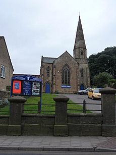
Crewkerne also has a Unitarian chapel on Hermitage Street. The Methodist church on South Street is used by both Roman Catholic and Methodist groups. Another church, Christ Church, was built in 1852 but was later taken down in 1975.
Education in Crewkerne
The main schools for younger children in Crewkerne are St. Bartholomew's, Ashlands, and Maiden Beech Primary Academy.
Crewkerne Grammar School used to be in the town. It closed in the late 1960s. Its students then joined St Martin's School. St Martin's School later closed its older student sections in 2003.
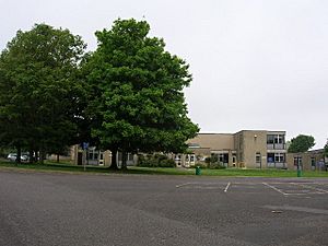
Wadham School is for students aged 11 to 18. Students from nearby villages also come to this school. The school has worked hard to improve and offers many opportunities for students.
Media and News
Local news and TV shows for Crewkerne come from BBC West and ITV West Country.
For radio, you can listen to BBC Radio Somerset on 95.5 FM. Other stations include Heart West on 97.1 FM and Greatest Hits Radio South West on 105.6 FM. There is also a local community radio station called Radio Ninesprings on 104.5 FM.
The local newspaper for Crewkerne is The Chard and Ilminster News.
Culture and Museums
The Henhayes Centre is a place where events and exhibitions are held.
The Crewkerne and District Museum is part of a larger heritage centre. It has local historical records and a meeting room. The museum opened in 2000. It shows how Crewkerne grew in the 18th and 19th centuries. It focuses on the flax and linen industry. The museum also has collections about local history, coins, clothes, art, and more.
Sports in Crewkerne
The Crewkerne Aqua Centre has a swimming pool and a gym. It is located near Henhayes Park. There is also another sports centre at Wadham School.
Crewkerne Cricket Club plays in the Somerset Cricket League. Crewkerne Rangers F.C. plays in the Perry Street and District League. There is also a ladies' football club and two lawn bowls clubs in the town.
Famous People from Crewkerne
- Thomas Coryat (born around 1577) was a famous traveler and writer.
- John Caswell, a mathematician, was also born here.
- Colonel Joshua Fry (born 1699) was a surveyor and mapmaker. He moved to the American Colonies.
- William Phelps (born around 1599) was another Englishman from Crewkerne who moved to America. He helped start towns and was important in early colonial government.
- Ralph Reader (born 1903) was an actor and songwriter. He is best known for creating the "Gang Show" for the Scouting Movement.
- The cricketer Michael Barnwell was born in Crewkerne in 1943.
Twin Towns
Crewkerne is twinned with two towns in France:
- Igny, Essonne
- Bures-sur-Yvette
See also
 In Spanish: Crewkerne para niños
 | Georgia Louise Harris Brown |
 | Julian Abele |
 | Norma Merrick Sklarek |
 | William Sidney Pittman |


