Lonoke County, Arkansas facts for kids
Quick facts for kids
Lonoke County
|
|
|---|---|
| County of Lonoke | |

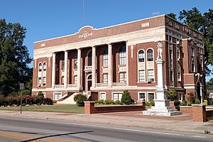
Lonoke County Courthouse
|
|

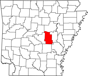
Location within the U.S. state of Arkansas
|
|
 Arkansas's location within the U.S. |
|
| Country | |
| State | |
| Formed | April 16, 1874 |
| Named for | "Lone oak" |
| Seat | Lonoke |
| Largest city | Cabot |
| Area | |
| • Total | 803 sq mi (2,080 km2) |
| • Land | 771 sq mi (2,000 km2) |
| • Water | 32 sq mi (80 km2) 4.0%% |
| Population
(2020)
|
|
| • Total | 74,015 |
| • Density | 92.17/sq mi (35.588/km2) |
| Time zone | UTC−6 (Central) |
| • Summer (DST) | UTC−5 (CDT) |
| ZIP Codes |
72007, 72023, 72024, 72037, 72046, 72072, 72076, 72083, 72086, 72142, 72160, 72176
|
| Congressional district | 1st |
Lonoke County is a county in the central part of Arkansas, a state in the United States. In 2020, about 74,015 people lived here. This makes it the 10th most populated county in Arkansas. The main town, or county seat, is Lonoke. The biggest city in the county is Cabot. Lonoke County is part of the larger Little Rock metropolitan area.
Contents
What's in a Name?
Lonoke County got its name from a "lone oak" tree. This tree stood in the area when the county was created. The name "Lonoke" is simply how "lone oak" sounds when you say it. This idea came from the chief engineer of the Cairo & Fulton Railroad.
A Look Back in Time
Lonoke County was formed on April 16, 1873. It was created from parts of Pulaski and Prairie counties.
The county's land can be split into three main parts. The northern part, near Cabot, has gentle rolling hills. The middle part, around Lonoke, is known as the Grand Prairie. This area was once a flat grassland. Today, it is famous for growing rice. Rice farming is a very important part of the county's history and economy. The southern part, near Scott, has rich, fertile soil from the Arkansas Delta.
Long ago, a military road and a railroad helped settlers move to this area. Growing cotton was very profitable for farmers. But in 1904, people learned that rice could grow well here too. When cotton prices dropped, many farmers switched to growing rice.
During World War I and World War II, Lonoke County was home to Eberts Field. This was an airfield used by the United States Army. Today, the land where the airfield was is used for aquaculture. This means raising fish and other water animals.
Where is Lonoke County?
Lonoke County covers about 803 square miles (2,080 square kilometers). Most of this area, about 771 square miles (1,997 square kilometers), is land. The rest, about 32 square miles (83 square kilometers), is water.
Main Roads and Highways
Many important roads pass through Lonoke County. These roads help people travel and transport goods.
 Interstate 40
 Future Interstate 57
 U.S. Highway 67
 U.S. Highway 70
 U.S. Highway 165
 U.S. Highway 167
 Highway 5
 Highway 13
 Highway 15
 Highway 31
 Highway 38
 Highway 89
Neighboring Counties
Lonoke County shares its borders with several other counties:
- White County (to the north)
- Prairie County (to the east)
- Arkansas County (to the southeast)
- Jefferson County (to the south)
- Pulaski County (to the west)
- Faulkner County (to the northwest)
Who Lives Here?
| Historical population | |||
|---|---|---|---|
| Census | Pop. | %± | |
| 1880 | 12,146 | — | |
| 1890 | 19,263 | 58.6% | |
| 1900 | 22,544 | 17.0% | |
| 1910 | 27,983 | 24.1% | |
| 1920 | 33,400 | 19.4% | |
| 1930 | 33,759 | 1.1% | |
| 1940 | 29,802 | −11.7% | |
| 1950 | 27,278 | −8.5% | |
| 1960 | 24,551 | −10.0% | |
| 1970 | 26,249 | 6.9% | |
| 1980 | 34,518 | 31.5% | |
| 1990 | 39,268 | 13.8% | |
| 2000 | 52,828 | 34.5% | |
| 2010 | 68,356 | 29.4% | |
| 2020 | 74,015 | 8.3% | |
| 2023 (est.) | 75,944 | 11.1% | |
| U.S. Decennial Census 1790–1960 1900–1990 1990–2000 2010 |
|||
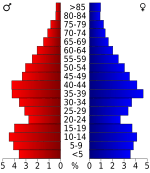
The population of Lonoke County has grown a lot over the years. In 2020, there were 74,015 people living in the county. These people made up 26,052 households and 18,824 families.
| Race | Number | Percentage |
|---|---|---|
| White (non-Hispanic) | 60,596 | 81.87% |
| Black or African American (non-Hispanic) | 4,349 | 5.88% |
| Native American | 314 | 0.42% |
| Asian | 716 | 0.97% |
| Pacific Islander | 49 | 0.07% |
| Other/Mixed | 4,381 | 5.92% |
| Hispanic or Latino | 3,610 | 4.88% |
Towns and Cities
Lonoke County has several cities and towns where people live.
Cities
Towns
Special Places
- Scott is a census-designated place. This means it's a community that the census bureau tracks.
Townships
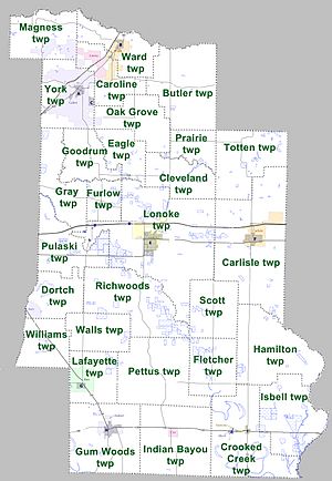
Counties in Arkansas are divided into smaller areas called townships. These are like local districts within the county.
Learning and Schools
Lonoke County has several school districts. These districts manage the public schools where students go to learn.
- Cabot Public Schools
- Carlisle School District
- Des Arc Public Schools
- England School District
- Jacksonville North Pulaski School District
- Lonoke School District
- Pulaski County Special School District
See also
 In Spanish: Condado de Lonoke para niños
 | Selma Burke |
 | Pauline Powell Burns |
 | Frederick J. Brown |
 | Robert Blackburn |


