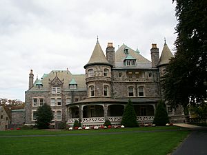
Lower Merion Township, Pennsylvania facts for kids
Quick facts for kids
Lower Merion
Lower Merion Township
|
|||
|---|---|---|---|
|
Township
|
|||
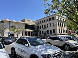
The Lower Merion Township building in Ardmore in April 2022
|
|||
|
|||
| Motto(s):
"A First-Class Township"
|
|||
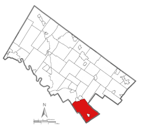
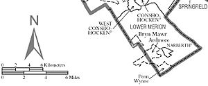
Location of Lower Merion Township in Montgomery County, Pennsylvania
|
|||
| Country | |||
| State | |||
| County | Montgomery | ||
| Settled | 1682 | ||
| Incorporated | 1713 | ||
| Area | |||
| • Total | 23.83 sq mi (61.73 km2) | ||
| • Land | 23.61 sq mi (61.16 km2) | ||
| • Water | 0.22 sq mi (0.57 km2) | ||
| Elevation | 200 ft (60 m) | ||
| Population
(2020)
|
|||
| • Total | 63,633 | ||
| • Estimate
(2021)
|
64,148 | ||
| • Density | 2,695/sq mi (1,040/km2) | ||
| Time zone | UTC-5 (EST) | ||
| • Summer (DST) | UTC-4 (EDT) | ||
| Area code | 610 and 484 | ||
| FIPS code | 42-091-44976 | ||
Lower Merion Township is a community in Montgomery County, Pennsylvania, United States. It is known as a "township," which is a type of local government area. Lower Merion is also part of the Philadelphia Main Line, a group of wealthy suburbs.
The township's name comes from a place in north Wales called Merioneth. This name is an English way of saying the Welsh word Meirionnydd.
Lower Merion Township is one of the main suburbs of Philadelphia, which is a very large city in the United States. In 2020, Lower Merion Township had about 63,633 people living there. This makes it one of the most populated communities in Pennsylvania.
The center of Lower Merion Township is about 11.9 miles (19.2 km) northwest of downtown Philadelphia. Some parts of the township even share a border with the city.
Contents
A Look at Lower Merion's History
Lower Merion Township was first settled in 1682. Welsh Quakers were the first to arrive. They were given land by William Penn, who founded Pennsylvania.
In 1713, Lower Merion officially became an independent township. At that time, it had about 52 landowners and people renting land. By 1900, it was set up as a "Township of the First Class."
Lower Merion is home to the Merion Friends Meeting House. This building has been used for worship since 1695, making it the oldest continuously used place of worship in the United States.
In 1991, a plane and a helicopter crashed over Merion Elementary School. This accident caused several deaths, including two elementary students.
Some important historical places in Lower Merion are listed on the National Register of Historic Places. These include the Mill Creek Historic District and the Seville Theatre. Green Hill Farms was added to this list in 2011.
In 2010, the township was in the news because of a lawsuit. A student sued the school district. This happened after a school worker used the webcam on a school laptop to watch the student at home.
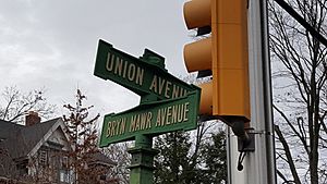
In 2012, there was a rule change that would have made Lower Merion replace its old street signs. Some of these signs were from the early 1900s. Local residents and a senator worked to save them. The township then declared the entire area a historic district. This helped them get permission to keep their unique old signs.
Geography and Nature
Lower Merion Township covers about 23.9 square miles (61.8 km²). Most of this area is land, with a small amount of water.
The township borders several other communities and counties. It is next to parts of Philadelphia. It also borders boroughs like Conshohocken and West Conshohocken. Other nearby townships include Upper Merion, Whitemarsh, Haverford, and Radnor. The small borough of Narberth is completely surrounded by Lower Merion.
City Avenue forms the southern border of the township, separating it from Philadelphia. Along City Avenue, there's an area sometimes called the "Golden Mile." This area has many businesses and buildings.
The eastern border of the township is along the Schuylkill River.
Before Europeans arrived, Lower Merion was a dense forest. It was home to many animals like bears, cougars, wolves, and beavers. There were also turkeys, eagles, and various fish. When Europeans settled, they cut down forests. This caused many animals to leave.
After World War II, Lower Merion changed from a farming area to a suburban one. The wildlife changed too. Today, you can find red foxes, raccoons, skunks, and white-tailed deer. There are also many birds and butterflies.
Communities in Lower Merion
Lower Merion Township includes several smaller communities. Some of these are:
- Ardmore
- Bala Cynwyd
- Belmont Hills
- Bryn Mawr
- Gladwyne
- Haverford
- Merion
- Overbrook Hills
- Pencoyd
- Penn Valley
- Penn Wynne
- Roseglen
- Rosemont
- Villanova
- Wynnewood
Population and People
| Historical population | |||
|---|---|---|---|
| Census | Pop. | %± | |
| 1900 | 13,271 | — | |
| 1910 | 17,671 | 33.2% | |
| 1920 | 23,866 | 35.1% | |
| 1930 | 35,166 | 47.3% | |
| 1940 | 39,566 | 12.5% | |
| 1950 | 48,745 | 23.2% | |
| 1960 | 59,420 | 21.9% | |
| 1970 | 63,594 | 7.0% | |
| 1980 | 59,635 | −6.2% | |
| 1990 | 58,003 | −2.7% | |
| 2000 | 59,850 | 3.2% | |
| 2010 | 57,825 | −3.4% | |
| 2020 | 63,633 | 10.0% | |
In 2020, Lower Merion Township had 63,633 people living there. The population density was about 2,670 people per square mile.
Most of the people in Lower Merion are White. There are also significant populations of Asian and African American residents. About 3.7% of the population is of Hispanic or Latino background.
In 2000, about 29.4% of households had children under 18. Most households were married couples living together. The average household had 2.42 people.
The median age in the township was 41 years old. This means half the people were older than 41 and half were younger.
The median income for a household in 2000 was $86,373. For families, it was $115,694. A small percentage of families and individuals lived below the poverty line.
Getting Around Lower Merion
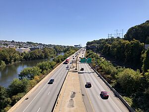
Lower Merion Township has many roads. In 2018, there were over 240 miles of public roads. Most of these roads are maintained by the township itself.
Several major highways pass through Lower Merion. These include the Schuylkill Expressway (Interstate 76) and "Blue Route" (Interstate 476). Other important roads are U.S. Route 1, U.S. Route 30, Pennsylvania Route 320, and Pennsylvania Route 23.
The Schuylkill Expressway runs along the northeastern edge of the township. US 1 follows City Avenue on the southeastern border. US 30 crosses the southern part of the township.
Public Transportation Options
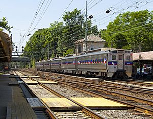
Lower Merion Township is a key part of the Philadelphia Main Line. This name comes from the old Pennsylvania Railroad line that runs through the area.
Today, this rail line is part of SEPTA Regional Rail. It is called the Paoli/Thorndale Line. This line has several stops in Lower Merion:
- Merion Station in Merion
- Wynnewood Station in Wynnewood
- Ardmore Station in Ardmore (also served by Amtrak trains)
- Haverford Station in Haverford
- Bryn Mawr Station in Bryn Mawr
- Rosemont Station in Rosemont
Another SEPTA train line, the Cynwyd Line, also has stops in Lower Merion. These are Bala Station and Cynwyd Station in Bala Cynwyd. This line runs on weekdays.
The Norristown High Speed Line also goes through the western part of Lower Merion. It has stops at Matsonford and County Line.
SEPTA also offers bus service throughout Lower Merion Township. These buses connect to Philadelphia and other nearby suburbs.
Economy and Jobs
Lower Merion Township has many different types of businesses and organizations that provide jobs. Here are some of the top employers in 2018:
| # | Employer | Number of Employees | Community |
|---|---|---|---|
| 1 | Main Line Health (Lankenau Medical Center and Bryn Mawr Hospital) |
4,168 | Wynnewood and Bryn Mawr |
| 2 | Lower Merion School District | 1,779 | Ardmore |
| 3 | Susquehanna International Group | 1,270 | Bala Cynwyd |
| 4 | Bryn Mawr College | 1,112 | Bryn Mawr |
| 5 | Maxim Healthcare Services | 723 | Bala Cynwyd |
| 6 | Saint Joseph's University | 603 | Merion |
| 7 | Great Valley Health | 584 | Bryn Mawr |
| 8 | Maguire Insurance Agency | 482 | Bala Cynwyd |
| 9 | Township of Lower Merion | 474 | Ardmore |
| 10 | 365 Health Services, LLC | 435 | Bala Cynwyd |
Education in Lower Merion
Public Schools
Students living in Lower Merion Township usually attend public schools. These schools are part of the Lower Merion School District. The area has a long history of education. The Lower Merion Academy was one of the first public schools in the country.
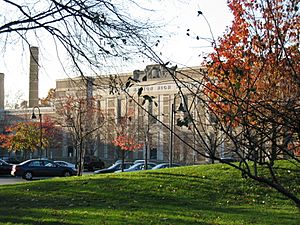
The district has six elementary schools, three middle schools, and two high schools. The high schools are Lower Merion High School and Harriton High School. Students go to specific schools based on where they live.
Private Schools
There are also many private schools in and around Lower Merion Township. Some of these include:
- Rosemont School of the Holy Child
- The Shipley School
- The Baldwin School
- Waldron Mercy Academy
- The Haverford School
- The Agnes Irwin School
- Friends Central School
- French International School of Philadelphia
- Kohelet Yeshiva High School
Colleges and Universities
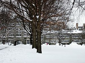
Several colleges and universities are located in Lower Merion Township. These include:
- Bryn Mawr College
- Harcum College
- Rosemont College
- St. Charles Borromeo Seminary
The campus of Saint Joseph's University is partly in Lower Merion and partly in Philadelphia. Haverford College is also split between Lower Merion and Haverford Townships.
Other Educational Resources
The Japanese Language School of Philadelphia holds its classes at the Friends Central School in Wynnewood. Residents can also use the Lower Merion Library System for books and other resources.
Historic Places and Buildings
Lower Merion Township has many historic places. Some of these are recognized as historic districts:
- Bryn Mawr College Historic District
- Gladwyne Historic District
- Mill Creek Historic District
Here are some other notable historic buildings and structures:
- 1690 House (built in 1690)
- Arboretum of the Barnes Foundation (1922)
- The Baldwin School (1890–91)
- Black Rock Dam (1825)
- Bryn Mawr Hospital (1893)
- Bryn Mawr Theater (1926)
- Dolobran (1881)
- Flat Rock Tunnel (1838–40)
- Green Hill Farms (1695)
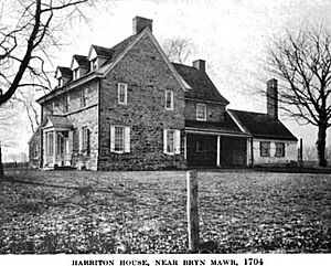
- Harriton House (1704)
- Idlewild Farm Complex (1740)
- Lankenau Medical Center (1953)
- Lower Merion Academy (1812)
- Manayunk Bridge (1918)
- Merion Cricket Club (1897)
- Merion Friends Meeting House (1714)
- Merion Tribute House (1924)
- Philadelphia Country Club (1890)
- Rathalla, Rosemont College (1889–91)
- St. Charles Borromeo Seminary (1871)
- Suburban Square (1928)
- M. Carey Thomas Library (1901–07)
- General Wayne Inn (1704)
- West Laurel Hill Cemetery (1869)
- Whitehall Apartments (1925–26)
- Woodmont (1891–94)
Famous People from Lower Merion
Many well-known people have lived in or are from Lower Merion Township. Some of them include:
- Hap Arnold, a famous World War II Air Force general
- Albert C. Barnes, who started the Barnes Foundation
- James H. Billington, a former Librarian of Congress
- Kobe Bryant, a legendary professional basketball player for the Los Angeles Lakers
- Taylor Buchholz, a former professional baseball player
- John Debella, a former DJ
- Alexander Haig, a former U.S. Secretary of State
- Patti LaBelle, a Grammy award-winning singer
- Jeffrey Lurie, the owner of the Philadelphia Eagles football team
- Garry Maddox, a former professional baseball player
- M. Night Shyamalan, a well-known filmmaker
- Lawrence Summers, a former president of Harvard University
See also
 In Spanish: Municipio de Lower Merion para niños
 | Valerie Thomas |
 | Frederick McKinley Jones |
 | George Edward Alcorn Jr. |
 | Thomas Mensah |


