Main Line of Public Works facts for kids
Quick facts for kids Main Line of Public Works |
|
|---|---|
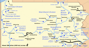
Map of historic Pennsylvania canals and connecting railroads
|
|
| Specifications | |
| Locks | 168 (The Eastern Division Canal had 14 locks, the Juniata Division 86, and the Western Division 68.) |
| Maximum height above sea level | 2,322 ft (708 m) (Summit of the Allegheny Portage Railroad through Blair Gap) |
| Status | Canals abandoned except for historic and recreational segments. Many railroad segments survive as part of the Keystone Corridor. |
| History | |
| Original owner | Commonwealth of Pennsylvania |
| Date of act | 1826 |
| Construction began | 1828 |
| Date completed | 1834 |
| Date closed | Sold to Pennsylvania Railroad in 1857; last canal segment, near Harrisburg, closed in 1901 |
| Geography | |
| Start point | Philadelphia |
| End point | Pittsburgh |
| Branch(es) | Wiconisco Canal, Kittanning Feeder, Allegheny Outlet |
| Branch of | Pennsylvania Canal |
| Connects to | Delaware River, Schuylkill Canal, Conestoga Navigation, Susquehanna and Tidewater Canal, Codorus Navigation, Union Canal, Susquehanna Division, Allegheny River, Monongahela River, Ohio River, Ashley Planes, Lehigh and Susquehanna Railroad, Lehigh Canal & Delaware Canal |
The Main Line of Public Works was a huge transportation system built in Pennsylvania. It combined canals and railroads to connect the cities of Philadelphia in the east and Pittsburgh in the west. This project was approved in 1826 and built by the state of Pennsylvania between 1828 and 1834. Its main goal was to create the best way to move goods and people across the state. It was a big part of the Pennsylvania Canal System.
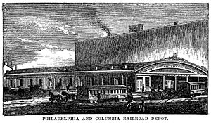
At first, the plan was to use only canals. But later, new ideas led to adding railroads. For example, the Philadelphia and Columbia Railroad was built instead of a canal to connect Philadelphia to the Susquehanna River. This was because railroads were faster and cheaper to build in that area.
Why was it built?
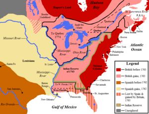
After the American Revolution, many families wanted to move west into new lands. Cities like Philadelphia wanted to connect with these growing western areas. They wanted to be the most important port in the United States.
In the early 1800s, people built turnpikes (toll roads) and small canals. These helped connect farms to cities. But there was a big need for better transportation, especially to move coal. Coal was important for factories and heating homes.
Other states were building big canals, like the Erie Canal in New York. This made Pennsylvania's leaders want to build their own large system. They wanted to make sure Philadelphia could compete with other big cities for trade. The Main Line of Public Works was Pennsylvania's answer to this challenge. It also helped bring coal from the Coal Region to eastern cities.
Parts of the Main Line
The Main Line of Public Works was made up of several key sections. These sections worked together to create a continuous route across Pennsylvania.
- Philadelphia and Columbia Railroad: This was an 82-mile (132 km) railroad from Philadelphia to Columbia, Pennsylvania. It was originally planned as a canal. But railroads were a newer technology that proved faster and cheaper to build.
- Eastern Division Canal: This 43-mile (69 km) canal ran from Columbia to Duncan's Island. It followed the east side of the Susquehanna River.
- Juniata Division Canal: This 127-mile (204 km) canal stretched from Duncan's Island to Hollidaysburg, Pennsylvania. It needed 86 locks to climb over 584 feet (178 m) in elevation.
- Allegheny Portage Railroad: This 36-mile (58 km) railroad connected Hollidaysburg to Johnstown, Pennsylvania. It was a special railroad designed to carry canal boats over the Allegheny Mountains.
- Western Division Canal: This 103-mile (166 km) canal ran from Johnstown to Pittsburgh. It connected to the Ohio River and the Monongahela River.
This amazing system cut travel time between Philadelphia and Pittsburgh from about 23 days to just four! The Main Line of Public Works was finished in 1834. It was later sold to the Pennsylvania Railroad in 1857. The railroad then replaced the canal and portage system with its own all-rail route.
Philadelphia and Columbia Railroad Details
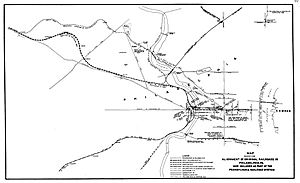
The Philadelphia and Columbia Railroad started in Philadelphia. It crossed the Schuylkill River on the Columbia Bridge. After crossing the river, it went up a steep slope called the Belmont Plane. This railroad then continued west to Columbia, Pennsylvania. There, another slope, the Columbia Plane, lowered cars to the Susquehanna River.
Belmont Plane
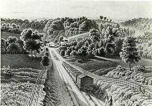
The Belmont Plane was a very steep section of track. It rose 187 feet (57 m) over 2,805 feet (855 m). Steam-powered cables pulled the railway cars up this hill.
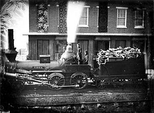
A famous event happened here on July 10, 1836. A locomotive named George Washington climbed the Belmont Plane while pulling a load. This was the first time a steam locomotive successfully climbed such a steep grade with a load. It was a huge achievement for railroad technology!
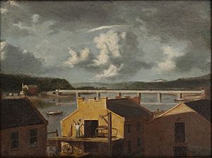
The original railroad line that went up the Belmont Plane was later replaced by a new, less steep route in 1850. Today, the western suburbs of Philadelphia are still known as the "Main Line" because of this historic railroad.
Eastern Division Canal Details
The Eastern Division Canal opened in 1833. It had 14 locks to help boats move up and down. At Duncan's Island, where several canals met, engineers built a long dam across the Susquehanna River. This created a pool of water. Boats could be pulled across this pool on a special two-tier bridge.
Juniata Division Canal Details
The Juniata Division Canal opened in 1832. It used many dams and 86 locks to manage the changing elevation. Boats were sometimes pulled across rivers using special aqueducts or ropes.
Juniata Canal Remnants
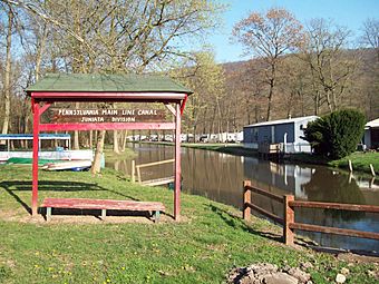
Today, you can still see parts of this canal. A 1.5-mile (2.4 km) section has been restored near Lewistown. In Hollidaysburg, the Canal Basin Park shows two canal basins and a lock. There's also a museum that explains how boats moved between the canal and the Allegheny Portage Railroad.
Allegheny Portage Railroad Details
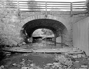
The Allegheny Portage Railroad was a marvel of engineering. From 1834 to 1854, it allowed boats to cross the Allegheny Mountains. It was 36 miles (58 km) long and had 10 inclined planes. These planes used stationary engines to raise and lower canal boats and their cargo. The railroad climbed 1,398 feet (426 m) from Hollidaysburg and 1,171 feet (357 m) from Johnstown. At its highest point, it reached 2,322 feet (708 m) above sea level.
Western Division Canal Details
|
Western Division-Pennsylvania Canal
|
|
| Lua error in Module:Location_map at line 420: attempt to index field 'wikibase' (a nil value). | |
| Location | Along the Conemaugh River, Bolivar, Derry Township, and Fairfield Township |
|---|---|
| Area | 15 acres (6.1 ha) |
| Built | 1830 |
| Built by | Pennsylvania Canal Commission |
| NRHP reference No. | 74001817 |
| Added to NRHP | September 17, 1974 |
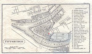
The Western Division Canal started in Pittsburgh. It needed a very long aqueduct, 1,140 feet (347 m) long, to cross the Allegheny River into Pittsburgh. It also had a tunnel, 810 feet (247 m) long, under Grant's Hill in Pittsburgh to connect to the Monongahela River.
This canal used 68 locks, 16 river dams, and 16 aqueducts. The first freight boat traveled from Johnstown to Pittsburgh in 1831.
Johnstown Flood
The Johnstown Flood in 1889 was a terrible disaster linked to the Main Line of Public Works. It happened when the South Fork Dam broke. This dam had created a large reservoir called Lake Conemaugh, which supplied water to the Western Division Canal. After the canal was no longer used, the dam was sold to private owners. Following heavy rains, the dam failed, sending 20 million tons of water towards Johnstown. More than 2,200 people died in the flood.
Western Canal Remnants
Today, you can visit the Tunnelview Historical Site. It shows where an 817-foot (249 m) canal tunnel was built through Bow Ridge. Saltsburg Canal Park also celebrates the canal's history and its importance to the town.
Points of Interest
| Feature | Coordinates | Description |
|---|---|---|
| Philadelphia | 39°57′08″N 75°09′50″W / 39.95222°N 75.16389°W | The city at the eastern end of the Main Line of Public Works. |
| Columbia | 40°02′01″N 76°30′16″W / 40.03361°N 76.50444°W | Where the Philadelphia and Columbia Railroad ended and the Eastern Division Canal began. |
| Duncan's Island | 40°25′02″N 77°00′33″W / 40.41722°N 77.00917°W | An island where the Eastern Division and Juniata Division Canals met. |
| Hollidaysburg | 40°25′38″N 78°23′20″W / 40.42722°N 78.38889°W | The eastern end of the Allegheny Portage Railroad and western end of the Juniata Division Canal. |
| Johnstown | 40°19′36″N 78°55′19″W / 40.32667°N 78.92194°W | The western end of the Allegheny Portage Railroad and eastern end of the Western Division Canal. |
| Pittsburgh | 40°26′26″N 79°59′45″W / 40.44056°N 79.99583°W | The city at the western end of the Main Line of Public Works. |
 | Janet Taylor Pickett |
 | Synthia Saint James |
 | Howardena Pindell |
 | Faith Ringgold |


