Marble Arch Caves Global Geopark facts for kids
The Marble Arch Caves Global Geopark is a special area that crosses the border between Northern Ireland and the Republic of Ireland. It's like a huge outdoor museum focused on rocks, landscapes, and history. The Geopark is centered around the famous Marble Arch Caves. In 2001, it became one of the very first geoparks in Europe.
This Geopark shows off amazing geological features, which are about the Earth's rocks and landforms. It also highlights the natural beauty and the cultural history of the area. People have lived here for 7,000 to 8,000 years, ever since the last ice age! The Geopark is managed by two local councils: Fermanagh and Omagh District Council and Cavan County Council.
Contents
Exploring the Geopark's Geography
The Geopark is made up of over 30 separate pieces of land. Most of these are owned by the public. They are spread across County Fermanagh and parts of Cavan. You can find them between Pettigo and Belleek in the north and west, and the town of Cavan in the southeast.
Main Areas and Mountains
Some of the biggest parts of the Geopark include the Cuilcagh Mountain Park. There are also many forests like Ballintempo, Belmore, Tullychurry, Lough Navar, Conagher, and Big Dog. The Forest Service Northern Ireland looks after these forests.
The Geopark also includes several national nature reserves. These are places where nature is specially protected. There are also historic sites and viewpoints. The way these sites are spread out has been compared to an archipelago, which is a group of islands. Many Geopark sites are found around Lower Lough Erne and south of Belcoo.
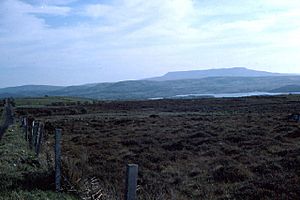
The Breifne Mountains are a range of hills that cross the border. They are a few miles southwest of Enniskillen. Cuilcagh Mountain itself is very tall, reaching about 666 meters (2,185 feet) high. Rivers like the Sruh Croppa, Owenbrean, and Aghinrawn flow on the northern side of Cuilcagh Mountain. When they reach the limestone rock, they disappear underground! These underground rivers then join up to form the Cladagh River. This river later comes out at a natural rock bridge called the Marble Arch.
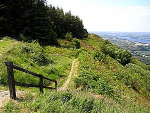
Other parts of the Geopark include hills stretching between Belmore Mountain (which is about 401 meters or 1,316 feet high) and the Cliffs of Magho. These cliffs offer amazing views over the western parts of Lower Lough Erne.
Understanding the Geopark's Geology
The Geopark's rocks mostly formed during the Carboniferous Period. This was a time long, long ago when Earth looked very different. The rocks here are mostly sandstones, mudstones, and limestones. They have been gently folded and faulted over millions of years.
Ancient Rocks and Earth's Changes
Even older rocks can be found in a few places. The very oldest rocks are called gneisses. They are found northwest of Lower Lough Erne. These rocks started as sand on the seafloor and were changed by huge pressure and heat during a mountain-building event called the Caledonian Orogeny.
Other old rocks include schists, phyllites, and marble. These are part of something called the Dalradian Supergroup. You can also find rocks from the Ordovician age, like greywackes, shales, sandstones, and conglomerates. These are around Cavan and Butlers Bridge.
Carboniferous Rocks and Caves
The Carboniferous rocks are divided into different layers or "formations." The Marble Arch Caves themselves formed in a type of limestone called the Glencar Limestone Formation and the Dartry Limestone Formation. Cuilcagh Mountain is mostly made of sandstone and shale formations.
Volcanic Intrusions
Many of these rock layers have cracks or breaks called faults. Some rocks at Cuilcagh have been pushed into by molten rock from deep inside the Earth. These are called dykes, which are like vertical walls of rock. There are also sills, which are horizontal layers of rock that squeezed between older layers. These intrusions are made of a rock called dolerite.
Ice Ages and Landscapes
The limestone rocks in the Geopark have created a fantastic karst landscape. This means there are lots of caves, sinkholes, and underground rivers. The Marble Arch Caves are very old, dating back over 380,000 years!
The area was covered by ice many times during the Quaternary period, which includes the recent ice ages. The last big ice age left behind huge rocks called glacial erratics. These rocks were carried by glaciers and dropped far from where they originally formed. You can see some of these at Cavan Burren Park.
The Geopark also has many drumlins. These are small, oval-shaped hills that were formed by the movement of a massive ice sheet. This ice sheet was more than 1,000 meters (3,280 feet) thick during the ice age! The unique look of Upper Lough Erne comes from many drumlins being partly covered by water after the ice melted.
Protected Natural Areas
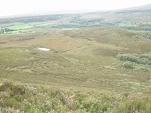
The Geopark is home to several National Nature Reserves. These include Correl Glen, Hanging Rock, Cladagh Glen, and Killykeegan. Some of the boggy land on Cuilcagh Mountain is also protected as a Special Area of Conservation (SAC). This is under the European Union's Habitats Directive. It's also a Ramsar site, which means it's an important wetland recognized internationally.
Fun Places to Visit
The Geopark has many exciting places to explore:
- Marble Arch Caves are a huge attraction. These show caves let visitors see amazing cave features by boat and on foot.
- Cavan Burren Park is a forest area near Blacklion in County Cavan. It has many ancient monuments from prehistoric times. There are trails to explore them and a visitors' center to learn more. You can see the Calf House (also called Druid's Altar), which is a portal tomb from the Neolithic period. There's also the Giant's Leap wedge tomb nearby.
- Shannon Pot is a natural pool believed to be the source of Ireland's longest river, the Shannon. It has many old stories and myths connected to it, like the tale of Sionnan.
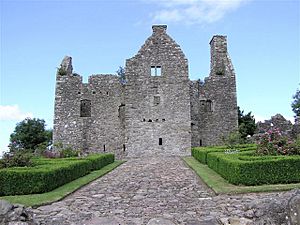
- Castles and Historic Buildings are scattered throughout the Geopark. Many are now ruins, like Castle Caldwell, Tully Castle, Monea Castle, and Drumlane Abbey. Enniskillen Castle has been restored and now has a museum inside.

- Devenish Island is an ancient monastic site in Lower Lough Erne. You can reach it by boat.
- Boa Island is off the northern shore of Lower Lough Erne and can be reached by road. It has important ancient monuments related to early Christianity.
A Brief History of the Geopark
The Marble Arch Caves were first explored in 1895 by a French speleologist (cave explorer) named Édouard-Alfred Martel. He was joined by a naturalist named Lyster Jameson. Over the next 70 years, other cave exploration groups continued to explore the cave system.
Fermanagh District Council decided to open the caves to the public, and they officially opened in 1985. The nearby Cuilcagh Mountain Park opened in 1998.
In 2001, these two areas became one of the first European geoparks. Then, in 2004, they became a global geopark after an agreement between UNESCO and the European Geoparks Network. In 2007, the Geopark grew to include many more thousands of acres of forest land. In September 2008, it became the world's first geopark to cross an international border! It expanded into County Cavan in the Republic of Ireland.
Geopark Events
The Geopark often organizes walks and events to help people learn about its attractions. These events are for both local people and visitors. One special event is European Geoparks Week, which happens at the end of May and beginning of June. This event takes place at the same time in geoparks all across Europe.
 | Delilah Pierce |
 | Gordon Parks |
 | Augusta Savage |
 | Charles Ethan Porter |


