Mazamitla facts for kids
Quick facts for kids
Mazamitla
|
||
|---|---|---|
|
Municipality and town
|
||
 |
||
|
||
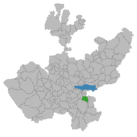
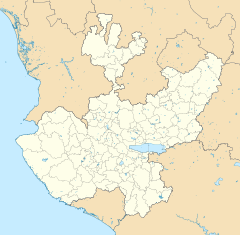
Location of the municipality in Jalisco
|
||
| Country | ||
| State | ||
| Area | ||
| • Total | 288.9 km2 (111.5 sq mi) | |
| • Town | 4.32 km2 (1.67 sq mi) | |
| Population
(2020 census)
|
||
| • Total | 14,043 | |
| • Density | 48.609/km2 (125.895/sq mi) | |
| • Town | 8,142 | |
| • Town density | 1,884.7/km2 (4,881/sq mi) | |
| Time zone | UTC-6 (Central Standard Time) | |
| • Summer (DST) | UTC-5 (Central Daylight Time) | |
| Website | Official site: http://www.mazamitla.com.mx | |
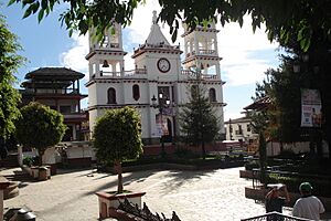
Mazamitla is a beautiful town and municipality in the Mexican state of Jalisco. It is located about 124 kilometers (77 miles) south of Guadalajara. This area is a very popular place for people from Guadalajara and other nearby cities to visit.
The name Mazamitla comes from the Nahuatl language. It means "place where arrows are made to hunt deer." The municipality covers an area of 288.9 square kilometers (111.5 square miles). In 2020, about 14,043 people lived there. Most people work in the service industry. Because of its amazing natural beauty, the Mexican government has named Mazamitla a Pueblo Mágico (Magical Town).
Contents
What Does Mazamitla Mean?
The name Mazamitla comes from the Nahuatl language. It combines three words: "Mazatl" (meaning deer), "Mitl" (meaning arrow), and "tlan" (meaning place).
People have thought about its meaning in a few different ways:
- "Where deer are hunted with arrows"
- "Where arrows for hunting deer are made"
- "The place of deer-hunting fletchers" (a fletcher is someone who puts feathers on arrows)
A Look at Mazamitla's History
Mazamitla was first settled by the Aztecs in the year 1165. It was part of a larger area called the Tzapotlán manor. People from Mazamitla used to pay tribute to Tamazollan, which was also known as Tamazula.
In 1481, the Purépecha group invaded the area. They wanted to take control of the Laguna de Sayula lake. However, the Purépecha only held the area for a few years. They were defeated at the end of the Salitre War in 1510.
Spanish Arrival and Changes
The Spanish arrived in Mazamitla in early 1522. Cristóbal de Olid and Juan Rodríguez Villafuerte led the conquest. They were sent by Hernán Cortés to explore western Mexico. After the conquest, the people of Tzapotlán were given to Hernán Cortés. He then appointed Anton Salcedo to manage the area. Later, Nuño de Guzmán took over these lands from Cortés.
An interesting story tells that Miguel Hidalgo, a famous Mexican priest, once held a church service in a place called Palo Gordo. He used the trunk of an oak tree as his altar. This tree trunk is now kept as a special item.
In 1812, a battle happened in the Zapatero area. Francisco Echeverria was the captain of the local fighters. Even though his side won, he was badly hurt and later died in Mazamitla. During the French intervention, French invaders burned many important local records.
Becoming a Town and Growing Tourism
From 1825, Mazamitla was part of Sayula. Then, in 1878, it became part of Ciudad Guzmán. On April 19, 1894, the state government officially declared Mazamitla a town.
After 1878, Mazamitla's population grew a lot. A local official named Alexis Ceja wanted to boost tourism. He came up with the idea of building cabins for visitors and future residents. This helped Mazamitla become the popular tourist spot it is today.
Mazamitla's Geography
Mazamitla is located in the south-central part of Jalisco. It is south of Lake Chapala. Its exact location is between 19º47'30" and 19º59'00" north latitude, and 102º58'35" and 103º10'45" west longitude. The town is about 2,200 meters (7,218 feet) above sea level.
Neighboring Areas
- To the north, Mazamitla borders La Manzanilla de La Paz, the state of Michoacán, and Valle de Juárez.
- To the east, it borders Valle de Juárez.
- To the south, it borders Valle de Juárez and Tamazula de Gordiano.
- To the west, it borders Concepción de Buenos Aires and La Manzanilla de La Paz.
Mountains and Hills
The area around Mazamitla has many hills (35% of the land). These hills are covered with forests and range from 2,200 to 2,800 meters (7,218 to 9,186 feet) high. About 40% of the land is made up of smaller hills and slopes, between 2,000 and 2,200 meters (6,562 to 7,218 feet) high. The remaining 25% is flat land, from 200 to 1,800 meters (656 to 5,906 feet) high. The highest points are Cerro El Jackal and Cerro del Tigre.
Soil and Land Use
The soil in Mazamitla formed during the Tertiary period. It is mostly hilly and uneven. The main types of soil are luvisol, feozem háplico, and litosol.
The municipality has a total land area of 17,718 hectares (about 43,782 acres). Here's how the land is used:
- 3,495 hectares (8,636 acres) are for farming.
- 3,095 hectares (7,648 acres) are for raising animals.
- 10,516 hectares (25,986 acres) are for forests.
- 206 hectares (509 acres) are for city areas.
- 442 hectares (1,092 acres) are for other uses.
Most of the land (11,286 hectares or 27,890 acres) is owned by the community or the public. The rest (6,432 hectares or 15,894 acres) is privately owned.
Water Resources
Mazamitla has several rivers and streams. The main rivers are La Pasión, Río de Gómez, Los Cazos, Ponche Grande, and La Media Luna. Some streams include El Salto, Barranca Verde, El Ruido, Cuate, Barranca, Los Puentes, and La Cuesta. There are also springs like Barranca los Hoyos, Paso Blanco, La Pasión, and Boca de Tinieblas.
Mazamitla's Climate
Mazamitla has a subtropical highland climate. This means it has dry and mild winters. The average temperature for the year is about 21°C (70°F). The highest temperatures can reach 25.7°C (78.3°F), and the lowest can be 7.1°C (44.8°F).
Most of the rain falls between June and September, with about 982 millimeters (38.7 inches) of rain on average. The area experiences frost about 52.6 days a year. The winds usually blow from the south.
| Climate data for Mazamitla | |||||||||||||
|---|---|---|---|---|---|---|---|---|---|---|---|---|---|
| Month | Jan | Feb | Mar | Apr | May | Jun | Jul | Aug | Sep | Oct | Nov | Dec | Year |
| Record high °C (°F) | 32.0 (89.6) |
30.0 (86.0) |
34.0 (93.2) |
39.0 (102.2) |
36.0 (96.8) |
35.0 (95.0) |
29.0 (84.2) |
29.0 (84.2) |
29.0 (84.2) |
29.5 (85.1) |
28.0 (82.4) |
28.0 (82.4) |
39.0 (102.2) |
| Mean daily maximum °C (°F) | 20.3 (68.5) |
21.8 (71.2) |
24.3 (75.7) |
26.2 (79.2) |
27.1 (80.8) |
24.1 (75.4) |
21.4 (70.5) |
21.6 (70.9) |
21.4 (70.5) |
21.8 (71.2) |
21.4 (70.5) |
20.5 (68.9) |
22.7 (72.9) |
| Daily mean °C (°F) | 13.3 (55.9) |
14.2 (57.6) |
16.1 (61.0) |
18.0 (64.4) |
19.0 (66.2) |
18.0 (64.4) |
16.4 (61.5) |
16.5 (61.7) |
16.3 (61.3) |
15.8 (60.4) |
14.9 (58.8) |
13.9 (57.0) |
16.0 (60.8) |
| Mean daily minimum °C (°F) | 6.4 (43.5) |
6.6 (43.9) |
7.9 (46.2) |
9.9 (49.8) |
11.0 (51.8) |
11.8 (53.2) |
11.3 (52.3) |
11.4 (52.5) |
11.2 (52.2) |
9.7 (49.5) |
8.3 (46.9) |
7.3 (45.1) |
9.4 (48.9) |
| Record low °C (°F) | −3.0 (26.6) |
1.0 (33.8) |
1.0 (33.8) |
1.0 (33.8) |
2.0 (35.6) |
1.0 (33.8) |
6.0 (42.8) |
6.0 (42.8) |
4.0 (39.2) |
2.0 (35.6) |
0.0 (32.0) |
−3.0 (26.6) |
−3.0 (26.6) |
| Average precipitation mm (inches) | 29.7 (1.17) |
15.6 (0.61) |
9.7 (0.38) |
11.4 (0.45) |
44.2 (1.74) |
178.6 (7.03) |
231.3 (9.11) |
199.6 (7.86) |
161.4 (6.35) |
98.4 (3.87) |
26.7 (1.05) |
15.9 (0.63) |
1,022.5 (40.26) |
| Average precipitation days (≥ 0.1 mm) | 2.3 | 1.2 | 0.9 | 1.5 | 4.7 | 15.9 | 20.7 | 18.7 | 15.5 | 9.6 | 3.0 | 1.7 | 95.7 |
| Source: Servicio Meteorologico Nacional | |||||||||||||
Plants and Animals of Mazamitla
The plants found here include pine trees, oak trees, arbutus, huizache, mesquite, palo dulce, nopal cactus, granjeno, and various fruit trees.
The wildlife in Mazamitla includes deer, porcupines, wild cats, rabbits, squirrels, eagles, sparrowhawks, chachalacas, and wild guajolotes (wild turkeys).
Mazamitla's Economy
Most people in Mazamitla work in the service industry (42.31%). About 26.37% work in farming, forestry, or fishing. Another 26.45% work in manufacturing or construction. About 30.78% of the people are actively working.
The main ways people earn money in Mazamitla are:
- Agriculture: Farmers grow corn, oats, barley, beans, potatoes, broad beans, and tomatoes.
- Livestock: People raise cattle, pigs, cows, horses, and birds.
- Tourism: Visitors come to see the town's buildings and natural beauty.
- Trade: This includes restaurants, shops, and markets. You can find everyday items and many different kinds of goods.
- Services: This covers things like financial help, professional advice, community services, tourism services, and maintenance.
- Industry: There are factories that make food products like dairy items, canned food, and cajeta (a sweet caramel made from goat's milk).
- Logging: People cut down pine and oak trees for wood.
- Mining: There are places where lime, sand, and stone from quarries are found.
Life in Mazamitla: Infrastructure and Services
Education for All Ages
About 90.11% of the people in Mazamitla can read and write. Of those, 31.28% have finished primary education. The municipality has:
- 18 preschools
- 30 Elementary schools
- 3 middle schools
- 1 high school
- 2 job training centers
Sports and Fun Activities
Mazamitla has sports centers where people play football, basketball, and volleyball. You can also enjoy extreme sports like hiking, mountaineering, hunting, and racing.
The town also has a cultural center, a main plaza, a cinema, places for traditional Mexican rodeos (palenques), a museum, a town hall auditorium, a lienzo charro (a charro arena), parks, gardens, and a library.
Homes and Living
There are 2,674 houses in Mazamitla, and most of them are privately owned. A large number of homes have important services:
- 96.33% have electricity.
- 76.93% have sewer and drinking water.
Most houses are built using tile, adobe (a type of mud brick), concrete, and brick.
Public Services
The municipality provides many services to its residents. These include clean drinking water, sewerage systems, street lighting, markets, a slaughterhouse (rastro), cemeteries, roads, trash collection, public safety, parks, gardens, and sports centers.
- 89.9% of homes have drinking water.
- 80.9% have sewerage.
- 93.3% have electricity.
Getting Around and Staying Connected
Mazamitla has access to mail, fax, telegraph, and telephone services. You can also get radio and television signals.
The main road to Mazamitla is the Guadalajara–Tuxcueca–Mazamitla highway. There are also many smaller roads that connect different parts of the area. You can travel by public buses, rental vehicles, and taxis.
Some of the main bus companies that serve Mazamitla are:
- Buses Valle de Juarez
- Autobuses de Occidente
- Autobuses Flecha Amarilla
- Autobuses del sur de Jalisco
- Autotransportes de Mazamitla
- Autobuses de Tamazula
Mazamitla's Population
In 2020, the municipality of Mazamitla had 14,043 people. There were 6,610 males and 7,433 females. A small part of the population (0.53%) are indigenous people.
| 1980 | 1990 | 2000 | 2005 |
|---|---|---|---|
| 8,765 | 10,226 | 11,004 | 15,742 |
Religious Beliefs
Most people in Mazamitla (96.92%) are Catholics. There are also people who are Jehovah's Witnesses, Protestants, or follow other religions. A very small number (0.30%) do not practice any religion.
Culture and Fun in Mazamitla
Places to Visit
Mazamitla has many interesting places to see:
- Jardín Encantado (Enchanted Garden)
- Parroquia de San Cristóbal (Parish Church of San Cristóbal)
- Bosque La Zanja (La Zanja Forest)
- Bosque Las Charandas (Las Charandas Forest)
- Bosque El Chacal (El Chacal Forest)
- Sierra Del Tigre (Tiger Mountain Range)
- La Cañada (The Canyon)
- Cascada El Salto (El Salto Waterfall)
- Los Cazos (The Potholes)
- Bosque El Tabardillo (El Tabardillo Forest)
- Bosque Las Peñitas (Las Peñitas Forest)
- Bosque Pinos de Mazamitla (Mazamitla Pine Forest)
- Mirador Las Peñitas (Las Peñitas Viewpoint)
- La casa de los fuentes (The house of the fountains)
Local Celebrations and Festivals
Mazamitla has several fun festivals throughout the year:
- Fiestas de San Cristóbal: This celebration honors the patron saint of the town. It takes place in the second week of July.
- Feast of the Virgin of Guadalupe: Celebrated from December 4 to 12.
- Patriotic Fiestas: These are national holidays on September 15 and 16.
- Festival de las Flores (Flower Festival): Held on weekends in October.
- Founding Celebrations: These celebrate the founding of Mazamitla from March 27 to 30.
Sister Cities
Mazamitla has special connections with other cities around the world. These are called "twinned cities" or "sister cities."
 Denton, Texas
 Cincinnati, Ohio
 Kentucky (This is a state, not a city, but it's listed as an association)
 Gatlinburg, Tennessee
 Norco, California
Images for kids
See also
 In Spanish: Mazamitla para niños
 | Ernest Everett Just |
 | Mary Jackson |
 | Emmett Chappelle |
 | Marie Maynard Daly |


