
Milliarium facts for kids


A milliarium (say "mill-ee-ARE-ee-um") was a special stone used by the Romans. These stones were placed along roads built by the Romans. They started using them around 300 BC. Milliaria helped people know distances. They were usually placed every Roman mile. One Roman mile was about 1,000 "milia passum," which is about 1.5 kilometers (or 0.9 miles). In some areas, like the Celtic provinces, they used "leagues" instead. A league was about 1,500 "milia passum," or about 2.2 kilometers (or 1.4 miles).
What Were Milliaria?
Milliaria were tall stone pillars. They were like early versions of road signs. But they did more than just show distance. They also showed who was in charge.
What Information Did They Show?
Milliaria often had important information carved into them:
- The name of the Emperor or person who built or fixed the road. They would also list all their important titles.
- The distance from a starting point. This could be the capital city or another big town. Sometimes, the stone showed the distance to a larger settlement nearby.
More Than Just Signs
Even though milliaria look like modern road signs, their main purpose might have been different. They probably weren't just for helping travelers find their way. It's more likely they were used to show the power of the person who put them there. Some were even used for propaganda. This means they helped spread messages about the emperor's greatness.
Interestingly, the words on the stones were often in two languages. The emperor's name and titles were usually in Latin. But the distance information was often in Greek. Most ordinary people could probably read the Greek part, but not the Latin. Today, we know about 7,000 to 8,000 of these ancient stones.
Images for kids
-
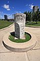
A mile marker on the U.S. National Road giving distances from many places
-
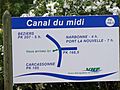
"You are here" sign on the Canal du Midi just before the turn onto La Nouvelle branch. Note that locations on this French canal are marked in PK (point kilometre) values.
-
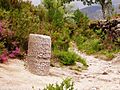
Roman milestone XXIX on Via Romana XVIII – the road linking the Iberian cities of Bracara Augusta and Asturica Augusta
-
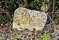
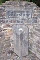
Roman milestone on the former A66 between Kirkby Thore and Temple Sowerby (no inscription)
-
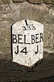
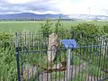
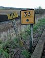
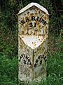
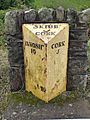
Milestone in Northumberland, indicating 1 mile to Berwick-upon-Tweed, 14 miles to Belford and 333 miles to London.
-

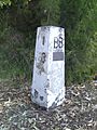
Milestone in Payyambalam beach, Kannur, India.
-
Example of a milestone in the Philippines
-
Typical mile marker used in the United States
-

Use of furlongs on a highway sign near Yangon in 2010
-
Mileposts on the Yangon-Mandalay Expressway use miles followed by furlongs
-
Old and new railway mileposts in the UK, indicating a distance of 33+1⁄4 miles (53.5 km) from the zero point
-
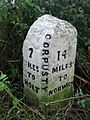
Milestone near Corpusty on the B1149 in Norfolk
-
A milestone marked "A.D. 1836", on the B3306 near Land's End Airport
-
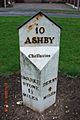
Milestone on the A514 in Chellaston, Derby
-
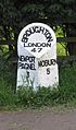
Milestone on the A5130 in Broughton, Milton Keynes
-
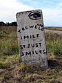
Milestone on the B3318 in Penwith, Cornwall
-
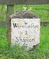
Milestone on A360 near Potterne, Wiltshire
-
Milestone on A350 in Longbridge Deverill, Wiltshire
-
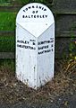
Milestone on B5500, in the township of Balterley, Staffordshire
-
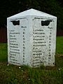
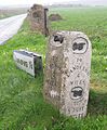
Milestone on the B940 near Lathones in Fife, Scotland
-
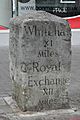
Milestone on Sutton High Street, Sutton, London
-
Milestone on Rod Moor Road, Dronfield, Derbyshire, UK
-
Milepost 18 from Batemans Bay, New South Wales, now preserved in the town. 35°42′05″S 150°10′53″E / 35.7014°S 150.1815°E
-
A milestone with royal cypher of Frederick VII in Skanderborg Dyrehave
-
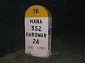
A milestone near Haridwar on an Indian highway
-
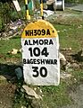
A Milestone on NH309A in Uttarakhand, India.
-
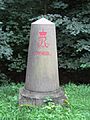
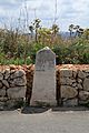
A milestone at Milestone in County Tipperary
-
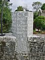
Cast iron milestone on N71 in County Cork
-
A milestone in Mountbellew, County Galway
-
A defaced milestone in Mellieħa
-
A defaced milestone in Swieqi
-
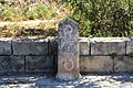
1774 Caleb Aldrich milestone on Great Road in Rhode Island, United States
-
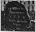
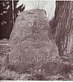
Peleg Arnold's 1774 milestone on Great Road in Rhode Island, United States
-
Milestone 8 on the Upper Boston Post Road in Harvard Square, Massachusetts, United States
-
Milestone along the boundary of the original District of Columbia set in 1792 and now marking the boundary between Washington, D.C., and Maryland in the United States.
-

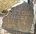
Historic granite milestone in Kingston, Massachusetts marking the 42nd parallel.


.JPG)


_near_Lathones.JPG)


.jpg)


_NE_2.jpg)
.jpg)
