Mount Pleasant, South Carolina facts for kids
Quick facts for kids
Mount Pleasant
|
||
|---|---|---|
|
||
|
||
| Country | United States | |
| State | South Carolina | |
| County | Charleston | |
| Settled | July 6, 1680 | |
| Founded | 1776 (Greenwich) 1803 (Mount Pleasant) |
|
| Consolidated | 1837 | |
| Named for | Hibben House | |
| Area | ||
| • Total | 58.66 sq mi (151.92 km2) | |
| • Land | 49.55 sq mi (128.32 km2) | |
| • Water | 9.11 sq mi (23.60 km2) 15.53% | |
| Elevation | 16 ft (5 m) | |
| Population
(2020)
|
||
| • Total | 90,801 | |
| • Estimate
(2023)
|
95,232 | |
| • Rank | 4th in South Carolina | |
| • Density | 1,832.70/sq mi (707.60/km2) | |
| Time zone | UTC−5 (EST) | |
| • Summer (DST) | UTC−4 (EDT) | |
| ZIP codes |
29464-29466, 29429
|
|
| Area code | 843, 854 | |
| FIPS code | 45-48535 | |
| GNIS feature ID | 1224770 | |
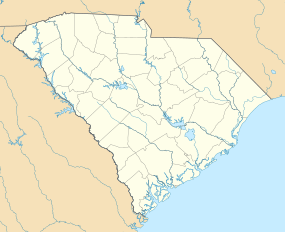
Mount Pleasant is a big town in Charleston County, South Carolina, United States. It's located in an area called the Lowcountry. Mount Pleasant is the fourth-largest town in South Carolina by population. For many years, it was one of the fastest-growing places in the state. Its population doubled between 1990 and 2000. In 2020, about 90,801 people lived there. It's part of the larger Charleston area.
Near the Arthur Ravenel Bridge is Patriots Point. This is a naval and maritime museum. It's home to the World War II aircraft carrier USS Yorktown, which is now a museum ship. The Ravenel Bridge is a large eight-lane highway. It's part of U.S. Route 17. This bridge was finished in 2005. It crosses the Cooper River and connects Mount Pleasant with the city of Charleston.
Contents
Exploring Mount Pleasant's Past
The land where Mount Pleasant now stands was first home to the Sewee people. They were a Native American tribe. The first European settlers came from England on July 6, 1680. They were led by Captain Florentia O'Sullivan. He was given a large piece of land. This land included Sullivan's Island and the future site of Mount Pleasant. Early maps called this area "North Point".
In 1696, 51 new families arrived. Each family received hundreds of acres in what became the Christ Church parish. In 1706, the Province of Carolina fought off attacks from the Spanish and French. They won against French invaders in an area called "Abcaw".
The "Abcaw" area was Hobcaw Plantation. It was located between Shem Creek and the Wando River. Later, it was also known as Shipyard Plantation. This spot was great for shipbuilding because it had deep water access and lots of good timber. Over time, many different English families owned land near Hobcaw Point. Many of them ran ferries that served Mount Pleasant. By 1721, 107 families lived in Christ Church parish. This included 400 white people and 637 enslaved Africans. As big plantations grew, enslaved Africans were forced to do most of the work. Because of this, most of the town's population was African American through the 1800s and early 1900s.
In 1754, Charles Pinckney bought a 715-acre plantation. He grew crops like rice and indigo there. This became known as Snee Farm. His son Charles owned the plantation until 1817. It continued to be a plantation throughout the 1800s.
On September 24, 1860, a public meeting in Mount Pleasant led to the first secession resolution in South Carolina. This meant they wanted to leave the United States. The secession convention met in Charleston on December 20, 1860. When the Civil War began, Battery Guerry and a floating battery helped defend the city. They were also used to attack Fort Sumter. Mount Pleasant was protected by a line of forts. It was also the secret training spot for the nine-man crew of the Confederate submarine H. L. Hunley. This small submarine launched from Breach Inlet in 1864. It attacked and sank the USS Housatonic.
The original wooden footbridge, later called the Pitt Street Bridge, was used by the H.L. Hunley crew. They crossed it to get to Breach Inlet to test the submarine. In 1899, a trolley bridge replaced the wooden one.
Later, in 1929, a steel drawbridge was built. It allowed vehicles to cross between Sullivan's Island and Mount Pleasant. The Pitt Street bridge was taken down in 1945. But its remains can still be seen in the Intracoastal Waterway. This area is now the Pickett Bridge Recreation Area. It was named after a Charleston doctor, Otis Pickett.
The "Old Village" is Mount Pleasant's oldest neighborhood. The oldest house there, 111 Hibben Street (the Hibben House), was built in 1755. It was built by Jacob Motte, whose family were French Huguenots. They came to South Carolina to escape religious unfairness.
Today, the Old Village has shops at the end of Pitt Street. One of them is the Pitt Street Pharmacy. It has been open for over 60 years and was even featured on the Food Network.
After the Civil War, many enslaved people became free. By 1875, African Americans made up 73% of the population in Charleston County.
Scanlonville: A New Beginning
After the Civil War, some freed African Americans created Scanlonville. This was one of the first African-American communities formed in the Charleston area. Today, it's a neighborhood within Mount Pleasant. Robert Scanlon, a freed carpenter, bought 614 acres of land. This land was known as Remley's Plantation. It was along the Wando River in Mount Pleasant. Scanlon was the leader of the Charleston Land Company. This company was started by 100 local freedmen. They put their money together, paying $10 per share. This allowed them to buy large areas of land. The Charleston Land Company divided Remley's Plantation into smaller lots. This way, freedmen could own their own land. Remley's Plantation was split into farm lots and smaller city lots to create Scanlonville. The Charleston Land Company and Scanlonville were unique projects. They were among the first cooperative real estate efforts by African-American freedmen after the Civil War. The Remley Point Cemetery is located in Scanlonville.
Riverside: A Place for Fun
West of Scanlonville is Riverside. For much of the 1900s, this was the biggest and oldest of five "black beaches" in Charleston County. It was created when public places were separated by law based on race. Riverside officially opened in 1930. It had a dance hall, sports field, bathhouse, playground, and a boardwalk along the Wando River. The Riverside Pavilion was the only place where black city residents could see famous African-American musicians. Stars like Duke Ellington, Count Basie, Louis Armstrong, B.B. King, and Ivory Joe Hunter performed there. These artists also played at places only for white people. Music at the Pavilion led to "juke joints" (night clubs) in Scanlonville. Eventually, a hotel called White's Paradise opened. James Brown was known to visit this hotel.
After the park owner died in 1975, Charleston County took over Riverside. Later, the county sold the land to a real estate company. This company built a private community there. Public access to the waterfront was then closed.
Hurricane Hugo and Town Growth
On September 21, 1989, Hurricane Hugo hit Mount Pleasant. It was a very strong Category Four hurricane. While the town didn't get the very worst of the storm, it still had serious damage. The nearby islands were also badly hit. Children who lived through the storm were shown in an early episode of Nickelodeon's Nick News.
After the hurricane, more people moved to the area. The town grew a lot. Its population went from about 23,000 in 1990 to about 47,000 in 2000.
Bridges Connecting Communities
In 1928, a bridge was built from the Charleston Peninsula to Mount Pleasant. It crossed Town Creek and the Cooper River. This bridge, the Grace Memorial Bridge, had two lanes and was a toll bridge. A second, larger bridge, the Silas N. Pearman Bridge, opened in 1966.
On July 16, 2005, the eight-lane Arthur Ravenel Bridge opened. It replaced the two older bridges. This new bridge is one of the longest cable-stayed bridges in the Western Hemisphere. A week before it officially opened, people were allowed to walk across it. There were also fireworks and special ceremonies. Some old cars from the time of the Grace Memorial Bridge made a final trip across the old bridges. The rest of the old bridges were taken down. Local people watched as the bridges were removed using explosives in 2006.
In 2004, Mount Pleasant was one of the first towns in the U.S. to pass a "pay-before-you-pump" gas rule. This was to help stop gas theft, which had increased with rising prices.
Historic Places to Visit
Mount Pleasant has many important historic sites. These places are listed on the National Register of Historic Places. They include:
- The Auld Mound
- Buzzard's Island Site
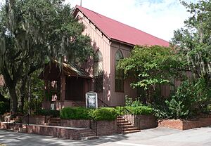
- Christ Church
- Cook's Old Field Cemetery
- Long Point Plantation (38CH321)
- Lucas Family Cemetery
- Mount Pleasant Historic District
- Oakland Plantation House
- Old Berkeley County Courthouse
- Paul Pritchard Shipyard
- Remley Point Cemetery
- Slave Street, Smokehouse, and Allee, Boone Hall Plantation
- Charles Pinckney National Historic Site
- USS Laffey (DD-724)
- USS Yorktown (CV-10)
Mount Pleasant's Location
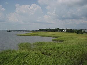
Mount Pleasant is in the middle of Charleston County. It's on the east side of Charleston Harbor and the Wando River. To the south is Sullivan's Island. To the west, across the water, is the city of Charleston. Over time, Mount Pleasant has grown northeastward. It now stretches about 24 miles along U.S. Route 17, almost to Awendaw.
The Cooper River separates Mount Pleasant from Charleston. For many years, wealthy Charleston residents used Mount Pleasant as a summer getaway. They believed they could escape summer sicknesses by crossing the river. The main part of Mount Pleasant used to be the "Old Village".
The town covers about 58.66 square miles. About 49.55 square miles is land, and 9.11 square miles (15.53%) is water.
Getting Around: Airports
Mount Pleasant is served by the Charleston International Airport. This airport is in North Charleston, about 12 miles northwest of Mount Pleasant. It's the busiest passenger airport in South Carolina. The airport shares runways with the nearby Charleston Air Force Base.
There's also the Mount Pleasant Regional Airport. It's also called "Faison Field". This public airport is within the town limits, about 9 miles northeast of the town center. Both airports are owned and run by the Charleston County Aviation Authority.
Who Lives in Mount Pleasant?
| Historical population | |||
|---|---|---|---|
| Census | Pop. | %± | |
| 1880 | 783 | — | |
| 1890 | 1,138 | 45.3% | |
| 1900 | 2,252 | 97.9% | |
| 1910 | 1,346 | −40.2% | |
| 1920 | 1,575 | 17.0% | |
| 1930 | 1,415 | −10.2% | |
| 1940 | 1,698 | 20.0% | |
| 1950 | 1,857 | 9.4% | |
| 1960 | 5,116 | 175.5% | |
| 1970 | 6,155 | 20.3% | |
| 1980 | 14,464 | 135.0% | |
| 1990 | 30,108 | 108.2% | |
| 2000 | 47,609 | 58.1% | |
| 2010 | 67,843 | 42.5% | |
| 2020 | 90,801 | 33.8% | |
| 2023 (est.) | 95,232 | 40.4% | |
| U.S. Decennial Census 2020 |
|||
Mount Pleasant has grown a lot over the years. In 2020, there were 90,801 people living in the town. There were 36,111 households and 24,203 families.
In 2010, the population was 67,843 people. About 90.17% of the people were White, and 7.25% were African American. About 1.33% of the population was Hispanic or Latino.
The average household had 2.47 people, and the average family had 2.99 people. About 25.1% of the population was under 18 years old. The median age was 36 years. The median income for a household was $61,054.
Local TV Stations
These TV stations have studios in Mount Pleasant and broadcast from there:
- WCBD-TV (Channel 2, NBC, CW)
- WCIV-TV (Channel 4, ABC, MyNetworkTV)
Famous People from Mount Pleasant
Many notable people have connections to Mount Pleasant, including:
- Ben Bridwell, lead singer of Band of Horses
- Ruby Middleton Forsythe, (1905–1992) a well-known educator
- Travis Jervey, former NFL player and Super Bowl champion
- James E. Livingston, a Major General in the U.S. Marine Corps and Medal of Honor recipient
- Justin Lock, a meteorologist
- Jack V. Mackmull, a U.S. Army lieutenant general
- Ronald Motley, a trial lawyer
- Barry Richardson, a football player
- Bear Rinehart, lead singer of Needtobreathe
- Shelby Rogers, a tennis player
- Darius Rucker, a country singer/songwriter
- Melanie Thornton, an American/German R&B, pop, and dance singer
- D. J. Trahan, a PGA Tour golfer
- Abraham J. Turner, a major general in the United States Army
- Steve Wood, an Anglican bishop
Schools in Mount Pleasant
Mount Pleasant's public schools are part of the Charleston County School District.
Public Elementary Schools
- Belle Hall Elementary School
- Carolina Park Elementary School
- Charles Pinckney Elementary School
- East Cooper Montessori Charter School
- James B. Edwards Elementary School
- Jennie Moore Elementary School
- Laurel Hill Primary School
- Mount Pleasant Academy
- Whitesides Elementary School
Public Middle Schools
- East Cooper Montessori Charter School
- Laing Middle School
- Moultrie Middle School
- Thomas Cario Middle School
Both Laing Middle School and Moultrie Middle School used to be the town's high schools before Wando High School was built in 1973.
Public High Schools
- Wando High School
- Oceanside Collegiate Academy
- Lucy Garret Beckham High School, named after a former principal of Wando High School.
Private Schools
- Christ Our King-Stella Maris Catholic School (Grades K-8)
- Coastal Christian Preparatory School (Grades K-8)
- Crown Leadership Academy (Preschool-12th grade)
- Palmetto Christian Academy (Preschool-12th grade)
- Trident Academy
- University School of the Lowcountry
- Primrose School of Mount Pleasant (infant through Pre-K and afterschool)
Parks and Recreation
The Charleston County Park and Recreation Commission (CCPRC) manages many parks in Charleston County. Several are located in Mount Pleasant:
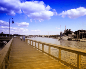
- Mount Pleasant Pier
- Palmetto Islands County Park
- Splash Island at Palmetto Islands County Park
- Laurel Hill County Park
- Future Park—off Rifle Range Road
Shopping in Mount Pleasant
Mount Pleasant has many places to shop, including large retail stores and smaller boutiques:
- Mount Pleasant Towne Centre
- Belle Hall Shopping Center
- The Market at Oakland
Images for kids
See also
 In Spanish: Mount Pleasant (Carolina del Sur) para niños
 | Charles R. Drew |
 | Benjamin Banneker |
 | Jane C. Wright |
 | Roger Arliner Young |


