Mount Pleasant Caldera facts for kids
Quick facts for kids Mount Pleasant Caldera |
|
|---|---|
| Highest point | |
| Elevation | approx. 248 m (814 ft) |
| Listing | List of volcanoes in Canada |
| Geography | |
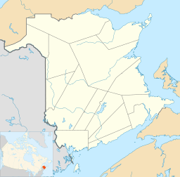
| Location | Charlotte County, New Brunswick, Canada |
| Parent range | Appalachian Mountains |
| Topo map | 021G07 |
| Geology | |
| Age of rock | Late Devonian |
| Mountain type | Caldera |
| Climbing | |
| Easiest route | All-weather road |
The Mount Pleasant Caldera is a huge, ancient volcano in southwestern New Brunswick, Canada. It's not a typical cone-shaped volcano you might imagine. Instead, it's a caldera, which is a large bowl-shaped hollow that forms when a volcano's magma chamber empties and the ground above it collapses. This caldera formed a very long time ago, during the Devonian Period, about 350 million years ago. It's special because not many old calderas like this are still easy to see. Its creation is linked to a time when the Earth's crust in the northern Appalachian Mountains became thinner after a big mountain-building event called the Acadian orogeny. Mount Pleasant Caldera is located quite close to the ocean.
Contents
Geology: How the Volcano Formed
This large, oval-shaped volcano formed during the late Devonian Period. Part of its northern side is now covered by younger rocks from the Mississippian Period and Pennsylvanian Period. The volcano is shaped like a long oval, measuring at least 13 by 34 kilometres (8 mi × 21 mi). Scientists figured this out by studying the area's gravity and magnetic fields. The northern part of the volcano has been covered by layers of rock over time.
The rocks inside the caldera are from the Devonian Period. They show that the volcano erupted many times throughout its history. The magma (molten rock) that came out of Mount Pleasant was rich in a mineral called silica. This is shown by the large amounts of rocks like ignimbrite, tuff, and rhyolite found there. These are all types of igneous rocks that are high in silica.
Magma with a lot of silica is very thick and sticky. It doesn't flow easily like runny lava. Because it's so thick, gases get trapped inside the magma under high pressure. When this magma gets close to the Earth's surface, the pressure suddenly drops. This causes the trapped gases to expand quickly, leading to explosive eruptions. These explosions can destroy the magma and spread volcanic ash over huge areas.
Gold and Other Minerals
Recently, geologists have become very interested in the gold found in veins around Mount Pleasant. These gold deposits are linked to the magma that pushed up into the Earth's crust. Gold has been found in this part of New Brunswick before. The promising early results have made people very excited about finding more gold here.
Inside the caldera, there are also granite rocks. These include the McDougall Brook Microgranite and the slightly younger Mount Pleasant Granite. Gold-rich quartz breccias (rocks made of broken pieces cemented together) and veins cut through the McDougall Brook Microgranite. Other valuable minerals like molybdenum, bismuth, and tungsten are found with the Mount Pleasant Granite.
The volcano had many layers of felsic rock. These layers formed as the magma inside the volcano's magma chamber slowly cooled and changed. This process was often interrupted by eruptions. Scientists have found evidence of seven different times when the caldera grew.
Mount Pleasant itself is on the southwestern edge of the caldera. There are two areas with lots of minerals, called the Fire Tower Zone and the North Zone. They are about 1 kilometre (1 mi) apart. These areas are defined by volcanic plugs, which are places where magma hardened inside the volcano's vents.
Volcano's Eruption Story
Scientists divide the eruption history of the Mount Pleasant Caldera into three main stages:
- The exocaldera sequence: These are rocks found outside the main caldera.
- The intracaldera sequence: These are rocks found inside the caldera.
- The late caldera-fill sequence: These are the youngest rocks that filled the caldera later.
The rocks inside the caldera include thick layers of volcanic ash (tuff), thick breccia layers, and other igneous rocks. These rocks often pushed into older layers, especially along the edges of the caldera. The rocks outside the caldera include ash flows, dark lavas, and reddish sedimentary rocks. The youngest rocks that filled the caldera are similar to the older layers, but they are generally dark-colored lavas.
Scientists study the chemistry of these rocks. They found that the dark, basaltic rocks came from deep inside the Earth, from the mantle. The lighter, more felsic rocks probably formed from the magma cooling and changing inside the magma chamber. Each time the magma changed, it was often interrupted by new eruptions. This is how scientists figured out the seven stages of the caldera's growth. The caldera's formation is linked to the thinning of the Earth's crust after the Acadian Orogeny in the northern Appalachian Mountains.
Exocaldera Layers
The exocaldera sequence has several layers, from oldest to youngest:
- The Hoyt Station Basalt: This is the oldest layer, made of dark basalt rock and volcanic ash.
- The Rothea Formation: This layer has three main lava flows, including compacted pumice and crystal tuff.
- The South Oromocto Andesite: This layer has at least three lava flows, mostly basalt. Signs of gas escaping were found here.
- The Carrow Formation: This is a reddish sedimentary rock layer with pebbles and mudstone. It also contains pieces from other older formations. This layer is about 350 million years old.
- The Bailey Rock Rhyolite: This is the last layer in this sequence, made of rhyolite lava. It connects the rocks found outside and inside the caldera. A layer of weathered rock separates it from the younger caldera-fill rocks.
Intracaldera Layers
The intracaldera sequence also has several layers, from oldest to youngest:
- The Scoullar Mountain Formation: This layer has sedimentary breccia and andesite lava. It also contains pyroclastic rocks (from explosive eruptions) and some sandstone.
- The Little Mount Pleasant Formation: This layer is made of crystal tuff and banded rhyolite. The crystals inside the pumice are larger, showing they broke during the eruption.
- The Seelys Formation: This layer contains different types of tuff and pumice. It also has pieces of the older Scoullar Mountain and Little Mount Pleasant formations.
- The McDougall Brook Granite Formation: This layer is mostly granite rock. The size of the crystals in the granite gets bigger towards the center.
Late Caldera-fill Layers
The youngest layers that filled the caldera include:
- The Mount Pleasant Porphyry: This forms as dykes (magma that squeezed into cracks) and small rock areas. It shows that magma pushed up multiple times.
- The Big Scott Mountain Formation: This layer has different types of rhyolite and tuff. It contains pieces from the Seelys and McDougall Brook Granite formations.
- The Kleef Formation: This layer includes reddish sedimentary rocks, basalt, and pumice-filled tuff. It's important to geologists because it contains many areas where gold might be found.
Mining: A Treasure Trove

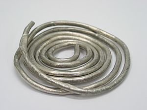
Mount Pleasant has a long history of mining and exploration. People first found tin on the mountain in 1937. Over the years, the focus of mining has changed. It went from tin to tungsten, molybdenum, and bismuth, then back to tin, and now to indium. Indium is a rare element that is very important for new technologies like LCD screens, solar cells, computers, and smart phones.
The Mount Pleasant mine is about 80 km (50 mi) south of Fredericton, the capital city of New Brunswick. A mining company called Adex Mining Inc. owns many claims in the area, covering a large amount of land. The mine is in a good location, close to roads and cities like Fredericton (population 50,000) and Saint John (population 70,000). It's also only 65 km (40 mi) from the Canada–United States border.
When the mine was last active, from 1983 to 1985, tungsten ore was regularly shipped to Europe through Saint John. The mine site can be reached by good roads from Fredericton, Saint John, and St. George. Electricity comes from the New Brunswick power grid, and water is pumped from the nearby Piskahegan River.
In 2005, a group of geologists visited the caldera and the Mount Pleasant Mine. They looked at two trenches that showed how the volcanic rocks and the gold-rich areas were connected.
In 2008, another company, Geodex Minerals Ltd., announced results from their drilling program on the west side of Mount Pleasant. This area, along with another project north of Fredericton, has been a major focus for the company. They are still doing research, especially on the McDougall Brook Granitic suite and the Mount Pleasant Granitic suite, as these are the most likely places to find more minerals. In 2011, the mine owners moved their offices to Fredericton. They wanted to focus on getting the mine running again by 2012.
 | Audre Lorde |
 | John Berry Meachum |
 | Ferdinand Lee Barnett |


