
Pearl and Hermes Atoll facts for kids
|
Native name:
Holoikauaua
|
|
|---|---|

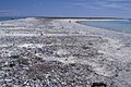
NASA picture of the Pearl and Hermes Atoll
|
|

Pearl and Hermes
Location in Pacific Ocean
Location of Pearl and Hermes Atoll in the Pacific Ocean
|
|
| Geography | |
| Location | Pacific Ocean |
| Coordinates | 27°51′40″N 175°51′10″W / 27.8611°N 175.8529°W |
| Archipelago | Northwestern Hawaiian Islands |
| Administration | |
| State | Hawaii |
| County | Honolulu County |
| Demographics | |
| Population | 0 |
| Additional information | |
| Time zone |
|

The Pearl and Hermes Atoll (called Holoikauaua in Hawaiian) is a special group of small islands. It is part of the Northwestern Hawaiian Islands, which are the farthest islands in the Hawaiian chain. This atoll is made up of a few flat, sandy islets, usually between five and seven. In the past, there were more islands, but some have been lost due to erosion and rising sea levels.
The atoll got its name from two English whaleships, the Pearl and the Hermes. Both ships crashed there in 1822. Many ships have wrecked at this atoll over time. Some famous ones include the Japanese Wiji Maru, the SS Quartette, and the M/V Casitas in 2005.
Pearl and Hermes Atoll is a very important home for many animals. These include seabirds, marine life, and small creatures without backbones (invertebrates). Twenty-two types of birds build their nests and raise their young here. This includes about 20% of all the black-footed albatrosses in the world. The atoll is part of the Papahānaumokuākea Marine National Monument, which was created in 2006 to protect it. However, dangers like lost fishing nets (called ghost nets), rising sea levels, and a harmful type of algae called Chondria tumulosa threaten the atoll and its wildlife.
Contents
Exploring Pearl and Hermes Atoll
Where is Pearl and Hermes Atoll?
The Pearl and Hermes Atoll is the third-most northern atoll in Hawaii. Only Midway and Kure are further north. It is about 2,090 kilometers (1,300 miles) northwest of Honolulu. It is also about 140 kilometers (87 miles) east-southeast of Midway Atoll. Like the rest of Hawaii, the atoll uses Hawaii Standard Time.
In total, Pearl and Hermes Atoll has about 80 acres (32 hectares) of land. It also has a huge coral reef area, almost 200,000 acres (81,000 hectares). A coral reef goes all the way around the atoll. It is about 69 kilometers (43 miles) long and is open on the west side.
What are the islands like?
The atoll's land area is made of several small islands. These islands are low and flat. Sometimes, big winter storms can wash over them. There are also some temporary sand spits that come and go. None of the islands have fresh water.
As of 2012, there are five main islands. These are Southeast Island (the biggest), North Island, Little North Island, Grass Island, and Seal-Kittery. Older records mention other islands like Sand Island and Bird Island, but they are no longer there.
How did the atoll get its name?
The atoll is named after the ships Pearl and Hermes. These ships crashed on the reefs in 1822.
The Hawaiian name for the atoll is Holoikauaua. This name was given in the late 1990s. It was part of an effort to bring back traditional Hawaiian names that had been forgotten or changed. Since the original Hawaiian name was not known, the new name Holoikauaua was chosen. It refers to the Hawaiian monk seal, which is often seen in the waters around the atoll.
History of the Atoll

First discovery and shipwrecks
The Pearl and Hermes Atoll was discovered by accident in 1822. Two English whaleships, the Pearl and the Hermes, were sailing to Japan from Honolulu. They were in waters that had not been mapped yet. Late on April 24 or early on April 25, the Hermes hit an unseen reef and got stuck. The Pearl came closer to help but also ran aground.
The crews from both ships, about 57 sailors, were stranded on a nearby island for several months. A carpenter named James Robinson led them in building a small 30-ton ship from the wreckage. Some say this new ship was called Drift, others say Deliverance.
On July 1, before their new ship could be launched, another ship called the Earl of Morby appeared. Most of the sailors left on this ship. But Robinson and eleven others decided to buy the ship they had built. They hoped to sail it back to Honolulu to get some money back from their lost ships. They successfully sailed the small vessel back to the main Hawaiian islands. Robinson later started his own shipyard in Honolulu in 1827.
Claiming the atoll
King Kamehameha III of Hawaii officially claimed the atoll in 1854. In 1857, a Hawaiian ship called the Manuokawai surveyed it. The United States took control of the atoll in 1859. Captain N.C. Brooks of the ship Gambia reported that the atoll had eleven or twelve islands. He also said some had trees and rough grass. In 1867, the US Navy published the first good map of the reef.
In 1894, people who wanted to start a rabbit canning business let rabbits loose on Southeast Island. The rabbits ate all the plants on the island. This was the first time animals like this were brought to the atoll.
In 1904, a Japanese ship called the Wiji Maru crashed on the atoll. The ship was destroyed, and its cargo of feathers was lost. Luckily, no one died. In 1916, sailors from the Thetis saw rabbits and Japanese fishing huts on Southeast Island. In 1923, a scientific trip called the Tanager Expedition visited the atoll. They removed almost all the rabbits from Southeast Island.
Pearl harvesting

In 1927, Captain William Greig Anderson found many black-lip pearl oysters at the atoll while fishing for tuna. He said they were full of pearls, and that these were the only pearl beds in the United States. Anderson started a company to collect these pearls. Over the next three years, his company collected about 20,000 pearls. Some of these pearls were very valuable. They also collected about 150 tons of oyster shells. These shells were valuable for their shiny inner layer, called mother-of-pearl, and were sold to make buttons.
In 1929, the government of the Territory of Hawaii made it illegal to collect oysters from the atoll. In 1930, the United States Bureau of Fisheries studied the atoll. They found only 470 oysters. They believed that Captain Anderson's company had collected between 150,000 and 200,000 oysters. This had greatly reduced the oyster population.
The study also found other wildlife like seals, sharks, sea turtles, albatrosses, booby birds, and many kinds of fish. They did not find any trees, even though Captain Brooks had mentioned them in 1857.
More shipwrecks

On December 21, 1952, a large ship called the SS Quartette hit the eastern reef of the atoll. Strong waves and winds pushed the ship further onto the reef, damaging it badly. The crew was rescued the next day. Attempts to pull the ship free failed because of bad weather. On January 3, the ship broke free from its anchors and was blown onto the reef. It was too damaged to be saved. Weeks later, it broke in half and sank. The wreck is now like an artificial reef, providing a home for many fish.

On July 2, 2005, a research ship called the M/V Casitas ran aground on the north end of the atoll. The ship had a lot of gasoline, diesel, and oil, which could have leaked and harmed the environment. The United States Coast Guard and other groups worked quickly to prevent leaks and remove the fuel. No one on board was hurt. The ship's grounding and the rescue efforts caused a lot of damage to the coral reef. The ship was removed on August 4, 2005, but it was too damaged to be repaired. It was sunk in deep water far from the atoll. Efforts to clean up the remaining debris and fix the reef are still happening.
Exploring shipwreck sites

In 2004, divers from the National Oceanic and Atmospheric Administration (NOAA) found parts of a shipwreck they thought were from the Pearl. They were removing debris when they found it. They also found another unknown fishing vessel wreck, which they called the "Oshima" site. This wreck had parts that looked like Japanese designs from the early 1900s.
Underwater archaeologists from NOAA went back to the Pearl wreck site in 2005 and 2006. They found many old items, including anchors, two cannons, and large pots used for melting whale blubber. Many smaller items were stuck in the coral. The items from the Pearl wreck were found close together, almost as if the ship had sunk in one piece.

In 2008, NOAA archaeologists returned to the Hermes wreck site. They confirmed it was about 400 meters (1,300 feet) west of the Pearl site. They found similar items, including two anchors and four cannons. They also found at least 33 cannonballs and many musket balls. About 150 iron ballast pieces were also found. The items from the Hermes were spread out, suggesting the ship broke apart quickly and scattered across the seafloor.
Wildlife and Plants
Plant life

The islands of Pearl and Hermes Atoll have thirteen native plant species. They also have seven introduced species (plants brought by humans). These include coastal grasses, vines, and herbal plants. Plants that are not native are a big problem for conservation. They often grow faster and take over the space of native plants. For example, Setaria verticillata, a harmful weed, has replaced the native grass Eragrostis variabilis on Southeast Island.
In the 1960s, an illegal landing by the military brought invasive field mustard seeds from Midway Atoll. The U.S. Fish and Wildlife Service had to remove them. A flowering plant called Verbesina encelioides has been a major invasive threat since at least 2001. Even though it provides food for some small birds, it can trap and harm native seabirds. So, removing it is a high priority for conservation.
Bird life and reproduction

The Pearl and Hermes Atoll is a very important place for many seabirds to nest and raise their young. About 160,000 birds from 22 different species live and breed on the atoll. Tristram's storm petrels and black-footed albatrosses are very common here. In 2001, it was reported that 20% of all the black-footed albatrosses in the world nested on Pearl and Hermes.
Pearl and Hermes is also one of only two places in Hawaii where little terns are known to nest. In 1967, the endangered Laysan finch was brought to the island. This was done to create a backup population. If a hurricane, disease, or other disaster wiped out the birds on Laysan island, these finches would help save the species.
Invertebrates
The atoll has a large and special home for invertebrates. These include different kinds of sponges and 33 species of stony corals. Some invasive invertebrate species have been found on the reef. These include the orange-striped sea anemone from Japan and the Christmas tree hydroid. These invasive species compete with native invertebrates for space.
The atoll used to have many black-lip pearl oysters. But too much fishing from 1927 to 1930 caused their numbers to drop sharply. In 1930, only 470 oysters were found. Later trips in 1950 and 1969 found only a few oysters. A study by NOAA in 2003 showed that the oyster population has never fully recovered to its original levels.
Other marine animals

The Pearl and Hermes Atoll is home to breeding populations of endangered Hawaiian monk seals and sea turtles. Spinner dolphins are known to mate in this area. The U.S. Fish and Wildlife Service says that the atoll has the most fish and the most types of fish in the Northwestern Hawaiian Islands. These include sabre squirrelfish, various eels, Galapagos sharks, Sandbar sharks, giant trevally, angelfish, Hawaiian bigeyes, parrotfish, and different types of lobsters.
While they are rare in other parts of Hawaii, masked angelfish and Japanese angelfish are common in the Pearl and Hermes Atoll.
In 2016, scientists found a new species of butterflyfish near the atoll. It was found at a depth of 55 meters (180 feet). It was named Prognathodes basabei to honor Pete Basabe, a diver who helped discover it.
Protecting the Atoll
Because Pearl and Hermes Atoll is small, it is usually protected as part of the larger Northwestern Hawaiian Islands. This region was first protected in 1909. U.S. President Theodore Roosevelt created the Hawaiian Islands Bird Reservation, which included Pearl and Hermes Atoll. Over the next century, protection for the area grew. In 2006, President George W. Bush made the waters of the Northwestern Hawaiian Islands a national monument.
Dangers to the atoll

Lost fishing gear, called ghost nets, and other marine debris are a big problem for the reefs and animals at the atoll. Pearl and Hermes Atoll is a high-risk area for monk seals to get tangled in these nets. People are working to prevent this problem and regularly remove debris from the water.
In 1999, a study removed and listed debris from the waters around Lisianski Island and Pearl and Hermes Atoll. They removed about 8,676 kilograms (19,127 pounds) of debris from the reefs and beaches. In 2000, a project was started to remove fishing debris and find any non-native species. In 2003, 90 short tons (82,000 kilograms) of marine debris were removed. In 2014, a huge tangled net weighing 11.5 short tons (10,400 kilograms) was found. It was 8.5 meters (28 feet) long, 2.1 meters (7 feet) wide, and 4.9 meters (16 feet) deep. It took three days to take apart and remove.
Rising sea levels are also a big worry for the atoll. Most of the islands are very low. The U.S. Environmental Protection Agency predicts that sea levels could rise 33–41 centimeters (13–16 inches) by 2100. Southeast Island is only about 0.9 meters (3 feet) above sea level. It would be almost completely underwater if sea levels rise that much. Other islands would also lose a lot of land. This threatens the homes of monk seals, sea turtles, and nesting birds.
In 2016, a new type of red algae called Chondria tumulosa was found growing on the reefs. By 2019, it had covered and killed large parts of the reef on the northeast side of the atoll. Scientists need to study this algae and find ways to manage it. This is important to stop it from taking over other reefs at the atoll and in the rest of the Hawaiian Islands.
Climate
There are no weather stations directly on Pearl and Hermes Atoll. So, the climate information comes from Midway Atoll, which is about 140 kilometers (87 miles) north-northwest of Pearl and Hermes. Like Midway, Pearl and Hermes has a tropical savanna climate. This means it has no cold season. Its wet season is during the warmer months, and its dry season is during the cooler months.
| Climate data for Pearl and Hermes Atoll | |||||||||||||
|---|---|---|---|---|---|---|---|---|---|---|---|---|---|
| Month | Jan | Feb | Mar | Apr | May | Jun | Jul | Aug | Sep | Oct | Nov | Dec | Year |
| Record high °F (°C) | 80 (27) |
81 (27) |
81 (27) |
82 (28) |
87 (31) |
89 (32) |
92 (33) |
92 (33) |
92 (33) |
89 (32) |
88 (31) |
82 (28) |
92 (33) |
| Mean daily maximum °F (°C) | 70 (21) |
70 (21) |
71 (22) |
72 (22) |
76 (24) |
81 (27) |
83 (28) |
84 (29) |
84 (29) |
80 (27) |
76 (24) |
73 (23) |
77 (25) |
| Daily mean °F (°C) | 66 (19) |
66 (19) |
67 (19) |
69 (21) |
72 (22) |
77 (25) |
79 (26) |
80 (27) |
80 (27) |
77 (25) |
73 (23) |
69 (21) |
73 (23) |
| Mean daily minimum °F (°C) | 62 (17) |
62 (17) |
63 (17) |
64 (18) |
68 (20) |
73 (23) |
75 (24) |
75 (24) |
75 (24) |
72 (22) |
69 (21) |
65 (18) |
69 (20) |
| Record low °F (°C) | 49 (9) |
50 (10) |
51 (11) |
53 (12) |
55 (13) |
61 (16) |
63 (17) |
64 (18) |
64 (18) |
59 (15) |
55 (13) |
51 (11) |
49 (9) |
| Average precipitation inches (mm) | 5.0 (130) |
3.8 (97) |
3.0 (76) |
2.5 (64) |
2.3 (58) |
2.2 (56) |
3.3 (84) |
4.3 (110) |
3.5 (89) |
3.5 (89) |
3.8 (97) |
4.1 (100) |
41.3 (1,050) |
| Average precipitation days | 16 | 14 | 12 | 11 | 9 | 9 | 15 | 15 | 15 | 14 | 14 | 16 | 160 |
| Source: Weatherbase | |||||||||||||
Images for kids
-
North Island of Pearl and Hermes Atoll in 1999

See also
 In Spanish: Pearl y Hermes para niños
