Punta Arenas facts for kids
Quick facts for kids
Punta Arenas
Sandy Point
Magallanes |
|||||
|---|---|---|---|---|---|
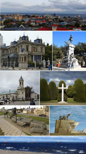
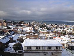
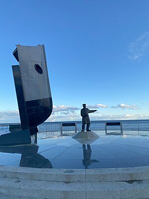
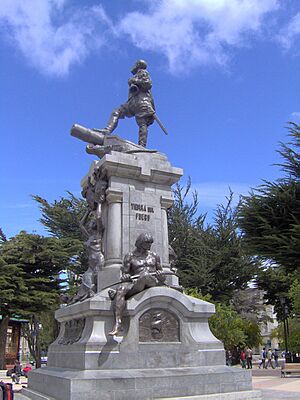
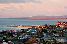
Top:Panoramic view of downtown Punta Arenas, from La Cruz Hills, Second:Sara Braun Palace (Palacio Sara Braun), Ferdinand Magellan Monument in Muñoz Gamero Square (Plaza Muñoz Gamero) Third:Punta Arenas Sacred Heart Cathedral, Cemetery of Punta Arenas, Fourth:Shepherd Monument, Goleta Ancud Monument, Bottom:An overview of Strait of Magellan, from Costanera area (all item from left to right)
|
|||||
|
|||||
| Motto(s):
"Labor omnia vincit"
("Work conquers all") |
|||||
| Country | |||||
| Region | |||||
| Province | Magallanes | ||||
| Founded as | Punta Arenas | ||||
| Foundation | 18 December 1848 | ||||
| Government | |||||
| • Type | Municipality | ||||
| Area | |||||
| • Total | 17,846.3 km2 (6,890.5 sq mi) | ||||
| Elevation | 34 m (112 ft) | ||||
| Population
(2012 Census)
|
|||||
| • Total | 127,454 | ||||
| • Density | 7.14176/km2 (18.49707/sq mi) | ||||
| • Urban | 116,005 | ||||
| • Rural | 3,491 | ||||
| Demonym(s) | Puntarenian | ||||
| Sex | |||||
| • Men | 60,616 (2002) | ||||
| • Women | 58,880 (2002) | ||||
| Time zone | UTC−3 (CLT) | ||||
| Area code(s) | 56 + 61 | ||||
| Climate | Cfc | ||||
| Website | Official website: http://www.puntaarenas.cl | ||||
Punta Arenas is a cool city in Chile! It's the capital of the Magallanes and Antarctica Chilena region, which is the southernmost part of Chile. People sometimes called it Sandy Point in the past. Even though its name was changed to Magallanes in 1927, it went back to Punta Arenas in 1938.
This city is super important because it's the largest city south of the 46th parallel south. It's also the most populated city in southern Chile and all of the Americas. Because of where it is, it's also the coldest coastal city in Latin America with over 100,000 people. Punta Arenas is one of the world's most southerly ports and acts as a gateway to Antarctica. It's the world's southernmost city with more than 100,000 people, though Ushuaia in Argentina also claims to be the southernmost city.
Since 1977, Punta Arenas has been one of only two free ports in Chile. This means goods can be imported and exported without certain taxes, which helps the economy. The city is located on the Brunswick Peninsula, near the Strait of Magellan. It was first started by the Chilean government in 1848 as a small settlement to show Chile's control over the Strait.
Punta Arenas grew a lot in the 1800s because of more ships passing through and trading. Many European immigrants, especially from Croatia and Russia, moved here. They were looking for gold and opportunities in sheep farming in the late 1800s and early 1900s. The biggest sheep company, which owned huge areas of land in Chile and Argentina, was based right here in Punta Arenas.
Chile has always used Punta Arenas to protect its claims in the southern part of South America. This led to the Boundary Treaty of 1881 between Chile and Argentina where the Strait of Magellan was officially recognized as Chilean territory. Even today, Punta Arenas is important for getting to the Antarctic Peninsula. Since 2017, the city and its region have their own time zone, using summer time all year round. The city gets its water from the San Juan River.
Contents
What's in a Name?
The name Punta Arenas means "Point Sands" in Spanish. It actually comes from the Spanish term Punta Arenosa, which is a direct translation of the old English name "Sandy Point."
The name "Sandy Point" was first used by John Narborough during his trip in 1669-1671. He described it as a "mean low Point" with "a few trees." Sometimes, people mistakenly think the 18th-century explorer John Byron named this area.
The city was also known as Magallanes for a while. Today, that name is usually used for the larger region that includes the city. Punta Arenas used to be called "the city of the red roofs" because many buildings had bright red metal roofs. Since the 1970s, people started using other colors for roofs, so you see more variety now.
Where is Punta Arenas?
Punta Arenas is located on the Brunswick Peninsula and is one of the biggest cities in Patagonia. In 2012, about 127,454 people lived there. It's about 1,419 kilometers (882 miles) from the coast of Antarctica. It's also about 635 kilometers (395 miles) from Ushuaia, a city in Argentina.
The Magallanes region is part of Chilean Patagonia. "Magallanes" is the Spanish name for Ferdinand Magellan, a Portuguese explorer who sailed for Spain. He passed near where Punta Arenas is now in 1520 while sailing around the world. Early English maps called this spot "Sandy Point."
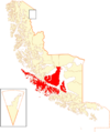
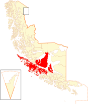
The main part of the city is on the northeastern shore of the Brunswick Peninsula. Most of the peninsula is empty, except for a few small towns on the eastern shore. The area of Punta Arenas includes the entire Brunswick Peninsula. It also includes all the islands west of the Isla Grande de Tierra del Fuego and north of Cockburn and Magdalena channels.
Some of the larger islands are:
Most of these islands are not inhabited, except for Dawson Island, which had about 301 people in 2002. Clarence Island had only five people.
Punta Arenas Climate
Punta Arenas has a subpolar oceanic climate. This means its temperatures don't change much throughout the year because it's close to the ocean. In July (winter), the average low is around -1°C (30°F). In January (summer), the average high is about 14°C (57°F).
It's known for having very steady temperatures. The most rain falls in April and May. Snow usually falls during the Chilean winter, from June to September. Like most of Patagonia, it doesn't get much rain overall, only about 380 mm (15 inches) per year. This is because the Andes mountains block the rain. The average temperature never goes below 1°C (34°F).
The city is also famous for its very strong winds, which can reach up to 130 km/h (81 mph)! These winds are strongest in the summer. City officials have even put up ropes between buildings downtown to help people walk when the winds are really strong.
Since 1986, Punta Arenas has been the first large city to be directly affected by the thinning ozone layer. This means its residents are exposed to higher levels of ultraviolet radiation.
| Climate data for Punta Arenas (1991–2020, extremes 1888–present) | |||||||||||||
|---|---|---|---|---|---|---|---|---|---|---|---|---|---|
| Month | Jan | Feb | Mar | Apr | May | Jun | Jul | Aug | Sep | Oct | Nov | Dec | Year |
| Record high °C (°F) | 25.0 (77.0) |
28.7 (83.7) |
26.0 (78.8) |
22.5 (72.5) |
16.0 (60.8) |
16.0 (60.8) |
12.0 (53.6) |
14.0 (57.2) |
19.0 (66.2) |
23.5 (74.3) |
24.9 (76.8) |
27.0 (80.6) |
28.7 (83.7) |
| Mean daily maximum °C (°F) | 16.3 (61.3) |
16.1 (61.0) |
15.4 (59.7) |
12.1 (53.8) |
8.8 (47.8) |
5.5 (41.9) |
4.9 (40.8) |
7.0 (44.6) |
10.2 (50.4) |
12.9 (55.2) |
14.2 (57.6) |
15.2 (59.4) |
11.6 (52.9) |
| Daily mean °C (°F) | 10.7 (51.3) |
10.3 (50.5) |
8.9 (48.0) |
6.6 (43.9) |
4.2 (39.6) |
1.9 (35.4) |
1.7 (35.1) |
2.7 (36.9) |
4.6 (40.3) |
6.4 (43.5) |
8.3 (46.9) |
9.7 (49.5) |
6.3 (43.3) |
| Mean daily minimum °C (°F) | 5.9 (42.6) |
5.4 (41.7) |
3.9 (39.0) |
2.2 (36.0) |
0.1 (32.2) |
−1.5 (29.3) |
−1.5 (29.3) |
−1.0 (30.2) |
0.0 (32.0) |
0.6 (33.1) |
3.5 (38.3) |
4.8 (40.6) |
1.9 (35.4) |
| Record low °C (°F) | −1.0 (30.2) |
−2.4 (27.7) |
−4.0 (24.8) |
−8.4 (16.9) |
−10.6 (12.9) |
−18.7 (−1.7) |
−14.2 (6.4) |
−12.0 (10.4) |
−9.6 (14.7) |
−4.8 (23.4) |
−3.0 (26.6) |
−1.0 (30.2) |
−18.7 (−1.7) |
| Average precipitation mm (inches) | 38.1 (1.50) |
31.5 (1.24) |
42.9 (1.69) |
45.1 (1.78) |
36.9 (1.45) |
31.3 (1.23) |
30.9 (1.22) |
29.5 (1.16) |
24.5 (0.96) |
24.6 (0.97) |
23.1 (0.91) |
31.8 (1.25) |
390.2 (15.36) |
| Average precipitation days (≥ 1.0 mm) | 8.3 | 7.4 | 8.4 | 8.8 | 7.7 | 6.7 | 7.0 | 7.0 | 5.7 | 5.8 | 6.0 | 7.5 | 86.3 |
| Average relative humidity (%) | 69 | 72 | 75 | 80 | 84 | 86 | 85 | 82 | 77 | 72 | 69 | 69 | 77 |
| Mean monthly sunshine hours | 224.9 | 187.3 | 157.4 | 118.5 | 95.4 | 71.7 | 85.5 | 118.9 | 147.0 | 201.1 | 216.4 | 232.5 | 1,856.6 |
| Source 1: Dirección Meteorológica de Chile | |||||||||||||
| Source 2: NOAA (precipitation days 1991–2020), Méteo Climat (record highs only) | |||||||||||||
A Look at History
Long ago, the Spanish tried to set up two settlements along the Strait of Magellan. The first, called Nombre de Jesús, failed in 1584 because of the harsh weather and lack of food. A second colony, Ciudad del Rey don Felipe, was tried about 80 kilometers (50 miles) south of Punta Arenas. This place later became known as Puerto del Hambre, which means Port Famine. Spain wanted these settlements to control the Strait of Magellan and stop English pirates. An English privateer, Thomas Cavendish, even rescued the last person from Puerto del Hambre in 1587.
Founding of Punta Arenas
In 1843, the Chilean government sent an expedition to build a fort and create a permanent settlement on the Strait of Magellan. They used a schooner called Goleta Ancud with 21 people on board. The settlement was officially started on September 21, 1843.
The first fort was on a rocky peninsula, but it wasn't a good spot for a town. So, in 1848, the military governor decided to move the settlement to its current location by the Las Minas river. He renamed it Punta Arenas.
In the mid-19th century, Chile used Punta Arenas as a place for military personnel who had caused trouble. They also encouraged immigrants to settle there. Over time, the town grew. In 1867, President José Joaquín Pérez offered land to Chileans and foreigners who would settle around Punta Arenas. Many British immigrants arrived first, especially as sheep farming became popular. After 1906, more Croatians started to arrive.
Economic Growth
Between about 1890 and 1940, the Magallanes region became a huge area for raising sheep. One company, Sociedad Explotadora de Tierra del Fuego, controlled over 11,000 square kilometers (4,200 sq mi) of land! By 1910, this company owned 3 million hectares (7.4 million acres) in southern Chile and Argentina, with over 2 million sheep. The main office of this company and the homes of its owners were in Punta Arenas. Today, the Sara Braun Museum is located in the old Braun-Menéndez mansion.
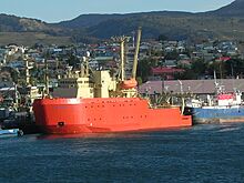
The harbor in Punta Arenas was very important before the Panama Canal was built. It was a place where steamships traveling between the Atlantic and Pacific oceans could stop to refuel with coal. Today, the port is mostly used by tourist cruises and scientific expeditions.
Modern City Life
Punta Arenas is often a starting point for expeditions to Antarctica. Other common starting points are Ushuaia in Argentina and Christchurch in New Zealand.
Who Lives in Punta Arenas?
In 2012, Punta Arenas had over 127,000 people living there. The population has been growing steadily.
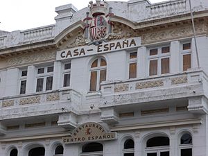
Many people who live in Punta Arenas are descendants of colonists from Spain and Croatia who arrived in the mid-19th century. You can still see this influence in the names of shops, streets, and buildings. Punta Arenas is said to have one of the largest percentages of people with Croatian heritage outside of Croatia itself!
There are also many people of German, English, Italian, Swiss, and Irish descent. Punta Arenas also has the highest percentage of people with British ancestry in all of Chile.
The city is home to the southernmost Hindu temple in the world. This temple is used by the Sindhi community, who are merchants from India. They started arriving in the early 1900s and are now one of the largest communities of Indians in Chile.
How Punta Arenas Makes Money
By 2006, the economy of Punta Arenas had become quite diverse. Chile's main oil reserves are nearby, and there's also some coal.
Farming, especially raising sheep and cattle, is still a big part of the economy.
Tourism is also very important and helps the city grow. Popular places for tourists to visit include the Cathedral, other churches, the city cemetery, and the statue of Magellan. Some cruise ships going to Antarctica leave from Punta Arenas. The port is also a hub for many cruise lines that explore the channels and fjords of the region.
There's a regular ferry service that connects Punta Arenas with the main island of Tierra del Fuego. A less frequent ferry goes to the Chilean town of Puerto Williams.
Learning in Punta Arenas
The University of Magallanes (UMAG) is located in Punta Arenas. It's one of Chile's traditional universities. It was started in 1981 and took over from a part of the Universidad Técnica del Estado that had been in Punta Arenas since 1961.
The University of Magallanes has campuses in Punta Arenas and Puerto Natales. It also has a university center in Puerto Williams. The university publishes a journal about humanities and social sciences called Magallania twice a year. There is also a German school in the city, called Deutsche Schule Punta Arenas.
Culture and Museums
Punta Arenas has several interesting museums where you can learn about the region's history and nature.
- Braun Menéndez Regional Museum (Spanish: Museo Regional Braun Menéndez)
This museum is in the beautiful Braun Menéndez Palace, which is a National Monument. Since 1983, it has shown items from the modern history of the region.
- Salesian Regional Museum Maggiorino Borgatello (Spanish: Museo Regional Salesiano Maggiorino Borgatello)
Located next to the Santuario María Auxiliadora, this is the most important museum in the area. It has a full collection of animals and plants from the region, as well as items from the Selk'nam culture. You can also see things from Antarctica here. It was started in 1893 by the Salesians religious group.
- Naval and Maritime Museum of Punta Arenas (Spanish: Museo Naval y Marítimo de Punta Arenas)
This museum is next to the Military Museum. It has a collection that shows the history of the Chilean Armed Forces during the time when the Magallanes and Chilean Antarctica territory was being settled.
- Nao Victoria Museum (Spanish: Museo Nao Victoria)

This museum is about 7.5 km (4.7 miles) north of the city. It has a full-size replica of the Nao Victoria, which was the first ship to sail around the world with Ferdinand Magellan. Since 2011, the museum also shows a full-size replica of the James Caird. This small boat was used by Ernest Shackleton during his amazing journey to save his crew after their ship, the Endurance, was trapped in ice.
- Museum of Remembrance (Spanish: Museo del Recuerdo)
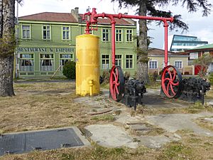
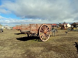
This museum, part of the University of Magallanes, shows examples of old buildings, machinery, and tools. It's like an open-air museum that celebrates the region's identity. It has 8 old wooden buildings, 40 antique vehicles, and many tools, mostly related to livestock farming and oil production.
City Government
Punta Arenas is a "comuna" (commune), which is a local administrative area in Chile. It's managed by a municipal council and led by an alcalde (mayor), who is elected every four years. The current mayor (2016–2020) is Claudio Radonich.
Punta Arenas is part of the 60th electoral district for the Chamber of Deputies. It's represented in the Senate as part of the 19th senatorial constituency.
Getting Around
The Carlos Ibáñez del Campo airport is about 20 kilometers (12 miles) from the city center. You can rent cars there, and there are customs services. Airlines like LATAM Chile and Sky Airline fly to this airport. The airport has both civilian and military sections.
Punta Arenas has connections by sea, land, and air. If you want to drive to other parts of Chile, you usually have to pass through Argentina. By sea, several cruises and ferries visit the city.
Famous People from Punta Arenas
- Gabriel Boric (1986–), the current President of Chile (since 2022)
- Sara Braun (1862–1955), a famous businesswoman
- Marina Latorre (1925–), a writer, journalist, and art gallery owner
- Mateo Martinic, a well-known historian and writer
- Julio Milostich (1966–), an actor
Sister Cities
Punta Arenas has "sister city" relationships with other cities around the world:
 Bellingham, United States
 Harbin, China
 Río Gallegos, Argentina
 Ushuaia, Argentina
See also
 In Spanish: Punta Arenas para niños


