Rapid Run (Buffalo Creek tributary) facts for kids
Quick facts for kids Rapid Run |
|
|---|---|
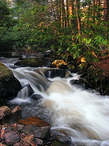
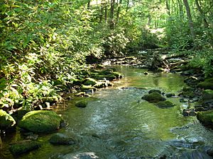
Rapids on Rapid Run
|
|
| Physical characteristics | |
| Main source | valley in Miles Township, Centre County, Pennsylvania between 1,620 and 1,640 feet (490 and 500 m) |
| River mouth | Buffalo Creek in Buffalo Township, Union County, Pennsylvania 512 ft (156 m) 40°57′27″N 77°00′41″W / 40.95747°N 77.01151°W |
| Length | 14.4 mi (23.2 km) |
| Basin features | |
| Progression | Buffalo Creek → West Branch Susquehanna River → Susquehanna River → Chesapeake Bay |
| Basin size | 18.7 sq mi (48 km2) |
| Tributaries |
|
Rapid Run is a stream in Pennsylvania, USA. It flows into Buffalo Creek. The stream is about 14.4 miles (23.2 km) long. It runs through parts of Centre County and Union County.
Rapid Run's watershed, which is the area of land that drains into it, covers about 18.7 square miles (48.4 km2). Most of this area is covered by forests. The stream is known as a "freestone mountain stream." This means its water comes from rain and melting snow, not from underground springs. It flows through a lake called Halfway Lake and also through a narrow passage called Rapid Run Gap.
Rapid Run is one of the main streams that feed Buffalo Creek. A major road, Pennsylvania Route 192, runs next to it for much of its length. Many bridges cross the stream. The area around Rapid Run is a great place for fishing. It is home to wild trout and other aquatic animals like eels and freshwater sponges. Rapid Run flows through several state parks, including Bald Eagle State Forest, R.B. Winter State Park, and Sand Bridge State Park.
Contents
The Stream's Path
Rapid Run starts in a valley in Miles Township, Centre County. It flows generally northeast for a few miles. Along the way, it gets water from a smaller stream called Yankee Run, which joins from the left side.
Then, Rapid Run enters Hartley Township in Union County. Here, it crosses Pennsylvania Route 192 and passes by a spring called The Little Bubbler. The stream then turns southeast and flows into Halfway Lake. Another stream, Halfway Run, joins it from the left at the lake.
After leaving Halfway Lake, Rapid Run continues flowing southeast. It crosses Pennsylvania Route 192 again and enters a much narrower valley. It flows past Bake Oven Mountain and Seven Notch Mountain. Then, it turns northeast to stay in the valley.
After more than a mile, Rapid Run enters Lewis Township, Union County. It keeps flowing east in its valley, next to Pennsylvania Route 192 and Jones Mountain. The stream crosses Pennsylvania Route 192 two more times. After several miles in Lewis Township, it enters West Buffalo Township.
In West Buffalo Township, Rapid Run continues heading east for over a mile. It crosses Pennsylvania Route 192 one last time and then turns southeast. The stream leaves its narrow valley and flows next to a wider, shallower valley shared with Stony Run. After a few miles, it enters Buffalo Township. Here, it continues flowing southeast for about 0.5 km (0.3 miles) until it meets Buffalo Creek.
Rapid Run joins Buffalo Creek about 10.22 miles (16.45 km) upstream from Buffalo Creek's mouth.
Smaller Streams Joining Rapid Run
Rapid Run has two main named smaller streams that flow into it: Yankee Run and Halfway Run.
- Yankee Run joins Rapid Run about 13.34 miles (21.47 km) upstream from its mouth. The area that drains into Yankee Run is about 0.83 square miles (2.1 km2).
- Halfway Run joins Rapid Run about 11.08 miles (17.83 km) upstream from its mouth. The area that drains into Halfway Run is about 1.51 square miles (3.9 km2).
Water Quality
Some parts of Rapid Run and its smaller streams have water quality issues. About 4.1 miles (6.6 km) of these streams are considered "impaired." This means the water quality is not as good as it should be. The main problems are too many nutrients and too much sediment (dirt and tiny particles). These issues often come from farming activities nearby.
The water in the Rapid Run watershed can also be affected by E. coli bacteria and changes in water temperature. Scientists measure how much water flows in the stream. For example, in one part of the stream, the average daily flow is about 6.59 cubic feet per second (0.187 m3/s).
Scientists also track the amount of sediment, nitrogen, and phosphorus in the water. These are important for the health of the stream. High levels of these can harm aquatic life. Efforts are being made to reduce these levels to keep the stream healthy.
Land and Rocks Around the Stream
The place where Rapid Run meets Buffalo Creek is about 512 feet (156 meters) above sea level. The stream starts much higher, between 1620 and 1640 feet (494 and 500 meters) above sea level. Rapid Run is a typical mountain stream.
Halfway Lake is a 7-acre (2.8 ha) lake on Rapid Run. It gets its water from other streams and springs. The lake has a dam made of sandstone. Rapid Run is a "freestone stream," meaning its water comes from rainfall and runoff, not from underground sources. It is located in the ridge and valley area, which has long, parallel mountains and valleys.
Upstream from Halfway Lake, Rapid Run flows through a valley called Brush Valley. Downstream from the lake, it leaves this valley through a deep "water gap." This gap has a steep slope covered in large quartzite boulders, some bigger than 6 feet (1.8 meters) across. The Rapid Run Gorge is also in this area, just south of Halfway Lake. In the gorge, you can see different types of sedimentary rock formations. These rocks, like shales and sandstones, formed during the Ordovician and Silurian periods, millions of years ago.
Long ago, the upper parts of Rapid Run and Halfway Run were actually the beginning of another stream called Elk Creek. But about a million years ago, Rapid Run "captured" these headwaters. This means Rapid Run cut back and took over the water that used to flow into Elk Creek. This event is sometimes called "stream piracy."
The temperature of Rapid Run in the summer is usually around 10°C (50°F).
The Rapid Run Watershed
The entire area that drains water into Rapid Run is called its watershed. This watershed covers about 18.7 square miles (48.4 km2). Rapid Run is one of the main streams that feed Buffalo Creek, making up 14 percent of Buffalo Creek's total drainage area. There are about 30 miles (48 km) of streams within the Rapid Run watershed.
Most of the Rapid Run watershed, about 88 percent, is covered by forests. About 7 percent is used for agriculture, and 2 percent is covered by paved surfaces like roads and buildings. The parts of the watershed with farms are mainly near the stream's impaired (less healthy) tributary. The main stream and its other smaller streams are mostly surrounded by forests.
Farmers in the watershed use methods like "no-till" farming on about 28 acres (11 ha) of land. This helps protect the soil. The watershed also has about 1 mile (1.6 km) of unpaved roads. The very beginning of the stream is in a swampy area.
Because Pennsylvania Route 192 runs alongside Rapid Run for much of its length, it's easy for people to get to the stream.
History of the Area
Rapid Run was officially named and added to the Geographic Names Information System in 1979. It was also known as Yankee Run in the past.
In 1820, a man named Daniel Reish settled near Rapid Run. He built a sawmill (for cutting wood), a gristmill (for grinding grain), and a distillery (for making alcoholic drinks). Later, in the 1920s and 1930s, some people used dynamite to catch fish in the stream, which is now illegal and harmful.
When logging was a big industry in the area, a log dam and another sawmill were built on the stream where Halfway Lake is now. The dam that holds back Halfway Lake today was the first stone dam ever built by the Civilian Conservation Corps, a group that worked on conservation projects in the 1930s.
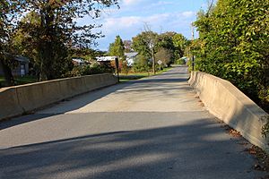
Many bridges have been built over Rapid Run over the years. Some of the older bridges were built in the 1910s, 1930s, and 1960s, and many have been repaired since then.
The Pennsylvania American Water Company used to own land along Rapid Run. They thought about using the stream as a source of drinking water, but they later sold the land. Efforts are ongoing to improve the watershed, with projects like improving farm lanes to reduce runoff.
Animals and Plants
The Rapid Run area is a special place for fish. It is called a "High-Quality Coldwater Fishery" and a "Migratory Fishery." This means the water is cold and clean, perfect for fish that like cold water, and it's a good place for fish that travel to different areas.
Wild trout live and reproduce naturally in Rapid Run, from where it starts all the way to its mouth. The Pennsylvania Fish and Boat Commission considers a part of Rapid Run to be "Class A Wild Trout Waters" for brown trout. This means it's an excellent place for these wild fish. Brook trout also live in the stream. Sometimes, fish are also "stocked" here, meaning they are added to the stream for fishing.
Rapid Run has a healthy population of small creatures that live on the bottom, like insects and worms. These are called "benthic macroinvertebrates." A type of freshwater sponge called Spongilla fragilis has also been found near the Halfway Dam. In 2012, two eels were found in Rapid Run, far upstream from where eels are usually stocked.
The forests around Rapid Run are mostly "second-growth," meaning they have grown back after being cut down in the past. These forests are mainly made up of pine and hemlock trees and are considered very natural.
Fun Activities
Rapid Run is known as a "high quality" stream with "excellent" opportunities for fishing. The stream's headwaters are in Bald Eagle State Forest. Parts of the stream also flow through R. B. Winter State Park and Sand Bridge State Park. There's even a hiking trail in Sand Bridge State Park that crosses the stream.
According to a fishing guide from 1988, the best fishing spots on Rapid Run are in its lower 1.1 miles (1.8 km).
 | Chris Smalls |
 | Fred Hampton |
 | Ralph Abernathy |


