Sanpoil River facts for kids
Quick facts for kids Sanpoil River |
|
|---|---|
 |
|
| Country | United States |
| Region | Okanagan Highlands |
| State | Washington |
| Counties | Ferry & Okanogan County |
| Towns | Republic & Keller |
| Physical characteristics | |
| Main source | Copper Butte 48°42′09″N 118°27′56″W / 48.7025°N 118.4656°W 7,135 ft (2,175 m) 48°38′54″N 118°38′12″W / 48.64833°N 118.63667°W |
| River mouth | Sanpoil Arm, Columbia River 1,293 ft (394 m) 47°56′55″N 118°40′50″W / 47.94861°N 118.68056°W |
| Length | 59 mi (95 km) |
| Basin features | |
| Basin size | 981 sq mi (2,540 km2) |
| Tributaries |
|
-
- For other references, see Sanpoil (disambiguation).
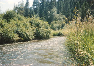
The Sanpoil River (also spelled San Poil) is a tributary of the Columbia River. It flows through the state of Washington in the United States. The river is named after the Sanpoil people. They are an Interior Salish group who have lived along the river for a long time. The name comes from the Okanagan term [snpʕʷílx]. This means "people of the gray country" or "gray as far as one can see."
Contents
Journey of the Sanpoil River

The Sanpoil River starts in the Kettle River Range in northeast Washington. It forms where the North Fork Sanpoil and South Fork Sanpoil rivers meet. The river then flows west into the Curlew Lake valley. At Torboy, it turns south and enters Sanpoil Lake.
After leaving Sanpoil Lake, O'Brien Creek joins the river near Pine Grove. The Sanpoil River then flows west again through the Ferry County Fairgrounds. It then enters the main Sanpoil Valley and turns south once more. Just south of Republic, Granite Creek joins it from the west.
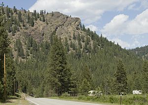
The rest of the river flows south through the Colville National Forest and Okanogan National Forest. It also passes through the Colville Indian Reservation. Inside the reservation, the West Fork Sanpoil River, its main tributary, joins it. Many smaller creeks also flow into the Sanpoil River. These include Twenty-one Mile Creek, Twenty-three Mile Creek, and Thirty Mile Creek.
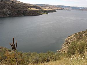
The Sanpoil River empties into Franklin D. Roosevelt Lake (Lake Roosevelt). This lake is part of the Columbia River, formed by the Grand Coulee Dam. The dam caused the last twelve miles of the Sanpoil River to be flooded. This flooded part of Lake Roosevelt is now called the Sanpoil Arm.
How the Sanpoil Valley Was Formed

The Sanpoil River flows between two different types of rock formations. These are the Kootenai Arc and the Okanogan microcontinent. In the southern part of the Sanpoil, these areas are covered by Columbia River basalt rocks. These rocks formed about 5 to 23 million years ago.
The lower part of the river was flooded many times by Glacial Lake Columbia. This happened over at least 900 years during the last Ice Age. At the same time, the northern part of the river valley was covered by a large ice sheet. This ice sheet shaped the land you see around Republic today.
Gold in the River Valley
Some placer gold has been found in the lower river system. Small amounts were reported where the West Fork Sanpoil and Sanpoil rivers meet. More gold was found along Strawberry and Gold Creeks. The richest gold was found in the upper river valley, especially in Granite Creek. This creek is a tributary of the Sanpoil, west of Republic.
The Republic Mining District was a center for gold mining. Both surface and underground mining took place there from 1896 into the early 1900s. Several mills operated near the Sanpoil River's tributaries. They used methods like mercury plate amalgamation and cyanide leaching to get the gold.
The Sanpoil Volcanics are a type of volcanic rock. They are named after the river because they were first studied near Republic.
Fish Life in the Sanpoil River
The Sanpoil River system has many kinds of fish. Some live in rivers, and some live in lakes. This is because the river's mouth is part of Lake Roosevelt.
Before the dams on the Columbia River were built, like Grand Coulee Dam in 1941, the Sanpoil River had many anadromous fish. These fish, like salmon and Steelhead trout, would swim from the ocean up the river to lay eggs. Pacific lamprey also used to live here. However, these fish runs stopped because Grand Coulee Dam does not have a fish ladder for them to pass.
Lost fish runs include Chinook salmon, coho, chum, pink, and sockeye salmon.
Fish Still Living Here
Some native fish from the salmon family are still found in the river. Others visit from Lake Roosevelt. These include:
- Mountain whitefish
- Cutthroat trout
- Rainbow trout
- Kokanee salmon (a type of sockeye that lives in lakes)
- Bull trout
In August 2019, the Colville Tribal Fish and Wildlife Department released 100 Chinook salmon into the Sanpoil River. This was an effort to bring salmon back after nearly 70 years. These salmon were raised in a hatchery and did not have a specific river to return to. In the fall of 2020, these adult salmon came back to the Sanpoil River to lay their eggs.
Other Native Fish
Several native carp species live in the river:
Native suckers found here include:
- Bridgelip sucker
- Largescale sucker
- Longnose sucker
Other native fish include the redside shiner (a minnow) and the burbot. There are also three types of sculpin: the mottled, paiute, and prickly. A population of white sturgeon that lives only in freshwater is also present.
Introduced Fish Species
Many fish species have been introduced to the river. These include:
Sport fish from the sunfish family are also here:
From the perch family, walleye and yellow perch are present.
Threats to Fish Populations
One threat to the river's fish is the spread of northern pike. These invasive fish were first seen in the Pend Oreille River in 2004. Pike are moving downstream towards the Sanpoil and Grand Coulee Dam. They are known to eat many smaller and larger fish, especially salmon and trout.
In spring 2019, two adult pike were caught in the Sanpoil arm. This happened before the female could lay eggs. However, there is worry that these fish could harm native redband and bull trout populations.
History of the Sanpoil River Valley
The Sanpoil River valley is the traditional home of the Sanpoil people. They are an Interior Salish group. Today, they are part of the Colville Confederated Tribes. The name Sanpoil comes from the Okanagan term [snpʕʷílx]. It means "people of the gray country" or "gray as far as one can see."
Early European Visits
The mouth and lower valley of the Sanpoil River were visited by David Thompson and his group on July 3, 1811. This was the first time Europeans visited the lower Sanpoil valley. Thompson was working for the Canadian fur trading North West Company. They wanted to map the Columbia River for trade routes.
Railway Plans
On January 2, 1902, the Spokane and British Columbia Railway got approval. They wanted to survey a railway line through the Colville Reservation along the Sanpoil River. This line was planned to be 140 miles (225 km) long. It would connect Republic to Spokane, Washington. However, by 1915, little of this southern route had been built.
Proposed Dams
Before 1930, several dams were planned along the Sanpoil River. None of these dams were ever built. Six sites were chosen along the lower Sanpoil. They were meant to create small pools for local use.
Recent Flooding
In the spring of 2017, heavy rains and melting snow caused severe flooding in the Sanpoil River Basin. This was the worst flooding in the valley in decades. The flood washed away at least one house. It also damaged the west side of the State Route 21 bridge over the West Fork Sanpoil River.
The highway was closed for over two weeks. The Washington State Department of Transportation built a temporary one-lane bridge. The permanent bridge was not fully replaced and reopened until October 2020. Construction on the new bridge began in spring 2020.
 | Selma Burke |
 | Pauline Powell Burns |
 | Frederick J. Brown |
 | Robert Blackburn |

