Satellite (artificial) facts for kids
A satellite is an object that orbits another object. In space, satellites can be natural, like the moon orbiting Earth. They can also be man-made, built by people. Most man-made satellites orbit Earth, but some orbit other planets like Mars or Saturn.
People use satellites for many different reasons. There are satellites that help us predict the weather, others that help us communicate, and some that are used for looking at stars or for military purposes.
The idea for communication satellites was first suggested by Herman Potočnik and later made popular by Arthur C. Clarke.
The very first artificial satellite was called Sputnik 1. The Soviet Union launched it on October 4, 1957. This event surprised the world and started the "space race" with the United States. Sputnik 2 was launched soon after, on November 3, 1957. It carried the first living creature into space, a dog named Laika. The United States launched its first satellite, Explorer 1, on January 31, 1958. The UK launched its first satellite in 1962.
Since then, thousands of satellites have been sent into orbit around Earth. Some very large satellites, like space stations, are launched in pieces and then put together in space.
Contents
How Satellites Began
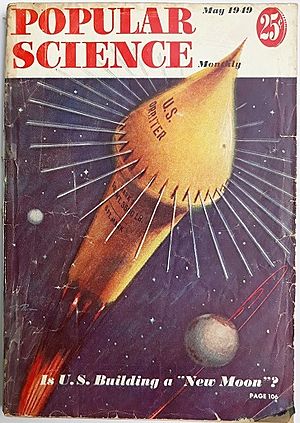
The idea of an artificial satellite was first explored mathematically by Isaac Newton in 1687. He used a thought experiment called "Newton's cannonball" to explain how natural satellites move. Later, in 1869, Edward Everett Hale wrote a short story called "The Brick Moon" which showed a fictional satellite being launched.
In 1903, Konstantin Tsiolkovsky wrote about using rockets to launch spacecraft. He figured out how fast a rocket needed to go to stay in orbit. He also suggested that multi-stage rockets could reach this speed.
Herman Potočnik wrote a book in 1928 about using orbiting spacecraft to observe Earth. He also thought about how the special conditions of space could be useful for science.
In 1945, science fiction writer Arthur C. Clarke wrote about using communications satellites for sending messages to many people. He thought that just three satellites could cover the whole planet.
In 1946, the United States Air Force's Project RAND suggested that satellites would be very important scientific tools. They saw satellites as useful for science, politics, and even propaganda.
The White House announced on July 29, 1955, that the U.S. planned to launch satellites by 1958. This project was called Project Vanguard. Just two days later, the Soviets announced their plan to launch a satellite by late 1957.
Sputnik 1, launched by the Soviet Union on October 4, 1957, was the first artificial satellite. It helped scientists learn about Earth's upper atmosphere. Its launch caused a big stir in the United States and started the "Space Race" during the Cold War.
Sputnik 2 followed on November 3, 1957. It carried the first living passenger into orbit, a dog named Laika.
The United States launched its first artificial satellite, Explorer 1, on January 31, 1958.
By 1961, there were 115 satellites orbiting Earth.
At first, each satellite was built uniquely. But as technology improved, satellites began to be built using standard designs called "satellite buses." The first standard design for a communication satellite was launched in 1972.
Today, the biggest artificial satellite is the International Space Station.
Satellites in Orbit Today
More than 50 countries have artificial satellites. Ten nations can launch their own satellites. Hundreds of satellites are working right now. However, thousands of old, unused satellites and pieces of satellites are also orbiting Earth. These are known as space debris.
The largest satellite is the International Space Station (ISS). Many countries, including NASA (USA), ESA (Europe), JAXA (Japan), and RKA (Russia), built it together. The ISS usually has a crew of six astronauts or cosmonauts living on board. The crew changes, but the station is always occupied. The Hubble Space Telescope is another famous satellite. Astronauts have repaired and updated it several times in space.
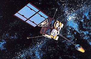
Some man-made satellites orbit other planets, not just Earth. The Mars Reconnaissance Orbiter orbits Mars. Cassini-Huygens orbited Saturn for many years. Venus Express orbited Venus. Two GRAIL satellites orbited the moon until 2012. Several satellites have orbited the Sun for years.
Man-made satellites have several main uses:
- Scientific Research: Learning more about space and our planet.
- Earth Observation: Watching Earth for weather forecasting, tracking storms, and monitoring pollution.
- Communication: Sending signals for satellite television and telephone calls.
- Navigation: Helping us find our way, like with the Global Positioning System (GPS).
- Military Uses: For things like reconnaissance photography and secure communications. (Nuclear weapons are not allowed in space.)
Satellite Orbits
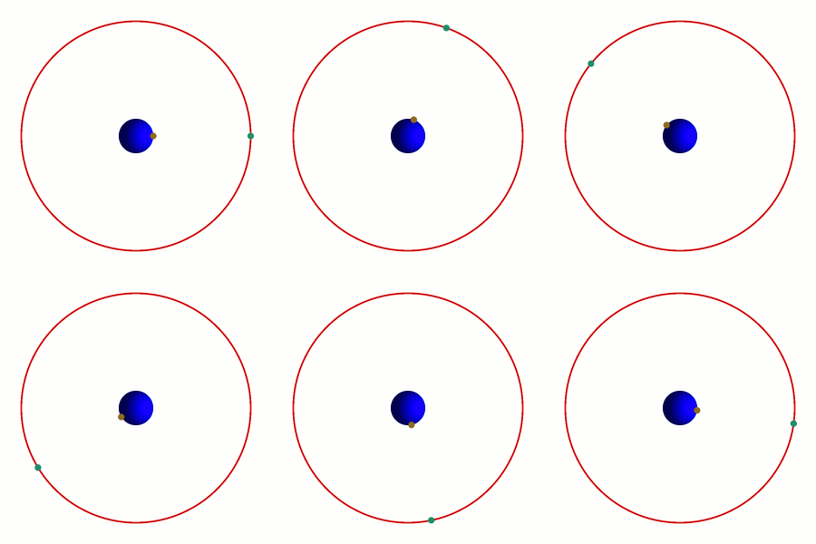
Most man-made satellites are in one of two main types of orbits: a low Earth orbit (LEO) or a geostationary orbit. To stay in orbit, a satellite's speed sideways must perfectly balance Earth's gravity.
Satellites in low Earth orbit are usually less than 1,000 kilometers (about 620 miles) above the ground. Closer to Earth, they must move faster to stay in orbit. Low orbits are great for satellites that take pictures of Earth. Many of these satellites swing above and below the equator. This allows them to communicate or look at different areas. It is easier to put a satellite into low Earth orbit. However, from the ground, these satellites appear to move across the sky. This means a satellite dish needs to constantly move to keep communicating with them.
Medium Earth orbits work well for GPS satellites. Receivers on Earth use the satellite's changing position and exact time to figure out where they are. These receivers do not need a dish that points directly at the satellite. But for things like satellite TV, where a lot of information is sent, constantly changing positions is not ideal.
For satellite TV and similar uses, satellites need to be in a geostationary orbit. A satellite in this orbit moves around Earth at the same speed that Earth spins. This makes it look like the satellite is staying still in the sky from the ground. To do this, the satellite must be directly above the equator. It also needs to be very high up, about 35,786 kilometers (22,236 miles) above the ground.
What Happens When Satellites Stop Working?
When satellites finish their job, usually after 3 or 4 years, operators have a few choices. They can try to bring the satellite back down to Earth, leave it where it is, or move it to a "graveyard orbit." In the past, satellites were rarely designed to come back down. For example, Vanguard 1, launched in 1958, was still in orbit in 2022.
Most satellites were either left in their orbit or moved to a graveyard orbit. Since 2002, in the U.S., new geostationary satellites must plan to move to a graveyard orbit when they are done.
When satellites fall back to Earth without control, they usually break apart. This happens between 72 and 84 kilometers (45-52 miles) up. Solar panels are often destroyed even higher, between 90 and 95 kilometers (56-59 miles) up.
Recently, with many new satellite groups being launched for things like satellite internet, companies are planning to regularly deorbit older satellites. This helps keep space cleaner.
Countries That Can Launch Satellites
This list includes countries that can build and launch their own satellites. Many more countries can design satellites but rely on other nations to launch them.
| Order | Country | Date of first launch | Rocket | Satellite(s) |
|---|---|---|---|---|
| 1 | Soviet Union | 4 October 1957 | Sputnik-PS | Sputnik 1 |
| 2 | United States | 1 February 1958 | Juno I | Explorer 1 |
| 3 | France | 26 November 1965 | Diamant-A | Astérix |
| 4 | Japan | 11 February 1970 | Lambda-4S | Ohsumi |
| 5 | China | 24 April 1970 | Long March 1 | Dong Fang Hong I |
| 6 | United Kingdom | 28 October 1971 | Black Arrow | Prospero |
| 7 | India | 18 July 1980 | SLV | Rohini RS-1 |
| 8 | Israel | 19 September 1988 | Shavit | Ofeq 1 |
| – | Russia | 21 January 1992 | Soyuz-U | Kosmos 2175 |
| – | Ukraine | 13 July 1992 | Tsyklon-3 | Strela |
| 9 | Iran | 2 February 2009 | Safir-1 | Omid |
| 10 | North Korea | 12 December 2012 | Unha-3 | Kwangmyŏngsŏng-3 Unit 2 |
| 11 | South Korea | 30 January 2013 | Naro-1 | STSAT-2C |
| 12 | New Zealand | 12 November 2018 | Electron | CubeSat |
How Satellites Are Used
Weather Forecasting
Weather satellites are mainly used to watch Earth's weather and climate. But they see more than just clouds. They can also see city lights, fires, pollution, auroras, sand and dust storms, snow, ice, and even ocean currents.
Weather satellite images have helped track volcanic ash clouds, like from Mount St. Helens. They also monitor smoke from wildfires.
Watching the Environment
Other environmental satellites help us keep an eye on Earth's environment. They can detect changes in plants, gases in the air, ocean conditions, and ice fields. By watching how plants change over time, we can track droughts. For example, a European satellite called Envisat watched an oil spill off the coast of Spain. These satellites can also monitor pollution by looking at gases in the air.
These types of satellites often fly in a special orbit called a Sun-synchronous orbit. This means they pass over the same spot on Earth at the same time each day. This makes it easier to compare observations over time.
Mapping the Earth
Satellites can also be used to create maps of Earth's surface. Satellites like Radarsat-1 and TerraSAR-X help us map terrain from space.
Related Pages
 | Sharif Bey |
 | Hale Woodruff |
 | Richmond Barthé |
 | Purvis Young |


