Selsey Bill facts for kids
Quick facts for kids Selsey Bill |
|
|---|---|
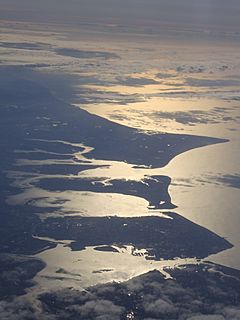 Photograph of Selsey Bill, situated above neighbouring Hayling Island from the air, from the west (north to the left) |
|
| OS grid reference | SZ8592 |
| • London | 60 miles (97 km) NNE |
| Civil parish |
|
| District |
|
| Shire county | |
| Region | |
| Country | England |
| Sovereign state | United Kingdom |
| Post town | CHICHESTER |
| Postcode district | PO20 |
| Dialling code | 01243 |
| Police | Sussex |
| Fire | West Sussex |
| Ambulance | South East Coast |
| EU Parliament | South East England |
| UK Parliament |
|
| Website | Selsey Town Council |
Selsey Bill is a piece of land that sticks out into the sea, called a headland. It's on the south coast of England, in a county called West Sussex. This headland reaches into the English Channel.
It's located on the southern coast of the town of Selsey, which is the most southern town in Sussex. Selsey itself is at the end of a land area known as the Manhood Peninsula. Selsey Bill marks the eastern edge of Bracklesham Bay and the western edge of the Sussex Coast.
Contents
What's in a Name? Selsey Bill's History
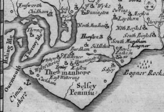
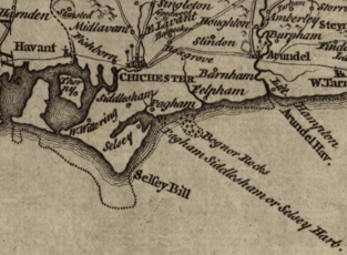
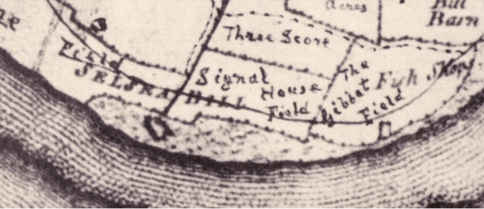
The name Selsey has been around since Saxon times. It comes from an old English phrase meaning Seal's Island. However, the name Selsey Bill isn't as old. It didn't appear on maps until the early 1700s. For example, Philip Overton's map of Sussex from 1740 and Richard Budgen's map from 1724 both show it.
Some people think the idea for the name "Selsey Bill" might have come from Portland Bill. That's another headland on the western side of the Solent sea area.
In 1801, a writer named Thomas Pennant described "Selsey-bill" in his book. He used a small "b" for "bill" because the headland looks a bit like a bird's beak. He wrote that this land helps protect ships from strong westerly winds.
Over time, "Selsey Bill" became very well known. Sometimes, people even use it to mean the whole town of Selsey. For instance, Edward Heron-Allen wrote about a church "on Selsey Bill," even though the church is actually in Selsey High Street.
Selsey Bill in Popular Culture
Selsey Bill has even been mentioned in popular songs!
- The band The Jam sang about it in their 1979 song "Saturday's Kids." They mention saving money for a holiday "To Selsey Bill, or Bracklesham Bay."
- The band Madness also mentioned it in their song "Driving in My Car." They sing, "I drive up to Muswell Hill, I've even been to Selsey Bill."
These songs usually refer to Selsey Bill as a holiday spot. However, most of the holiday places are actually on other parts of Selsey's coast. There used to be Pontin's holiday camps in Selsey and Bracklesham Bay, but they are now closed. The Pontin's at Broadreeds in Selsey was the only one close to the actual "Bill."
It's important to know that Selsey Bill is mostly covered by the sea at high tide. The town of Selsey is on the mainland. Maps from the United Kingdom Hydrographic Office and the Ordnance Survey confirm this.
A Look Back: Selsey Bill's History
Even though the name "Selsey Bill" isn't very old, sailors have known this area for a very long time. It has seen many shipwrecks throughout history.
One of the earliest recorded shipwrecks happened around the year 666. Wilfrid, who was going to be the Archbishop of York, was on his way back from France. His ship was wrecked off Selsey Bill. The local people, who were not Christian at the time, almost killed him.
Later, in 895, there was a sea battle near Selsey Bill. This battle was between Viking ships and the new navy of Alfred the Great. Three Danish ships tried to get away, but two got stuck on what is believed to be Selsey Bill. The crews were captured and sent to Winchester, where Alfred ordered them to be executed.
In the past, the King of England, Henry VI, gave special rights to Chichester Cathedral. This meant that any shipwrecks found off Selsey Bill would belong to the bishop, not the King's court.
Since 1861, there has been a lifeboat station to the east of Selsey Bill. There are also special lights and markers, called beacons, that warn sailors about dangerous rocks. These rocks, called the Owers and Mixon, are south of Selsey Bill. The Mixon rock was once used as a quarry, meaning stone was dug out of it. This happened during Roman times and continued until the early 1800s.
In 1926, the Southern Railway Company named one of their steam trains "Selsey Bill." This train was later taken apart in the 1950s.
Selsey Bill and the Sea
The Meteorological Office (Met Office) gives out Shipping Forecasts on BBC Radio 4 four times a day. These forecasts tell sailors about weather conditions in different sea areas around the UK. Selsey Bill is an important boundary for two of these "inshore water forecasts." The area to the west goes to Lyme Regis, and the area to the east goes to North Foreland. Selsey Bill itself is in the sea area called Wight.
In the 1800s and early 1900s, local fishermen used a large boat with 22 oars. If a ship got stuck near Selsey Bill, after helping rescue people, the fishermen would agree on a price to help the damaged ship get to a safe harbor.
Today, sailing guides warn that Selsey Bill can be hard to see in bad weather. However, in clear weather, sailors can take a shortcut through the Looe Channel. This channel goes through the rocks and ledges south of the "Bill" and is marked by buoys. Sailors need a detailed map and should be very careful if they use this shortcut.
Dolphin Head Highly Protected Marine Area
About 55 kilometers offshore from Selsey Bill is an area called Dolphin Head. In July 2023, this area was made a Highly Protected Marine Area. This means it's a special place where marine life is protected.
Maps
See also
 In Spanish: Selsey Bill para niños
- Hawkhurst Gang
 | Misty Copeland |
 | Raven Wilkinson |
 | Debra Austin |
 | Aesha Ash |


