
Taupō Volcanic Zone facts for kids
Quick facts for kids Taupō Volcanic Zone |
|
|---|---|

|
|

Taupō Volcanic Zone
Location in New Zealand

Taupō Volcanic Zone
Location in North Island
|
|
| Location | North Island |
| Coordinates | 38°40′00″S 176°01′00″E / 38.66667°S 176.01667°E |
| Highest point – elevation – coordinates |
Mount Ruapehu 2,797 m (9,177 ft) 39°17′S 175°34′E / 39.283°S 175.567°E |
| Formed by | Volcanic action |
| Geology | see Taupō Rift |
| Age | Miocene - Holocene |
The Taupō Volcanic Zone (TVZ) is a very active volcanic area. It is located in the North Island of New Zealand. This zone has been active for the last two million years.
It stretches from Mount Ruapehu in the southwest. It goes northeast through the Taupō and Rotorua areas. It even extends offshore into the Bay of Plenty. The zone is named after Lake Taupō. This lake fills a large caldera, which is a collapsed volcano crater.
Contents
Volcano Activity

The Taupō Volcanic Zone has many volcanoes and hot spring areas. Mount Ruapehu, Mount Ngauruhoe, and Whakaari / White Island erupt most often. Whakaari has been active since 1826. This includes constant steaming from its vents.
Over the last 350,000 years, the TVZ has produced a huge amount of volcanic material. It has had over 300 eruptions of thick, sticky lava. Twelve of these eruptions were so big they created calderas. Both the Taupō Volcano and the Ōkataina Caldera have erupted many times in the last 25,000 years.
The biggest eruption since Europeans arrived was Mount Tarawera in 1886. This eruption killed over 100 people. An even larger eruption happened around 1315 CE. This was the Kaharoa eruption from Tarawera. It would have affected early Māori.
The last major eruption from Lake Taupō was the Hatepe eruption in 232 CE. It is thought to have first emptied the lake. Then, a fast-moving cloud of hot gas and ash, called a pyroclastic flow, covered about 20,000 square kilometers of land. A massive 120 cubic kilometers of material was ejected. Over 30 cubic kilometers was ejected in just a few minutes.
Whakaari / White Island had a big collapse of its volcano around 946 BCE. This might have caused a huge tsunami. This tsunami was tens of meters tall. It went up to 7 kilometers inland in the Bay of Plenty.
The Oruanui eruption from Taupō happened 25,580 years ago. It ejected about 1170 cubic kilometers of material. This was Earth's most recent eruption to reach VEI-8. This is the highest level on the Volcanic Explosivity Index. The Rotorua caldera has been quiet for a long time. Its main eruption was about 225,000 years ago.
Zone Size and Geology


The Taupō Volcanic Zone is about 350 kilometers long. It is also about 50 kilometers wide. Mount Ruapehu is at its southwest end. Whakaari / White Island is at its northeast end.
This zone is part of a larger area of volcanic activity. This area is called the Lau-Havre-Taupō back-arc basin. It sits behind the Kermadec-Tonga Subduction Zone. This is where one of Earth's plates slides under another.
The Earth's crust under the Taupō Volcanic Zone is very thin. It might be as thin as 16 kilometers. A layer of magma (molten rock) lies about 10 kilometers under the surface. This magma layer is 50 kilometers wide and 160 kilometers long. The volcanoes here erupt rarely. But when they do, their eruptions are very large and powerful.
The zone is also a rift area. This means the Earth's crust is pulling apart. This pulling apart causes faults. These faults can cause strong earthquakes. The 1987 Edgecumbe earthquake showed how new faults can be found. Earthquakes can also cause landslides. They can also cause tsunamis in lakes or along the coast.
Types of Volcanic Activity

The northern part of the zone has volcanoes made of andesite magma. This is a type of lava that is not too thick. Whakaari / White Island is an example. Its eruptions are often phreatic (steam explosions) or phreatomagmatic (steam and magma explosions).
The central part of the zone has eight large calderas. These are huge craters formed when a volcano collapses. These calderas were created by massive eruptions of rhyolite magma. Rhyolite magma is very thick and full of gas. These eruptions created wide sheets of volcanic rock. This rock is called ignimbrite.
The southern part of the zone has classic cone-shaped volcanoes. These are made of andesite magma. When this magma cools, it forms dark grey lava or scoria. Mount Ruapehu is the tallest mountain in the North Island. It is a large andesite cone. Other volcanoes here include Mount Tongariro and Mount Ngauruhoe.
Volcanoes, Lakes, and Geothermal Areas
The Taupō Volcanic Zone has several important volcanic centers. These include Rotorua, Ōkataina, Maroa, Taupō, Tongariro, and Mangakino.
- Tauranga Volcanic Centre
- This area was active over two million years ago. It is now extinct.
- Whakatāne Graben
- This area includes Mayor Island / Tūhua and Whakaari / White Island.
- Putauaki (Mount Edgecumbe) is also here.
- The Kawerau Power Station uses geothermal energy from this area.
- Rotorua Volcanic Centre
- This center has the Rotorua caldera, which is 22 km wide.
- Lake Rotorua is inside this caldera.
- Geothermal areas like Whakarewarewa are found here. Pōhutu Geyser is a famous geyser in Whakarewarewa.
- Ōkataina Volcanic Centre
- This center includes the large Ōkataina Caldera.
- Mount Tarawera is part of this complex.
- Many lakes are in this area, such as Lake Ōkataina and Lake Tarawera.
- The Waimangu Volcanic Rift Valley is a major geothermal area here. It has Frying Pan Lake.
- Maroa Volcanic Centre
- This area includes the Maroa Caldera and Reporoa caldera.
- The Whakamaru Caldera is also here.
- Important geothermal fields are Waiotapu, Wairakei, and Orakei Korako. Craters of the Moon is a popular geothermal site.
- Taupō Volcanic Center
- This center has the huge Taupō Caldera, about 35 km wide.
- Mount Tauhara is a volcanic dome near Lake Taupō.
- Horomatangi Reefs and Motutaiko Island are features in Lake Taupō.
- The Tauhara-Taupō geothermal field is located here.
- Tongariro Volcanic Centre
- This area includes Mount Tongariro and Mount Ruapehu. Ruapehu is the North Island's tallest mountain.
- Mount Ngauruhoe is a main vent of Tongariro.
- The Tama Lakes are crater lakes in this area.
- Lake Rotoaira and Lake Rotopounamu are also found here.
- Ketetahi Springs is a geothermal area.
- Mangakino Volcanic Centre
- This is the westernmost and oldest caldera volcano in the TVZ.
- It includes artificial lakes like Lake Maraetai.
Images for kids
-
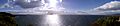
Panorama across Lake Taupō
See also
 In Spanish: Zona volcánica de Taupo para niños
- Geology of New Zealand
- Geothermal areas in New Zealand
- Geothermal power in New Zealand
- List of volcanoes in New Zealand
- North Island Volcanic Plateau
- Rotorua Caldera
- Taupō Volcano
- Volcanology of New Zealand
