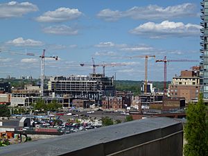
Toronto waterfront facts for kids
The Toronto waterfront is the beautiful shoreline of Lake Ontario in Toronto, Ontario, Canada. It stretches for 46 kilometres, from the Etobicoke Creek in the west to the Rouge River in the east. It's a busy and important part of the city!
Contents
The Story of the Waterfront
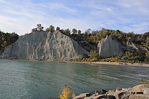
Lake Ontario hasn't always looked the way it does today. Long, long ago, after the last Ice Age, a huge glacier covered this area. As it melted, it left behind a much bigger lake called Lake Iroquois. This ancient lake was much deeper than Lake Ontario. You can still see its old shoreline in steep hills, like the one near Casa Loma.
When the glacier finally moved away from the St. Lawrence River valley, the water level dropped a lot. The land that had been pressed down by the heavy ice slowly started to rise again.
Over time, natural currents in Lake Ontario carried a lot of sand and dirt, especially from the Scarborough Bluffs. This created long strips of land, including the Toronto Islands.
Much of the Toronto waterfront you see today, especially around the harbour, was actually built by people! They filled in parts of the lake with land, a process called land reclamation.
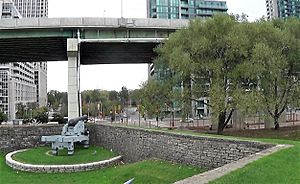
For example, in the early 1900s, a large area called Ashbridge's Bay was filled in to create the Port Lands. This was done partly to improve public health, as people used to dump waste there. The Don River, which used to flow into the bay, was also straightened and moved. This made it easier for large ships to reach the industrial areas. For many years, the central waterfront was a busy industrial hub, with ships bringing goods to and from Toronto.
As Toronto grew, new neighbourhoods were built along the waterfront. Areas like Sunnyside were filled in to create parks and recreational spaces. The lands near Fort York, which were once military grounds, became Exhibition Place and are now public parks.
In the 1950s, the Gardiner Expressway, a big highway, was built, changing the western waterfront a lot. As the city developed, industries started moving out of the central waterfront because land in the suburbs was cheaper. This left behind many polluted sites. The old railway lands north of the waterfront became very valuable and were turned into new developments like the CN Tower in the 1970s, the Rogers Centre (formerly SkyDome), and many apartment buildings.
Shipping to Toronto's port has decreased over the last 50 years. The Toronto Harbour Commission was replaced by the Toronto Port Authority, which manages the port and the Island Airport.
In 1972, the Canadian government started the "Harbourfront" project. This transformed the central waterfront from industrial areas into cultural, recreational, and residential spaces. Buildings like Queen's Quay Terminal were renovated, and new apartment towers were built.
Today, the areas east of Yonge Street, around the Don River, are being redeveloped by Waterfront Toronto. The goal is to create new low-rise buildings and open up the waterfront for public use and recreation. There are also plans to make the Don River look more natural again.
Waterfront Milestones
- 1750 – The French military builds Fort Rouillé, a trading post, on the waterfront.
- 1793 – John Graves Simcoe orders the building of the Toronto Garrison to protect the harbour.
- 1813 – American forces attack and capture the Toronto Garrison during the Battle of York.
- 1814 – The garrison is rebuilt as Fort York.
- 1858 – A big storm creates a new channel at the eastern end of the Toronto Bay peninsula, which is now part of the Toronto Islands.
- 1911 – The Toronto Harbour Commission is created to manage the port.
- 1922 – The Keating Channel is finished, allowing larger ships to reach industries near the Don River.
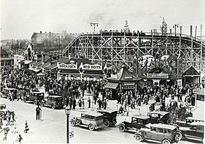
- 1920s – The Toronto Harbour Commission fills in large areas of the harbour shoreline and marshlands, creating the Port Lands and extending the shoreline in Sunnyside, where Sunnyside Amusement Park opens.
- 1939 – The Port George VI Island Airport (now Billy Bishop Toronto City Airport) opens on the western sandbar.
- 1954 – Hurricane Hazel changes the shape of the harbour, breaking the main island into several smaller ones.
- 1971 – Ontario Place opens on man-made islands.
- 1972 – Harbourfront Centre is created by the government.
- 1999 – Waterfront Toronto is established to lead the revitalization of the waterfront. The Toronto Port Authority (TPA) replaces the Toronto Harbour Commission.
- 2003 – Plans for a bridge to the island airport are cancelled by Mayor David Miller.
- 2009 – The Toronto City Centre Airport is renamed Billy Bishop Toronto City Airport.
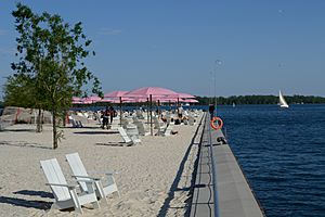
- 2010 – Sugar Beach opens at the foot of Jarvis Street.
- 2015 – A pedestrian tunnel opens, connecting the mainland to the island airport.
- 2015 – The Pan American Games use the revitalized water channel near Ontario Place for competitions.
Exploring the Waterfront Areas
Western Waterfront
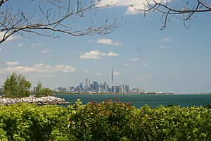
The western part of Toronto's waterfront, near Etobicoke Creek, has many private properties, but also lovely parks and public spaces. You'll find the lakeshore campus of Humber College here, and Humber Bay Park, which has marinas for boats. More parkland is being built to extend the Martin Goodman Trail for walking and biking.
The Humber River marks the border of the old city of Toronto. A cool new bridge, the Humber Bay Arch Bridge, crosses the river here. East of the Humber, the Sunnyside area is full of waterfront parks and places for fun activities. Nearby is the large High Park.
Further east, you'll find Exhibition Place, a big fairground, with Ontario Place on three artificial islands just south of it. This area was also home to Fort Rouillé, one of the first European settlements.
Toronto Harbour
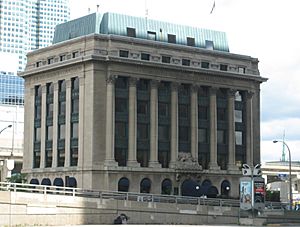
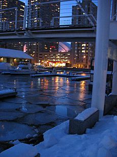
East of Exhibition Place, the waterfront changes from industrial areas to some of Toronto's most expensive homes and apartment buildings. Old commercial buildings like the Queen's Quay Terminal have been turned into fancy condos with lake views. Queens Quay now has many shops and restaurants. This area is also home to Harbourfront Centre, a big cultural spot with galleries and performance spaces. Some large industrial buildings remain, like the Canada Malting Silos, but most are no longer in use.
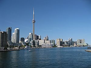
North of the Gardiner Expressway, the former railway lands have also been developed with buildings like the Rogers Centre and CN Tower, which you can easily see from the waterfront.
Between York and Yonge Streets, there are many tall skyscrapers, including the Westin Harbour Castle Hotel. The Redpath Sugar Building is still an active industrial site here.
East of Yonge Street, the East Bayfront area is being developed. Corus Quay is one of the first new buildings there. In the future, thousands of new homes and businesses are planned for this area. South of this, the Toronto Harbour still operates, with docks for both cargo and cruise ships.
The Toronto Islands are a chain of small natural islands that form the southern edge of the Inner Harbour. Most of the islands are parks, but a few people live there. The western part of the islands is home to the island airport. You can get to the airport by a ferry from Bathurst Street. In 2015, a pedestrian tunnel opened, making it even easier to get to the airport.
Port Lands
East of Cherry Street is the Port Lands, an area that used to be industrial and is now partly empty. It has the Hearn Generating Station and the Portlands Energy Centre. There are big plans to turn this area into a mix of businesses and homes. The southern part of the Portlands was meant to be a bigger harbour, but it was never fully developed. Today, it's home to Cherry Beach, and the long breakwater called the Leslie Street Spit is a popular park and a great place for bird watching.
The Beaches
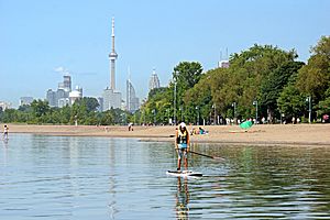
East of the Portlands is the famous Beaches area. It's named after the four connected sandy beaches along this part of the lake. The R. C. Harris Water Treatment Plant, an impressive Art Deco building, is also here and provides much of Toronto's water.
Eastern Waterfront
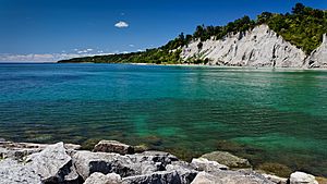
The Scarborough part of the waterfront is dominated by the amazing Scarborough Bluffs. These are a series of tall cliffs that run along the lakeshore for 15 kilometres, reaching up to 90 metres high! On top of the cliffs are several neighbourhoods. Below the bluffs, you'll find Bluffer's Park, a large park and marina built on filled land.
East of Highland Creek is Port Union, named after an old port facility. The Rouge River forms the eastern end of Toronto's waterfront, marking the border between Toronto and Pickering. This area is part of Rouge National Urban Park, a national park with a beautiful beach and river mouth.
Waterfront Revitalization Plans
Improving Toronto's waterfront has been a big topic for many years. In 1972, the government started the "Harbourfront Project" to change parts of the central waterfront from industrial to cultural and recreational uses. Harbourfront Centre and Queen's Quay Terminal are examples of this early work.
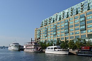
In 1999, the Canadian and Toronto governments created Waterfront Toronto. This organization is in charge of leading and managing the big project to renew Toronto's waterfront. The governments have promised $1.5 billion to help with this redevelopment.
Waterfront revitalization is focused on the central waterfront, an area that stretches from Dowling Avenue in the west to Coxwell Avenue in the east. This is one of the largest urban redevelopment projects in North America! It involves about 800 hectares of mostly unused land, very close to Toronto's downtown. The full project is expected to take 25 to 30 years and cost about $17 billion from public and private sources.
According to Waterfront Toronto's plan, the revitalized waterfront will include 40,000 new homes (with 20% being affordable housing), 40,000 new jobs, new public transportation, and 300 hectares of parks and public spaces.
Waterfront Toronto wants to make sure everyone can easily access the waterfront and enjoy its parks and public spaces. Many projects have already been finished, including improvements to Cherry Beach, the Western Beaches Watercourse, and the expansion of the Martin Goodman Trail.
The first new neighbourhoods being developed by Waterfront Toronto are the East Bayfront and West Don Lands. These areas are being designed as "green" communities with features like green rooftops, streets friendly to walkers, lots of parks, affordable housing, and public transit close by.
Waterfront Toronto also holds many public meetings each year to get ideas from people and keep everyone informed about the progress.
New Designs for the Central Waterfront
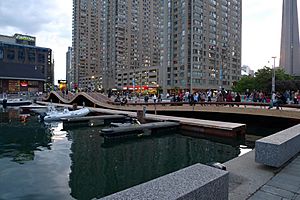
In 2006, a design competition was held for the Central Waterfront. The winning plan, by West 8 and DTAH, aims to give the central waterfront a bold new look. It includes a wide walkway along the water and lots of green space. Bridges and unique WaveDecks will rise from the boardwalk, connecting different areas and allowing continuous public access to the lake. The plan also suggests turning the southern half of Queens Quay into a pedestrian walkway, similar to the famous La Rambla in Barcelona.
Challenges and Solutions
- The Gardiner Expressway: This raised highway runs just north of the lakeshore. Many people see it as a barrier that separates the city from the lake. There are ideas to replace it with a street-level road or even bury it in a tunnel, but these would be very expensive and cause a lot of traffic problems.
- The Island Airport: The island airport is a big topic of debate. Some people want it to expand, while others are against it because of concerns about noise and traffic. In 2015, plans to allow jet aircraft at the airport were cancelled.
- Restoring the Don River: There are plans to make the mouth of the Don River more natural again. This would help prevent flooding in the downtown area and bring back the natural marshland that used to be there.
- Recreational Clubs: Many sailing, rowing, and windsurfing clubs use the area east of Cherry Beach. These clubs have built up their facilities over many years, and it would be hard to move them elsewhere. Their needs are an important part of the planning.
 | Delilah Pierce |
 | Gordon Parks |
 | Augusta Savage |
 | Charles Ethan Porter |


