Tryon Creek facts for kids
Quick facts for kids Tryon Creek |
|
|---|---|
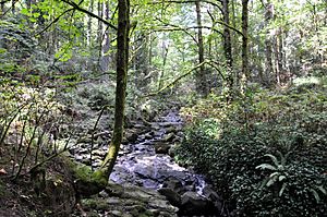
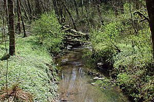
Upper Tryon Creek in Marshall Park
|
|
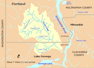
Tryon Creek watershed
|
|
|
Location of the mouth of Tryon Creek in Oregon
|
|
| Country | United States |
| State | Oregon |
| County | Multnomah and Clackamas |
| Physical characteristics | |
| Main source | Tualatin Mountains (West Hills) Portland, Multnomah County, Oregon 641 ft (195 m) 45°26′49″N 122°43′18″W / 45.44694°N 122.72167°W |
| River mouth | Willamette River Lake Oswego, Clackamas County, Oregon 10 ft (3.0 m) 45°25′22″N 122°39′24″W / 45.42278°N 122.65667°W |
| Length | 4.85 mi (7.81 km) |
| Basin features | |
| Basin size | 6.5 sq mi (17 km2) |
Tryon Creek is a small river, about 4.85-mile (7.81 km) long, in Oregon, USA. It flows into the Willamette River. The area around the creek, called its watershed, covers about 6.5 square miles (16.8 km2). This area is in Multnomah and Clackamas counties.
The creek starts in the Tualatin Mountains (also called West Hills) near Portland. It then flows southeast through neighborhoods and the Tryon Creek State Natural Area. Finally, it reaches the Willamette River in Lake Oswego. About 21 percent of the watershed is covered by parks and open spaces. The rest is mostly covered by single-family homes. The biggest park is the state natural area, which is located in both cities and counties.
The land under the watershed was formed millions of years ago. It includes old seamounts (underwater mountains) that became part of North America. This land is now buried under layers of ash, lava, and dirt from volcanoes and floods. Two inactive volcanoes are also found in the Tryon Creek watershed.
The creek is named after Socrates Hotchkiss Tryon, Sr., who settled nearby in 1850. Forests of cedar and fir trees once grew here. These trees were later cut down by companies like the Oregon Iron Company until the mid-1900s. People started trying to create a large park in the area in the 1950s. Their efforts succeeded in 1975 when the state park was officially opened. By 2005, about 37 percent of the watershed was still wooded. It was home to over 60 types of birds, small mammals, amphibians, and fish.
Contents
Where Does Tryon Creek Flow?
Tryon Creek starts just north of Interstate 5 (I-5) and Oregon Route 99W near Multnomah Village. It flows southeast for about 4.85 miles (7.81 km). The creek passes through Portland neighborhoods, Marshall Park, and the Tryon Creek State Natural Area. It then joins the Willamette River in Lake Oswego.
Near its start, the creek flows through several underground pipes called culverts. One culvert is 260 feet (79 m) long, and another is 160 feet (49 m) long under Southwest 30th Avenue. It also goes under Route 99W and I-5 through a 560 feet (170 m) long culvert.
Tryon Creek has several smaller streams that flow into it. Falling Creek joins from the right side. Quail and Burlingame creeks also enter from the right soon after. In Marshall Park, the creek flows over rocks and steps, creating a feature called the Marshall Cascade. Arnold Creek, the largest stream feeding Tryon Creek, also joins from the right. After this, the creek goes under Southwest Boones Ferry Road through another culvert.
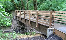
The creek then enters the Tryon Creek State Natural Area. Inside the park, several footbridges cross the creek. These include the High Bridge, Beaver Bridge, and Obie's Bridge. These bridges carry trails for hikers and horses.
Further downstream, Park Creek enters from the right. The Red Fox Bridge crosses the creek here. The creek then flows roughly parallel to the South Creek Trail. Red Fox Creek and Palatine Hill Creek also join the main stream. After this, Tryon Creek leaves Portland and Multnomah County. It enters Lake Oswego and Clackamas County.
The Iron Mountain Bridge crosses the creek next. Just below this bridge, Nettle Creek joins from the right. A United States Geological Survey (USGS) station measures the creek's flow here. Tryon Creek leaves the state natural area and flows under Oregon Route 43 through a 200-foot (61 m) culvert. It then passes under Union Pacific Railroad tracks.
In its final stretch, Tryon Creek forms the border between Lake Oswego and an area called Briarwood. The Tryon Creek Wastewater Treatment Plant is also located nearby. Finally, the creek flows into the Willamette River. This is about 20 miles (32 km) upstream from where the Willamette meets the Columbia River.
How Much Water Flows in Tryon Creek?
Since 2002, the USGS has been measuring the amount of water flowing in Tryon Creek. This measuring station is about 1 mile (1.6 km) from where the creek meets the Willamette River. From 2002 to 2011, the creek's average flow was about 8.72 cubic feet per second (0.25 m3/s). This measurement covers about 97 percent of the entire Tryon Creek watershed.
The most water recorded flowing in the creek was 1,210 cubic feet per second (34 m3/s) on December 9, 2010. The least amount of water was 0.09 cubic feet per second (0.0025 m3/s) on a few days in September 2002.
What is the Land Like Around Tryon Creek?
The land under the Tryon Creek watershed has a long and interesting history. Millions of years ago, the North American continent slowly moved westward. As it moved, it collided with and added new pieces of land, like islands and reefs. One of the last pieces added, during a time called the Eocene epoch, is found under the Tryon Creek watershed. This land was once a chain of underwater mountains called seamounts. Over time, these mountains were pushed up to form the Oregon Coast Range and the Tualatin Mountains.
Later, about 15 to 16 million years ago, volcanoes in eastern Oregon and Washington erupted. Their lava flowed across much of northern Oregon. Some of this lava flowed around the older land formations in the Tryon Creek watershed but did not completely cover them.
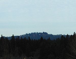
Starting about 3 million years ago, smaller volcanoes erupted in the Boring Lava Field. Two of these volcanoes, Mount Sylvania and Cook's Butte, are located in the Tryon Creek watershed. Mount Sylvania's eruptions sent out ash and lava that covered some of the older rock layers.
About 15,000 years ago, huge floods, known as the Missoula Floods, swept through the Columbia River basin many times. These floods carried massive amounts of dirt and rocks. They also created new flat areas along the rivers. In between these big floods, strong winds blew silt (fine dirt) across the land. In the Tryon Creek watershed, wind-blown silt covers the lava at higher elevations. At lower elevations, sand and gravel cover the bedrock.
The Tryon Creek Watershed
The Tryon Creek watershed covers about 6.5 square miles (17 km2). About 80 percent of this area is within Portland city limits. The rest is divided among Lake Oswego and Multnomah and Clackamas counties. The State of Oregon also owns the natural area within the watershed.
Other watersheds nearby include Fanno Creek to the west, Stephens Creek to the north, the Willamette River to the east, and Oswego Lake to the south. Many roads, including parts of Interstate 5 and Oregon Route 43, run through the watershed.
About 35 inches (890 mm) of rain falls on the watershed each year. Most of this rain occurs between October and May, with dry summers. The elevation in the watershed ranges from Mount Sylvania, which is 970 feet (300 m) above sea level, to 10 feet (3.0 m) where the creek enters the Willamette River. Many slopes in the watershed are very steep.
About 24 percent of the basin is covered by Impervious surfaces like roads and buildings. These surfaces, along with the clay soils, cause rain to run off quickly. This leads to fast water flow and low water levels in the creek during dry times. In 1996, major flooding caused landslides and damage to the creek beds. However, it did not cause much property damage in the watershed.
In 2000, about 18,000 people lived in the Portland part of the Tryon Creek watershed. In 2005, a study showed that 55 percent of the land was for single-family homes. Parks and open spaces covered 14 percent. The regional government, Metro, states that parks and natural areas make up about 21 percent of the total watershed.
What are the Smaller Streams in the Watershed?
The main smaller streams that flow into Tryon Creek are Arnold Creek and Falling Creek. Arnold Creek's watershed is about 1.2 square miles (3.1 km2), which is 18 percent of the total. Falling Creek's watershed is about 0.4 square miles (1.0 km2), or 6 percent of the total.
The seven named streams that feed Tryon Creek, from its mouth to its source, are Nettle, Palatine Hill, Red Fox, Park, Fourth Avenue, Arnold, and Falling creeks.
How Clean is the Water?
The Oregon Department of Environmental Quality (DEQ) uses a system called the Oregon Water Quality Index (OWQI) to rate water quality. Scores range from 10 (worst) to 100 (ideal). In 2004, Tryon Creek's overall OWQI score was 74, which is considered "poor."
In 1998, Oregon listed Tryon Creek as having "water-quality limited" issues. This was because water temperatures in the lower 5 miles (8 km) of the creek and its tributaries were too high in the summer. High temperatures can harm fish like salmon and steelhead.
Pollution from many different sources, like runoff from streets, enters the creek. There are also two large stormwater pipes that drain into the creek. As of 2004, the only water quality problem that did not meet standards was the water temperature.
Annual Report Card for the Creek
Since 2015, Portland's Bureau of Environmental Services (BES) has given annual "report cards" for local watersheds. They grade four areas:
- Hydrology: How much pavement and other hard surfaces are in the watershed, and how freely the streams flow.
- Water Quality: Measurements of things like dissolved oxygen, bacteria, temperature, and chemicals.
- Habitat: The condition of stream banks, riparian zones (areas along the water), and tree canopies.
- Fish and Wildlife: The health of birds, fish, and macroinvertebrates (small creatures without backbones).
In 2015, Tryon Creek received these grades: Hydrology, B; Water Quality, B; Habitat, B; and Fish and Wildlife, C−.
History of Tryon Creek Area
Before European settlers arrived in the 1800s, Native American groups lived in this area. The Clackamas tribe lived near the Clackamas River, about 5 miles (8 km) upstream from Tryon Creek's mouth. They were part of the Chinookan speakers. In 1806, when Lewis and Clark visited, there were about 1,800 Clackamas people. However, diseases like smallpox and malaria greatly reduced their population. By 1855, the tribe signed a treaty and gave up their lands.
Another Chinookan group, the Multnomahs, lived on Sauvie Island, about 17 miles (27 km) downstream from Tryon Creek. They also faced a similar decline in population due to disease.
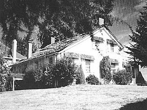
In 1850, Socrates Hotchkiss Tryon, Sr., a pioneer settler, claimed land at the south end of Tryon Creek canyon. After he died, his land was sold to the Oregon Iron Company in 1874. For nearly 25 years, the company cut down cedar and fir trees to use in its iron factory in Lake Oswego. Their logging road later became the Old Iron Mountain Trail in the state natural area. In 1900, a fire in the upper canyon left behind burned tree stumps that can still be seen today.
Logging continued in the canyon until 1961. A big windstorm in 1962, called the Columbus Day Storm, blew down many of the remaining trees.
In the 1950s, local people started working to create a park along the creek. In 1969, Multnomah County bought 45 acres (18 ha) to start a large regional park. A group called "Friends of Tryon Creek Park" was formed. They raised money, helped with land deals, and worked with the state. In 1970, Oregon Governor Tom McCall announced the creation of Tryon Creek State Park.
Over the next few years, the state bought more than 600 acres (240 ha) of land. Volunteers helped build trails, and the nature center was finished by 1975. The park was officially opened on July 1, 1975. It was later renamed Tryon Creek State Natural Area.
Plants and Animals in the Watershed
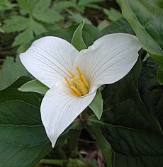
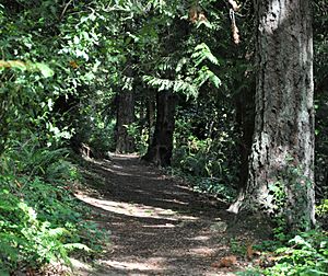
About 37 percent of the Tryon Creek watershed is covered in trees. The main trees are red alder, bigleaf maple, Douglas-fir, western redcedar, and western hemlock. In the Tryon Creek State Natural Area, you can find many trillium flowers. They are celebrated each spring during the park's Trillium Festival. More than 90 types of wildflowers, like fringecup, grow in the park. You can also find plants like sword fern.
However, some unwanted plants, called invasive species, are also found. These include English ivy, Himalayan blackberry, English holly, and garlic mustard.
The areas along the creek banks (called riparian zones) are in good condition in the state natural area and Marshall Park. However, in areas surrounded by homes, these zones are not as healthy. When native plants are removed from these areas, it can cause erosion, damage to the creek banks, and higher water temperatures.
Tryon Creek is one of the few streams in the Portland area where steelhead Trout live. Coho salmon have also been seen spawning (laying eggs) in the creek. Surveys in 2002 found coho, chinook salmon, steelhead, and coastal cutthroat trout in different parts of the creek. Water striders, which are insects that can walk on water, are common in the creek's pools.
More than 60 types of birds visit the area. These include Cooper's hawks, great blue herons, and kingfishers. Some of the animals living here are bats, coyotes, moles, rabbits, skunks, and squirrels. Frogs, salamanders, snakes, and turtles also live well in the watershed.
Parks to Explore
The most important park in the Tryon Creek watershed is the Tryon Creek State Natural Area. It is Oregon's only state park located within a major city. At about 630 acres (250 ha), it is much larger than the other parks in the watershed.
The state park has a 3-mile (5 km) bike path along Terwilliger Boulevard. This path is part of the Portland area's greenway trail system called the 40-Mile Loop. Horse riders can enjoy about 5 miles (8 km) of horse trails. Hikers can use the bike path, horse trails, and about 8 miles (13 km) of hiking trails. There is also a paved loop trail, about 0.35-mile (0.56 km) long, that is good for wheelchairs. It has drinking fountains and signs that explain things about the park.
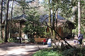
The park also has a building called the Nature Center. It has a gift shop, a large classroom, educational exhibits, and a play area for small children.
Tryon Creek flows through the middle of the state park. It also runs through Marshall Park. Marshall Park is a natural area of about 26 acres (11 ha) located in a canyon. It offers hiking trails, a playground, picnic tables, a waterfall, and a stone bridge over the creek. Other parks in the watershed include West Portland Park (about 15 acres (6 ha)) and Maricara Park (about 17 acres (7 ha)). The regional government, Metro, plans to buy more land along the creek to add to these parks.
 | Jewel Prestage |
 | Ella Baker |
 | Fannie Lou Hamer |


