Walcott, Norfolk facts for kids
Quick facts for kids Walcott |
|
|---|---|
 Walcott village sign |
|
| Population | 548 (Including Ostend 2011) |
| OS grid reference | TG360320 |
| • London | 137 miles (220 km) |
| Civil parish |
|
| District | |
| Shire county | |
| Region | |
| Country | England |
| Sovereign state | United Kingdom |
| Post town | NORWICH |
| Postcode district | NR12 |
| Dialling code | 01692 |
| Police | Norfolk |
| Fire | Norfolk |
| Ambulance | East of England |
| EU Parliament | East of England |
| UK Parliament |
|
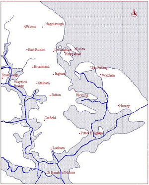
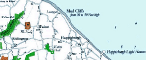
Walcott is a small village and civil parish located on the North Norfolk coast in England. You can find it between the villages of Mundesley and Happisburgh. The name 'Walcott' comes from old words: 'walh' (meaning 'Welsh') and 'cot' (meaning 'cottage' or 'shelter').
The village is about 19.1 miles (30.7 km) north-east of Norwich. It's also 11.9 miles (19.2 km) south-east of Cromer and 137 miles (220 km) north-east of London. Walcott is special because the B1159 (the coast road) runs right along the sea's edge here. This makes it a popular spot for day-trippers and people who like to watch storms. The parish of Walcott was officially created in 2008.
Contents
Walcott's Past: A Journey Through Time
How Walcott's Landscape Was Formed
The land around Walcott has been shaped by many things over thousands of years. These include past ice ages, times when the sea covered the land, and rivers. They all left behind different materials on top of the chalk rock underneath.
Around 16,000 BC, the last ice sheet left Norfolk. This allowed pine trees to grow in the area. Later, between 10,000 and 6000 BC, the weather became warmer and drier. This brought more types of trees like oak and elm.
The rising temperatures also caused sea levels to go up. Around 5000 BC, the North Sea connected to the English Channel. This created wide river mouths (estuaries) in Norfolk. These estuaries started to deposit marine clay over the peat in the Broadland area.
By 3000 BC, the Norfolk coastline looked much like it does today. However, the cliffs continued to wear away. Some of this eroded material forms a sand bar a few miles offshore. This sand bar can be dangerous for ships.
During the Bronze Age (2,500 – 800 BC), the climate got cooler, but the sea level kept rising. Around 750 BC, the sea started to break through land barriers further south. This made Walcott part of a large area with many islands and waterways. This area was perfect for early humans to live. It had fresh water, good fishing, and reeds for building. The good farming land and its isolated location also offered some protection.
From the Iron Age to the end of the Roman period (800 BC – 410 AD), the climate became wet and cold. The sea level in Walcott was probably about 1 metre (3 feet) higher than it is now.
Around 500 AD (during the Anglo-Saxon period), natural land barriers started to form again. These barriers kept the sea out of the local estuaries. Over time, people helped maintain these barriers to protect farmland.
The coast around Walcott has been eroding at about 1 metre (3 feet) per year. This means that a strip of land about 2 kilometres (1¼ miles) wide has been lost since the Romans arrived in 43 AD. Several old villages, like Waxham Parva, have disappeared into the sea because of this.
Early People in Walcott
The climate was very different during the Palaeolithic or Old Stone Age (before 10,000 BC). We know this from bones of elephants, rhinoceros, and hippos found in East Anglia. People lived here sometimes during this period. Most tools found were flint hand axes, used for clearing forests.
Not much happened in Walcott during the Mesolithic or Middle Stone Age (10,000 – 5000 BC). Few tools from this time have been found.
During the Neolithic or New Stone Age (5000 – 2500 BC), most tools were found on higher ground.
The number of Bronze Age (2500 – 800 BC) tools found in Walcott increased a lot. This suggests more people lived here. Norfolk didn't have copper or tin, so these materials must have been brought in through trade.
Fewer Iron Age (800 BC – 43 AD) tools have been found compared to the Bronze Age. This might be because iron rusts faster than bronze. However, more Iron Age pottery has been found.
The local Iron Age tribe was called the Iceni. They were probably a group of smaller tribes. It's thought that East Norfolk, including Walcott, might have been home to one of these smaller tribes.
Roman Times in Walcott
When the Romans were in Britain (43 AD – 410 AD), many more items were found in Walcott. There were small groups of Roman finds near Happisburgh and larger groups in the Stalham/Ingham area.
Most Roman items found (about 75%) are from the 1st and 2nd centuries AD. Only about 25% are from the 3rd and 4th centuries AD. This might mean Roman activity in the area slowed down after 200 AD.
The Early Middle Ages
After the Romans left, the Walcott area saw a decline in its economy and technology. Items found in graves from this time suggest many people came from the Anglian region of Germany/Denmark. These were the Angles.
Later in the Anglo-Saxon period (650 – 865 AD), evidence shows that Norfolk became more Christian than pagan.
From the late Anglo-Saxon period (865–1066), few but high-quality items have been found in Walcott. These suggest important people lived here.
Viking warriors first attacked East Anglia in 865 AD. The area stayed under Scandinavian control until 917 AD. This is when the West Saxons took back East Anglia. This period is thought to be the start of the "Hundreds" system. A Hundred was an area of land with about 100 families. Walcott is in the Happing Hundred.
People started cutting peat around 900 AD. This led to the creation of The Broads. This practice might have been introduced by the Angles. It could also mean there wasn't much firewood available.
Medieval Walcott
Before the Norman Conquest in 1066, a noble named Eadric de Laxfield owned Walcott. The village had about 486 acres of farmland, 8 villagers, and 16 small farmers. There were also meadows, a mill, and animals like cattle, pigs, and sheep. A church with 20 acres of land was also present. The value of the manor was 40 shillings.
After the Norman Conquest, Walcott was given to Robert Malet. Later, it was given to Ralph, brother of Iger, and managed by Humphrey. The Domesday Survey of 1088 recorded 8 villagers and 16 smallholders. It also mentioned a church, a mill, and various animals. Based on this survey, the population of Walcott in 1088 was around 170 people.
The de Walcott family were the main landowners (Lords of the Manor) in Walcott from the late 1100s to the late 1300s.
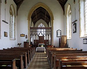
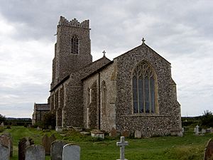
Walcott's church is called All Saints. It was built in the mid-1300s. The font inside is even older, from the 1200s. This font stands on an old stone memorial slab. Both are from an earlier church, whose foundations might have been found nearby.
During the time of King Edward I (1239–1307), the church was valued at £13 6s 8d per year.
Walcott originally had two large houses: East Hall and West Hall. In 1405, West Hall was joined with East Hall.
In 1360, the Stapleton family started a college of Friars (religious brothers) to serve Ingham and Walcott. The church was rebuilt in 1360, and its Chancel (the part of the church near the altar) is from the 1340s.
To help pay for a crusade (a religious war) in the Holy Land, a special tax called the Norwich Tax was introduced in 1254. For Walcott, the tax was £16 13s 4d.
Between 1250 and 1350, farming in the area mainly involved Barley (about 50%), Legumes (20%), and Wheat (15%). The rest was Rye, Oats, and mixed grains. Farmers also raised cattle (55%), sheep (30%), and some horses, oxen, and pigs.
In 1334, another tax was collected for a crusade. This tax showed that Walcott's wealth was £6 0s 0d.
The Black Death (a terrible plague) reached Norfolk in the spring of 1349. It spread from Yarmouth up the rivers, likely brought by ships. In the autumn of 1349, the harvest in Walcott was less than half the usual amount.
After the Black Death, prices went up a lot because there were fewer people. The King tried to control this by forcing wages down and adding a Poll Tax (a tax on every person). This was very unpopular and led to rebellions, known as the Peasants' Revolt. Bromholm Priory was attacked in June 1381. The uprising was eventually stopped.
Walcott in More Recent Times
Most church records (parish registers) started after the medieval period. Walcott's registers began in 1558. In 1603, there were 110 church members listed. This suggests Walcott's population had grown since 1088.
In August 1797, William Faden published the first detailed map of Norfolk, which included Walcott.
In 1830, there was another rebellion called the 'Swing riots'. This happened because new farming machines meant fewer jobs for people. Farmers received threatening letters signed by a mysterious 'Captain Swing'. In Walcott, farm machinery was destroyed.
According to the Whites Trade Directory from 1845, Walcott had a population of 172 people and 685 acres of land. The village had a Shopkeeper and Smith, a Wheelwright, a pub called the Light House, and seven Farmers.
Things to Do and See in Walcott
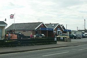
Walcott has a parish church (All Saints, built in the 14th-15th century). There are also two shops (one with a post office), several restaurants and pubs, a caravan site, and an infant school.
You can get to the beach in a couple of ways:
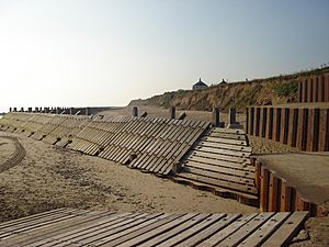
- Walcott Gap: This is a wooden ramp that goes from the road to the sand. Cars, tractors, and trailers can use it to launch small boats, including local fishing boats.
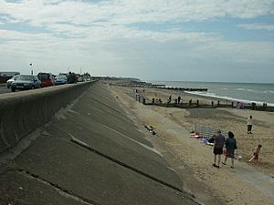
- Steps: There are steps built into the sea defenses at different spots along the seafront.
Getting Around Walcott
There is a bus service that goes through the village. It connects Walcott to North Walsham on a circular route, but it doesn't run very often.
The closest train station is at North Walsham. From there, you can take the Bittern Line train between Cromer and Norwich.
The nearest airport is Norwich International Airport.
Floods in Walcott
Walcott has faced several serious floods over the years due to its coastal location.
The Great North Sea Flood of 1953
On the night of January 31, 1953, a very high tide combined with a strong storm. This caused a huge storm surge. The area was badly hit, and much of Walcott village was lost to the sea. The nearby village of Keswick was also affected.
The North Sea Flood of 2007
On November 10, 2007, another storm surge hit the East Anglian coast. The sea wall in Walcott was broken by waves that were 12 ft (3.7 m) high. Homes were damaged, and boats and caravans were blown across the coast road. A film called Wordland (2008) shows the damage from this flood and includes interviews with local people.
The North Sea Flood of 2013
The village was hit hard by another storm surge on December 5, 2013. Many homes and businesses were damaged.
To protect the coast, a big project started in July 2019. Almost 3 million cubic yards (two million cubic metres) of sand were added to create a 6-kilometre (3¾-mile) artificial sand dune. This dune is 7 metres (23 feet) high and extends up to 250 metres (820 feet) out to sea. This £20 million project helps protect the nearby Bacton Gas Terminal and the villages of Bacton and Walcott.
|
 | Janet Taylor Pickett |
 | Synthia Saint James |
 | Howardena Pindell |
 | Faith Ringgold |


