Wappinger, New York facts for kids
Quick facts for kids
Wappinger, New York
|
||
|---|---|---|
| Town of Wappinger | ||
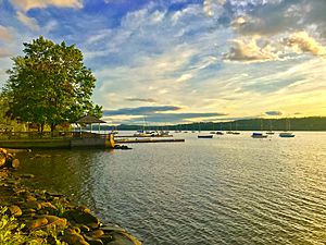
Wappinger waterfront along the Hudson River
|
||
|
||
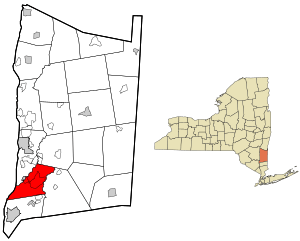
Location of the Town of Wappinger, New York
|
||
| Country | United States | |
| State | New York | |
| County | Dutchess | |
| Town of Wappinger | May 20, 1875 | |
| Government | ||
| • Type | Town Council | |
| Area | ||
| • Total | 28.53 sq mi (73.90 km2) | |
| • Land | 27.05 sq mi (70.07 km2) | |
| • Water | 1.48 sq mi (3.83 km2) | |
| Elevation | 197 ft (60 m) | |
| Population
(2020)
|
||
| • Total | 28,216 | |
| • Estimate
(2016)
|
26,780 | |
| • Density | 989.87/sq mi (382.20/km2) | |
| Time zone | UTC-5 (Eastern (EST)) | |
| • Summer (DST) | UTC-4 (EDT) | |
| ZIP code |
12590 - Wappingers Falls, 12512 - Chelsea, 12537 - Hughsonville, 12524 - Fishkill, 12533 - Hopewell Junction, 12603 - Poughkeepsie
|
|
| Area code(s) | 845 | |
| FIPS code | 36-027-78157 | |
| GNIS feature ID | 0979595 | |
Wappinger is a town in Dutchess County, New York, United States. It is located in the beautiful Hudson River Valley region. The town sits on the eastern side of the famous Hudson River.
In 2020, about 28,216 people lived here. The town's name comes from the Wappinger Native Americans. They were the first people to live in this area. Wappinger includes most of the village of Wappingers Falls. It also has many smaller communities called hamlets, like Chelsea and Hughsonville.
Contents
History of Wappinger
The Wappinger were a group of Native Americans who lived along the eastern side of the Hudson River in the 1600s. Their land was mostly in what is now Dutchess County. It stretched from Manhattan Island in the south to the Mahican territory in the north. Their land also went east into parts of Connecticut.
The Wappinger people spoke a language called Eastern-Algonkian. They were culturally similar to the Lenape people (Delaware Indians) and the Mahican people. The word Wappinger means "easterner" in most Algonkian languages.
The town of Wappinger was officially formed on May 20, 1875. Before that, it was part of the town of Fishkill. The area is part of a historic land grant called the Rombout Patent from 1685.
Some people from the Massachusetts Bay Colony first settled here illegally in 1659. They were looking for religious freedom and settled near the Wappinger Creek. However, Dutch authorities made them leave a few months later.
The first legal land purchase happened in 1685. Francis Rombout and Gulian Verplanck bought 85,000 acres from the Wappinger people. This land became known as the Rombout Patent. It covered several towns, including Fishkill, Wappinger, and parts of Poughkeepsie.
The first legal land purchase within the Town of Wappinger itself was in 1714. Elias Van Benschoten bought land and settled in the hamlet of New Hackensack. Other families from Hackensack, New Jersey followed him.
Wappinger was mostly a farming area. Mills were built along the creek in the Village of Wappingers Falls. After the town was created in 1875, it took a year to elect its first officials. Their main jobs were to keep the roads and bridges in good condition.
Historic Districts
Wappinger has special areas that are important for their history and buildings.
Wheeler Hill Historic District
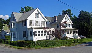
This district includes many old buildings and sites built between 1740 and 1940. It features large estates like Obercreek and Carnwath Farms. There are also two old commercial buildings from the 1700s near the river. Wheeler Hill Road was once called Rives Avenue.
Wappingers Falls Historic District
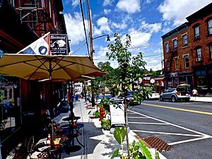
This district is in the center of the village of Wappingers Falls. It was added to the National Register of Historic Places in 1984. It includes Mesier Park and many old homes. Most of the buildings were built in the 1800s when industries grew in Wappingers Falls. An 1884 stone arch bridge connects the east and west sides of the village over the falls.
Hamlets of Wappinger
Wappinger is made up of several smaller communities called hamlets.
Chelsea
Chelsea is a hamlet in the southwest part of town, close to the Hudson River. It's mostly a place where people live. There's a marina on the river. A large pumping station here takes water from the river for New York City during dry times. Chelsea was first known as Low Point. It was renamed Carthage, then Carthage Landing, and finally Chelsea in 1901.
Diddell
Diddell is a hamlet in the northeastern part of town. In the 1800s, the Maybrook Railroad had a station here. This old rail line is now the William R. Steinhaus Dutchess Rail Trail. In 2017, the 750-mile Empire State Trail was announced. It runs from Manhattan to Buffalo and passes through Diddell.
Hughsonville
Hughsonville is about one mile south of Wappingers Falls. It gets its name from William Hughson, who came from England. The Presbyterian Church of Hughsonville was built in 1840. The Hughsonville Fire Company started in 1912.
Middlebush
Middlebush is about one mile southeast of Wappingers Falls. It was an early business center. The first Baptist church in town was started here in 1782. An old cemetery still remains there. This hamlet now has schools, businesses, homes, and the Wappinger Town Hall.
Myers Corners
Myers Corners is located at the intersection of Myers Corners Road and All Angels Hill Road. It was named after John Myers from Holland. It used to be mostly farmland but had a doctor, a school, and a tavern.
New Hackensack
Johannes Schurrie was an early settler here around 1740. He came from Hackensack, New Jersey, which is where the hamlet gets its name. Most early settlers were Dutch and German. Part of NYS Route 376 is known as New Hackensack Road. The main street used to have a post office and stores.
Swartwoutville
Swartwoutville is in the southeastern part of town. It's named after General Jacobus Swartwout. This was an important meeting place during the American Revolution. General George Washington and other famous generals like Baron Von Stueben and Marquis de Lafayette visited and stayed here.
Toponyms (Place Names)
All Angels' Hill
This area was first called Mount Hope. In the 1850s, a farmer named William Marvin owned land here. His daughter married Dr. Anthony Underhill. In 1903, All Angels Episcopal Church from Manhattan bought the property. They used it for All Angels' Farm, which helped poor children.
Geography of Wappinger
The town of Wappinger covers about 28.53 square miles (73.9 square kilometers). Most of this area is land, with about 1.48 square miles (3.8 square kilometers) being water. The western edge of the town is along the Hudson River. This border is shared with Orange County.
Wappinger is bordered by several other towns. To the south is Fishkill. To the east, across Sprout Creek, is East Fishkill. Across the Hudson River to the west is the town of Newburgh. Wappinger Creek forms part of the northwest border. To the northeast is LaGrange.
The town of Wappinger also includes part of the village of Wappingers Falls. The other part of the village is across Wappinger Creek in the town of Poughkeepsie.
The highest point in Wappinger is about 545 feet (166 meters) above sea level. This hilltop is in the southern part of town. The lowest point is at sea level along the Hudson River.
Population and People
| Historical population | |||
|---|---|---|---|
| Census | Pop. | %± | |
| 1880 | 4,961 | — | |
| 1890 | 4,575 | −7.8% | |
| 1900 | 4,319 | −5.6% | |
| 1910 | 3,813 | −11.7% | |
| 1920 | 3,467 | −9.1% | |
| 1930 | 4,083 | 17.8% | |
| 1940 | 4,345 | 6.4% | |
| 1950 | 5,090 | 17.1% | |
| 1960 | 9,577 | 88.2% | |
| 1970 | 22,040 | 130.1% | |
| 1980 | 26,776 | 21.5% | |
| 1990 | 26,008 | −2.9% | |
| 2000 | 26,274 | 1.0% | |
| 2010 | 27,048 | 2.9% | |
| 2020 | 28,216 | 4.3% | |
| U.S. Decennial Census | |||
In 2000, there were 26,274 people living in Wappinger. There were 9,793 households, and 6,992 families. The population density was about 963 people per square mile.
About 34.3% of households had children under 18 living with them. Most households (58.1%) were married couples. About 23.1% of households were individuals living alone. The average household had 2.67 people.
The median age in the town was 36 years old. About 25.4% of the population was under 18. About 10.4% were 65 years or older.
The median income for a household in the town was $58,079. For families, the median income was $66,273. About 4.1% of the population lived below the poverty line.
Education in Wappinger
The Wappingers Central School District was created in 1937. It is the second largest school district in New York State. Before this, there were many small, one-room schoolhouses. The district decided to combine them into one central school system.
The first school in the new district was Wappingers Falls Junior High School. It taught students from kindergarten all the way to 12th grade. Students came from Wappinger and several nearby towns.
Today, the district has 14 schools. This includes 9 elementary schools, 2 junior high schools, and 3 high schools. Within the town of Wappinger, you'll find Myers Corners Elementary School, James S. Evans Elementary School, Wappingers Falls Junior High School, and Roy C. Ketcham Senior High School. The Randolph School is a private school for children in grades K-6.
Transportation
Several important roads pass through Wappinger. These include U.S. Route 9, NY 9D, New York State Route 82, and NY 376.
The Hudson Valley Regional Airport is located in Wappinger's New Hackensack hamlet. Dutchess County Public Transit buses also serve the town. The Metro-North Hudson Line train tracks run through Wappinger. The closest train stop is at New Hamburg.
Notable People from Wappinger
Many interesting people have connections to Wappinger:
- Tyler Adams: An American soccer player who plays for AFC Bournemouth and the United States national team. He is from the Swartwoutville area.
- Big Dan Brouthers: One of the first baseball sluggers. He is in the Baseball Hall of Fame. He was from the village of Wappingers Falls.
- Samuel Cooper: A U.S. Army general who later became a Confederate general during the American Civil War. He was from the New Hackensack area.
- Alex Grey: A well-known artist who lives in the Wheeler Hill Historic District.
- George Lockhart Rives: A United States Assistant Secretary of State. He grew up at Carnwath Farms.
- Jacobus Swartwout: The highest-ranking Revolutionary War general in Dutchess County.
- Baron Friedrich Wilhelm von Steuben: A Prussian-American general who had his headquarters in Swartwoutville during the Revolutionary War.
- John Lorimer Worden: The commander of the ironclad ship Monitor during the American Civil War. He lived in Swartwoutville before the war.
- Wallace Worsley: An actor and director from the Silent film era.
- Tim Wyskida: A drummer, known for his work with the band Khanate (band).
See also
 In Spanish: Wappinger (Nueva York) para niños
 | DeHart Hubbard |
 | Wilma Rudolph |
 | Jesse Owens |
 | Jackie Joyner-Kersee |
 | Major Taylor |


