Washington County, Wisconsin facts for kids
Quick facts for kids
Washington County
|
|
|---|---|

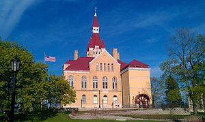
Old Washington County courthouse
|
|

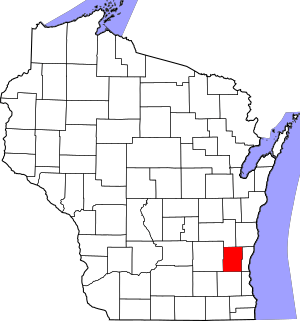
Location within the U.S. state of Wisconsin
|
|
 Wisconsin's location within the U.S. |
|
| Country | |
| State | |
| Founded | 1836 |
| Named for | George Washington |
| Seat | West Bend |
| Largest city | West Bend |
| Area | |
| • Total | 436 sq mi (1,130 km2) |
| • Land | 431 sq mi (1,120 km2) |
| • Water | 5.0 sq mi (13 km2) 1.2%% |
| Population | |
| • Total | 136,761 |
| • Estimate
(2023)
|
138,168 |
| • Density | 313.7/sq mi (121.11/km2) |
| Time zone | UTC−6 (Central) |
| • Summer (DST) | UTC−5 (CDT) |
| Congressional district | 5th |
Washington County is a place in the state of Wisconsin, USA. It's like a big neighborhood or district. As of 2020, about 136,761 people lived here. The main town, or county seat, is West Bend.
The county was created in 1836 when Wisconsin was still a territory. It was officially set up in 1845. The county is named after the first U.S. President, George Washington. Washington County is also part of the larger Milwaukee area.
Contents
History of Washington County
Washington County was formed on December 7, 1836. This was done by the government of the Wisconsin Territory. At first, Port Washington was chosen as the main town.
The county was managed by Milwaukee County until 1840. Then, a new law allowed Washington County to govern itself. The main town was moved to Grafton, which was called Hamburg back then.
Choosing the County Seat
This new arrangement didn't work very well. Four towns wanted to be the county seat: Port Washington, Grafton, Cedarburg, and West Bend. People voted many times between 1848 and 1852. But the results were often messy and unclear. There were even claims of unfair play during the elections.
In 1852, the state government tried to split the county in two. The northern part would stay Washington County. The southern part would become Tuskola County. But voters said no to this idea.
So, in 1853, the government tried again. This time, they split the county into a western and an eastern part. The western part remained Washington County, with West Bend as its main town. The eastern part became Ozaukee County, and Port Washington became its main town.
Geography and Landscape
Washington County covers about 436 square miles. Most of this area, about 431 square miles, is land. The rest, about 5 square miles, is water. This means about 1.2% of the county is water. It is the fifth smallest county in Wisconsin by total area.
Major Roads and Highways
Many important roads run through Washington County. These include:
 Interstate 41
 U.S. Highway 41
 U.S. Highway 45
 Highway 28 (Wisconsin)
 Highway 33 (Wisconsin)
 Highway 60 (Wisconsin)
 Highway 83 (Wisconsin)
 Highway 144 (Wisconsin)
 Highway 145 (Wisconsin)
 Highway 164 (Wisconsin)
 Highway 167 (Wisconsin)
 Highway 175 (Wisconsin)
Railroads and Public Transport
Two railroad lines run through the county:
- Canadian National
- Wisconsin and Southern Railroad
Washington County used to have a bus service called the Washington County Commuter Express. This service connected the county to the wider Milwaukee area. However, this bus service stopped in 2023. Now, there are no public bus options linking Washington County to the Milwaukee area. There is still a limited shared taxi service available.
Airports in the Area
There are two local airports that serve the county:
- Hartford Municipal Airport (KHXF)
- West Bend Municipal Airport (KETB)
For bigger flights, Milwaukee Mitchell International Airport is the closest commercial airport.
Neighboring Counties
Washington County shares borders with several other counties:
- Fond du Lac County to the northwest
- Sheboygan County to the northeast
- Ozaukee County to the east
- Milwaukee County to the southeast
- Waukesha County to the south
- Dodge County to the west
Parks and Protected Areas
Washington County has many beautiful parks and protected natural areas, including:
- Ackerman's Grove County Park
- Allenton Marsh State Wildlife Area
- Goeden County Park
- Heritage Trails County Park
- Isadore and Lorraine Spaeth County Park
- Jackson Marsh State Wildlife Area
- Kettle Moraine State Forest (part of it)
- Leonard J. Yahr County Park
- Lizard Mound State Park
- Pike Lake State Park
- Sandy Knoll County Park
- Theresa Marsh State Wildlife Area (part of it)
Population and People
| Historical population | |||
|---|---|---|---|
| Census | Pop. | %± | |
| 1840 | 343 | — | |
| 1850 | 19,485 | 5,580.8% | |
| 1860 | 23,622 | 21.2% | |
| 1870 | 23,919 | 1.3% | |
| 1880 | 23,442 | −2.0% | |
| 1890 | 22,751 | −2.9% | |
| 1900 | 23,589 | 3.7% | |
| 1910 | 23,784 | 0.8% | |
| 1920 | 25,713 | 8.1% | |
| 1930 | 26,551 | 3.3% | |
| 1940 | 28,430 | 7.1% | |
| 1950 | 33,902 | 19.2% | |
| 1960 | 46,119 | 36.0% | |
| 1970 | 63,839 | 38.4% | |
| 1980 | 84,848 | 32.9% | |
| 1990 | 95,328 | 12.4% | |
| 2000 | 117,493 | 23.3% | |
| 2010 | 131,887 | 12.3% | |
| 2020 | 136,761 | 3.7% | |
| U.S. Decennial Census 1790–1960 1900–1990 1990–2000 2010 2020 |
|||
2020 Census Information
In 2020, the county's population was 136,761 people. This means there were about 317.6 people living in each square mile. There were also 58,311 homes, with about 135.4 homes per square mile.
Most people in the county, about 91.7%, identified as White. About 1.4% were Asian, and 1.3% were Black or African American. About 0.3% were Native American. Around 1.1% were from other races, and 4.2% were from two or more races. About 3.5% of the population identified as Hispanic or Latino.
Cities, Towns, and Villages
Washington County is made up of several different types of communities:
Cities
- Hartford (partly in Dodge County)
- Milwaukee (a small part is in Washington County, most is in Milwaukee County and Waukesha County)
- West Bend (This is the county seat, the main town)
Villages
- Germantown
- Jackson
- Kewaskum (partly in Fond du Lac County)
- Newburg (partly in Ozaukee County)
- Richfield
- Slinger
Towns
Census-Designated Place
Smaller Communities
These are smaller, unincorporated communities within the county:
- Ackerville
- Addison
- Aurora
- Boltonville
- Cedar Creek
- Cedar Lake
- Cheeseville
- Colgate
- Diefenbach Corners
- Fillmore
- Hubertus
- Kirchhayn
- Kohlsville
- Mayfield
- Myra
- Nenno
- Nabob
- Orchard Grove
- Pike Lake
- Pleasant Hill
- Rockfield
- Rugby Junction
- Saint Anthony
- Saint Lawrence
- Saint Michaels
- Thompson
- Toland's Prairie
- Victory Center
- Wayne
- Young America
Public High Schools
Washington County has several public high schools:
- East High School
- Germantown High School
- Hartford Union High School
- Kewaskum High School
- Slinger High School
- West High School
The East High School and West High Schools share the same building but are separate schools.
The Slinger High School Owls and the Hartford Union High School Orioles have a friendly rivalry. They play each other every year in the Coaches vs Cancer Game. Even with their rivalry, they have a joint swim team.
See also
 In Spanish: Condado de Washington (Wisconsin) para niños
 | Victor J. Glover |
 | Yvonne Cagle |
 | Jeanette Epps |
 | Bernard A. Harris Jr. |


