Yadkin–Pee Dee River Basin facts for kids
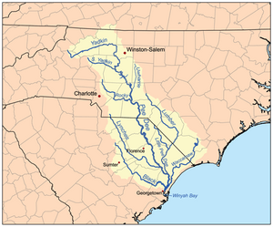
The Yadkin–Pee Dee River Basin is a very large area of land where all the water flows into the same river system. It covers about 7,221 square miles. This makes it the second biggest river basin in North Carolina. The water starts high up in the mountains near Blowing Rock, North Carolina. It then flows all the way to the Atlantic Ocean at Winyah Bay in Georgetown, South Carolina.
Most of this basin is in the Piedmont area of the United States. But it also includes parts of the coastal plains in North and South Carolina. Some parts even reach into the Appalachian Mountains in North Carolina.
Contents
Geography: Where the River Flows
This huge river basin begins in the northwest part of North Carolina, close to Blowing Rock. A tiny bit of it even goes into Virginia. From there, it stretches south and southeast, crossing into South Carolina. More than half of the basin is in North Carolina. It is the second largest river basin in the state.
The basin is about 433 miles long. It includes 5,862 miles of streams and rivers. There are also 22,988 acres of lakes within its borders. The total area is about 7,221 square miles. Many towns and cities are located here. About 1.4 million people lived in this basin in 2000.
The basin covers many different types of land. It starts in the Appalachian Mountains and the North Carolina Foothills. Then it goes through the central Piedmont area. After that, it reaches the Sandhills region and the Coastal Plains. Finally, its water flows into the Atlantic Ocean at Winyah Bay.
Cool Features of the Basin
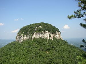
The Yadkin–Pee Dee River Basin has many special natural spots. One famous place is Pilot Mountain. It's a tall, rocky hill that stands 2,421 feet high. This mountain was the idea for "Mount Pilot" in the old TV show The Andy Griffith Show. Pilot Mountain is near Mount Airy, North Carolina, which was the real-life town that inspired "Mayberry" in the show.
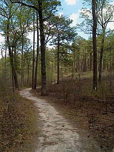
This area also has many national and state parks. You can find Blowing Rock here, which is a unique rock formation. Parts of the beautiful Blue Ridge Parkway are also in the basin. Other natural places include Tanglewood Park, the 45,000-acre Carolina Sandhills National Wildlife Refuge, and the 50,000-acre Uwharrie National Forest.
The Pee Dee National Wildlife Refuge is an 8,443-acre area. It protects waterfowl, which are birds that live near water. More than half of the land in the basin is covered by forests. This includes the Uwharrie National Forest.
Animals and Plants
The basin is home to 38 types of rare water animals. This includes the Shortnose sturgeon and the Carolina heelsplitter. These two species are listed as "federally endangered." This means they are at high risk of disappearing forever. Bald eagles can also be seen near Badin Lake. These eagles often visit the area, but they usually don't build nests there.
Farmers in North Carolina raise many animals in this basin. About 42 percent of the state's dairy cows live here. Also, 36 percent of the state's chickens (about 66 million birds) are raised in this area. Hog farming is not as common here, with only 2 percent of North Carolina's pigs. Between 1982 and 1992, the amount of land used for crops went down by 46 percent. At the same time, urban areas (cities and towns) grew by 38 percent.
Hydrology: Water in the Basin
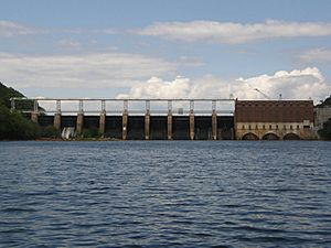
The Yadkin–Pee Dee River Basin has 22,988 acres of lakes. It also has 5,863 miles of watercourses, which are paths where water flows. Five main lakes are found in the North Carolina part of the basin:
All these major lakes, except for W. Kerr Scott Reservoir, help make hydroelectric power. This is electricity made from moving water. This power comes from the "Yadkin Project." It is managed by a company called Alcoa, which makes aluminium. The Yadkin Project can create almost 215 megawatts of electricity. The Narrows Dam at Badin Lake is very important. It is the only hydroelectric project in North Carolina listed on the National Register of Historic Places. This means it's a special historical site.
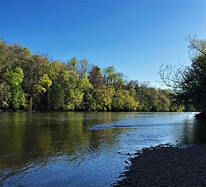
Many large rivers flow through the Yadkin–Pee Dee watershed. In South Carolina, these include the Lynches River, Great Pee Dee River, Little Pee Dee River, Black River, and Waccamaw River. In North Carolina, the main rivers are the Yadkin River, South Yadkin River, Abbotts Creek, Roaring River, Uwharrie River, and Rocky River.
Water Quality: Keeping Water Clean
There are some issues with water quality in the basin. In a normal river basin, about 5 to 58 tons of fine dirt and sand wash off the land each year. But in the Yadkin–Pee Dee River Basin, about 300 tons per square mile wash off every year. This happens because the population is growing fast. Also, some farming methods leave the soil open to erosion.
As of 2010, 39 percent of the rivers in the North Carolina part of the basin were not clean enough. They did not meet the state's water quality rules. These rivers are listed as "impaired," meaning their water quality is not good.
 | Janet Taylor Pickett |
 | Synthia Saint James |
 | Howardena Pindell |
 | Faith Ringgold |


