Bamyan facts for kids
Quick facts for kids
Bamyan
بامیان
Bamiyan
|
|
|---|---|
| Motto(s):
بامیان بام دنیا
"Bamyan, roof of the world" |
|
| Country | |
| Province | Bamyan |
| Settled | 2800 BCE |
| Area | |
| • Total | 35 km2 (14 sq mi) |
| Elevation | 2,550 m (8,370 ft) |
| Population
(2014)
|
|
| • Total | 70,000 |
| Time zone | UTC+4:30 |
| Postal code |
16XX
|
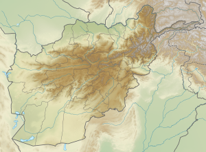
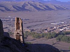
Bamyan (Dari: بامیان), also spelled Bamiyan or Bamian, is the main city of Bamyan Province in central Afghanistan. About 70,000 people live here, making it the biggest city in Hazarajat. Bamyan is very high up, about 8,366 feet (2,550 m) above sea level.
The Bamyan Airport is right in the middle of the city. It's about 180 kilometres (110 mi) to drive from Bamyan to Kabul in the southeast. The beautiful Band-e-Amir National Park is a short drive west of the city.
People sometimes call Bamyan the "Shining Light" or "Valley of Gods." There are many cool places to visit nearby. This includes the famous Buddhas of Bamyan. These huge statues were carved into cliffs in the 6th and 7th centuries CE. Other interesting spots are Shahr-e Gholghola and Zuhak.
In 2008, scientists found that Bamyan was home to the world's oldest oil paintings. Hundreds of years ago, thousands of Buddhist monks lived in caves carved into the mountains. The two biggest Buddha statues, called Salsal (53 meters tall) and Shahmama (35 meters tall), were amazing monuments. Sadly, the Taliban destroyed them in 2001.
Many cultural sites from both Buddhist and Islamic times can still be found in the valley. After the Taliban were removed in 2002, people worked hard to protect these historical places. Bamyan city has four areas and covers about 3,539 hectares. There are 4,435 homes in the city.
The Bamyan valley was a key spot for trade for a long time. It was where the East met the West. Its old ruins show a mix of Greek, Turkic, Persian, Chinese, and Indian styles. Today, it's one of Afghanistan's most popular places for tourists.
In 2017, Bamyan joined the UNESCO Creative Cities Network for its crafts and folk art. UNESCO said the Bamiyan Valley is a great example of Western Buddhism. Now, UNESCO lists Bamiyan as a World Heritage Site that is in danger.
Contents
What's in a Name?
The name "Bamiyan" comes from an old Persian word, Bamikan.
Bamyan's Location and Landscape
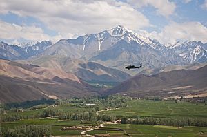
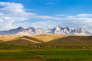
The Bamyan valley is about 2,500 meters high. It's about 230 km northwest of Kabul. This valley separates the Hindu Kush mountains from the Koh-e Baba mountains.
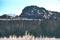
On the north side of the valley, there's a tall, almost straight sandstone cliff. It's about 1.5 kilometers long. The Buddha statues and most of the caves were carved into this cliff. You can also find many old ruins in the valley and on its slopes.
Bamyan is located between the Indian subcontinent and Central Asia. This made it a very important stop on the ancient Silk Route. All trade between China and the Middle East used to pass through here. The Hunas even made it their capital in the 5th century.
Because of its famous Buddha cliff, old monk caves, and beautiful scenery, Bamyan is a top tourist spot. The ruins of Shahr-e Gholghola, also known as the 'City of Sighs', are here. This ancient city was destroyed by Genghis Khan in 1221. The Shahr-e Zuhak mound, south of the valley, was once a fort protecting the city.
The town is the cultural center for the Hazara people in Afghanistan. Most people live in downtown Bamyan. The valley sits between the Hindu Kush and the Koh-i-Baba mountain ranges.
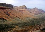
Mountains cover 90% of the province. Winters are long and cold, lasting six months. Temperatures can drop to three to twenty degrees Celsius below zero. Most people living here are Daizangi Hazara.
Transportation is getting better. Bamyan is now connected to Kabul by road through Parwan and Maidan Wardak provinces. A nearly finished road makes it possible to reach Kabul in about 2 hours.
The main crops grown in spring are wheat, barley, mushung, and baquli. If bad weather damages crops, people take their animals to Ghazni and Maidan provinces to trade for food.
Bamyan's Weather
Bamyan has a cold desert climate. This means it has cold winters and warm, dry summers. Most rain and snow fall in late winter and spring.
| Climate data for Bamyan | |||||||||||||
|---|---|---|---|---|---|---|---|---|---|---|---|---|---|
| Month | Jan | Feb | Mar | Apr | May | Jun | Jul | Aug | Sep | Oct | Nov | Dec | Year |
| Record high °C (°F) | 12.0 (53.6) |
12.5 (54.5) |
20.6 (69.1) |
28.7 (83.7) |
29.4 (84.9) |
31.2 (88.2) |
33.2 (91.8) |
32.2 (90.0) |
31.4 (88.5) |
26.2 (79.2) |
20.6 (69.1) |
13.0 (55.4) |
33.2 (91.8) |
| Mean daily maximum °C (°F) | 1.0 (33.8) |
2.0 (35.6) |
7.9 (46.2) |
15.6 (60.1) |
19.9 (67.8) |
24.1 (75.4) |
26.3 (79.3) |
26.1 (79.0) |
22.9 (73.2) |
17.4 (63.3) |
11.0 (51.8) |
5.1 (41.2) |
14.9 (58.9) |
| Daily mean °C (°F) | −6.4 (20.5) |
−4.8 (23.4) |
1.4 (34.5) |
8.6 (47.5) |
12.4 (54.3) |
16.3 (61.3) |
18.4 (65.1) |
17.4 (63.3) |
12.8 (55.0) |
7.8 (46.0) |
1.6 (34.9) |
−2.8 (27.0) |
6.9 (44.4) |
| Mean daily minimum °C (°F) | −10.1 (13.8) |
−6.1 (21.0) |
−3.8 (25.2) |
2.9 (37.2) |
5.7 (42.3) |
8.5 (47.3) |
10.0 (50.0) |
8.8 (47.8) |
4.2 (39.6) |
0.0 (32.0) |
−4.9 (23.2) |
−8.6 (16.5) |
0.5 (33.0) |
| Record low °C (°F) | −30.5 (−22.9) |
−28.4 (−19.1) |
−21.2 (−6.2) |
−6.5 (20.3) |
−2.5 (27.5) |
0.6 (33.1) |
5.4 (41.7) |
3.0 (37.4) |
−2.6 (27.3) |
−7.9 (17.8) |
−14.5 (5.9) |
−25 (−13) |
−30.5 (−22.9) |
| Average precipitation mm (inches) | 8.3 (0.33) |
15.7 (0.62) |
27.4 (1.08) |
29.8 (1.17) |
26.0 (1.02) |
5.7 (0.22) |
1.0 (0.04) |
0.0 (0.0) |
3.1 (0.12) |
4.2 (0.17) |
7.5 (0.30) |
4.3 (0.17) |
133 (5.24) |
| Average rainy days | 0 | 0 | 2 | 7 | 6 | 1 | 1 | 0 | 0 | 2 | 2 | 0 | 21 |
| Average snowy days | 5 | 7 | 6 | 2 | 0 | 0 | 0 | 0 | 0 | 0 | 1 | 3 | 24 |
| Average relative humidity (%) | 43 | 54 | 52 | 52 | 52 | 46 | 45 | 45 | 43 | 44 | 48 | 52 | 48 |
| Mean monthly sunshine hours | 196.7 | 174.6 | 210.7 | 239.4 | — | 356.9 | 372.9 | 357.8 | 325.3 | 276.7 | 245.5 | 198.0 | — |
| Source 1: Hong Kong Observatory | |||||||||||||
| Source 2: NOAA (1960–1983) | |||||||||||||
A Look Back in Time: Bamyan's History
The city of Bamyan was part of the Kushan Empire a long time ago. Later, it became part of a smaller kingdom. A Buddhist traveler named Fa Xian visited Bamyan in the 5th century. He wrote about the king and the monks there. Another traveler, Xuanzang, came in the 7th century. He saw the Bamiyan Buddhas and the cave monastery already built.
The Hephthalites took over Bamyan in the 5th century. After their kingdom ended, Bamyan became a capital until 870. Then, the Saffarids conquered it. Because it was on a major trade route to China and India, Bamyan was very important. It became a stop for traders and a big Buddhist center for hundreds of years.
In the 11th century, the Ghaznavids took control. Bamyan became an Islamic city around this time. The city's center moved from near the Buddha statues to the southeast. Some forts in the valley are from this period.
Under the Ghurids, Bamyan was the capital of a large kingdom for about 60 years (1155 to 1212). In 1221, Genghis Khan attacked the city. It's said he destroyed it completely to get revenge for his grandson. Bamyan took a very long time to recover from this.
Later, a new town slowly grew in the valley. During the Timurids in the 15th century, Bamyan was somewhat rebuilt. However, trade had slowed down, so the city didn't become as big or important as before.
Bamyan is also mentioned during the Mughal Empire. For example, Aurangzeb is said to have shot cannons at the 53-meter-tall Buddha statue.
In 1840, the region saw fighting during the First Anglo-Afghan War. The British fought against Dost Mohammad Khan. The first European to see Bamyan was William Moorcroft (explorer) around 1824.
From 1998 to 2001, Bamyan was a place of conflict between different groups. Bamyan is also known as the capital of Daizangi.
The Giant Buddhas of Bamiyan
Buddhism slowly grew in the Hindu Kush area under the Kushana dynasty. Between the 2nd and 4th centuries AD, many Buddhist sites appeared along trade routes. Bamiyan became the largest and most famous of these sites.
The art style here was influenced by the Gandhara culture and Indian Gupta culture. This mix created a unique art style.
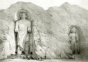
The two huge Buddha statues were built into the large rock on the north side of the valley in the 6th century. Passages and rooms were carved around them. Hundreds of prayer halls and caves were also made, many decorated with beautiful wall paintings.
Today, there are about 1,000 caves in Bamiyan. They were created between 450 and 850 AD. Some of the wall paintings are the oldest known oil paintings in the world, from the 7th century. Scientists found that 12 out of 50 caves had oil paintings. They likely used walnut and poppy seed oils.
Xuanzang, a Chinese monk, visited the valley around 630 AD. He stayed for about 15 days and described the Buddha statues and temples. His descriptions have been proven very accurate by scientists. He believed at least half of the 1,000 caves were lived in. About 100 years later, in 727, a Korean monk named Hyecho described Bamiyan as a strong kingdom.
On the cliff, three giant statues were carved far apart. One of them was a 175-foot (53 m) tall standing statue of Buddha. It was the world's tallest. This ancient statue was carved during the Kushan Empire in the 5th century.
The Taliban destroyed these statues in March 2001. They said the statues were against their beliefs. This destruction was a huge loss for Afghanistan's culture and history. News about it spread worldwide.
At one time, two thousand monks meditated in caves among the sandstone cliffs. These caves were also a big tourist spot before many wars in Afghanistan.
The world's earliest oil paintings were found in caves behind the destroyed statues. Scientists confirmed these oil paintings, possibly made with walnut or poppy seed oil, are in 12 of 50 caves. They date from the 5th to 9th centuries. The paintings often have a white base layer and then colorful layers mixed with oils. Artists traveling on the Silk Road might have created them.
The Taliban used the caves at the base of these statues to store weapons. After the Taliban left, people made their homes in the caves. Some Afghan refugees found a collection of Buddhist statues and old Buddhist writings hidden in the caves. This discovery was very exciting for scholars, like finding the Dead Sea Scrolls.
From 2003 to 2013, a team from New Zealand Defence Force helped rebuild Bamyan. Bamiyan was also one of the first places where former soldiers could give up their weapons and return to normal life.
People of Bamyan
As of 2014, about 70,000 people live in Bamyan city. The whole Bamiyan province has about 425,500 people.
Fun in Bamyan: Festivals and Markets
Potato Flower Festival
The Potato Flower Festival is a popular event in Bamyan. Farmers and the government organize it to promote local products. It's called "Gol-e- Kachalo" in Dari. It first happened in 2017. People make many different foods from potatoes, and there's music too. More than 80% of people in Bamyan depend on farming. Potatoes are their main crop. Bamyan grows 60% of Afghanistan's potatoes.
Dambura Music Festival
The Dambura is a famous traditional musical instrument. It's like a guitar and made from mulberry wood. Classic singers and folk musicians often play it, especially in central Afghanistan. A traditional Dambura festival is held every year. It helps to bring more tourists to Bamyan province.
Bamyan Art Bazaar
The "Bamyan art bazaar" was created by Afghan women. Here, they show and sell their handicrafts to tourists. You can find carpets, rugs, felts, embroidery, pottery, and other local women's products. All the sellers are women, and they sell their own creations or items bought from other women who make them at home.
Bamiyan city is the only big town in the whole Bamiyan Province. It became the center of the new Bamiyan Province in 1964. The city grew quickly. Bamiyan's market used to have about 300 to 400 shops and was very busy twice a week.
Bamyan's Natural Beauty
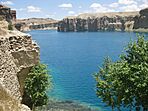
Afghanistan opened its first national park on April 22, 2009. This park protects the amazing blue lakes of Band-e-Amir. These lakes are in the Hindu Kush mountains. The lakes formed from mineral-rich water that came out of cracks in the rocks. Over time, the minerals built up walls that now hold the water. This type of lake system is rare in the world.
Even though Bamyan is one of the poorer areas, it's one of the safest in Afghanistan. The peaceful Band-e-Amir National Park shows a different side of a country often known for conflict.
The deep blue color of the lakes comes from the clear air and pure water. The high mineral content also makes the lake colors intense and varied. Band-e-Amir has six lakes. Band-e Panir is the smallest, about 100 m (330 ft) across. The largest is Band-e Zulfiqar, which is about 6.5 km (4 mi) long. The easiest lake to reach is Band-e-Haibat, which means "Dam of Awe."
Important Historical Sites
Many old monasteries, painted caves, statues, and forts in Bamyan are on the UNESCO World Cultural Heritage list since 2003. They are also on the list of World Heritage in Danger.
These protected sites include:
- The famous Bamiyan Buddha statues from the 6th century. Around the spots where the two 53 and 35-meter-tall statues once stood, there are at least 900 caves carved into the rock. They are decorated with paintings and stucco art.
- The Islamic fortress of Schahr-i Suhak, about 15 km east of the cliff. It's from the time of the Ghaznavids and the Ghurids (10th to 13th centuries).
- The remains of Qallai Kaphari, about 12 km east of the cliff. It has old protective walls, towers, and castles.
- The fortified castle Schahr-e Gholghola on a hill in the middle of the valley (6th to 10th centuries).
- The Kakrak valley, about 3 km southeast of the cliff. It has over 100 caves from the 6th to 13th centuries. There are also remains of a 10-meter-tall Buddha statue and an altar with paintings from the Sassanid Empire.
- The caves in the Foladi Valley, about 2 km southwest of the cliff. This includes the decorated Qoul-i Akram and Kalai Ghamai caves.
Sports in Bamyan
"Ski championships" have been held in Bamiyan since 2011. It's a race where all skiers start at once. The first skiers got modern equipment in 2011. However, local people also used homemade skis to move around the mountains, for example, to find lost animals.
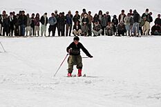
On November 4, 2016, a marathon took place in Bamiyan. For the first time, women athletes also took part in the race.
International Sister Cities
 Gering, Nebraska, U.S.
 Langley, British Columbia, Canada
 Porirua, New Zealand
See also
 In Spanish: Bamiyán para niños
 | Sharif Bey |
 | Hale Woodruff |
 | Richmond Barthé |
 | Purvis Young |


