
Blaine, Washington facts for kids
Quick facts for kids
Blaine, Washington
|
||
|---|---|---|
 _-_3.JPG) _-_1.JPG) From top: view of Blaine from Canada–United States border, view of U.S. Port of entry, Welcome to the United States of America sign
|
||
|
||
| Nickname(s):
The Peace Arch City
|
||
| Motto(s):
Blaine is Where America Begins
|
||

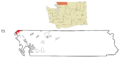
Location in the state of Washington and Whatcom County
|
||
| Country | United States | |
| State | Washington | |
| County | Whatcom | |
| Incorporated | May 20, 1890 | |
| Government | ||
| • Type | Council–manager | |
| Area | ||
| • City | 8.62 sq mi (22.33 km2) | |
| • Land | 5.58 sq mi (14.45 km2) | |
| • Water | 3.04 sq mi (7.88 km2) | |
| Elevation | 53 ft (16 m) | |
| Population
(2020)
|
||
| • City | 5,884 | |
| • Estimate
(2022)
|
6,018 | |
| • Density | 1,005.20/sq mi (388.08/km2) | |
| • Metro | 231,919 (US: 204th) | |
| • Metro density | 109.4/sq mi (42.25/km2) | |
| Demonym(s) | Blaineite | |
| Time zone | UTC-8 (Pacific (PST)) | |
| • Summer (DST) | UTC-7 (PDT) | |
| ZIP codes |
98230 (home delivery) and 98231 (post office boxes)
|
|
| Area code | 360 | |
| FIPS code | 53-06505 | |
| GNIS feature ID | 2409860 | |

Blaine is a city in Whatcom County, Washington, USA. It's right on the border with Canada! The famous Peace Arch monument stands on the border between the two countries. Blaine is the fourth largest city in the Bellingham area. In 2020, about 5,884 people lived there. Because Blaine is located right on the border, it's the northernmost city on Interstate 5.
Contents
Blaine's History and Growth
The area where Blaine is now was first settled in the mid-1800s. Pioneers started the town as a busy seaport. It was important for the logging and fishing industries on the west coast. It was also a starting point for people looking for gold in British Columbia.
Blaine officially became a city on May 20, 1890. It was named after James G. Blaine, a well-known American politician. He was a U.S. senator and Secretary of State. The city has a "turn-of-the-century" look. Many buildings and signs are designed to look like they did in the late 1800s and early 1900s.

For many years, the world's largest salmon cannery was in Blaine. It was run by the Alaska Packers' Association. Today, that cannery site is a beautiful waterfront resort on Semiahmoo Spit. Blaine's waterfront also had several saw mills. Much of the wood from these mills was sent to help rebuild San Francisco after the big fire in 1906.
Even after the forests were cut down, Blaine's fishing industry stayed strong. In the 1970s, many commercial fishing boats used Blaine as their home base. Today, Blaine's two large marinas are home to hundreds of recreational sailboats and yachts. People who love nature enjoy Blaine's coastal location. They also like its bike and walking trails, and the views of mountains and water. Birdwatchers from all over North America visit the area. Blaine's Drayton Harbor, Semiahmoo Spit, and Boundary Bay are important spots for migratory birds and waterfowl. The Audubon Society even calls them Important Birding Areas.
The Cain family is very important in Blaine's history. They are known for helping to found the city and for its early achievements. At one time, the Cain brothers owned most of what is now Blaine. They built the biggest store north of Seattle, a lumber mill, and a large hotel. They also built the first public wharf and gave away large areas of land for public use.
In 1889, Nathan Cornish and his family moved to Blaine. He became mayor in 1901. His daughter, Nellie Cornish, later moved to Seattle. There, she founded the Cornish College of the Arts in 1914, which is still a well-known school today.
In 1970, about 450 Canadian protestors came to Blaine. They were showing their feelings about a conflict happening far away. Police and local people helped to calm the situation.
Blaine's Location and Climate
According to the United States Census Bureau, Blaine covers about 8.43 square miles (21.8 km²). About 5.63 square miles (14.6 km²) is land, and 2.80 square miles (7.25 km²) is water. Blaine has several nicknames like "Where America Begins" and "The Gateway to the Pacific Northwest." These names show how special Blaine's location is. It's at the very northern end of Interstate 5 in the U.S. It's also next to Drayton Harbor and Boundary Bay.
Blaine's Weather
Blaine is located between the mountains near Vancouver, the flatlands of Skagit County, Washington, and the North Cascades mountains. This location gives Blaine a mild climate. It's a mix of a Mediterranean and maritime climate. This means the weather is usually mild compared to other parts of the Pacific Northwest. Blaine gets about 40 inches (100 cm) of rain each year. Because of its mild location, Blaine often has more sunny days than nearby towns.
| Climate data for Blaine, Washington (1991–2020 normals, extremes 1893–2021) | |||||||||||||
|---|---|---|---|---|---|---|---|---|---|---|---|---|---|
| Month | Jan | Feb | Mar | Apr | May | Jun | Jul | Aug | Sep | Oct | Nov | Dec | Year |
| Record high °F (°C) | 64 (18) |
68 (20) |
72 (22) |
83 (28) |
86 (30) |
98 (37) |
95 (35) |
97 (36) |
87 (31) |
78 (26) |
71 (22) |
63 (17) |
98 (37) |
| Mean maximum °F (°C) | 54.5 (12.5) |
55.4 (13.0) |
60.7 (15.9) |
67.7 (19.8) |
74.8 (23.8) |
77.9 (25.5) |
80.8 (27.1) |
81.3 (27.4) |
75.1 (23.9) |
66.0 (18.9) |
59.1 (15.1) |
54.0 (12.2) |
83.3 (28.5) |
| Mean daily maximum °F (°C) | 44.7 (7.1) |
47.7 (8.7) |
52.1 (11.2) |
57.6 (14.2) |
64.0 (17.8) |
68.5 (20.3) |
72.8 (22.7) |
72.7 (22.6) |
66.9 (19.4) |
57.4 (14.1) |
49.6 (9.8) |
44.2 (6.8) |
58.2 (14.6) |
| Daily mean °F (°C) | 39.3 (4.1) |
41.1 (5.1) |
44.9 (7.2) |
49.8 (9.9) |
55.7 (13.2) |
60.3 (15.7) |
64.0 (17.8) |
63.8 (17.7) |
58.6 (14.8) |
50.7 (10.4) |
43.8 (6.6) |
39.2 (4.0) |
50.9 (10.5) |
| Mean daily minimum °F (°C) | 33.9 (1.1) |
34.6 (1.4) |
37.7 (3.2) |
41.9 (5.5) |
47.3 (8.5) |
52.1 (11.2) |
55.1 (12.8) |
54.9 (12.7) |
50.4 (10.2) |
44.0 (6.7) |
37.9 (3.3) |
34.1 (1.2) |
43.7 (6.5) |
| Mean minimum °F (°C) | 20.5 (−6.4) |
23.7 (−4.6) |
26.5 (−3.1) |
32.3 (0.2) |
36.9 (2.7) |
43.2 (6.2) |
47.8 (8.8) |
47.3 (8.5) |
41.1 (5.1) |
32.9 (0.5) |
25.2 (−3.8) |
21.4 (−5.9) |
16.0 (−8.9) |
| Record low °F (°C) | −1 (−18) |
−9 (−23) |
11 (−12) |
21 (−6) |
21 (−6) |
31 (−1) |
34 (1) |
33 (1) |
25 (−4) |
19 (−7) |
5 (−15) |
−1 (−18) |
−9 (−23) |
| Average precipitation inches (mm) | 6.17 (157) |
3.37 (86) |
4.21 (107) |
2.97 (75) |
2.57 (65) |
1.93 (49) |
1.14 (29) |
1.13 (29) |
2.22 (56) |
4.39 (112) |
6.08 (154) |
5.63 (143) |
41.81 (1,062) |
| Average snowfall inches (cm) | 3.7 (9.4) |
0.8 (2.0) |
1.0 (2.5) |
0.0 (0.0) |
0.0 (0.0) |
0.0 (0.0) |
0.0 (0.0) |
0.0 (0.0) |
0.0 (0.0) |
0.1 (0.25) |
0.4 (1.0) |
3.3 (8.4) |
9.3 (23.55) |
| Average extreme snow depth inches (cm) | — | — | — | — | — | — | 0.0 (0.0) |
0.0 (0.0) |
0.0 (0.0) |
0.0 (0.0) |
0.0 (0.0) |
0.0 (0.0) |
0.0 (0.0) |
| Average precipitation days (≥ 0.01 in) | 18.6 | 14.8 | 17.8 | 14.6 | 10.9 | 10.2 | 5.8 | 6.3 | 9.0 | 15.7 | 19.0 | 19.1 | 161.8 |
| Average snowy days (≥ 0.1 in) | 1.2 | 0.4 | 0.4 | 0.0 | 0.0 | 0.0 | 0.0 | 0.0 | 0.0 | 0.1 | 0.2 | 0.8 | 3.1 |
| Source 1: NOAA | |||||||||||||
| Source 2: National Weather Service | |||||||||||||
Crossing the Canada-U.S. Border
Blaine is home to two main border crossings between the United States and Canada on the West Coast. The Peace Arch Border Crossing is where I-5 ends in the U.S. and Highway 99 begins in Canada. This crossing is mainly for cars.
About a mile to the east is the Pacific Highway Border Crossing. This one is mostly for large trucks, so it's also called the Truck Crossing. You can reach it from Washington State Route 543.
New buildings for border control were finished in 2011 on the U.S. side. On the Canadian side, a new building opened in 2009. This helped reduce delays for travelers, especially for the 2010 Winter Olympics in Vancouver.

The Interstate 5 freeway runs all the way from the U.S./Mexico border in San Diego to Blaine. It ends right at the Canadian border. In Peace Arch Park, there's a special pedestrian crosswalk that goes over the Interstate freeway. This park is unique because people can walk freely between the U.S. and Canadian sides without going through customs. The Peace Arch monument in the park stands for lasting peace and friendship between the two countries.
Since 1937, an event called "Hands Across the Border" has been held at the park. Hundreds of Scouts from the U.S. and Canada attend. They march through the Peace Arch, showing unity. Important people from both countries also attend. After a break, the event started again in 2015.
Blaine's Economy and Jobs
A big part of Blaine's economy comes from trade with Canada. On the eastern side of the city, you'll find many warehouses, freight services, and gas stations. These serve the large trucks that carry goods across the border. The U.S. Customs and Border Protection agency has two border inspection stations in Blaine. The US Border Patrol also has its headquarters here, employing many federal officers.
Blaine is also home to manufacturing companies like Nature's Path (which makes cereal) and Totally Chocolate.
The Port of Bellingham runs a large marina in Blaine. This marina is used by many pleasure boats and fishing vessels.
Because Vancouver, British Columbia, is just north of Blaine, many actors and actresses who work on TV shows filmed in Vancouver choose to live in Blaine. It's often less expensive than living in Vancouver. For similar reasons, many Americans who work for companies in Vancouver also live in Blaine.
Several mail service companies have opened in Blaine. They help Canadian residents avoid high shipping costs when buying things online from the U.S. This industry has grown a lot, especially with the rise of online shopping.
Blaine used to have a small airport. It was popular with owners of light aircraft because of its lower fuel prices and less fog. However, the city decided to close the airport, and it officially shut down on December 31, 2008. The land where the airport was is now planned for new businesses and light manufacturing.
Blaine's Population
| Historical population | |||
|---|---|---|---|
| Census | Pop. | %± | |
| 1890 | 1,563 | — | |
| 1900 | 1,592 | 1.9% | |
| 1910 | 2,289 | 43.8% | |
| 1920 | 2,254 | −1.5% | |
| 1930 | 1,642 | −27.2% | |
| 1940 | 1,524 | −7.2% | |
| 1950 | 1,693 | 11.1% | |
| 1960 | 1,735 | 2.5% | |
| 1970 | 1,955 | 12.7% | |
| 1980 | 2,363 | 20.9% | |
| 1990 | 2,489 | 5.3% | |
| 2000 | 3,770 | 51.5% | |
| 2010 | 4,684 | 24.2% | |
| 2020 | 5,884 | 25.6% | |
| 2022 (est.) | 6,018 | 28.5% | |
| U.S. Decennial Census 2020 Census |
|||
In 2020, the census showed that 5,884 people lived in Blaine. There were 2,459 households.
In 2010, there were 4,684 people living in the city. The population density was about 832 people per square mile. Most residents (86.5%) were White. About 5.1% were Asian, and 5.0% were Hispanic or Latino.
The average age in Blaine in 2010 was 44.3 years old. About 21.4% of residents were under 18. About 19.1% were 65 years or older. The population was almost evenly split between males (49.1%) and females (50.9%).
Famous People from Blaine
- Carlos Becerra, a television presenter
- Luke Ridnour, a former NBA basketball player
Education in Blaine
The Blaine School District has five public schools. They serve the city of Blaine and nearby communities like Birch Bay and Point Roberts. Most of the schools are on a main campus in central Blaine. This campus has facilities for about 2,100 students. It includes Blaine High School, Blaine Middle School, and Blaine Elementary School. Students from the small nearby area of Point Roberts (who are older than 3rd grade) take a bus through the border to attend school in Blaine.
Getting Around Blaine
Blaine is at the northern end of Interstate 5 (I-5). This is the main north-south freeway on the West Coast. The freeway ends at the Peace Arch Border Crossing. There's also a side road, State Route 543, that goes to the Pacific Highway Border Crossing to the east. Large vehicles like trucks and buses must use this eastern crossing. Another state highway, State Route 548, goes south from Blaine to Birch Bay.
Blaine is also served by Whatcom Transportation Authority buses. These buses connect Blaine to Ferndale and Bellingham.
The Great Northern Railway opened a train station in Blaine in 1909. Amtrak trains used to stop there daily from 1972 to 1981. There have been talks in recent years about bringing Amtrak service back to Blaine.
Images for kids
-
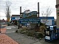
View of Blaine from the Canada-U.S. border
-
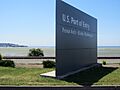
View of the U.S. Port of Entry
-
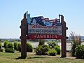
Welcome to the United States of America sign
-
Seal of Blaine, Washington
-
Map showing Blaine's location in Washington
See also
 In Spanish: Blaine (Washington) para niños
