Crawford County, Missouri facts for kids
Quick facts for kids
Crawford County
|
|
|---|---|

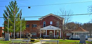
Crawford County Courthouse in Steelville
|
|

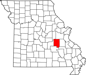
Location within the U.S. state of Missouri
|
|
 Missouri's location within the U.S. |
|
| Country | |
| State | |
| Founded | January 23, 1829 |
| Named for | William H. Crawford |
| Seat | Steelville |
| Largest city | Cuba |
| Area | |
| • Total | 744 sq mi (1,930 km2) |
| • Land | 743 sq mi (1,920 km2) |
| • Water | 1.2 sq mi (3 km2) 0.2% |
| Population
(2020)
|
|
| • Total | 23,056 |
| • Density | 30.989/sq mi (11.965/km2) |
| Time zone | UTC−6 (Central) |
| • Summer (DST) | UTC−5 (CDT) |
| Congressional district | 8th |
Crawford County is a county located in the middle-eastern part of Missouri, a state in the United States. In 2020, about 23,056 people lived here. The main town and county seat is Steelville.
Crawford County was created in 1829. It is named after William H. Crawford, who was a U.S. Senator from Georgia. The town of Steelville was officially set up in 1836.
A small part of Sullivan is in Crawford County. This area is considered part of the larger St. Louis city area. In 1990, the exact middle point of the U.S. population was in southwestern Crawford County.
Contents
Geography of Crawford County
Crawford County covers a total area of 744 square miles (1,927 square kilometers). Most of this area, 743 square miles (1,924 square kilometers), is land. Only a small part, 1.2 square miles (3.1 square kilometers), is water.
Neighboring Counties
Crawford County shares its borders with several other counties:
- Franklin County to the north
- Washington County to the east
- Iron County to the southeast
- Dent County to the south
- Phelps County to the west
- Gasconade County to the northwest
Main Roads
Important highways that run through Crawford County include:
 Interstate 44
 U.S. Route 66 (This famous road was used from 1926 to 1979)
 Route 8
 Route 19
 Route 49
Protected Natural Areas
A part of the Mark Twain National Forest is located within Crawford County. This forest is a large area of protected land.
People of Crawford County
The number of people living in Crawford County has changed over the years. Here's how the population has grown:
| Historical population | |||
|---|---|---|---|
| Census | Pop. | %± | |
| 1830 | 1,712 | — | |
| 1840 | 3,561 | 108.0% | |
| 1850 | 6,397 | 79.6% | |
| 1860 | 5,823 | −9.0% | |
| 1870 | 7,982 | 37.1% | |
| 1880 | 10,756 | 34.8% | |
| 1890 | 11,961 | 11.2% | |
| 1900 | 12,959 | 8.3% | |
| 1910 | 13,576 | 4.8% | |
| 1920 | 12,355 | −9.0% | |
| 1930 | 11,287 | −8.6% | |
| 1940 | 12,693 | 12.5% | |
| 1950 | 11,615 | −8.5% | |
| 1960 | 12,647 | 8.9% | |
| 1970 | 14,828 | 17.2% | |
| 1980 | 18,300 | 23.4% | |
| 1990 | 19,173 | 4.8% | |
| 2000 | 22,804 | 18.9% | |
| 2010 | 24,646 | 8.1% | |
| 2020 | 23,056 | −6.5% | |
| U.S. Decennial Census | |||
In 2000, there were 22,804 people living in the county. The average number of people per square mile was about 31. Most people in the county were White (98.26%). About 26.30% of the population was under 18 years old. The average age was 38 years.
2020 Census Information
The 2020 Census showed the following breakdown of people in Crawford County:
| Race | Number | Percentage |
|---|---|---|
| White | 20,980 | 91% |
| Black or African American | 148 | 0.64% |
| Native American | 107 | 0.5% |
| Asian | 81 | 0.35% |
| Pacific Islander | 14 | 0.06% |
| Other/Mixed | 1,244 | 5.4% |
| Hispanic or Latino | 482 | 2.1% |
Education
Crawford County has several schools and libraries for its residents.
Public Schools
There are three main public school districts in the county:
- Crawford County R-I School District in Bourbon
- Bourbon Elementary School (Grades PK-4)
- Bourbon Middle School (Grades 5-8)
- Bourbon High School (Grades 9-12)
- Crawford County R-II School District in Cuba
- Cuba Elementary School (Grades K-4)
- Cuba Middle School (Grades 5-8)
- Cuba High School (Grades 9-12)
- Steelville R-III School District in Steelville
- Steelville Elementary School (Grades PK-4)
- Steelville Middle School (Grades 5-8)
- Steelville High School (Grades 9-12)
Private Schools
- Meramec Valley Christian School in Sullivan (Grades PK-12)
- Holy Cross Catholic School in Cuba, Missouri (Grades PK-8)
Public Libraries
- Bourbon Branch Library
- Recklein Memorial Branch Library
- Steelville Branch Library
Communities
Crawford County has several cities, towns, and smaller communities.
Cities and Towns
- Bourbon
- Cook Station
- Cuba
- Leasburg
- St. Cloud
- Steelville (the county seat)
- Sullivan (partially in this county)
- West Sullivan
Census-Designated Place
- Indian Lake
Unincorporated Communities
These are smaller places that are not officially organized as cities or towns:
Townships
Crawford County is divided into several townships:
- Benton
- Boone
- Courtois
- Knobview
- Liberty
- Meramec
- Oak Hill
- Osage
- Union
See also
 In Spanish: Condado de Crawford (Misuri) para niños
 | William M. Jackson |
 | Juan E. Gilbert |
 | Neil deGrasse Tyson |

