
Washington County, Missouri facts for kids
Quick facts for kids
Washington County
|
|
|---|---|

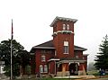
The Washington County Courthouse in Potosi
|
|

Location within the U.S. state of Missouri
|
|
 Missouri's location within the U.S. |
|
| Country | |
| State | |
| Founded | August 21, 1813 |
| Named for | President George Washington |
| Seat | Potosi |
| Largest city | Potosi |
| Area | |
| • Total | 762 sq mi (1,970 km2) |
| • Land | 760 sq mi (2,000 km2) |
| • Water | 2.6 sq mi (7 km2) 0.3% |
| Population
(2020)
|
|
| • Total | 23,514 |
| • Density | 31/sq mi (12/km2) |
| Time zone | UTC−6 (Central) |
| • Summer (DST) | UTC−5 (CDT) |
| Congressional district | 8th |
Washington County is a special area in the southeastern part of Missouri, a state in the United States. It's called a county. In 2020, about 23,514 people lived here. The main town and largest city is Potosi.
Washington County was officially created on August 21, 1813. It was named after George Washington, who was the very first President of the United States.
Contents
History of Washington County
Long ago, in 1722 and 1723, French explorers named Renault and La Motte visited the area where Potosi is today. But they didn't build any lasting homes there.
The first permanent homes were made in 1763. A person named François Breton settled near Potosi. He started a mine there that was named after him. Later, in 1802, more families settled in Bellview Valley. This area is near Caledonia and Belgrade. Washington County was officially formed from Ste. Genevieve County on August 21, 1813.
Geography of Washington County
Washington County covers a total area of about 762 square miles. Most of this area, about 760 square miles, is land. The rest, about 2.6 square miles, is water.
Counties Nearby
Washington County shares its borders with several other counties:
- Franklin County (to the north)
- Jefferson County (to the northeast)
- St. Francois County (to the east)
- Iron County (to the south)
- Crawford County (to the west)
Protected Natural Areas
Part of the Mark Twain National Forest is located in Washington County. This is a large forest area protected by the government.
People of Washington County
| Historical population | |||
|---|---|---|---|
| Census | Pop. | %± | |
| 1820 | 2,769 | — | |
| 1830 | 6,784 | 145.0% | |
| 1840 | 7,213 | 6.3% | |
| 1850 | 8,811 | 22.2% | |
| 1860 | 9,723 | 10.4% | |
| 1870 | 11,719 | 20.5% | |
| 1880 | 12,896 | 10.0% | |
| 1890 | 13,153 | 2.0% | |
| 1900 | 14,263 | 8.4% | |
| 1910 | 13,378 | −6.2% | |
| 1920 | 13,803 | 3.2% | |
| 1930 | 14,450 | 4.7% | |
| 1940 | 17,492 | 21.1% | |
| 1950 | 14,689 | −16.0% | |
| 1960 | 14,346 | −2.3% | |
| 1970 | 15,086 | 5.2% | |
| 1980 | 17,983 | 19.2% | |
| 1990 | 20,380 | 13.3% | |
| 2000 | 23,344 | 14.5% | |
| 2010 | 25,195 | 7.9% | |
| 2020 | 23,514 | −6.7% | |
| U.S. Decennial Census 1790–1960 1900–1990 1990–2000 2010–2015 2020 |
|||
In 2000, there were 23,344 people living in the county. Most people in Washington County are White. There are also smaller groups of Black or African American, Native American, and Asian people. Some people are from Hispanic or Latino backgrounds.
Many families live in Washington County. In 2000, about 36 out of every 100 households had children under 18 living there. The average age of people in the county was 35 years old.
Religious Beliefs
Washington County is part of an area known as the Bible Belt. This means that many people here are Protestant Christians. The main religions include Roman Catholics, Southern Baptists, and Baptist Missionary Association of America.
2020 Census Information
| Race | Num. | Perc. |
|---|---|---|
| White (NH) | 21,378 | 91% |
| Black or African American (NH) | 610 | 2.6% |
| Native American (NH) | 78 | 0.33% |
| Asian (NH) | 40 | 0.17% |
| Pacific Islander (NH) | 1 | 0.004% |
| Other/Mixed (NH) | 1,180 | 5% |
| Hispanic or Latino | 227 | 0.97% |
Education in Washington County
Many adults in Washington County have finished high school. About 62.5% of adults aged 25 and older have a high school diploma or higher. About 7.5% have gone on to earn a bachelor's degree or more from a college.
Public Schools
Here are some of the public school districts in Washington County:
- Kingston K-XIV School District in Cadet
- Kingston Elementary School (grades PK-5)
- Kingston Middle School (grades 6-8)
- Kingston High School (grades 9-12)
- Potosi R-III School District in Potosi
- Potosi Pre-School (PK)
- Potosi Elementary School (grades PK-3)
- Trojan Intermediate School (grades 4-6)
- John A. Evans Middle School (grades 7-8)
- Potosi High School (grades 9-12)
- Richwoods R-VII School District in Richwoods
- Richwoods Elementary School (grades PK-8)
- Valley R-VI School District in Caledonia/ Belgrade
Private Schools
- St. Joachim Elementary School in Cadet (grades PK-8) is a Roman Catholic school.
Colleges and Universities
- Mineral Area College Annex in Potosi is a smaller campus of Mineral Area College from Park Hills.
Public Libraries
- The Washington County Library is available for everyone to use.
Fun Places to Visit
Washington County has many cool places to explore:
- Big River Access – in Belgrade
- Council Bluff Lake – in Belgrade
- Berryman Camp & Trail National Forest – in Berryman
- Bootleg Park Bootleg Access – in Caledonia
- Buford Mountain – in Caledonia
- Hughes Mountain Natural Area – in Irondale
- Bismarck Conservation Area – in Bismarck
- Little Indian Creek Conservation Area – in Sullivan
- Pea Ridge Conservation Area – in Sullivan
- YMCA of the Ozarks – in Shirley
Getting Around Washington County
Main Roads
These are the most important state highways in the county:
- Route 8 connects Hopewell and Potosi.
- Route 21 goes through Cadet, Potosi, and Caledonia.
- Route 32 connects Caledonia and Bismarck.
- Route 47 runs through Lonedell, Richwoods, and Blackwell.
- Route 104 is in Blackwell.
- Route 185 connects Sullivan, Ebo, and Potosi.
Other State Roads
- State Route A (Richwoods-Sullivan)
- State Route AA (Shirley)
- State Route BB (Belgrade)
- State Route C (Belgrade-Viburnum)
- State Route CC (Blackwell)
- State Route DD (Belgrade)
- State Route E (Potosi-Cadet-Blackwell)
- State Route EE (Sullivan)
- State Route F (Potosi)
- State Route H (Richwoods-Fletcher)
- State Route JJ (Belgrade)
- State Route M (Irondale)
- State Route N (Sullivan)
- State Route o (Mineral Point)
- State Route P (Belgrade-Potosi)
- State Route T (Richwoods)
- State Route U (Irondale-Mineral Point)
- State Route W (Bourbon)
- State Route WW (Fletcher)
- State Route N (Bourbon)
- State Route Y (Viburnum-Belgrade-Berryman)
- State Route Z (Belgrade)
Airports
- The Washington County Airport helps people travel by air.
Railroads
- The Union Pacific Railroad has lines running through the county.
Communities in Washington County
Cities
Villages
Smaller Communities (Unincorporated)
These are places that are not officially cities or villages.
- Anthonies Mill
- Aptus
- Baryties
- Bellefontaine
- Belgrade
- Berryman
- Bliss
- Cadet
- Cannon Mines
- Courtois
- Cruise Mill
- Delbridge
- Ebo
- Fertile
- Floyd
- French Town
- Frogtown
- Happy Hollow
- Hopewell
- Horton Town
- Hulsey
- Hurricane
- Latty
- Levy
- Maryden
- Northcut
- Old Mines
- Peoria
- Quaker
- Rabbitville
- Racola
- Richwoods
- Robidoux
- Shibboleth
- Shirley
- Summit
- Sunlight
- Theabeau Town
- Tiff
Townships
Townships are smaller divisions within the county, often used for local government or land organization.
- Belgrade
- Breton
- Concord
- Harmony
- Johnson
- Kingston
- Liberty
- Richwoods
- Union
- Walton
Images for kids
-
The Washington County Courthouse in Potosi
See also
 In Spanish: Condado de Washington (Misuri) para niños
