Davis County, Utah facts for kids
Quick facts for kids
Davis County
|
|
|---|---|

Davis County, Utah
|
|

Location within the U.S. state of Utah
|
|
 Utah's location within the U.S. |
|
| Country | |
| State | |
| Founded | October 5, 1850 |
| Named for | Daniel C. Davis |
| Seat | Farmington |
| Largest city | Layton |
| Area | |
| • Total | 634 sq mi (1,640 km2) |
| • Land | 299 sq mi (770 km2) |
| • Water | 335 sq mi (870 km2) 53% |
| Population
(2020)
|
|
| • Total | 362,679 |
| • Estimate
(2023)
|
373,207 |
| • Density | 1,248/sq mi (482/km2) |
| Time zone | UTC−7 (Mountain) |
| • Summer (DST) | UTC−6 (MDT) |
| Congressional districts | 1st, 2nd |
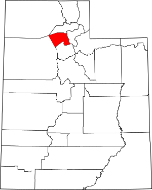
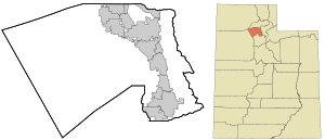
Davis County is a busy area in northern Utah, United States. It's home to many people, with a population of 362,679 in 2020. This makes it the third most populated county in Utah! The main city, or "county seat," is Farmington. The biggest city in Davis County, both in size and population, is Layton.
Davis County is part of a larger group of cities, including Ogden and Clearfield. It's also connected to the even bigger area that includes Salt Lake City and Provo.
Contents
History
Davis County was officially created on October 5, 1850, by the government of the early State of Deseret. They chose Farmington as the county seat because it was in the middle of the county. The county was named after Daniel C. Davis, who was a captain in the Mormon Battalion. The county's borders changed a few times in the early years, but they have stayed the same since 1880.
For its first 50 years, Davis County grew slowly. But when the Utah Central Rail Road arrived in 1870, things started to change. Farming became more modern, and there was more trade, banking, and better roads. Homes even started getting electricity! Still, by 1940, only about 16,000 people lived here.
After World War II, the population really took off! This was mainly because Hill Air Force Base was built nearby. Many new jobs became available for civilians. The county's population doubled between 1940 and 1950, and then doubled again between 1950 and 1960. This was part of a big "suburb boom" happening across the country. By 1990, there were 188,000 residents, and by 2020, the population was over 360,000!
Geography
Davis County is quite small. It has a total area of about 634 square miles (1,642 km²). Out of this, 299 square miles (774 km²) is land, and a large part, 335 square miles (868 km²), is water. This means more than half of the county's area is water! It's actually Utah's smallest county by land area.
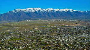
The county is located between the Great Salt Lake to the west and the Wasatch Range of mountains to the east. The highest point in the county is Thurston Peak, which is about 9,707 feet (2,959 meters) tall.
The Great Salt Lake is surrounded by wet marshlands and flat mudflats. The lake's height changes a lot, which can make its size change drastically because it's so shallow. Davis County is home to Antelope Island, which is the biggest island in the Great Salt Lake. The whole island is a state park. It's a special place to protect the beautiful scenery and wildlife, like bighorn sheep, pronghorn, and a herd of bison.
The part of Davis County where most people live, between the lake and the mountains, is called the Wasatch Front. This is a narrow strip of land that makes it a bit tricky to travel north and south in the county.
Neighboring Counties
- Weber County - north
- Morgan County - east
- Salt Lake County - south
- Tooele County - west
- Box Elder County - northwest
Protected Areas
- Antelope Island State Park
- Crystal West Unit Farmington Bay (part)
- Farmington Bay Waterfowl Management Area
- Howard Slough Waterfowl Management Area
- Wasatch-Cache National Forest (part)
Climate
The weather in Davis County changes depending on where you are. The eastern parts have a climate with dry, hot summers and cold, wet winters. The western parts might have a climate with hot, dry summers and mild, wet winters. It snows often in winter, with some areas getting up to 90 inches (229 cm) of snow each year! Even the valley floor gets at least 60 inches (152 cm).
Summers are hot, with temperatures sometimes going above 95°F (35°C). But the air isn't very humid, which makes it feel more comfortable. In winter, temperatures can sometimes drop below 0°F (-18°C), but usually not for very long.
Davis County can get strong winds from the east, especially when there's a powerful high-pressure system over Wyoming. These "canyon winds" can sometimes cause a lot of damage, with gusts reported over 100 mph (161 km/h)!
Demographics
| Historical population | |||
|---|---|---|---|
| Census | Pop. | %± | |
| 1850 | 1,134 | — | |
| 1860 | 2,904 | 156.1% | |
| 1870 | 4,459 | 53.5% | |
| 1880 | 5,279 | 18.4% | |
| 1890 | 6,751 | 27.9% | |
| 1900 | 7,996 | 18.4% | |
| 1910 | 10,191 | 27.5% | |
| 1920 | 11,450 | 12.4% | |
| 1930 | 14,021 | 22.5% | |
| 1940 | 15,784 | 12.6% | |
| 1950 | 30,867 | 95.6% | |
| 1960 | 64,760 | 109.8% | |
| 1970 | 99,028 | 52.9% | |
| 1980 | 146,540 | 48.0% | |
| 1990 | 187,941 | 28.3% | |
| 2000 | 238,994 | 27.2% | |
| 2010 | 306,479 | 28.2% | |
| 2020 | 362,679 | 18.3% | |
| US Decennial Census 1790–1960 1900–1990 1990–2000 2010 2020 |
|||
Population in 2020
In 2020, Davis County had 362,679 people. The population density was about 1,117 people per square mile (431 people/km²).
- There were slightly more males (50.25%) than females (49.75%).
- About 32.1% of the people were under 18 years old.
- The average age of people in Davis County was 31.4 years.
There were 111,552 households, and the average household had about 3.25 people. Most households (79.7%) were families. About 45% of all households had children under 18 living there. Most homes (76.2%) were owned by the people living in them.
The average income for a household in Davis County was $87,570.
Economy
Davis County is often called a "bedroom community." This means that many people who live here travel to other counties for work. For example, many people who live in southern Davis County commute to Salt Lake County for their jobs. To help with traffic, projects like the Legacy Parkway and the FrontRunner commuter train were built.
The train stations in the county have led to plans for new developments called "transit-oriented developments" (TOD). These are places where homes, shops, and businesses are built close to public transportation. An example is the Station Park development in Farmington.
Farmington is also home to Lagoon Amusement Park, which is a very popular amusement park in the area.
Davis County's biggest employer is Hill Air Force Base. The people who work there, especially civilians, earn almost double the average salary in Utah. Hill Air Force Base makes up about 12% of Davis County's economy. It provides jobs for nearly 23,000 military and civilian workers. Other big employers in the county include the Davis School District, Lagoon Amusement Park, and Lifetime Products.
Education
Public schools in Davis County are managed by the Davis School District. There are currently 59 elementary schools, 16 junior high schools, and 9 high schools. There are also 3 alternative schools. Here are the high schools and where they are located:
- Bountiful High School - Bountiful
- Clearfield High School - Clearfield
- Davis High School - Kaysville
- Layton High School - Layton
- Northridge High School - Layton
- Syracuse High School - Syracuse
- Farmington High School - Farmington
- Viewmont High School - Bountiful
- Woods Cross High School - Woods Cross
For higher education, the Davis Technical College is in Kaysville. Utah State University has the Utah Botanical Center in Kaysville, which includes an education center. Weber State University also has campuses in Layton and Farmington.
Transportation
The most important road in Davis County is Interstate 15 (I-15). It runs north and south right through the middle of the county. US-89 also runs through the county, sometimes merging with I-15 and sometimes running along the eastern side near the mountains. The Utah Department of Transportation is currently making US-89 into a freeway in some areas to help with traffic.
Traffic can be a big problem in the county because the area between the lake and the mountains is narrow. Also, many people travel south to Salt Lake County for work.
To help with traffic, the Legacy Parkway was built. Construction started in 2006. There was a temporary stop because some environmental groups were worried the road would harm the marshlands near the Great Salt Lake. They reached an agreement, and the road opened in 2008. The Legacy Parkway runs from Farmington south to connect with I-215 near the Salt Lake County border. As part of the agreement, there are trails, wetland protection, and a lower speed limit. Trucks were also not allowed on the highway for a while, but this rule ended in 2020.
In 2008, the Utah Transit Authority opened the FrontRunner commuter train line. This train runs from Salt Lake City north to Ogden. It has stations in Davis County in Woods Cross, Farmington, Layton, and Clearfield, making it easier for people to travel.
Major Highways
Communities
Cities
See also
 In Spanish: Condado de Davis (Utah) para niños


