Garfield County, Oklahoma facts for kids
Quick facts for kids
Garfield County
|
|
|---|---|

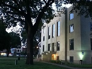
Garfield County Courthouse in Enid (2011)
|
|
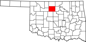
Location within the U.S. state of Oklahoma
|
|
 Oklahoma's location within the U.S. |
|
| Country | |
| State | |
| Founded | 1893 |
| Named for | James A. Garfield |
| Seat | Enid |
| Largest city | Enid |
| Area | |
| • Total | 1,060 sq mi (2,700 km2) |
| • Land | 1,058 sq mi (2,740 km2) |
| • Water | 1.6 sq mi (4 km2) 0.2%% |
| Population
(2020)
|
|
| • Total | 62,846 |
| • Density | 59/sq mi (23/km2) |
| Time zone | UTC−6 (Central) |
| • Summer (DST) | UTC−5 (CDT) |
| Congressional district | 3rd |
Garfield County is a special area in the state of Oklahoma. It's called a county. In 2020, about 62,846 people lived here. The biggest city and the main center for the county's government is Enid. The county is named after a former U.S. President, James A. Garfield. Garfield County is also part of the larger Enid metropolitan area. This means it's a busy place with a main city and nearby towns that are all connected.
Long ago, before 1893, this area was known as O County. It was part of the Cherokee Outlet. This land belonged to the Cherokee people. They had moved here after a sad event called the Cherokee trail of tears. Before that, different Native American tribes like the Wichita, Osage, and Kiowa used the land for hunting.
Important trails and routes passed through Garfield County. The famous Chisholm Trail was one of them. This trail was used to move cattle. Stagecoaches, mail routes, and railroads also came through. Early stations were at Buffalo Springs and Skeleton. Today, these places are called Bison and Enid. Railroads started coming to the county four years before the big land opening. Enid quickly became a central hub for all this travel and trade. Many different railroads helped connect the county.
Contents
Exploring Garfield County: Geography and Location
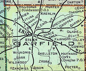
Garfield County covers a total area of about 1,060 square miles. Most of this is land, about 1,058 square miles. Only a small part, about 1.6 square miles, is water. That's about 0.2% of the total area. Several creeks flow through the county. These include Black Bear, Boggy, Red Rock, Rock, Skeleton, and Turkey creeks.
Neighboring Counties
Garfield County shares its borders with several other counties.
- Grant County is to the north.
- Noble County is to the east.
- Logan County is to the southeast.
- Kingfisher County is to the south.
- Major County is to the west.
- Alfalfa County is to the northwest.
Main Roads
Many important highways run through Garfield County. These roads help people travel easily across the county and to other parts of Oklahoma.
 U.S. Highway 60
 U.S. Highway 64
 U.S. Highway 81
 U.S. Highway 412
 State Highway 15
 State Highway 45
 State Highway 74
Who Lives Here: Population and People
The number of people living in Garfield County has changed over the years.
| Historical population | |||
|---|---|---|---|
| Census | Pop. | %± | |
| 1890 | 22,076 | — | |
| 1900 | 10,037 | −54.5% | |
| 1910 | 33,050 | 229.3% | |
| 1920 | 37,500 | 13.5% | |
| 1930 | 45,588 | 21.6% | |
| 1940 | 45,484 | −0.2% | |
| 1950 | 52,820 | 16.1% | |
| 1960 | 52,975 | 0.3% | |
| 1970 | 55,365 | 4.5% | |
| 1980 | 62,820 | 13.5% | |
| 1990 | 56,735 | −9.7% | |
| 2000 | 57,813 | 1.9% | |
| 2010 | 60,580 | 4.8% | |
| 2020 | 62,846 | 3.7% | |
| U.S. Decennial Census 1790-1960 1900-1990 1990-2000 2010 |
|||
In 2000, there were 57,813 people living in the county. By 2020, the population grew to 62,846 people. The county is home to many different families and individuals. About 25% of the people were under 18 years old in 2000. The average age was 38 years old.
In 2000, the average income for a family in the county was about $39,872 per year. By 2021, this average income had grown to about $60,732. This shows that the economy in Garfield County has been improving for its residents.
Economy: How People Make a Living
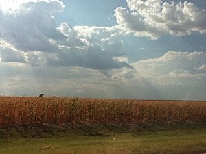
The main ways people make money in Garfield County are through farming and raising animals. Farmers grow crops like wheat, corn, and oats. Wheat is especially important here. The county seat, Enid, is even called the "Wheat Capital of Oklahoma."
Besides farming, oil and natural gas are also big industries. There are also businesses that turn grain into flour. Enid has some of the largest grain storage buildings in the entire United States. One of the biggest grain elevators in the world is located there. Another major employer in the area is Vance Air Force Base. It provides jobs for both military members and civilians.
Communities: Cities and Towns
Garfield County has several cities, towns, and other communities where people live and work.
Cities
Towns
Census-designated place
Other Unincorporated Places
Historic Places: NRHP Sites
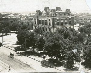
Garfield County is home to many important historical buildings and places. These sites are listed on the National Register of Historic Places. This means they are recognized for their special history and are protected. Some of these sites include the Garfield County Courthouse and the Rock Island Depot in Enid. There are also historic barns and other buildings in smaller towns like Covington and Hunter.
See also
 In Spanish: Condado de Garfield (Oklahoma) para niños
 | Mary Eliza Mahoney |
 | Susie King Taylor |
 | Ida Gray |
 | Eliza Ann Grier |


