
Halcott Mountain facts for kids
Quick facts for kids Halcott Mountain |
|
|---|---|

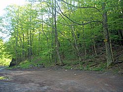
Halcott from Belleayre Ski Center to the south
|
|
| Highest point | |
| Elevation | 3520+ ft (1073 m)+ NGVD 29 |
| Prominence | 700 ft (210 m) |
| Listing | Catskill High Peaks #32 |
| Geography | |
| Location | Lexington, New York, United States |
| Parent range | Catskill Mountains |
| Topo map | USGS West Kill |
| Geology | |
| Age of rock | 250-350 mya |
| Mountain type | Dissected plateau |
| Climbing | |
| Easiest route | Hike up east slope from NY 42 to summit ridge |
Halcott Mountain is one of the beautiful Catskill Mountains in New York, USA. Most of it is in Greene County, with some parts stretching into Delaware and Ulster counties. We don't know its exact height, but it's at least 3,520 feet (1,073 meters) tall. This mountain helps separate the waters that flow into the Delaware River from those that go to the Hudson River.
Halcott Mountain is one of the special "Catskill High Peaks" that are over 3,500 feet (1,067 meters) high. If you love hiking and want to join the Catskill Mountain 3500 Club, you need to climb this mountain! It's part of the Catskill Park Forest Preserve, which means it's public land. There are no marked trails here, so hikers have to "bushwhack" (hike through the woods without a path) to reach the top. Once there, they can sign a special book called a canister to prove they made it. Halcott Mountain is known as one of the easier peaks to climb among the 13 High Peaks that don't have trails.
Contents
Exploring Halcott Mountain's Geography
Halcott Mountain covers a large area. Most of it is in the town of Lexington in Greene County. Some of its lower parts are in Halcott to the west. There's even a special spot where three counties meet (Greene, Ulster, and Delaware) on one of its southern ridges.
Most of the land on the mountain in Greene County is part of the 4,760-acre (1,926-hectare) Halcott Mountain Wild Forest. This area is managed by the New York State Department of Environmental Conservation (DEC). The closest towns are Fleischmanns and Pine Hill to the southwest and south.
Mountain Slopes and Valleys
Halcott Mountain's sides are shaped by valleys and ridges. The eastern slopes are quite steep, dropping about 1,700 feet (518 meters) into a deep pass called Deep Notch. This pass is where NY 42 runs. The southern slopes are gentler, leading to the Birch Creek valley.

On the southwest, a ridge continues to a lower area between Halcott and Monka Hill. Another ridge to the west connects Halcott to one of the other South Mountains in the Catskills. Experts think the mountain's actual summit might be as high as 3,541 feet (1,079 meters).
The western slopes are very gentle, leading to the Elk Creek valley. To the north, a ridge goes down gently before rising again to a peak called Northeast Halcott or Sleeping Lion.

Waterways Around Halcott Mountain
Several creeks flow from Halcott Mountain. Bushnellsville Creek and another unnamed stream drain the eastern side. Both of these flow into Esopus Creek. The water from Esopus Creek eventually goes into New York City's Ashokan Reservoir before reaching the Hudson River. You can see beautiful waterfalls near Route 42 from Bushnellsville Creek and its tributary.
Birch Creek, which starts in the valleys south of Halcott, also flows into the Esopus. Elk and Emory creeks flow into Bush Kill, which then empties into the East Branch Delaware River near Arkville.
How Halcott Mountain Was Formed (Geology)
Like all the Catskill Mountains, Halcott Mountain is a "dissected plateau". This means it wasn't formed by rocks pushing up, but by streams slowly carving out valleys in an area that was already lifted up. This happened about 350 million years ago.
The rocks here are mostly Devonian and Silurian shale and sandstone. Later, during the Ice Ages (like the Illinois and Wisconsin periods), glaciers helped shape the mountain. They smoothed the western slopes as they moved over them. They also made the eastern slopes steeper when meltwater burst through Deep Notch.

The soil on Halcott Mountain is reddish and has many small rock pieces. It's not very deep and is quite acidic, so it doesn't hold much water. This means the soil can easily wash away, and you'll often see rocks sticking out on the mountain slopes.
Plants and Animals (Flora and Fauna)
Halcott Mountain is covered in thick forests. You'll mostly find northern hardwood trees like beech, birch, and maple. There are also some small areas with Norway spruce and red pine trees that were planted. You might also see hemlock trees, which were once harvested for their bark to make leather.
A special type of paper birch tree grows on the southwestern slope because of past human activity. In 1908, a forest fire led to a group of yellow birch trees growing in Hemlock Gully.
Most of the mountain was logged (trees cut down) up to about 3,150 feet (960 meters). But there's still an area of about 0.6 square miles (1.6 square kilometers) near the summit that has "first-growth" trees. These trees are often small and twisted because of the strong winds and weather. Unlike some other Catskill High Peaks, you won't find many balsam fir or red spruce trees here.
The DEC believes that 49 types of mammals, 20 types of amphibians, 13 types of reptiles, and 71 types of birds live on Halcott Mountain. You might see large animals like white-tailed deer and black bears. Fishers were brought back to the Catskills in the late 1970s.
Among the birds, you might spot bald eagles (which are considered threatened) and the eastern bluebird (New York's state bird, which is a species of concern).
History of Halcott Mountain
Halcott Mountain got its name from an early landowner, just like the nearby town. In the past, the western slopes of the mountain were cleared for farming, even at high elevations. The steeper eastern slopes were not cleared as much. You can still find old stone walls and building foundations in the forest on the lower parts of the mountain.
Between the old farms and the untouched forest near the summit, there was a "forestry belt." Here, local farmers cut trees for firewood. They also harvested hemlock trees for their tannin-rich bark, which was used to tan leather. This was a big industry in the region until the late 1800s, when most of the hemlock trees were gone, and new ways to make tannin were invented.
After the bark-peeling industry ended, New York State created the Forest Preserve in 1885. The goal was to protect the remaining land. A rule was made that all state-owned land in the Catskill Park must be kept "forever wild." This means it cannot be sold or leased. This rule was even added to the state constitution in 1894. The state bought the land around Halcott's summit a few years later, and by 1957, the state owned all the land it does today.
The DEC hasn't done much to manage the land on Halcott Mountain because there's no trail. The area is called a "Wild Forest," which usually allows for some intense use. However, because this area is small, land above 2,700 feet (823 meters) is treated like a wilderness area. Halcott Mountain has been on the 3500 Club's list since 1962, and it's also a popular spot for hunters.
How to Hike Halcott Mountain (Access)

The most common way to reach the top of Halcott Mountain is by starting at a parking area on the west side of Route 42. This spot is south of Deep Notch, right next to a waterfall, at about 1,800 feet (549 meters) elevation.
From here, hikers usually follow the ridge to the west, moving a bit southward. Once they reach the ridge at 3,000 feet (914 meters), they follow it south up gentle slopes to the mountain's summit. At the top, there's a rough path that runs north-south to the summit canister, which is on a cherry tree at the southern end. This hike involves climbing about 1,720 feet (524 meters), and the round trip is about six miles (9.6 kilometers).
When the trees have leaves, you won't find any views from the very top of the mountain. In other seasons, views to the south might be partly blocked by trees. You might find some views from the southern slopes where there are steep drops.
You can also access the mountain from the south and west, where the slopes are gentler. However, you'll need to get permission from landowners to cross private property at the base of the mountain. It's also possible to hike entirely on public land from the north, but this is a longer route across Northeast Halcott.
