History of the Bundjalung facts for kids
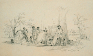
The Bundjalung people are a large group of Aboriginal people who have lived for a very long time on the land from Grafton in northern New South Wales up to Ipswich and Beaudesert in southern Queensland. Their land stretches around the Great Dividing Range and back to Grafton.
To the north, the Bundjalung Nation shares borders with the Yuggera and Barrunggam Nations. To the east is the Tasman Sea (Pacific Ocean). To the south is the Gumbaynggirr Nation, and to the west is the Ngarabal Nation.
Before Europeans arrived, the Bundjalung Nation had some of the best hunting and fishing areas in Australia. Their old stories say that these lands were first settled by the Three Brothers and their families.
The Bundjalung Nation is made up of 15 main groups, including the Arakwal, Minjungbal, and Jugumbir.
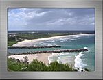
Bundjalung people have lived on and visited Goanna Headland for at least 12,000 years. This place is important because their ancestors arrived there by sea. This event is told in the legend of "The Three Brothers (Bundjalung Nation)".
Contents
European Arrivals and Changes
First European Sightings
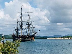
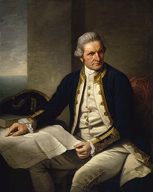
On 15 May 1770, the coast near Evans Head was first mapped by Lieutenant James Cook. He was on his ship, the HMS Endeavour, exploring what would become New Zealand and Australia. Cook did not land on the coast.
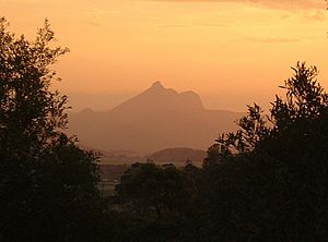
The next day, Cook saw and named Cape Byron and Mount Warning. He named Mount Warning because he saw dangerous reefs nearby. Cook did not notice the entrance to the Richmond River.
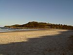
However, he did see about 20 Bundjalung people on what is now Seven Mile Beach. Sir Joseph Banks, who was with Cook, noticed that these people seemed to ignore the ship. This might mean they had seen other ships before the Endeavour.
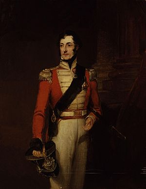
On 20 August 1828, Captain Henry John Rous arrived at Byron Bay on his ship, the HMS Rainbow. He was looking for a river that ships could use and a safe place to anchor. On 26 August 1828, Captain Rous found the entrance to the Richmond River. He explored about 32 kilometers upstream. Captain Rous named the river Richmond after his brother's good friend, Charles Gordon-Lennox, 5th Duke of Richmond.
Early European Settlement
Europeans began to settle in the Richmond River area around 1842. This happened after red cedar cutters and farmers heard stories about the valuable 'red gold' (red cedar trees) in the area.
These cedar cutters were very keen to find the big old trees. To legally cut cedar, they needed a license. This license cost 6 pounds in 1851. It allowed them to build a hut and cut timber on unsettled land. News of the amazing red cedar quickly spread, helping many men make money.
Important Dates in History
| Date | Events | |
|---|---|---|
| 10,000 BC |
The ancestors of the Bundjalung Nation first arrived on the North Coast of NSW thousands of years ago. This happened at least 12,000 years ago. This important event is told in the Bundjalung people's traditional stories, known as the "The Three Brothers (Bundjalung Nation)" legend. |
Details |
| 4000 BC |
Around 12,000 years ago, the ice caps melted, and sea levels rose. This covered some land off the east coast of Australia. The old camping spots of the Bundjalung ancestors, used before the sea settled, are now under the ocean. |
Details |
| 1650 AD |
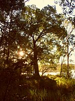
In Bundjalung National Park, there is a Western Kurrajong tree that is over 360 years old. It is near an old Aboriginal campsite. This tree is called "The Marriage Tree" by Bundjalung Aboriginals. It was a gift from the Wahlubal tribe during a wedding at Gummigurrah. Gummigurrah was a winter camping spot for the Bundjalung people. |
Details |
| May 1770 AD |
The coast near Evans Head was first mapped by Lieutenant James Cook of the United Kingdom on his ship, HMS Endeavour. |
Details |
| 15 May 1770 AD |
Lieutenant James Cook noted about 20 Bundjalung Arakwal Aboriginal people on what is now called 'Seven Mile Beach'. This beach is north of Lennox Head. |
Details |
| 15 May 1770 AD |
Sir Joseph Banks also saw the same Bundjalung Arakwal people. He wrote that they did not even look at the ship. He noted: "...not one was once observed to stop and look toward the ship; they pursued their way in all appearance entirely unmoved by the neighbourhood of so remarkable an object as a ship must necessarily be to people who have never seen one." This suggests they might have seen other ships before. |
Details |
| 16 May 1770 AD |
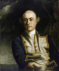
Lieutenant James Cook on the Endeavour named Cape Byron. He named it after Vice-Admiral John 'Foulweather Jack' Byron, who was a British navigator. Cook also named two small islands, Julian Rocks, after his nephew and niece. Cook was the first European to write in his diary about seeing "... a remarkable sharp peaked Mountain lying inland..." from Cape Byron. Later, he named this mountain Mount Warning. |
Details |
| 17 May 1770 AD |
Mount Warning (Wulambiny Momoli) was named by Lieutenant James Cook. It was a warning to other sailors about dangerous reefs along the coast. Cook did not know that the Bundjalung people called the mountain 'Wulambiny Momoli'. It was a very important sacred site for them, as their lives and beliefs were strongly connected to the land. |
Details |
| 20 August 1828 AD |
Captain Henry John Rous anchored his ship, the HMS Rainbow, at Byron Bay. He was looking for a river that could be used by ships and a safe place to anchor. Rous found the mouth of the Richmond River while sailing along the coast. |
Details |
| 26 August 1828 AD |
Captain Henry John Rous discovered the entrance to the Richmond River. He explored 32 kilometers up the river. Captain Rous then named the river Richmond, after his brother's best friend, Charles Gordon-Lennox, 5th Duke of Richmond. |
Details |
| 1839 AD |
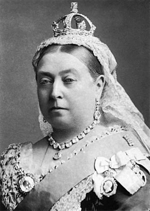
In 1839, Queen Victoria's laws stated that Aboriginal people were subjects of the Crown. This meant that if an Aboriginal person died violently because of a conflict with white men, an investigation should happen, just as if the person were European. |
Details |
| 1839 AD | The area around Tabulam was originally home to Bundjalung people. Europeans first settled there in 1839. | Details |
| 1840 AD |
Two settlers, Henry Clay and George Stapleton, traveled through the bush from Glen Innes to Tabulam. They bought cattle and moved their herds to the Richmond River. They named their large grazing area "Cassino" (now the town of Casino), after a town in Italy. Before Europeans arrived, the Casino area was part of the Bundjalung lands. One report from 1840 mentioned a gathering of "five hundred or upwards" Aboriginal people. The Bundjalung people moved across a wide area. One of their yearly traditions was to go to the coast in winter when mullet fish were plentiful. People from inland areas traded black bean seeds for fish. These seeds are poisonous but can be eaten after careful preparation. |
Details |
| 1841 AD | On 11 August 1841, Oliver Fry became the first commissioner of Crown Lands for the Clarence area. He decided not to officially record Aboriginal culture. Fry was told to "gain confidence and goodwill" of the Bundjalung people to help them live a "civilised life." | Details |
| 1842 AD |
European settlement began in the Richmond River area with Red Cedar cutters and farmers. The environment was challenging for early European settlers. High rainfall, humidity, injuries, and insect bites caused serious infections. European medicines were scarce and not very effective. However, the Bundjalung people had a solution. They would crush tea tree leaves and put them on wounds and infections. This helped control infection and heal wounds quickly. Scientists later identified this unique tree as Melaleuca alternifolia. Bundjalung people also used "tea trees" as traditional medicine. They would breathe in the oils from crushed leaves to treat coughs and colds. They also soaked tea tree leaves to make a drink for sore throats or skin problems. The 'Bungawalbyn Valley Basin' is known as the birthplace of the 'TEA TREE INDUSTRY'. |
Details |
| 1842 AD | PELICAN CREEK TRAGEDY: In 1842, five European men were killed at Pelican Creek, near Coraki. This led to a large number of Bundjalung people being killed in revenge at Evans Head. | Details |
| 1842 AD | EVANS HEAD MASSACRE: The Evans Head Massacre resulted in the deaths of about 100 Bundjalung people by Europeans at Evans Head. Aboriginal people said it was in revenge for "a few sheep" being killed. Europeans said it was for the killing of "five European men" in the 1842 'Pelican Creek Tragedy'. | Details |
| 1843 AD | Surveyor James Burnett named the new settlement at the mouth of the Richmond River 'Deptford'. This place is now known as the town of Ballina. | Details |
| 1843 AD |
The European history of Lismore began around 1843. The first sheep farm in the Lismore area was on the north arm of the Richmond River. Captain Dumaresq started this farm around 1843. The sheep did not like the wet, sub-tropical climate, and many died. In January 1845, William and Jane Wilson took over the farm and named it Lismore. They named it after a small island in Scotland. They built houses there, and the north arm of the Richmond River was later renamed Wilson River in their honor. |
Details |
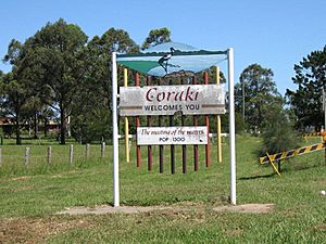
| 1849 AD |
The village of Coraki was started by William Yabsley. |
Details |
| 1853/4 AD | EAST BALLINA MASSACRE: The Native Mounted Police were formed in 1848. These police were Aboriginal people from different tribes, led by European officers. They enforced European law on Aboriginal tribes they had no connection with.
In 1853–54, near the present-day East Ballina Golf Course, the Native Police killed at least 30–40 Bundjalung Nyangbal Aboriginal men, women, and children while they slept. The Native Mounted Police believed that some Aboriginal people from north of the Tweed River had killed Europeans and fled south. The police rode out at 3 am to where 200 to 300 Bundjalung Nyangbal people were sleeping. The police surrounded the camp and opened fire. Many Bundjalung people were killed. The European settlers in East Ballina were upset by this attack on friendly local people. They reported it to the NSW Government. However, the government took no action against those responsible and warned the settlers to "mind their own business." Because of this, there are no official records of these killings. The Aboriginal survivors did not seek revenge. There are strong oral stories among the Bundjalung community about this massacre. These stories include people escaping, people being shot and buried in the forests, and some being driven off the cliff at Black Head. It is believed that some victims were never buried. |
Details |
| 1860s AD | SOUTH BALLINA POISONING: The South Ballina clan of the Nyangbal people was a group of about 200 Bundjalung people. In the early 1860s, there was an attempt to poison them. Poisoned flour was given to the Bundjalung Nyangbal people to make damper (a type of bread). They took it to their camp at South Ballina to cook. The older people and children did not eat the damper because it was a new food. The next morning, nearly 150 adults were found dead. | Details |
| 1882 AD | New Italy Settlement: In 1882, a group of Italians settled near Woodburn, which was known to Bundjalung Aboriginals as 'Maniworkan'. These Italians were survivors of a difficult journey to New Ireland (now part of Papua New Guinea).
They faced sickness and starvation there. After four months, the survivors went to Nouméa and asked for help from the Government of New South Wales. The Premier, Sir Henry Parkes, arranged for them to come to Sydney. Many of them came to this area and built a successful settlement called "New Italy". |
Details |
| 1877 AD | Gold was discovered at Evans Head. | Details |
| 1928 AD |
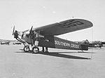
Sir Charles Edward Kingsford Smith and Charles Ulm were the first people to fly across the Pacific Ocean in an aircraft. They flew their plane, the "Southern Cross," from Oakland, California, to Brisbane, Queensland, stopping in Honolulu, Suva, and Ballina. They covered about 7,200 miles in 83 hours and 50 minutes of flying time, from 31 May to 9 June 1928. |
Details |
| 1954 AD |
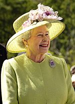
Queen Elizabeth II visited Evans Head during her Royal visit to Australia. |
Details |
| 1968 AD | Before 1968, it was illegal to pay an Indigenous worker more than a certain amount in goods or money. Aboriginal people were not allowed to own land. Any money they earned was managed by white people for them. In many cases, government payments for Indigenous workers went into company accounts instead of to the individuals.
Aboriginal people were stopped from raising their own children, moving freely, getting an education, earning fair wages, marrying without permission, eating in restaurants, entering a pub, swimming in a public pool, or having the right to vote. |
Details |
| 1973 AD |
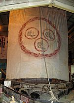
The 1973 Las Balsas expedition was the first (and only) time multiple rafts crossed the Pacific Ocean in recent history. It is the longest known raft journey ever. The Las Balsas rafts were pulled into Ballina by fishing boats after their journey from Ecuador. They had planned to arrive in Mooloolaba, Queensland, but ocean currents pushed them off course. Their journey was almost twice as long as the 1947 Kon-Tiki expedition. It showed that people could have traveled across the Pacific in ancient times. |
Details |
| 1976 AD | Aboriginal culture in the Bundjalung Nation includes many bora rings (special meeting places). Casino was an important Aboriginal meeting place. A very large bora ring was found just north of the town. However, this site was unfortunately destroyed in 1976 for landfill at the Casino Hospital. | Details |
| 1983 AD | The NSW Land Rights Act 1983 was an important step. This law recognized that Aboriginal people were removed from their land without fair payment. The Act states:
* Land in New South Wales was traditionally owned and lived on by Aboriginal people.
|
Details |
| 1985 AD |
A 16-hectare part of southern Goanna Headland at Evans Head became the first Aboriginal land grant in New South Wales. |
Details |
See also
- Animal worship
- Australian frontier wars
- Australian megafauna
- Bandjalang language
- Bundjalung people
- Caledonian Confederacy
- Commercialization of traditional medicines
- Comparative linguistics
- Demiurge
- Dirawong
- Dreaming (spirituality)
- History wars
- Land rights
- Limes (Roman Empire)
- Lists of legendary creatures
- List of Australian place names of Aboriginal origin
- List of massacres of Indigenous Australians
- Living Tongues Institute for Endangered Languages
- Noongar
- Philology
- Three Sisters (Australia)
- The Three Sisters (Queensland)
- Yagan
 | Emma Amos |
 | Edward Mitchell Bannister |
 | Larry D. Alexander |
 | Ernie Barnes |


