Holliston, Massachusetts facts for kids
Quick facts for kids
Holliston, Massachusetts
|
|||
|---|---|---|---|
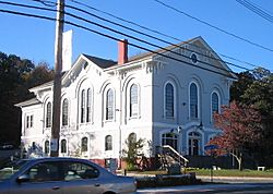
Holliston Town Hall on the east border of the town green
|
|||
|
|||
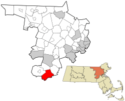
Location in Middlesex County in Massachusetts
|
|||
| Country | United States | ||
| State | Massachusetts | ||
| County | Middlesex | ||
| Settled | 1659 | ||
| Incorporated | 1724 | ||
| Named for | Thomas Hollis | ||
| Government | |||
| • Type | Open town meeting | ||
| Area | |||
| • Total | 19.0 sq mi (49.3 km2) | ||
| • Land | 18.7 sq mi (48.5 km2) | ||
| • Water | 0.3 sq mi (0.9 km2) | ||
| Elevation | 188 ft (57 m) | ||
| Population
(2020)
|
|||
| • Total | 15,221 | ||
| • Density | 801.1/sq mi (308.7/km2) | ||
| Time zone | UTC−5 (Eastern) | ||
| • Summer (DST) | UTC−4 (Eastern) | ||
| ZIP Code |
01746
|
||
| Area code(s) | 508/774 | ||
| FIPS code | 25-30700 | ||
| GNIS feature ID | 0618225 | ||
| Website | www.townofholliston.us | ||
Holliston is a town in Middlesex County, Massachusetts, in the United States. It's part of the Greater Boston area. In 2020, about 15,221 people lived there.
Holliston is located in a region called MetroWest, which is west of Boston. It's special because it's the only town in Middlesex County that touches both Norfolk and Worcester counties.
Contents
History of Holliston
When Europeans first arrived, the land where Holliston is now belonged to the Awassamog family. They were part of the Nipmuc tribe from Natick. In 1701, a large area, including parts of Holliston, was given to the Nipmucs. However, settlers soon bought land there, and the Nipmuc presence faded.
A Nipmuc village called Mucksquit was located near what is now Lake Winthrop. The name Mucksquit means "place of much grass." The lake was known as Wennakeening, meaning "smile of the great spirit."
Early settlers like the Morses and Bullards followed an old Native American path called Pout Lane. This path is now partly modern-day Route 16 and Highland Street. They settled along this path, forming the first farms that grew into Holliston.
Founding and Naming the Town
European settlers from the Massachusetts Bay area first arrived in 1659. At that time, Holliston was part of Sherborn.
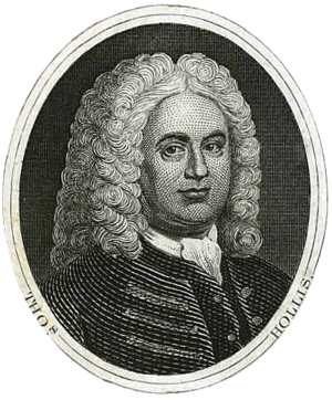
Holliston officially became a town on December 3, 1724. The name was chosen to honor Thomas Hollis from London. He was a generous supporter of Harvard College.
The first town meeting was held on December 23, 1724. Five selectmen and other officers were chosen to lead the new town. Holliston has grown from a small community to one with over 13,000 residents. It now has a large budget, with much of it going to its well-known school system.
Holliston's Past Industries
Holliston was once the biggest producer of shoes in the United States. Many shoe factories were lost due to fires and other issues. The largest company, the Goodwill Shoe Company, still has empty factories on Water Street. Today, many of these old factories are used as artists' studios. The shoe industry declined because of competition from factories in other countries.
Holliston's Mudville neighborhood claims to be the setting for the famous 1888 poem, "Casey at the Bat." This claim creates a friendly rivalry with Stockton, California, which also says the poem is about their town.
The Legend of Balancing Rock
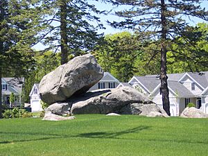
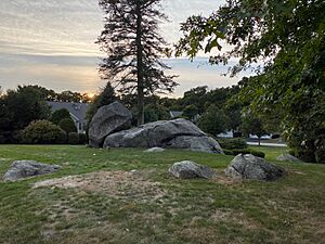
On the north side of Route 16, near Milford, there was a huge rock. It was about 20 feet (6 meters) long, 10 feet (3 meters) wide, and 6 feet (1.8 meters) thick. It weighed over 5 tons (4.5 metric tons). The rock looked like it was carefully balanced on a granite ledge.
A legend says that on November 6, 1789, General George Washington passed by this rock. He was traveling from Boston to New York. His diary mentioned the road in Holliston, which would later be named after him.
The legend says that General Washington and his group tried to push the Balancing Rock off its spot. They wanted to see if they could tip it over. Even the General himself tried to help push it. But their efforts, and those of many others over the years, didn't work. The rock stayed put.
However, on September 22, 2020, the Balancing Rock finally fell. The rock is on land that is now a community for adults over 55.
Geography and Location
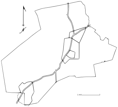
Holliston covers about 19.0 square miles (49.3 square kilometers). Most of this area is land, about 18.7 square miles (48.5 square kilometers). A small part, about 0.3 square miles (0.9 square kilometers), is water. The Charles River flows near the southern part of the town.
Holliston is located about 21.6 miles (34.8 kilometers) west of Boston. It's also close to major highways like Interstate 495 and the Massachusetts Turnpike (part of Interstate 90). Massachusetts Route 16 and Massachusetts Route 126 also go through the town.
Historic Areas in Holliston
Holliston has a long history, almost 300 years old. Because of this, it has many smaller areas with names linked to their past. Even though the town only has one post office today, some of its historic villages used to have their own post offices or train stops.
Today, Holliston has two official historic districts. These districts contain even smaller areas that are important historically. There are also other neighborhoods with their own names. The following are the areas officially recognized as historic by the town and the U.S. Geologic Survey:
- Braggville
- East Holliston
- Gooch Corners
- Metcalf
- Thomas Hollis Historic District
- Mudville
- Brentwood
- Lakeside
Neighboring Towns
Holliston is in eastern Massachusetts and shares borders with these towns:
- Sherborn to the east
- Millis to the southeast
- Medway to the south
- Milford to the southwest
- Hopkinton to the northwest
- Ashland to the north
Population and People
| Historical population | ||
|---|---|---|
| Year | Pop. | ±% |
| 1765 | 705 | — |
| 1776 | 909 | +28.9% |
| 1790 | 875 | −3.7% |
| 1800 | 783 | −10.5% |
| 1810 | 989 | +26.3% |
| 1820 | 1,024 | +3.5% |
| 1830 | 1,304 | +27.3% |
| 1840 | 1,782 | +36.7% |
| 1850 | 2,428 | +36.3% |
| 1860 | 3,339 | +37.5% |
| 1870 | 3,073 | −8.0% |
| 1880 | 3,098 | +0.8% |
| 1890 | 2,619 | −15.5% |
| 1900 | 2,598 | −0.8% |
| 1910 | 2,711 | +4.3% |
| 1920 | 2,707 | −0.1% |
| 1930 | 2,804 | +3.6% |
| 1940 | 3,000 | +7.0% |
| 1950 | 3,753 | +25.1% |
| 1960 | 6,222 | +65.8% |
| 1970 | 12,069 | +94.0% |
| 1980 | 12,622 | +4.6% |
| 1990 | 12,926 | +2.4% |
| 2000 | 13,801 | +6.8% |
| 2010 | 13,547 | −1.8% |
| 2020 | 14,996 | +10.7% |
| 2022* | 14,856 | −0.9% |
| * = population estimate. Source: United States Census records and Population Estimates Program data. |
||
In 2000, there were 13,801 people living in Holliston. There were 4,795 households, and 3,842 families. The town had about 737.8 people per square mile.
Most residents (96.7%) were White. About 0.9% were African American, and 0.9% were Native American. About 1.2% were Asian. People of Hispanic or Latino background made up 1.4% of the population.
Many Holliston residents have Irish (29.4%), Italian (18.3%), or English (17.8%) heritage. Other backgrounds include German (9.7%), French (5.6%), and Polish (5.6%).
About 44.2% of households had children under 18 living with them. Most households (70.2%) were married couples. The average household had 2.87 people, and the average family had 3.25 people.
The median age in Holliston was 38.2 years. About 30.0% of the population was under 18. About 8.9% were 65 years or older.
In 2000, the median income for a household was $78,092. For families, it was $84,878. The income per person in the town was $32,116. About 2.4% of the population lived below the poverty line.
By 2009, many adults in Holliston had a good education. About 79% of residents aged 25 and over had a bachelor's degree or higher. Also, 35.8% had a graduate or professional degree.
Education in Holliston
Holliston has a public school system for students from kindergarten through twelfth grade. The district includes two elementary schools, a middle school, and a high school.
The public schools are:
- Sam Placentino Elementary School
- Fred W. Miller Elementary School
- Robert H. Adams Middle School
- Holliston High School
Holliston High School has been ranked among the top 150 public high schools in the Greater Boston area. The Holliston public school system also offers special programs. These include a Montessori program and a French Immersion program for kindergarten students.
Environment and Superfund Sites
Holliston has five registered Superfund sites. These are places where hazardous waste might be found. Three of these sites are still monitored by CERCLIS. CERCLIS stands for Comprehensive Environmental Response, Compensation, and Liability Information System.
| Name of site | Location | Status |
|---|---|---|
| Adams Street Property | 519 Adams Street | Archived |
| Wood Engineering | 29 Everett Road | Archived |
| Axton Cross Corp | 1 Cross Street | Non-NPL (National Priorities List) |
| Bird Property (Prentice Street Property) | 708 Prentice Street | Non-NPL |
| Photofabrication Engineering Inc. | 229 Lowland Street | Non-NPL |
An "Archived" status means the site has been cleaned up. It doesn't need more investigation and is not a big threat. A "Non-NPL" status means the EPA doesn't see these sites as the most dangerous. So, they are not on the National Priorities List (NPL). However, cleanup might still be happening, and these sites are still watched. An "NPL" status means the EPA thinks the site has serious health and environmental risks. These are the most dangerous sites in the country.
Axton Cross Corp Site
The Axton Cross Corp started in 1967. It was a company that sold industrial chemicals for different industries. In the early 1990s, the company went out of business. The site covers 8.6 acres and has two buildings. These buildings might be torn down.
The Mass DEP considers Axton Cross a "Disposal Site." They found oil and other unknown hazardous materials there. Locals said that Axton-Cross polluted its property and nearby land with toxic chemicals. The EPA's last check in 1995 showed that the water was okay. However, the air quality for Ozone was not good in that area. No new information has been recorded since then.
Bird Property (Prentice Street Property) Site
In 1966, a permit was given to mine gravel on this property. Gravel mining continued until the late 1970s. From the late 1960s to early 1980s, the mined areas were filled with building trash and commercial waste. The property was also used to store many tires. The site is about 53 acres. There are plans to build homes on this land.
Since then, the Mass DEP and EPA have ordered cleanup work. This included removing possible harmful substances, trash, building debris, and tires. Over 70 tons of affected soil were also removed. The groundwater near the site has low levels of a chemical called TCE. Because the levels are low and naturally decreasing, the Mass DEP believes no more water cleanup is needed. Other chemicals found were VOCs. The EPA also noted that the air quality for Ozone was not good in this area. No new information has been recorded.
Photofabrication Engineering Inc. Site
Photofabrication Engineering, Inc. (PEI) started in 1968. They make precise metal parts for computers and semiconductors. In 1984, the company moved from Holliston to Milford, MA. Their new facility helped them become a cleaner manufacturer for the environment.
The Mass DEP found chlorinated solvents, metals, and wastewater discharge at the old site. The Mass DEP says the cleanup plan is now being put into action. The EPA's inspection found that the water was not harmed. However, the air quality for Ozone was not good in that area. No new information has been recorded.
Things to See and Do
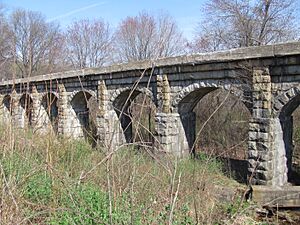
- Bogastow Brook Viaduct: Also known as the Arch Bridge, this bridge off Woodland Street is a beautiful sight. It's even named one of the 1,000 places to visit in Massachusetts.
- Bullard Farm: This is the preserved home of the Bullard family, who were among the first settlers in Holliston. It was a family farm from 1652 until 1916.
- Fatima Shrine: This is a peaceful place for prayer and quiet thought. The rosary walk at Fatima Shrine is thought to be the largest rosary in the world.
- Fiske's General Store: Founded in 1863, this is the oldest store in town. It's known for its saying, "'most everything."
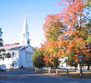
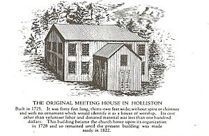
- First Congregational Church of Holliston: Built where Holliston's first meeting house stood. It holds a King James Bible given by Thomas Hollis in 1724.
- Holliston Police Station: This station has one of the American sycamore trees that grew from seeds flown to the moon on Apollo 14.
- Lake Winthrop: This lake is almost 1 mile (1.6 kilometers) across and covers about 140 acres (57 hectares). It was once called "Dean Winthrop's Pond." The Nipmuck tribe, part of the Algonquian Indians, lived near the lake. They called it Wennakeening, meaning "smile of the great spirit." Today, you can fish, kayak, and swim at Lake Winthrop.
- Mount Hollis Lodge A.F. & A.M.: This Masonic Lodge was founded in Holliston in 1865. It's in a historic building that used to be the Methodist Church.
- Upper Charles River Trail: This is a scenic path for biking, walking, and other non-motorized activities. When finished, the 20-mile (32-kilometer) trail will connect Holliston to Ashland, Hopkinton, Milford, and Sherborn.
Golf Courses
- Pinecrest Golf Club: An 18-hole golf course for playing golf.
Parks and Playing Fields
- Goodwill Park: Has a playground, tennis courts, and fields for baseball and soccer.
- Patoma Park: Offers woodland trails for hiking and other fun activities. It's like a sister park to Stoddard Park.
- Pleasure Point: Located on Lake Winthrop, it has a beach, picnic area, playground, and a place to launch boats.
- Stoddard Park: Also on Lake Winthrop, with a beach, picnic area, and two youth baseball/softball fields.
- Weston Pond: Has fields for multiple sports practices and soccer games.
- Damigella Field: A large baseball diamond and softball fields, part of the elementary and middle school complex.
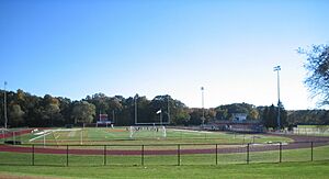
- Kamitian Field: A multi-sport artificial turf field, part of the high school complex.
- Marshall Street Soccer Fields: Private fields managed by Holliston Youth Soccer.
Famous People from Holliston
Holliston has been home to many interesting people, including:
- Lyndon Byers: A retired NHL hockey player.
- Mike Condon: A goalie who played for NHL teams like the Ottawa Senators.
- Adam Green: A director and writer known for horror films.
- Mike Grier: A former NHL forward for teams like the Edmonton Oilers.
- Michael Mantenuto: An actor who played Jack O'Callahan in the movie Miracle.
- Jo Dee Messina: A popular country music singer.
- Kevin Systrom: The co-founder of Instagram.
- Jeff Taylor: The founder of Monster.com.
- Kara Wolters: A professional basketball player and Olympic medal winner.
See also
 In Spanish: Holliston (Massachusetts) para niños
 | Toni Morrison |
 | Barack Obama |
 | Martin Luther King Jr. |
 | Ralph Bunche |


