
Image: Bristol UK location map

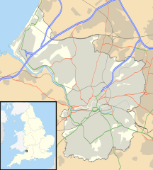
Description: Map of Bristol, UK with the following information shown: Administrative borders Coastline, lakes and rivers Roads and railways Urban areas Equirectangular map projection on WGS 84 datum, with N/S stretched 160% Geographic limits: West: 2.73W East: 2.5W North: 51.55N South: 51.39N
Title: Bristol UK location map
Credit: Ordnance Survey OpenData. Administrative borders and coastline data from Boundary-Line product. All other geographic data from Meridian 2 product. Inset derived from England location map.svg by Spischot.
Author: Nilfanion, created using Ordnance Survey data
Permission: This file is licensed under the Creative Commons Attribution-Share Alike 3.0 Unported license. Attribution: Contains Ordnance Survey data © Crown copyright and database right You are free: to share – to copy, distribute and transmit the work to remix – to adapt the work Under the following conditions: attribution – You must give appropriate credit, provide a link to the license, and indicate if changes were made. You may do so in any reasonable manner, but not in any way that suggests the licensor endorses you or your use. share alike – If you remix, transform, or build upon the material, you must distribute your contributions under the same or compatible license as the original. https://creativecommons.org/licenses/by-sa/3.0 CC BY-SA 3.0 Creative Commons Attribution-Share Alike 3.0 truetrue
Usage Terms: Creative Commons Attribution-Share Alike 3.0
License: CC BY-SA 3.0
License Link: https://creativecommons.org/licenses/by-sa/3.0
Attribution Required?: Yes
Image usage
The following 61 pages link to this image:
- All Saints' Church, Bristol
- Ashton Gate, Bristol
- Avon Gorge
- Avonmouth
- Barton Hill, Bristol
- Berkeley Square, Bristol
- Black Castle, Bristol
- Blaise Hamlet
- Brandon Hill, Bristol
- Brislington East (ward)
- Brislington West (ward)
- Bristol Cathedral
- Broadmead Baptist Church
- Caledonia Place, Bristol
- Catbrain
- Christmas Steps, Bristol
- Church of All Saints, Clifton
- Church of Holy Trinity, Stapleton
- Clifton East (former ward)
- Clifton Suspension Bridge
- Coombe Dingle, Bristol
- Cotham Church
- Counterslip Baptist Church
- Crew's Hole, Bristol
- Cumberland Basin (Bristol)
- Fishponds
- Golden Hill, Bristol
- Greenbank, Bristol
- Holy Trinity Church, Westbury on Trym
- Horseshoe Bend, Shirehampton
- Hotwells
- Kings Weston Hill
- Kingsdown, Bristol
- Knowle West
- Lawrence Weston, Bristol
- Lodge Hill, Bristol
- Manor Hall, Bristol
- Old Market Street drill hall, Bristol
- Portland Square, Bristol
- Pro-Cathedral of the Holy Apostles
- Purdown BT Tower
- Redcliffe, Bristol
- Redcliffe Caves
- Redfield, Bristol
- SS Great Britain
- Sea Mills, Bristol
- Speedwell, Bristol
- Spike Island, Bristol
- St Mary's Church, Henbury
- St Mary Magdalen Nunnery, Bristol
- St Mary Redcliffe
- St Pauls, Bristol
- St Philip's Marsh
- St Philip and St Jacob, Bristol
- St Stephen's Church, Bristol
- St Werburghs
- Stapleton, Bristol
- The Downs, Bristol
- Totterdown, Bristol
- Whitehall, Bristol
- Woodlands Christian Centre
