Itchen Navigation facts for kids
Quick facts for kids Itchen Navigation |
|
|---|---|
|
|
| Specifications | |
| Locks | 15 + 2 single gates |
| Status | Limited restoration |
| History | |
| Original owner | Itchen Navigation Company |
| Date of act | 1665 |
| Date of first use | 1710 |
| Date closed | 1869 |
| Geography | |
| Start point | Winchester |
| End point | Northam Quay |
The Itchen Navigation is a disused canal system in Hampshire, England. It is about 10.4 miles (16.7 km) long. For about 150 years, it was an important way to move goods from Winchester to the sea at Southampton.
People started improving the River Itchen in 1665. But it took a long time. The navigation was finally finished in 1710. It was called a "navigation" because it used parts of the natural river. It also had new channels with locks to go around difficult areas. The water in the navigation comes from the River Itchen. It was a key way to transport farm products and coal between the two cities.
When it was finished, the navigation could handle shallow barges. These boats were about 13 feet (4 meters) wide and 70 feet (21 meters) long. Not many goods were carried on it, though. In 1802, a good year, 18,310 tons of freight were moved. There were never more than six boats using the waterway at one time.
In 1840, the London and Southampton Railway opened. After that, fewer goods were moved on the navigation. It stopped working in 1869. People tried to make it work again, but they were not successful. There were also ideas to connect it to the Basingstoke Canal. This would have created a water route from London to Southampton. But these plans never happened.
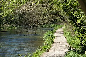
After the Second World War, people became interested in old waterways again. The path next to the canal, called a tow path, is now part of the Itchen Way. This is a long-distance walking path. It's a popular place for walkers. In the 1970s, the Itchen Navigation Preservation Society was formed. But things moved slowly.
In 2005, the Environment Agency and the Hampshire and Isle of Wight Wildlife Trust teamed up. They created the Itchen Navigation Trust. Two years later, they got money from the Heritage Lottery Fund. This money helped start the Itchen Navigation Heritage Trail Project. This project works to protect and explain the remains of the navigation. The route is home to many different plants and animals. Because of this, it is a European Special Area of Conservation and a Site of Special Scientific Interest.
Contents
The River Itchen was important for trade even before Norman times. In 960, a place to unload boats was recorded at Bishopstoke. Stone for Winchester Cathedral was likely brought by water. Winchester was once the capital city of England.
The first improvements to the river were made by Godfrey de Lucy. He was the Bishop of Winchester from 1189 to 1204. He paid for the work himself. So, King John gave him the right to charge tolls for goods on the river. There was a lot of trade in wool and leather. But this trade moved to other cities later. By 1452, the river was in bad shape. A report in 1617 said that many mills blocked the river.
Building the Canal
An Act of Parliament in 1665 allowed the canal to be built. This Act said that certain rivers could be made navigable. People called "undertakers" were chosen to do the work. Local officials, called "commissioners," set the tolls. The undertakers worked very slowly. The navigation was not finished until 1710.
They built locks and new channels. These channels helped boats bypass difficult parts of the river. They also made a towing path for horses. The route was 10.4 miles (16.7 km) long. About 2.75 miles (4.4 km) were new channels. The rest used parts of the river or other streams.
As the original undertakers died, new ones were not chosen. By 1767, one man, Mr. Edward Pyott, owned the navigation. Local people felt he had too much power. They said he refused to carry coal and other goods. This hurt the poor people and those in Winchester. So, they got a second Act of Parliament in 1767. This Act was unusual because Pyott didn't agree to it.
The new Act created a group of commissioners. They were local officials and important people. They could set the prices for tolls. The owner had to transport all goods at these set prices. If there weren't enough boats, they could allow others to provide boat services. They could also order new locks, wharves, and warehouses to be built. Boats had to be able to carry 20 to 30 tons of cargo. The tolls were quite fair. Some merchants leased the river from Pyott for a while. But he eventually took control again.
More locks were added over time. By 1795, there were fifteen locks. Three were made of stone, and twelve had turf sides. There were also two single gates, or half locks. The lowest lock was at Woodmill. Here, the navigation joined the River Itchen estuary, leading to Southampton Water. The main wharves in Southampton were at Northam. This was about 2 miles (3.2 km) below Woodmill lock. Barges would go there with the tide.
The river below Woodmill Lock was tidal. So, the lock was rebuilt in 1829. It had a third set of gates facing downstream. This stopped high tides from flooding the navigation.
After Pyott died, James D'Arcy bought the navigation. He was married to the widow of one of Pyott's sons. There were still debts of £4,666. All these debts were owed to Pyott's family. D'Arcy seemed to lease the tolls to others. Then he took over again in 1794. Around 1802, the navigation carried 18,310 tons of goods. Most of this was coal (10,300 tons). The average yearly income was £3,735. D'Arcy also ran four barges.
There was a chance to link the navigation to the Basingstoke Canal. So, the navigation was valued at £24,000. D'Arcy sold half of it to his agent, George Hollis. Then he sold the other half to him and moved away. Hollis became the sole owner in 1804. He wanted to end the navigation's monopoly. He got an Act of Parliament in 1802. This Act made it an open navigation. Anyone could use it by paying the tolls. The Act set the tolls, so the Commissioners no longer did. Hollis had three years to fix the river, which he did. He then leased it to a group of merchants.
From 1808, some people complained the navigation was in bad condition. They hoped to get water rights for mills. Traffic on the canal went down. Another Act in 1811 allowed Hollis to raise tolls. Eight years later, he held a meeting in Winchester Guildhall. He explained why he needed to raise tolls even more. The meeting asked him to delay his next Bill for a year. In return, they would give him £1,200 for one year's tolls and rent. He would spend £600 on repairs. The remaining £600 was like interest on the navigation's value, which was £12,000. He got his Act of Parliament a year later. This Act raised the tolls. But the Commissioners lowered freight charges at the same time. This made it more profitable for Hollis but less so for the barge owners.
Decline and Closure
Hollis borrowed money to pay for improvements. But income dropped to £1,821 in 1839. This was the last full year before the London and Southampton Railway opened. All the money came from tolls. Independent carriers moved all the goods. Hollis then gave control of the navigation to his family. His son managed it until 1841. Then a banker named W. W. Bulpett took over. In 1847, the Hollis family told him to leave. But he refused. F. W. Hollis eventually got most of the shares from other family members. He started legal action to remove Bulpett.
The railway caused a big drop in income. It went from £1,012 in 1843 to £430 in 1861. Payments to shareholders and lenders stopped in 1850 and 1857. In 1863, Mr. Clarke replaced Bulpett. Clarke used to manage the Andover Canal. But Bulpett returned after winning the legal case against Hollis.
However, Bulpett's return didn't last long. The navigation stopped working in January 1869. That was the last month tolls were collected. Debts of £19,708 were still owed. A plan to buy the waterway in 1871 failed. Another attempt to buy it was made in 1909. Patrick O'Carroll created a company called Itchen Navigation Ltd. But they couldn't figure out who owned the navigation. So, the company never traded.
Proposals for Extensions
During the canal's life, there were several ideas to link it to the Basingstoke Canal. This would create an inland route between London and Southampton. The first idea was in 1788. A survey was done, but nothing else happened.
Later, interest switched back to linking with the Itchen. A meeting was held in Southampton in 1792. This idea became part of a bigger plan to link Bristol to Salisbury and London. Most of this bigger plan failed. But the Itchen to Basingstoke link was still considered in 1796. It was called the London and Southampton Ports Junction Canal. Two routes were surveyed.
The main goal was to create a safe route between London and Southampton. This was important because of the war with France. Shipping along the coast was risky. But prices were rising. Other canal projects were also having problems. So, the plan was put on hold until 1807.
In 1807, the previous plan got more attention. It was now called the Portsmouth, Southampton and London Junction Canal. From Winchester, it would go through Alresford, Alton, and Farnham. It would then join either the Basingstoke Canal or the Wey and Godalming Navigations. To build it faster, they suggested a 2-mile (3.2 km) tunnel could be replaced by a 7-mile (11.3 km) railway. The tunnel could be built later.
People discussed very different costs for the project. The first estimate was £140,000 with the railway. It was £200,000 with the tunnel. Opponents said the cost would be closer to £700,000. John Rennie estimated the tunnel line would cost £440,790 in 1809. Opponents argued the real goal was to get more water for the Basingstoke Canal. Or to make money for George Hollis, the owner of the Itchen Navigation. Many people were interested in the plan. But with opposition and higher cost estimates, the project was dropped.
One last idea came up in 1902. It involved using electric power to pull barges. The plan was for a 64-mile (103 km) canal from the River Thames to Winchester. Barges carrying 250 tons would be pulled by engines. These engines would get power from overhead wires. This system was used in France, but nothing came of this idea in England.
What Happened After Closure
Even though the navigation closed in 1869, Woodmill Lock was still used. It allowed barges to reach Gaters Mill at West End. This mill was on the main river channel. Most of the bridges over the navigation belonged to the navigation company. Their condition got worse. In 1879, the manager, Mr. Bulpett, was told to repair Shawford Bridge. He replied that the navigation had no money. He would help transfer responsibility to the county council. The council did temporary repairs. Bulpett agreed the navigation would pay for proper repairs if it ever reopened. The next year, Bulpett was threatened with legal action over Bishopstoke Bridge. But it was agreed the navigation had no income. So, the county had to maintain the bridges.
In 1911, a Mr. Bowker tried to change the towpath's route. But this was stopped. The change was allowed in 1914. Later, two more changes were made to the towpath. No maintenance was done on the waterway until Catchment Boards were formed. So, the Hampshire Catchment Board became responsible for the waterway as a drainage channel in 1942. Some work was done to keep the waterway working. These jobs later went to the Southern Water Authority, and now to the Environment Agency.
In the 1960s, people started to see the towpath as a place for fun. In 1966, the Deputy County Clerk walked the towpath with members of the Ramblers Association. He decided to ask local councils to maintain the towpath. These councils were Southampton, Eastleigh, and Winchester. The Southern Water Authority built weirs at most locks. This helped bring water levels back up in many parts of the navigation. The navigation's powers are still in Acts of Parliament from 1665, 1767, 1795, 1802, 1811, and 1820. None of these have been cancelled.
Restoration Efforts
New ways of transport, like roads and railways, made the navigation less useful. Some parts of the system were drained. Others became overgrown with plants. It became harder to tell the difference between the canal and the river. But you can still see parts of the original locks.
The building of the M3 motorway threatened the remains of the navigation. This made local groups take action in 1975. They suggested the waterway could be restored. These groups worked together. They formed the Itchen Navigation Preservation Society.
Not much happened for a while. But in 2005, the Environment Agency and the Hampshire and Isle of Wight Wildlife Trust helped form the Itchen Navigation Trust. They decided to protect the remains, not fully restore it for boats. They asked the Heritage Lottery Fund for money. This project was called The Itchen Navigation Heritage Trail Project. They got the money, and a five-year restoration project began.
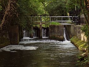
Work has included making openings wider at College Mead Lock. They also built a bypass channel around Malm Lock. This helps fish and other water animals move. The navigation is now a European Special Area of Conservation. It is also a Site of Special Scientific Interest. This is because of the many different kinds of wildlife found there. Its history is also important.
The canal officially started at Blackbridge Wharf in Winchester. This is just south of Wharf Mill. Wharf Mill is an old water mill from 1885. College Walk bridge, from the 1700s, crosses the river here. Below the bridge, the channel splits. The river flows west, and the navigation flows east. Blackbridge Wharf was reached by Wharf Bridge. This is the oldest bridge over the navigation, from the 1760s. Nearby, the manager's house, a warehouse, and stables still stand.
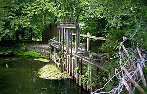
The navigation flows past Winchester College. The college uses the waterway for rowing practice. Their rowing eights use a turning basin. This is just above the remains of St Catherine's Hill Lock. This lock now has a modern sluice. A water-powered sawmill was once here.
It passes St Catherine's Hill, an ancient hill fort. It also passes some plague pits. These were graves for victims of the 1666 plague. Then it goes under the old Didcot, Newbury and Southampton Railway. This railway line was used from 1891 to 1966. The navigation then goes through a culvert under junction 11 of the M3 motorway. This was once a bridge for a road from Winchester to Botley. It was replaced by a concrete tunnel in the 1930s. When the M3 motorway was built, the tunnel became a culvert. The building of the M3 across Twyford Down was debated. But removing the old Winchester Bypass has brought peace back to the valley.
The canal is on the western edge of Twyford Down. It continues through Twyford Lane End Lock. Then it briefly joins the river again. About 220 yards (200 meters) south are Tumbling Bay Hatches. These used to control water levels in the water meadows. A modern sluice was put in here in 1971. It controls water flow to the Twyford Drain. This is the main channel east of the navigation. Modern maps call this drain the River Itchen.
A leat (a channel for water) was made here when the canal was built. It provided water for the Twyford Mead water meadows. Farmers used these water meadows until about 1930. This was a lot of work. But controlled flooding with silt from the water helped the land. It could produce two crops of hay each year. It also provided grazing for sheep and cattle. Sometimes, demonstrations show how these meadows were flooded.
South of Twyford
The next lock is Compton Lock. It's also called Compton Place Lock or Twyford Lock. It's the only lock built on a river section. The extra water flow here might explain why there's a circular water area between the gates. Just above Shawford Bridge, the river and navigation split. Shawford Mill is just below the split. The mill building is still there. The bridge is new. The towpath crosses to the western bank here. Just south is a weir at Shawford Single Gates. This probably made sure the mill had enough water. The village of Twyford is to the east. The Twyford Drain splits. The western channel rejoins the river. The eastern channel continues as a relief channel. There are two more locks on the navigation: Malm Lock and College Mead Lock. Then the navigation rejoins the river. Near the junction is the intake for Otterbourne Water Treatment Works.
After about 450 yards (410 meters), the river goes straight. Another channel begins, turning sharply right. Soon, you reach the remains of Brambridge Lock. It includes an old eel trap. A drawing from 1880 clearly showed the gate design. The gates had vents near the top to let out extra water. Below it were Brambridge Single Gates. These probably kept water levels for a mill. Some brickwork remains. There were hatches to let water return to the river. One is now a modern sluice. The navigation runs along a 5-foot (1.5 meter) high bank for about 450 yards (410 meters). Then it reaches Allbrook Lock. This lock was moved in 1838 when the railway was built. It was repaired in 1944. It has a brick chamber, unlike other turf-sided locks. A bridge carries the B3335 road over the end of the lock. It has been widened. At the start of the lock is a gauging station. The Environment Agency measures water flow and level here.
The navigation turns west. It goes under the railway line. Then it loops back to the east side of the railway. It runs along the north edge of some railway sidings. These are part of Eastleigh Works. It then reaches Withymead Lock. This lock was special. It had a bypass channel for extra water. Other locks used vents in their gates. Just below the lock, the navigation rejoins the river. At Barton Bay, the Barton River leaves the navigation. It flows west of the channel. A horse bridge carried the towpath over the river. This river used to supply water to Barton Peveril Mill.
The next channel began a little further south. Bishopstoke or Stoke Lock was at its start. There are four bridges on Bishopstoke Road. They cross the Barton River, the navigation, the river channel, and the Shears Mill tailrace. The mill was a large building. It was torn down in the 1920s. Before it was demolished, two water turbines were installed. They were kept, hoping to generate DC power for the village. Some groups are looking into restoring the turbines to make electricity.
The next lock is Conegar Lock. It was also called Stoke Conegar or Coneygear Lock. Just above it are hatches that supplied water to nearby water meadows. They were built of stone. They are the best-preserved original hatches. There is no modern sluice at Conegar Lock. The change in water level has created fast-flowing rapids. These have cut back the channel above the lock. A little further south, at Fish House Bay, the navigation crossed the Barton River. A footbridge on the east bank carried the towpath over the Barton River. But the navigation below this point is dry. A vegetable garden now sits where it used to be.
Towards Southampton
This next section is the least preserved part of the navigation. It went east of Eastleigh Sewage Treatment Works. Then it was crossed by the railway from Eastleigh to Gosport. Two parts have been filled in. There is a footpath, but it follows the general route, not the exact towpath. The railway bridge was built in 1841. It had two arches. One for the navigation, and one for landowners. It was replaced in 1979. Part of it was replaced by a bank. But a large concrete tube was put in. It was big enough for the navigation if it were ever reopened. The next lock is Lock House Lock, also called Chickenhall Lock. There used to be a lock-keeper's house here, but it's gone.
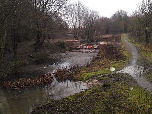
The navigation then passes east of Southampton Airport. Further east is the river channel and the Itchen Valley Country Park. Between the two waterways is Decoy Covert. This small wood had a duck decoy. The nearby lock is Decoy Pond Lock. Below it is Sandy Lock. There isn't much water in this section. Its main water supply has been cut off. Springs provide some water. But the channel is sometimes blocked where bridges have been replaced by earth banks. Sandy Lock has a lot of barbed wire in it. It might have been dumped when the airport's wartime defenses were removed. The last lock in this section is Mans Bridge Lock. This is shortly after the modern M27 motorway crossing. The channel then rejoins the main river. It passes under the A27 road. The current bridge was built in 1975. It replaced a temporary bridge from the Second World War. Just below it is an old stone footbridge from the early 1800s. It has been restored.
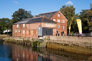
The final lock was the sea lock at Woodmill. You can't see any remains of it now. But its location is still visible. The mill was to the west. It's now part of the Woodmill Outdoor Activities Centre. The main building is a canoe shop. The center started in the late 1960s. It is a registered charity. The navigation officially continued downstream to a wharf at Northam. There was never a towpath on this tidal part. But the Itchen Way footpath follows the eastern bank of the river. Nothing remains of Northam Quay. The bridge there has been rebuilt twice since 1796. The last time was in 1954. The river also passes under the A3035 Cobden Bridge. And a railway bridge built in 1866. This railway bridge still looks mostly original. It is now part of the West Coastway Line.
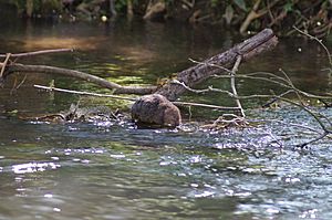
The Itchen Navigation is home to many different plants and animals. The 5-year restoration project has helped by regularly checking and reporting on them. Yearly reports are made on birds, bats, otters, water voles, butterflies, damselflies, and dragonflies. Other reports are made sometimes. The Environment Agency also creates reports on fish.
As part of the project, some engineering work has been done. This includes making the banks stronger. Trees have been cut back to let in more sunlight. This helps plants grow along the edges of the water. For the water vole survey, they focused on areas where work was done. The butterfly, damselfly, and dragonfly survey covered the whole navigation.
Vegetated berms have been placed along the banks. These are raised areas with plants. The project tried not to install revetments (walls to prevent erosion). Vertical walls stop wildlife from reaching the banks. But where a revetment is needed, it's built of oak. A berm is placed in front of it to make the edge softer.
Many people use the towpath to walk their dogs. So, dog dips have been installed at Allbrook and Shawford. These make it easy for dogs to get into the water. Owners are asked to let dogs swim only in these spots. This helps protect the banks in other places.
The water vole surveys follow the best practices. They also record signs of otters, brown rats, and American minks. While working, surveyors also count sightings of kingfishers, herons, moorhens, and coots. A bat survey in 2008 found six of the 17 bat species common in the UK. These included common pipistrelle, soprano pipistrelle, Daubenton's, noctule, serotine, and brown long-eared bats.
Eel surveys have been done every two years since 2009. The 2017 survey showed a small increase in smaller eels. But overall, the eel population is still at risk. It has dropped by about 60 percent since 2009. However, there was a small increase since 2015. The sizes of the eels were more varied. This suggests the population might be getting better. Most eels are found in the lower river, below Shawford. The surveys also record other fish caught. These include brown trout, Atlantic salmon, and grayling in good numbers. Smaller amounts of gudgeon, roach, perch, and pike are also found. Brown trout live in most of the river. Other species are mainly found in the lower river.
Points of Interest
| Point | Coordinates (Links to map resources) |
OS Grid Ref | Notes |
|---|---|---|---|
| Blackbridge Wharf | 51°03′22″N 1°18′33″W / 51.0561°N 1.3091°W | SU485287 | Start of navigation |
| St Catherines Lock | 51°02′36″N 1°18′57″W / 51.0432°N 1.3157°W | SU480273 | modern sluice |
| M3 motorway culvert | 51°02′16″N 1°19′04″W / 51.0377°N 1.3179°W | SU479267 | tunnel under bypass from 1930s |
| Twyford Lane End Lock | 51°02′11″N 1°19′03″W / 51.0363°N 1.3175°W | SU479265 | modern weir |
| Compton Lock | 51°01′38″N 1°19′20″W / 51.0272°N 1.3222°W | SU476255 | modern weir |
| Shawford Single Gates | 51°01′19″N 1°19′35″W / 51.0220°N 1.3263°W | SU473249 | |
| Malm Lock | 51°00′41″N 1°19′48″W / 51.0114°N 1.3300°W | SU471237 | modern weir |
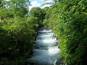
| College Mead Lock | 51°00′28″N 1°19′53″W / 51.0078°N 1.3313°W | SU470233 | cascading weir |
| Brambridge Lock | 51°00′03″N 1°20′03″W / 51.0009°N 1.3342°W | SU468226 | modern sluice |
| Brambridge Single Gates | 50°59′46″N 1°20′17″W / 50.9960°N 1.3381°W | SU465220 | |
| Allbrook Lock | 50°59′15″N 1°20′39″W / 50.9875°N 1.3442°W | SU461211 | Rebuilt 1838, 1944. Stepped weir |
| Withymead Lock | 50°58′47″N 1°20′40″W / 50.9797°N 1.3445°W | SU461202 | built with bypass stream |
| Stoke Lock | 50°58′18″N 1°20′26″W / 50.9716°N 1.3405°W | SU464193 | modern sluice |
| Coneger Lock | 50°58′02″N 1°20′20″W / 50.9673°N 1.3389°W | SU465188 | |
| Lock House Lock | 50°57′17″N 1°20′34″W / 50.9546°N 1.3429°W | SU462174 | |
| Decoy Pond Lock | 50°56′57″N 1°21′11″W / 50.9493°N 1.3530°W | SU455168 | |
| Sandy Lock | 50°56′45″N 1°21′16″W / 50.9457°N 1.3544°W | SU454164 | |
| M27 motorway crossing | 50°56′27″N 1°21′39″W / 50.9409°N 1.3607°W | SU450159 | |
| Mansbridge Lock | 50°56′25″N 1°21′42″W / 50.9403°N 1.3616°W | SU449158 | modern weir |
| A27 Mans Bridge | 50°56′15″N 1°21′53″W / 50.9376°N 1.3648°W | SU447155 | |
| Woodmill Lock | 50°56′05″N 1°22′35″W / 50.9348°N 1.3765°W | SU439152 | Destroyed |
| Northam Bridge | 50°54′53″N 1°23′08″W / 50.9147°N 1.3856°W | SU432129 | Wharf and end of Navigation |
 | Ernest Everett Just |
 | Mary Jackson |
 | Emmett Chappelle |
 | Marie Maynard Daly |


