Kota Kinabalu facts for kids
Quick facts for kids
Kota Kinabalu
|
|||
|---|---|---|---|
|
State capital city and district capital
|
|||
| City of Kota Kinabalu Bandaraya Kota Kinabalu |
|||
| Other transcription(s) | |||
| • Jawi | کوتا کينابالو | ||
| • Mandarin | 亚庇 (Simplified Chinese) 亞庇 (Traditional Chinese) Yà bì (Hanyu Pinyin) |
||
| • Hakka | â-pi (Pha̍k-fa-sṳ) | ||
| • Kadazandusun | Dondoung | ||
| • Bajau | Deasoka | ||
|
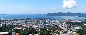
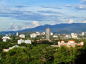
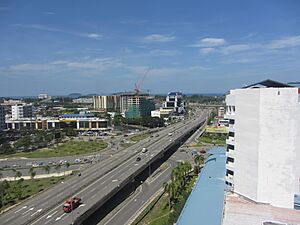
Kota Kinabalu Skyline.
Wawasan Intersection.
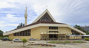
SICC
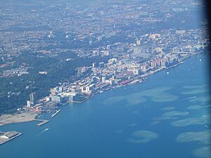
Kota Kinabalu Coastal Highway.
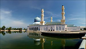
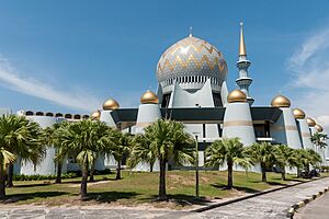
The Kota Kinabalu City Mosque.
The Wisma Tun Fuad Stephens building.
Marlin and I♥️KK Statue.
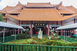
Gaya Street during Chinese New Year.
|
|||
|
|||
| Nickname(s):
KK, Nature Resort City
|
|||
| Country | |||
| State | |||
| Division | West Coast | ||
| District | Kota Kinabalu | ||
| Bruneian Empire | 15th–18th century | ||
| Settled by BNBC | 1882 | ||
| Declared capital of North Borneo | 1946 | ||
| Municipality status | 1 January 1979 | ||
| City status | 2 February 2000 | ||
| Government | |||
| • Type | City council | ||
| • Body | Kota Kinabalu City Hall | ||
| Area | |||
| • State capital city and district capital | 351 km2 (136 sq mi) | ||
| • Urban | 816 km2 (315 sq mi) | ||
| • Metro | 3,277 km2 (1,265 sq mi) | ||
| Elevation | 5 m (16 ft) | ||
| Population
(2024)
|
|||
| • State capital city and district capital | 601,000 | ||
| • Density | 1,712/km2 (4,419/sq mi) | ||
| • Metro | 731,406 | ||
| • Demonym | Orang KK / K.K-ites / K.K-ians | ||
| Time zone | UTC+8 (MST) | ||
| Postal code |
88xxx; 89xxx
|
||
| Area code(s) | 088, 087 | ||
| Vehicle registration | EJ, EJA, EJB (1967–1980) SA/SAA/SAB/SAC (1980–2018) SY (2018-2023) SJ (2023–present) |
||
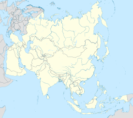
Kota Kinabalu (Malaysian: [ˈkota kinaˈbalu]), often called KK, is the capital city of Sabah, Malaysia. It's also the main city for the Kota Kinabalu District and the West Coast Division of Sabah. This city sits on the northwest coast of Borneo, facing the South China Sea. To its west is the Tunku Abdul Rahman National Park. To its east is Mount Kinabalu, which gave the city its name.
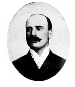
In the 15th century, the Kota Kinabalu area was part of the Bruneian Empire. Local people, the Kadazandusuns, called it Dondoung. In the 1800s, the British North Borneo Company (BNBC) started a settlement near Gaya Island. But a local leader named Mat Salleh destroyed it in 1897. In 1899, a new spot was found across from Gaya Island. This place was called "Api-api" before it was renamed "Jesselton" after Sir Charles Jessel from BNBC.
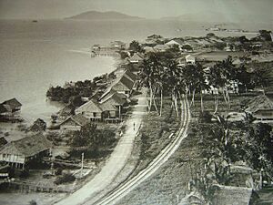
Jesselton became a big trading port and was connected to the North Borneo Railway. During World War II, Jesselton was heavily damaged. The Japanese took over, leading to local uprisings like the Jesselton Revolt. After the war, the British couldn't afford to rebuild, so they gave control to the British Crown. Jesselton became the new capital of North Borneo in 1946 and was rebuilt. When Malaysia was formed in 1963, North Borneo became Sabah. In 1967, Jesselton was renamed Kota Kinabalu. "Kota" means "City" in Malay. Kota Kinabalu officially became a city in 2000.
Kota Kinabalu is a popular place for tourists. It's a main entry point for people visiting Sabah and Borneo. Kinabalu Park is about 90 kilometers away. There are many other fun places to visit in and around the city. Kota Kinabalu is also a big business and industry hub in East Malaysia. These reasons make Kota Kinabalu one of Malaysia's fastest-growing cities.
Contents
- What's in a Name? Kota Kinabalu's Meaning
- A Brief History of Kota Kinabalu
- Kota Kinabalu: The Capital City
- Geography and Climate of Kota Kinabalu
- Who Lives in Kota Kinabalu?
- Kota Kinabalu's Economy
- Getting Around Kota Kinabalu
- Other Services in Kota Kinabalu
- Culture and Fun in Kota Kinabalu
- International Connections
- Famous People from Kota Kinabalu
- See also
What's in a Name? Kota Kinabalu's Meaning
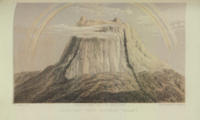
Kota Kinabalu gets its name from Mount Kinabalu. This mountain is about 50 kilometers east of the city. The name Kinabalu comes from Aki Nabalu. This means "revered place of the dead" in the Dusun language. Aki means "ancestors" or "grandfather". Nabalu is the mountain's name. Some also say it comes from Ki Nabalu, where Ki means "have" or "exist", and Nabalu means "spirit of the dead".
The word kota is a Malay word. It comes from the Sanskrit word "koṭṭa". This means fort, fortress, castle, or a city surrounded by walls. You can find "Kota" in other Malaysian city names too, like Kota Bharu and Kota Tinggi. So, Kota Kinabalu means "City of Kinabalu".
Older Names for Kota Kinabalu
Before it was Kota Kinabalu or Jesselton, the city had other names. The most common old name was Api-Api, or just Api. This is a Malay word for 'Fire'. Some believe it was named after a seaside tree with the same name. Others think it was named after a nearby river called Sungai Api-Api. In Chinese, the city is still known as 'Api'. This is the Hakka way to say 亚庇.
Another old name was Deasoka. This means "below the coconut tree" in the Bajau language. Locals used this name for a village full of coconut trees in the city's south. Singgah Mata was another name. It means "pleasing to the eye". Fishermen from Gaya Island used this name for the beautiful land where downtown Kota Kinabalu is today. You can still see these names on streets and buildings in the city, like Lintasan Deasoka and Api-Api Centre.
A Brief History of Kota Kinabalu

Since the 15th century, the area of Kota Kinabalu was part of the Bruneian Empire. In the late 1800s, the British North Borneo Company (BNBC) started setting up settlements. In 1882, BNBC built a small settlement on Gaya Island. This area was already home to the Bajau people. But in 1897, a local chief named Mat Salleh burned and destroyed it.
After this, BNBC decided to move the settlement. They chose a spot on the mainland called Gantian Bay in 1898. However, this place wasn't suitable. In July 1899, a land official found a better spot. This new place was a fishing village called Api-Api. It was chosen because it was close to the North Borneo Railway and had a good natural harbor.
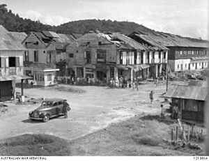
By the end of 1899, construction began on shops, a pier, and government buildings. This new center was named Jesselton after Sir Charles Jessel. Jesselton became a major trading hub for goods like rubber and honey. The North Borneo Railway helped transport these goods to the Jesselton harbor.
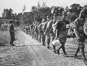
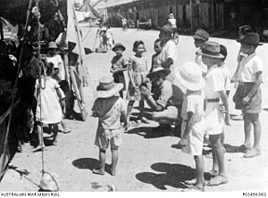
During World War II, Jesselton was badly damaged. The British burned parts of it when the Japanese army advanced. After the Japanese took over, the town was renamed Api. Local people rebelled against the Japanese. One big rebellion happened on October 10, 1943, by a group called Kinabalu Guerrillas. The Japanese stopped the rebellion and executed its leader, Albert Kwok.
Later in the war, Allied forces bombed the town for over six months in 1945. This left only three buildings standing. The war in North Borneo ended when the Japanese army surrendered on September 10, 1945.
After the war, the British North Borneo Company was almost broke. They couldn't afford to rebuild Jesselton. So, they gave control of North Borneo to the British Crown in 1946. The British decided to rebuild Jesselton as the capital. When North Borneo joined Malaysia in 1963, it became Sabah, and Jesselton remained its capital. On December 22, 1967, Jesselton was renamed Kota Kinabalu. The city officially gained city status on February 2, 2000.
Kota Kinabalu: The Capital City
As the capital of Sabah, Kota Kinabalu is very important for the state's politics and economy. It's where the state government offices are located. Most of the Malaysian federal government offices are also here. The Sabah State Legislative Assembly, where laws are made, is nearby. The city has several Members of Parliament (MPs) representing its areas. These MPs work in the national parliament.
How the City is Governed
The city is managed by the Kota Kinabalu City Hall. The current mayor is Sabin Samitah. Kota Kinabalu became a city on February 2, 2000. Before that, it was managed by the Kota Kinabalu Municipal Council.
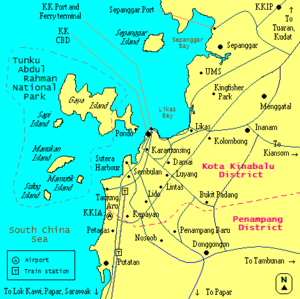
The city covers an area of 351 square kilometers. It's the smallest but most populated district in Sabah. It includes areas like Tanjung Aru in the south and Telipok in the north. The city's urban area also stretches into the Penampang and Putatan districts. The combined area of Kota Kinabalu, Penampang, and Putatan is called Greater Kota Kinabalu.
Sometimes, "Kota Kinabalu" refers only to the city center near the sea. Other times, it means the larger metropolitan area. This includes nearby towns like Papar, Kinarut, Tuaran, and Tamparuli.
Geography and Climate of Kota Kinabalu
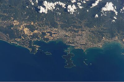
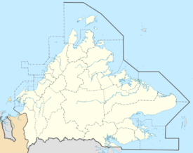
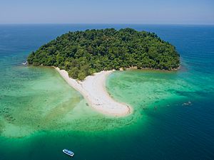
Kota Kinabalu is on Sabah's west coast. It sits on a narrow flat area. To the east are the Crocker Range mountains, and to the west is the South China Sea. There are six islands off the city's coast. Gaya Island is the largest, where the first British settlement was. The other islands are Sapi, Manukan Island, Sulug, Mamutik, and Sepanggar Island.
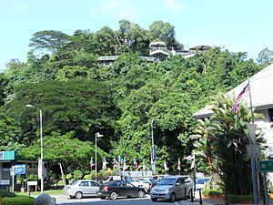
Flat land is limited in the city center. Buildings have height limits because the airport is only 7 kilometers away. Most of the city center is built on land that was once part of the sea. Some hills in the city are still covered with tropical rainforest. Signal Hill is one of these, which keeps the city center close to the shore.
In the Likas Bay area, a large mangrove forest was almost lost. In 1996, the government protected 24 acres of it. This forest is now the Kota Kinabalu City Bird Sanctuary. It became a State Cultural Heritage Site in 1998.
The five islands (Gaya, Sapi, Manukan, Sulug, Mamutik) and their waters are part of the Tunku Abdul Rahman National Park. This park is named after Malaysia's first Prime Minister. It's a popular place for tourists and locals.
The city center includes areas like Karamunsing and Gaya Street. Outside the city, there are suburbs like Tanjung Aru and Luyang. The city is growing, and its urban area now reaches towns like Inanam, Menggatal, and Sepanggar. Kota Kinabalu is about 1624 kilometers from Kuala Lumpur in Peninsular Malaysia.
Kota Kinabalu's Weather
Kota Kinabalu has a tropical monsoon climate. This means it has high temperatures and lots of rain and humidity all year. Two main monsoons affect the weather: the Northeast Monsoon (November to March) and the Southwest Monsoon (May to September). There are also two short periods between monsoons in April-May and September-October.
From 1995 to 2004, Kota Kinabalu's average temperature was between 26°C and 28°C. April and May are usually the hottest months, and January is the coolest. The city gets about 2,400 millimeters of rain each year. February and March are the driest months, while October gets the most rain.
Who Lives in Kota Kinabalu?
People from Kota Kinabalu are often called "orang KK". Orang means "person" or "people" in Malay. People from Sabah are called Sabahans.
Ethnic Groups and Religions
According to the 2010 census, Kota Kinabalu had 452,058 people. The city has many different ethnic groups. The largest group is non-Malaysian citizens (110,556 people). After that are Chinese (93,429), Bajau/Suluk (72,931), and Kadazan-Dusun (69,993).
Most Chinese people are Hakkas. They live mainly in Luyang, Likas, and Damai. There are also many Cantonese-speaking people and smaller groups of Hokkien and Fuzhounese speakers. Most Fuzhounese came from Sarawak. The Penampang district is mostly Kadazans. Bajaus and Dusuns live in Likas, Sembulan, and other areas.
The Brunei Malays and Bajau/Suluks are Muslims. Kadazan-Dusuns, Muruts, and others often practice Christianity or Animism. Chinese people are mostly Buddhists, Taoists, or Christians. There are many churches in the city. A small number of Hindus, Sikhs, and Animists also live here. The 2020 census showed the population increased to 500,421.
There are many Filipino people in the city. Some arrived in the 15th century during Spanish rule. More came in the 1970s due to problems in the Philippines. Many of the earlier migrants are now Malaysian citizens. However, some Filipinos live in the city without proper documents. Most Filipino migrants are Chavacano-speaking Tausūgs from the southern Philippines. The city also has immigrants from Indonesia.
There are also small groups of Indians, Pakistanis, and Eurasians. Recently, more people from other countries have moved to Kota Kinabalu. Many come from China, South Korea, Japan, Australia, and Europe. Marriages between different ethnic groups are common, especially between Kadazan and Chinese people. Their children are called Sino-Kadazans or "Sinos".
Languages Spoken in KK
People in Kota Kinabalu mainly speak Malay. They use a special Sabahan way of speaking. Since almost half of the residents are Chinese, Chinese languages are also widely spoken. Among the Chinese, Hakka and Mandarin are most common. Many Chinese can also speak Cantonese.
Almost everyone can speak English, especially young people. However, some find it hard to speak English fluently because it's not used much for daily conversations in Sabah. The number of Kadazan-Dusun speakers has gone down, especially in cities like Kota Kinabalu. But efforts are being made to help people use the language more. Kadazan is considered an endangered language.
Kota Kinabalu's Economy
Kota Kinabalu is not just the capital; it's also Sabah's main center for business and industry. The economy used to be mostly about making things. But now, it's shifting more towards services, especially with the growth of tourism. Many banks and insurance companies have their main offices or branches here. The Chinese community has also helped KK's economy grow since they arrived in the late 1800s.
Many factories and manufacturing companies have plants here. These are in industrial areas like Likas and Kolombong. The Kota Kinabalu Industrial Park (KKIP) is being built in Sepanggar. This huge project aims to boost the city's industry and business. It will make Kota Kinabalu a major growth center in East Malaysia.
Getting Around Kota Kinabalu
Land Transportation
The roads inside the city are state roads. Most major roads have two lanes in each direction. The Lintas-Tuaran Bypass Road acts like a ring road. It connects different parts of the city and its suburbs. There are no freeways in Kota Kinabalu or Sabah.
Highways connect Kota Kinabalu to other towns in Sabah. These are federal roads. Some routes include:
- Kota Kinabalu – Tuaran – Kudat
- Kota Kinabalu – Papar – Sindumin (part of the Pan Borneo Highway)
- Kota Kinabalu – Tambunan – Tawau (completing the Southern route)
- Kota Kinabalu – Ranau – Tawau (Northern route, part of the Pan Borneo Highway)
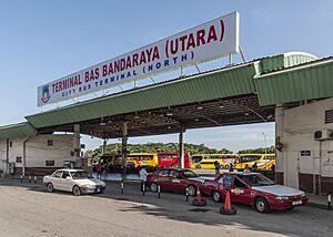
Buses and minibuses operate regularly in the city. There are two main bus terminals in the city center. One is for city routes, and the KK Sentral terminal is for trips to towns south of the city. The North Kota Kinabalu Bus Terminal in Inanam serves buses going north and northeast. Taxis are also available.
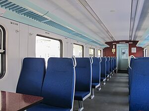
A railway system, once called the North Borneo Railway, started in 1896. It was built to move goods from the interior to Jesselton (now Kota Kinabalu). Today, this railway is called the Western Sabah Railway Line. It connects Tanjung Aru in Kota Kinabalu to Tenom. It's the only railway system in East Malaysia. It carries commuters, travelers, and cargo. There's also a special North Borneo Railway tour with an old steam train for tourists. In 2016, the Tanjung Aru railway station moved to Aeropod.
Air Travel
Kota Kinabalu International Airport (KKIA) is a major airport. It's a main hub for Malaysia Airlines and a secondary hub for AirAsia and MASwings. It's the second busiest airport in Malaysia. KKIA has flights within Sabah and Malaysia, and international flights to cities in Asia and Perth, Australia.
Sea Travel
Kota Kinabalu has two ports: Kota Kinabalu Port and Sepanggar Bay Container Port (SBCP). Kota Kinabalu Port handles general cargo. SBCP is a naval base for the Royal Malaysian Navy and handles container cargo. In 2004, Kota Kinabalu Port handled a lot of cargo. It handles the most containers in Sabah.
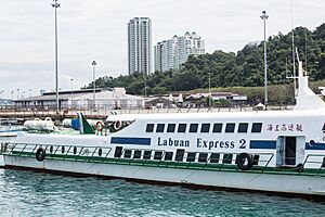
The Kota Kinabalu Ferry Service operates from Jesselton Point. It offers ferry and motorboat services to nearby islands. There are also regular ferry services to Labuan.
Other Services in Kota Kinabalu
Courts and Police
The Kota Kinabalu Court Complex has different courts, including High Courts and Magistrates' Courts. There's also a Syariah Court for Islamic law.
The Sabah Police Headquarters is in Kepayan. There are also two district police headquarters in Kota Kinabalu and Penampang. Other police stations are at KKIA, Tanjung Aru, and Putatan. Smaller police posts are in Luyang and Likas. The city's traffic police are near Gaya Street, and the marine police are near the ferry terminal.
The Kota Kinabalu Central Prison is in Kepayan.
Healthcare Services
Kota Kinabalu has three public hospitals and several public health clinics. Queen Elizabeth General Hospital is the largest public hospital in Sabah. It has 589 beds and is a very important healthcare center. Queen Elizabeth Hospital II is mainly for heart care. The Hospital Wanita dan Kanak-kanak (Sabah Women and Children Hospital) is for children and women. Hospital Mesra Bukit Padang provides mental health services.
There are also several private hospitals, like KPJ Specialist Hospital and Gleneagles Kota Kinabalu.
Education in Kota Kinabalu
There are many government schools in and around the city. Some well-known secondary schools include Sekolah Menengah Sains Sabah and KK High School.
There are also private schools like Sabah Tshung Tsin Secondary School. Classes usually start at 7 am and end around 1 pm. Children start primary school at age 7 for six years. Then, they go to lower secondary school for three years. After that, they can choose between science or arts streams in upper secondary.
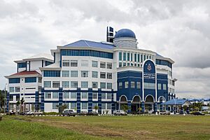
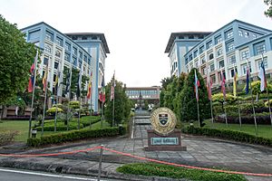
Universiti Malaysia Sabah (UMS), founded in 1994, is the biggest university in Sabah. Its main campus is on a hill facing the South China Sea. The oldest university in Sabah is Universiti Teknologi MARA Sabah.
There are also private colleges and a polytechnic. Many students go overseas for higher education.
Libraries for Learning
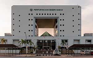
The Sabah State Library Headquarters is on Tasik Road. Its main branch in Tanjung Aru is between Perdana Park and Plaza Tanjung Aru. Other public libraries include the Kota Kinabalu City Library and Penampang Branch Library. Schools and universities also have their own libraries.
Free Wi-Fi Zones
Since September 23, 2017, Kota Kinabalu has offered free public Wi-Fi. This service uses high-speed fiber optic cables. Users get 10GB of data daily with no time limit. The first phase covered areas from Tun Fuad Stephens Road to Pantai Road and other central spots.
Culture and Fun in Kota Kinabalu
Attractions and Recreation Spots
Cultural Places to Visit
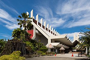
Kota Kinabalu has many cultural sites. The Sabah State Museum is the main museum in Sabah. Near it are the Science and Technology Centre and the Sabah Art Gallery. The Hongkod Koisaan building in Penampang is home to the Kadazan-Dusun Cultural Association (KDCA). It hosts the yearly Kaamatan or Harvest Festival in May. The Monsopiad Cultural Village shows cultural performances about the Kadazan-Dusun people. It's named after a famous warrior, Monsopiad.
Historical Landmarks
Merdeka Square is where Sabah's independence and the formation of Malaysia were declared. This happened on September 16, 1963, by Sabah's first Chief Minister, Tun Fuad Stephens. Today, the square hosts City Day and Merdeka Day celebrations.
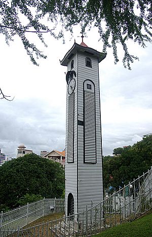
The Atkinson Clock Tower was built in 1905. It was a memorial for Francis George Atkinson. It was also used to guide ships. It's one of only three buildings that survived World War II. The Petagas War Memorial remembers those who died fighting the Japanese during World War II. The Double Six Monument in Sembulan remembers Sabah's first Chief Minister and six other ministers who died in a plane crash on June 6, 1976.
Leisure and Nature Areas
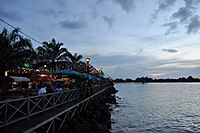
There are many fun places and nature spots in Kota Kinabalu. Anjung Samudra (KK Waterfront) is a lively area with restaurants, cafes, and pubs. The North Borneo Railway offers a scenic tour of the countryside. The journey ends in Tenom. Sutera Harbour Golf & Country Club has a golf course, a marina, and hotels.
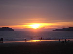
Tanjung Aru beach is about 10 kilometers from the city center. It's named after the casuarina trees (Aru trees) that grow there. The beach is 3 kilometers long. It's famous for its beautiful sunsets. Near Tanjung Aru are the Kinabalu Golf Club and Prince Philip Botanical Park.
The Kota Kinabalu City Bird Sanctuary is in Likas Bay. It's a protected area of mangrove forest. It helps people learn about wetlands. The Sabah Zoological and Botanical Park (Lok Kawi Wildlife Park) is about 20 kilometers south of the city. It's the first zoo in Sabah and one of the largest in Malaysia.
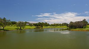
Tun Fuad Stephens Park is used for jogging and hiking. It has forests and a man-made lake. Tunku Abdul Rahman Park is a State Park with five islands: Sapi, Mamutik, Manukan, Sulug, and Gaya. It's great for snorkelling. You can reach the park by boat from the city ferry terminal in 10-15 minutes. Babagon River and Kiansom Falls are popular for picnics.
Outside the city, Crocker Range Park is good for jungle trekking and camping. Kota Kinabalu is also the gateway to Kinabalu Park. This park is a two-hour drive away. Mount Kinabalu, the highest peak in Malaysia, is located there. The Rafflesia Forest Reserve is also nearby. The Tuaran Crocodile Farm, about 30 kilometers north, has around 1400 crocodiles.
Other Interesting Sights
The Tun Mustapha Tower is a 30-story glass building. It's one of only three buildings in the world built using high-tensile steel rods.
Other sights include the stilt villages in areas like Sembulan and Tanjung Aru. These houses are built over shallow coastal waters. They are home to the Bajau and Suluk people.
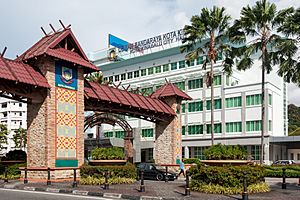
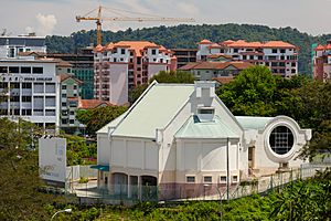
The Sabah State Mosque is the main mosque in the city. The City Mosque on Likas Bay is another important landmark. There is also a freemason hall on a hill.
The Signal Hill Observatory is the highest point in Kota Kinabalu. It offers amazing views of the city and the islands. You can reach it by climbing steps from the city center.
Shopping Fun
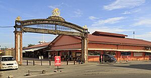
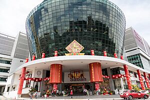
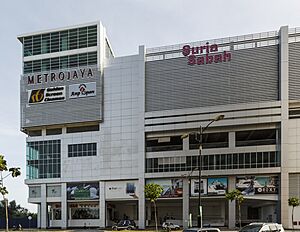
Kota Kinabalu has many shopping malls. These include Imago KK Times Square, Oceanus Waterfront Mall, and Suria Sabah. Karamunsing has many computer shops. The weekly Gaya Street Sunday Market has local sellers offering everything from souvenirs to flowers. The Anjung Kinabalu (Handicraft Market) sells traditional handicrafts and food.
Entertainment Options
There are six cinemas in Kota Kinabalu, including Golden Screen Cinemas (GSC) and MBO cinemas. 1Borneo Hypermall and Sutera Harbour Marina have bowling alleys and pool tables.
Kota Kinabalu is known for its fresh seafood. There are many seafood restaurants like Hua Hing Seafood Restaurant and Welcome Seafood Restaurant.
Sports and Activities
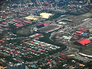
The Likas Sports Complex has many facilities for public use. It has a football stadium, badminton courts, a gym, and an Olympic-size swimming pool. It's the largest sports complex in Sabah. Likas Stadium is the home stadium for Sabah F.C.. There's another sports complex in Penampang with a football stadium.
Kota Kinabalu has four golf courses. These include the Sabah Golf and Country Club and Sutera Harbour Golf and Country Club.
The city has hosted national and international sports events. It's also the starting point for the annual Borneo Safari 4x4 Challenge. Kota Kinabalu has been a host city for the F2 Powerboat World Cup Series since 2007.
Music Scene
Kota Kinabalu hosts the KK Jazz Festival, an annual event. Famous international and local jazz artists have performed there. In 2019, Sabah Jazz started, showcasing local jazz artists.
BandWidth Street Press Magazine is a free monthly magazine in Kota Kinabalu. It promotes local Sabah music and shares news about the entertainment scene.
International Connections
 Many countries have consulates in Kota Kinabalu. These include Australia, Brunei, China, Japan, South Korea, and the United Kingdom. In 2018, Russia opened a branch office here to improve cooperation in culture, economy, and education.
Sister Cities
Kota Kinabalu has several sister cities around the world:
 Balikpapan, Indonesia
 Hangzhou, China
 Heyuan, China
 Jiangmen, China
 Ratchaburi, Thailand
 Vladivostok, Russia
 Yeosu, South Korea
 Yongin, South Korea
Cooperation and Friendship
Kota Kinabalu also works closely with:
Famous People from Kota Kinabalu
- Penny Wong (born 1968) - Australian Foreign Minister.
- Black & White (born 2010) - Malaysian Rapper.
See also
In Spanish: Kota Kinabalu para niños
 | Precious Adams |
 | Lauren Anderson |
 | Janet Collins |


