
Languedoc-Roussillon facts for kids
Quick facts for kids Languedoc-Roussillon |
|||
| Region | |||
|
|||
| Country | |||
|---|---|---|---|
| Préfecture | Montpellier | ||
| - coordinates | 43°36′43″N 3°52′38″E / 43.61194°N 3.87722°E | ||
| Highest point | Pic Carlit | ||
| - elevation | 2,921 m (9,583 ft) | ||
| - coordinates | 42°34′11″N 1°55′55″E / 42.56972°N 1.93194°E | ||
| Area | 27,376 km² (10,570 sq mi) | ||
| Population | 2,700,266 (2012) | ||
| Density | 99 /km² (256 /sq mi) | ||
| Subdivisions | 5 departments 14 arrondissements 186 cantons 1,545 communes |
||
| President | Damien Alary | ||
| Timezone | CET (UTC+1) | ||
| - summer (DST) | CEST (UTC+2) | ||


Languedoc-Roussillon (pronounced: Lahng-dok Roo-see-yohn) was a region in France. It's now part of a bigger region called Occitanie. This area is in the very south of mainland France. It shares borders with Spain and Andorra.
This region used to have five main areas called departments. These were Aude, Gard, Hérault, Lozère, and Pyrénées-Orientales. The main city and capital was Montpellier. People from this region were called Languedocien-Roussillonnais.
Contents
Understanding the Name: Languedoc-Roussillon
The name Languedoc comes from the language spoken in southern France. This language is called langue d'oc, or simply Occitan. The second part of the name, Roussillon, refers to a specific area in the southern part of what was Languedoc-Roussillon.
Exploring the Geography of Languedoc-Roussillon
The Languedoc-Roussillon region covered an area of about 27,376 square kilometers (10,570 square miles). To the south, it bordered Spain and Andorra. To the east, it met the Mediterranean Sea, specifically the Gulf of Lion.
It also shared borders with four other French regions. These were Midi-Pyrénées to the west, Auvergne and Rhône-Alpes to the north, and Provence-Alpes-Côte d'Azur (PACA) to the northeast.
The highest point in Languedoc-Roussillon is Pic Carlit. This mountain is located in the Pyrénées-Orientales department. It stands tall at 2,921 meters (9,583 feet) high.
The Departments of Languedoc-Roussillon
The Languedoc-Roussillon region was made up of five different departments. Each department has its own main city, called a préfecture.
| Département | Préfecture | Population (2012) |
Area (km²) |
Density (Inh./km²) |
|---|---|---|---|---|
| Aude | Carcassonne | 362,339 | 6,139 | 59.0 |
| Gard | Nîmes | 725,618 | 5,853 | 124.0 |
| Hérault | Montpellier | 1,077,627 | 6,101 | 176.6 |
| Lozère | Mende | 76,889 | 5,167 | 14.9 |
| Pyrénées-Orientales | Perpignan | 457,793 | 4,116 | 111.2 |
Population and Major Cities
In 2012, the Languedoc-Roussillon region had a population of 2,700,266 people. This means there were about 98.6 inhabitants per square kilometer.
Here are the 10 largest cities in the region:

| City | Population (2012) |
Départment |
|---|---|---|
| Montpellier | 268456 | Hérault |
| Nîmes | 146,709 | Gard |
| Perpignan | 120,489 | Pyrénées-Orientales |
| Béziers | 72,970 | Hérault |
| Narbonne | 51,869 | Aude |
| Carcassonne | 47,068 | Aude |
| Sète | 44,558 | Hérault |
| Alès | 41,031 | Gard |
| Lunel | 25,405 | Hérault |
| Agde | 24,651 | Hérault |
Gallery
-
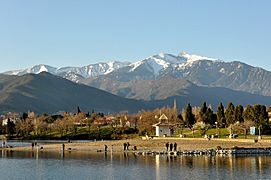
Vinça and the Canigou mountain
-
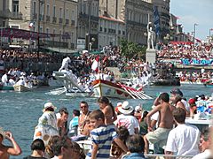
Les Joutes de la Saint-Louis 2005, Sète
-
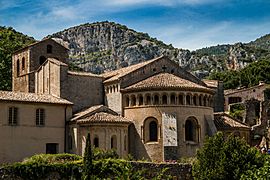
Saint-Guilhem-le-Désert abbey


Images for kids
-
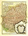
Map of the Governments of Languedoc, Foix and Roussillon by Rigobert Bonne (1727-1795), Paris, circa 1783
-
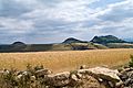
Landscape in Lozère, Languedoc-Roussillon
-
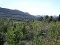
Landscape in Aude, Languedoc-Roussillon
-

Pont du Gard aqueduct near Nîmes
-
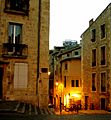
Street in Montpellier


See also
 In Spanish: Languedoc-Rosellón para niños
