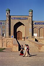
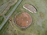
List of World Heritage Sites in Northern and Central Asia facts for kids
The UNESCO (United Nations Educational, Scientific and Cultural Organization) is a special part of the United Nations. It helps protect important places around the world. These places are called World Heritage Sites. They are special because of their history, culture, or natural beauty.
In Central and North Asia, UNESCO has chosen 19 World Heritage Sites. These sites are found in six countries: Kazakhstan, Kyrgyzstan, Tajikistan, Turkmenistan, Uzbekistan, and the Asian part of Russia. The European part of Russia has its own list of sites.
Russia has the most sites in this region, with 8 places on the list. Two of these Russian sites are shared with Mongolia. The very first site from this area to be added was the Itchan Kala in Uzbekistan in 1990. Every year, the World Heritage Committee decides which new places to add. They also check if sites still meet the rules.
To be chosen, a site must meet at least one of ten special rules. Six rules are for cultural heritage (like old buildings or historical areas). Four rules are for natural heritage (like unique mountains or forests). Some sites are "mixed," meaning they have both cultural and natural importance. In Central and North Asia, there are 11 cultural sites and 8 natural sites. There are no mixed sites here. Most of Russia's sites (7) are natural. Most sites in Central Asia are cultural, except for Saryarka in Kazakhstan, which is natural.
UNESCO can also say if a site is in danger. This means something is threatening what makes the site special. Luckily, none of the sites in this region have ever been listed as endangered.
World Heritage Sites in Central and North Asia
* Shared site between countries Here is a list of the amazing World Heritage Sites in Central and North Asia. You can click on the small arrows next to the column titles to sort the list!
| Site | Image | Location | Criteria | Area ha (acre) |
Year | Refs |
|---|---|---|---|---|---|---|
| Central Sikhote-Alin | 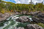 |
Primorsky Krai, 45°20′N 136°10′E / 45.333°N 136.167°E |
Natural: (x) |
1,553,928 (3,839,840); buffer zone 65,250 (161,200) | 2001 | |
| Golden Mountains of Altai | 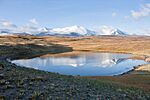 |
Altai Republic, 50°28′N 86°0′E / 50.467°N 86.000°E |
Natural: (x) |
1,611,457 (3,982,000) | 1998 | |
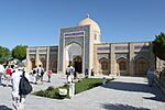
| Historic Centre of Bukhara |  |
Bukhara Region, 39°46′29″N 64°25′43″E / 39.77472°N 64.42861°E |
Cultural: (ii), (iv), (vi) |
|
1993 | |
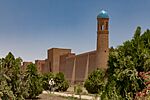
| Historic Centre of Shakhrisyabz | 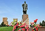 |
Qashqadaryo Region, 39°3′0″N 66°50′0″E / 39.05000°N 66.83333°E |
Cultural: (iii), (iv) |
240 (590); buffer zone 82 (200) | 2000 | |
| Itchan Kala | 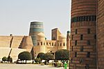 |
Khiva, Xorazm Region, 41°22′42″N 60°21′50″E / 41.37833°N 60.36389°E |
Cultural: (iii), (iv), (v) |
26 (64) | 1990 | |
| Kunya-Urgench | 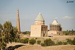 |
Daşoguz Region, 42°10′59″N 59°5′6″E / 42.18306°N 59.08500°E |
Cultural: (ii), (iii) |
|
2005 | |
| Lake Baikal | 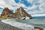 |
Irkutsk Oblast and Republic of Buryatia, 53°10′25″N 107°39′45″E / 53.17361°N 107.66250°E |
Natural: (vii), (viii), (ix), (x) |
8,800,000 (22,000,000) | 1996 | |
| Landscapes of Dauria | 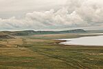 |
Zabaykalsky Krai, Dornod Province, 49°55′N 115°25′E / 49.917°N 115.417°E |
Natural: (ix), (x) |
912,624 (2,255,140); buffer zone 307,317 (759,400) | 2017 | |
| Lena Pillars Nature Park | 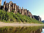 |
Sakha Republic, 60°40′0″N 127°0′0″E / 60.66667°N 127.00000°E |
Natural: (viii) |
1,272,150 (3,143,600) | 2012 | |
| Mausoleum of Khoja Ahmed Yasawi |  |
Turkistan, Turkistan Region, 43°17′35″N 68°16′28″E / 43.29306°N 68.27444°E |
Cultural: (i), (iii), (iv) |
0.55 (1.4); buffer zone 88 (220) | 2003 | |
| Natural System of Wrangel Island Reserve |  |
Chukotka Autonomous Okrug, 71°11′20″N 179°42′55″E / 71.18889°N 179.71528°E |
Natural: (ix), (x) |
916,300 (2,264,000); buffer zone 3,745,300 (9,255,000) | 2004 | |
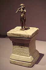
| Parthian Fortresses of Nisa |  |
Bagyr settlement, Ruhabat District, Ahal Region, 37°59′59″N 58°11′55″E / 37.99972°N 58.19861°E |
Cultural: (ii), (iii) |
78 (190); buffer zone 400 (990) | 2007 | |
| Petroglyphs within the Archaeological Landscape of Tamgaly | 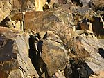 |
Almaty Region, 43°48′12″N 75°32′6″E / 43.80333°N 75.53500°E |
Cultural: (iii) |
900 (2,200); buffer zone 2,900 (7,200) | 2004 | |
| Proto-urban site of Sarazm | 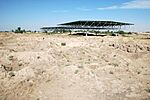 |
Panjakent, 39°30′28″N 67°27′37″E / 39.50778°N 67.46028°E |
Cultural: (ii), (iii) |
16 (40); buffer zone 142 (350) | 2010 | |
| Putorana Plateau |  |
Krasnoyarsk Krai, 69°2′49″N 94°9′29″E / 69.04694°N 94.15806°E |
Natural: (vii), (ix) |
1,887,251 (4,663,500); buffer zone 1,773,300 (4,382,000) | 2010 | |
| Samarkand – Crossroads of Cultures | 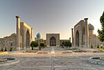 |
Samarqand Region, 39°40′7″N 67°0′0″E / 39.66861°N 67.00000°E |
Cultural: (i), (ii), (iv) |
965 (2,380) | 2001 | |
| Saryarka — Steppe and Lakes of Northern Kazakhstan | 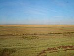 |
Akmola and Kostanay Regions, 50°26′N 69°11′E / 50.433°N 69.183°E |
Natural: (ix), (x) |
450,344 (1,112,820); buffer zone 211,148 (521,760) | 2008 | |
| Silk Roads: the Routes Network of Chang'an-Tianshan Corridor | 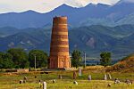 |
22 sites in 8 sites in 3 sites in |
Cultural: (ii)(iii)(iv)(vi) |
42,668.16 (105,435.3); buffer zone 189,963.13 (469,409.1) | 2014 | |
| State Historical and Cultural Park “Ancient Merv” | 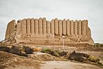 |
Mary Region, 37°42′3″N 62°10′39″E / 37.70083°N 62.17750°E |
Cultural: (ii), (iii) |
353 (870); buffer zone 883 (2,180) | 1999 | |
| Sulaiman-Too Sacred Mountain | 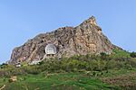 |
Osh, 40°31′52″N 72°46′58″E / 40.53111°N 72.78278°E |
Cultural: (iii), (vi) |
112 (280); buffer zone 4,788 (11,830) | 2009 | |
| Tajik National Park (Mountains of the Pamirs) | 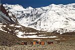 |
38°45′54″N 72°18′19″E / 38.76500°N 72.30528°E |
Natural: (vii), (viii) |
2,611,674 (6,453,590) | 2013 | |
| Uvs Nuur Basin |  |
Uvs, Zavkhan and Khövsgöl Provinces Mongun-Tayginsky, Ovyursky, Tes-Khemsky and Erzinsky Districts, Tuva Republic, 50°16′30″N 92°43′1″E / 50.27500°N 92.71694°E |
Natural: (ix), (x) |
898,064 (2,219,160); buffer zone 170,790 (422,000) | 2003 | |
| Volcanoes of Kamchatka |  |
Kamchatka Krai, 56°20′N 158°30′E / 56.333°N 158.500°E |
Natural: (vii), (viii), (ix), (x) |
3,830,200 (9,465,000) | 1996 |
Sites That Might Be Added Soon
These are places that countries have suggested to UNESCO. They are on a "Tentative List," meaning they could become World Heritage Sites in the future!
| Site | Image | Location | Criteria | Year | Refs |
|---|---|---|---|---|---|
| Cultural Landscape of Ulytau | 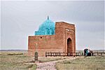 |
Ulytau Region, |
Cultural: (v) |
2021 | |
| Northern Tyan Shan (Ili-Alatau National Park) |  |
Almaty Region, |
Natural: (x) | 2002 | |
| State National Natural Park "Altyn Emel" | 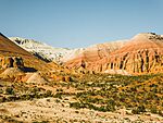 |
Almaty Region, |
Natural: (vii), (viii), (ix) | 2002 | |
| Saimaly-Tash Petroglyphs | 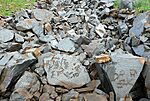 |
Jalal-Abad Region, |
Cultural: (iii), (iv), (vi) | 2001 | |
| Khulbuk -Capital of Ancient Khuttal | Hulbuk, Vose' District, Khatlon Region, |
Cultural: (ii), (iii), (iv) | 2021 | ||
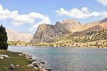
| Fann Mountains | Sughd Region, |
Mixed: (vii), (x) | 2006 | ||
| Mausoleum of Amir Khamza Khashti Podshoh | 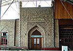 |
Chorkuh, Isfara District, Sughd Region, |
Cultural | 1999 | |
| Mausoleum of Khoja Mashkhad | 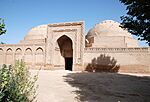 |
Khatlon Region, |
Cultural | 1999 | |
| Ancient Town of Takht-i-Sangin | Khatlon Region, |
Cultural | 1999 | ||
| Bahoutdin Architectural Complex | Bukhara, Bukhara Region, |
Cultural: (iv) | 2008 | ||
| Historic Centre of Qoqon | Kokand, Fergana Region, |
Cultural: (ii) | 2008 | ||
| Andijan | 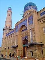 |
Andijan, Andijan Region, |
Cultural: (iii), (iv), (v) | 2008 | |
| Ancient Termiz | 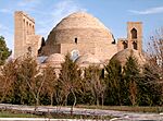 |
Termez, Surxondaryo Region, |
Mixed: (i), (ii), (iii), (iv), (v), (vi), (ix) | 2008 | |
| Historic Centre of Irkutsk | 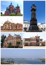 |
Irkutsk, Irkutsk Oblast, |
Cultural | 1998 | |
| Historic Centre of Yeniseysk | 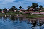 |
Yeniseysk, Krasnoyarsk Krai, |
Cultural: (ii), (iii), (iv) | 2000 | |
| Valley of the Kings of Tuva (Arzhan) | Tuva Republic, |
Cultural: (i), (iii), (iv) | 2021 | ||
| Kytalyk National Park | 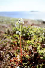 |
Sakha Republic, |
Natural: (ix), (x) | 2021 | |
| Krasnoyarsk Stolby |  |
Krasnoyarsk Krai, |
Natural: (vii), (viii), (ix), (x) | 2007 | |
| Magadansky Nature Reserve |  |
Magadan Oblast, |
Natural: (vii), (viii), (ix), (x) | 2007 |


