
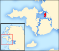
List of islands of County Mayo facts for kids


This article explores the islands of County Mayo, a county located on the mainland of Ireland. It includes both islands found in the sea and those in freshwater lakes, as officially recorded. You'll also learn about special areas important for nature, which are protected by the National Parks and Wildlife Service.
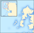
County Mayo has hundreds of islands, both in the ocean and in its lakes. However, only a few are big enough to easily spot on a map. These include Achill Island, Clare Island, and Inishturk. There are also groups of islands like those in Duvillaun, Inishkea, Clew Bay, and the county's major lakes. More than 100 islands are larger than 10 acres (4 hectares). The biggest island is Achill, which is about 148 square kilometers (36,572 acres). This makes it the largest island off the coast of Ireland.
Mayo is known for having the longest coastline of any county in Ireland. It stretches for about 1,168 kilometers (726 miles), which is roughly 21% of Ireland's total coastline. This is because of its many bays, inlets, and offshore islands.
The rocks and landforms of Mayo and its islands are very diverse. Some islands, like those in Clew Bay, are low and flat. They formed when rising sea levels covered many small hills called drumlins. Other islands, such as Clare Island and Achill, have tall mountains and huge sea-cliffs. Croaghaun on Achill Island has the third-highest sea-cliffs in Europe, reaching 688 meters (2,257 feet) high.
The rocks on the islands generally fall into two main types. Islands north of Clew Bay, like Achill and those near the Mullet Peninsula, have very old rocks from the Dalradian period. These are similar to rocks found in County Donegal and the Grampian Highlands. Inishglora even has some of Ireland's oldest rocks, dating back 1.75 billion years! Further south, the islands have a wider variety of rocks. Clare Island alone has rocks from the Cambrian, Ordovician, Silurian, and Carboniferous periods, all joined together. The Clew Bay islands are the youngest in the county, formed about 350 million years ago during the Lower Carboniferous period.
For centuries, the islands off Ireland's west coast, including Mayo's, developed their own special cultures and traditions. Records from the 1841 Census show that 47 of Mayo's offshore islands had people living on them, with a total population of about 10,000. However, the Great Famine caused many islands to become empty or have very few people left. Towards the end of the 1800s, the population on larger islands started to grow again. But then, after Ireland gained independence, many people left the islands. The Irish government even encouraged people to move off the islands because it was expensive to provide services there. This made the population decline even faster.
Today, the Irish government sees the islands as a key part of Ireland's history and culture. They help preserve a unique way of life. The islands that still have people living on them get support and money from the Department of Culture, Heritage and the Gaeltacht. In 2016, about 2,700 people lived on 14 of Mayo's offshore islands. Most of them (2,440 people) live on Achill Island. This means islanders make up about 1.87% of the county's total population.
Contents
Islands of Mayo by Population Size
How Many People Live on the Islands?
The 2016 census showed that 14 offshore islands had people living on them. Achill has been connected to the mainland by a bridge since 1887. This makes Clare Island the most populated island that is not connected to the mainland, with 159 residents in 2016. Clare Island is the fifth most populated unconnected island in Ireland. The three Aran Islands off Galway and Arranmore off County Donegal have more people.
.jpg)
Mayo County Council manages the islands. Islanders get certain benefits, like lower car tax rates. The islands also receive money from the Department of Culture, Heritage and the Gaeltacht. This is because many offshore islands and parts of northwest Mayo are recognized Gaeltacht areas, where the Irish language is spoken.
Before the Great Famine, as many as 47 offshore islands had people living on them all the time. Communities had lived on these islands for many generations. You can still see what they left behind today, like old villages, stone walls, and lazybeds (a type of garden bed). By the late 1800s, most of Mayo's islands were empty. Achill was different because its bridge to the mainland helped its population grow for a while, reaching its highest point in 1911.
.jpg)
People continued to leave the islands in the 1900s. Traditional jobs like fishing and making textiles didn't pay enough for young islanders. Recently, the islands have become popular places for tourists. They rely a lot on tourism and hotels. Their populations grow a lot during the summer, especially on Achill and Clare. Fun activities include surfing, sailing, island-hopping in Clew Bay, spiritual retreats, and eco-tourism (tourism that helps nature).
The table below shows how the populations of the 14 currently inhabited islands have changed. Overall, the number of people living on Mayo's offshore islands continues to decrease. The population is now at its lowest point in history. County Mayo was one of only three counties in Ireland where the population went down between 2011 and 2016. Mayo's population dropped by 0.2%, while the islands' population fell by 5.3%. Even though the overall population went down, four islands that were empty before got new residents. This includes Achillbeg, which had been empty since 1965.
Islands with People Living There Now
| Rank | Island | Barony | Population | |||
|---|---|---|---|---|---|---|
| 2016 | 2011 | 1841 | Peak Population (if not 1841) |
|||
| 1 | Achill | Burrishoole | 2,440 | 2,569 | 4,901 | 5,260 (1911) |
| 2 | Clare | Murrisk | 159 | 168 | 1,615 | |
| 3 | Inishturk | Murrisk | 51 | 53 | 577 | |
| 4 | Inis Bigil | Erris | 18 | 25 | 67 | 162 (1926) |
| 5 | Collanmore | Burrishoole | 7 | 4 | 213 | 215 (1851) |
| 6 | Inishnakillew | Burrishoole | 6 | 7 | 126 | |
| 7 | Inishlyre | Burrishoole | 4 | 4 | 113 | 122 (1851) |
| 8 | Clynish | Burrishoole | 4 | 4 | 87 | |
| 9 | Inish Turk Beg | Burrishoole | 4 | 10 | 57 | |
| 10 | Duvillaun More | Erris | 2 | 2 | 31 | |
| 11 | Collanbeg | Burrishoole | 2 | 0 | 4 | 9 (1861) |
| 12 | Achillbeg | Burrishoole | 1 | 0 | 178 | |
| 13 | Inishkea North | Burrishoole | 1 | 0 | 155 | |
| 14 | Rosbarnagh | Burrishoole | 1 | 0 | 42 | |
| Total | 2,700 | 2,846 | 8,166 | |||
| Change | -5.3% | -65.2% | - | |||
Islands Where People Used to Live
| Island | Barony | Population | ||
|---|---|---|---|---|
| 1841 | Peak Population (if not 1841) |
Year Abandoned | ||
| Rosmore Island | Burrishoole | 133 | ||
| Moynish More | Burrishoole | 99 | 1881-1891 | |
| Island More | Burrishoole | 88 | ||
| Rosturk Island | Burrishoole | 64 | ||
| Inishkea South | Erris | 62 | 1934 | |
| Inishdaff | Burrishoole | 57 | ||
| Inishgowla South | Burrishoole | 52 | ||
| Inishtubbrid | Burrishoole | 42 | ||
| Knockycahillaun | Burrishoole | 41 | ||
| Inishcottle | Burrishoole | 40 | 45 (1911) | 2011-2016 |
| Derrinish | Burrishoole | 40 | ||
| Inishquirk | Burrishoole | 37 | ||
| Inisheeny | Burrishoole | 36 | ||
| Annagh Islands | Erris | 33 | 1851 | |
| Illanataggart | Burrishoole | 33 | ||
| Inishgort | Burrishoole | 32 | 35 (1871) | 2006-2011 |
| Crovinish | Burrishoole | 32 | ||
| Inishoo | Burrishoole | 29 | ||
| Bartragh Island | Tirawley | 28 | 1951 | |
| Inisherkin | Burrishoole | 28 | ||
| Inishgowla | Burrishoole | 28 | ||
| Inishnacross | Burrishoole | 27 | ||
| Inishturlin | Burrishoole | 25 | ||
| Inishkeel | Burrishoole | 23 | ||
| Inishbee | Burrishoole | 20 | ||
| Inishglora | Erris | 16 | ||
| Eagle Island | Erris | 15 | 22 (1861) | 1988 |
| Dorinish | Burrishoole | 13 | 15 (1871) | 1901 |
| Inishbobunnan | Burrishoole | 13 | ||
| Inishilra | Burrishoole | 12 | ||
| Inishcooa | Burrishoole | 6 | ||
| Barranagh Island | Erris | 0 | 1 (1874) | late 1800s |
| Blackrock Island | Erris | 0 | 15 (1881) | 1974 |
| Roman Island | Burrishoole | 0 | 36 (1911) | 1966-1971 |
| Total | 1,229 | |||
Islands of Mayo by Size
The Largest Islands
Except for Achill, most of County Mayo's islands are small. Only 13 are larger than 100 acres (40 hectares), and just 3 are bigger than 1,000 acres (405 hectares). There are many offshore islands between 10 and 100 acres. Also, at least 15 freshwater islands are larger than 10 acres. The biggest freshwater island is Illannaglashy on Lough Conn, which is 82 acres (33 hectares).
Here is a list of the largest islands in the county. "F" means it's a freshwater island.
.jpg)


| Island | Irish name | Archipelago / Location | Area (Acres) |
Highest Point |
|---|---|---|---|---|
| Achill | Acaill | Achill Islands | 36,572 | 688 m (2,257 ft) |
| Clare | Oileán Chliara | Clew Bay | 4,053 | 462 m (1,516 ft) |
| Inishturk | Inis Toirc | Atlantic Islands | 1,620 | 191 m (627 ft) |
| Inishbiggle | Inis Bigil | Achill Islands | 637 | 34 m (112 ft) |
| Annagh Island | Oileán an Eanaigh | Achill Islands | 627 | 23 m (75 ft) |
| Inishkea North | Inis Gé Thuaidh | Inishkea Islands | 574 | 24 m (79 ft) |
| Bartragh Island | An Bheartrach | Killala Bay | 477 | 26 m (85 ft) |
| Inishkea South | Inis Gé Theas | Inishkea Islands | 389 | 72 m (236 ft) |
| Achillbeg | Acaill Bheag | Achill Islands | 331 | 110 m (360 ft) |
| Collanmore Island | Collainn Mhór | Clew Bay | 199 | 53 m (174 ft) |
| Duvillaun More | Dubhoileán Mór | Duvillaun Islands | 177 | 63 m (207 ft) |
| Caher Island | Cathair na Naomh | Atlantic Islands | 130 | 61 m (200 ft) |
| Rosmore Island | An Ros Mór | Newport Bay | 116 | 28 m (92 ft) |
| Illannaglashy (F) | Oileán na Glaise | Lough Conn | 82 | 27 m (89 ft) |
| Clynish | Claínis | Clew Bay | 81 | 42 m (138 ft) |
| Island More | An tOileán Mór | Clew Bay | 78 | 42 m (138 ft) |
| Barranagh Island | Oileán Bearanach | Blacksod Bay | 74 | 7 m (23 ft) |
| Inish Turk Beg | Inis Toirc Bheag | Clew Bay | 64 | 53 m (174 ft) |
| Inishnakillew | Inis na Coilleadh | Newport Bay | 64 | 27 m (89 ft) |
| Moynish More | Maínis Mór | Clew Bay | 62 | 37 m (121 ft) |
| Inishglora | Inis Gluaire | Atlantic Islands | 60 | 22 m (72 ft) |
| Inishbee | Inis Bí | Newport Bay | 56 | 29 m (95 ft) |
| Duvillaun Beg | Dubhoileán Beag | Duvillaun Islands | 53 | 14 m (46 ft) |
| Rosbarnagh Island | Oileán Ros Bairneach | Newport Bay | 53 | 37 m (121 ft) |
| Inishlyre | Inis Ladhair | Dorinish Harbour | 52 | 26 m (85 ft) |
| Annagh Island East | An tEanach Thoir | Wesport Bay | 48 | 9 m (30 ft) |
| Annagh Island (F) | Oileán an Eanaigh | Lough Conn | 45 | 23 m (75 ft) |
| Inishtubbrid | Inis Tiobrad | Newport Bay | 41 | 28 m (92 ft) |
| Inishdaff | Inis Damh | Newport Bay | 40 | 31 m (102 ft) |
| Inishower (F) | Inis Odhar | Furnace Lough | 36 | 16 m (52 ft) |
| Knockycahillaun | Cnoc Uí Chathaláin | Clew Bay | 35 | 36 m (118 ft) |
| Carrigeenamore (F) | An Carraigín Mór | Lough Mask | 35 | 22 m (72 ft) |
| Bleanmore Island | An Bhléan Mhór | Corraun Peninsula | 34 | 14 m (46 ft) |
| Rosturk Island | Ros Toirc | Newport Bay | 34 | 24 m (79 ft) |
| Inishgowla | Inis Gabhla | Newport Bay | 33 | 28 m (92 ft) |
| Inishdegil More | Inis Téigil Mór | Atlantic Islands | 32 | 12 m (39 ft) |
| Inishkeeragh | Inis Caorach | Atlantic Islands | 32 | 17 m (56 ft) |
| Kid Island | Oileán Mionnán | Broadhaven Bay | 32 | 86 m (282 ft) |
| Illanataggart | Oileán an tSagairt | Clew Bay | 32 | 28 m (92 ft) |
| Carrickmoylenacurhoga | Carraig Bhéal na gCaróg | Inishkea Islands | 32 | 14 m (46 ft) |
| Inishquirk | Inis Coirce | Newport Bay | 32 | 44 m (144 ft) |
| Inishgort | Inis Goirt | Clew Bay | 31 | 29 m (95 ft) |
| Inishsherkin | Inis Earcáin | Newport Bay | 31 | 30 m (98 ft) |
| Inishkeel | Inis Caol | Newport Bay | 30 | 27 m (89 ft) |
| Crovinish | Croibhinis | Dorinish Harbour | 29 | 23 m (75 ft) |
| Derrinish | Dairinis | Newport Bay | 29 | 21 m (69 ft) |
| Inishraher | Inis Raithir | Westport Bay | 29 | 33 m (108 ft) |
| Inishlaughil | Inis Leamhchoille | Newport Bay | 28 | 45 m (148 ft) |
| Bartraw Island | An Bheartrach | Westport Bay | 28 | 13 m (43 ft) |
| Inishgowla South | Inis Gabhla Theas | Westport Bay | 28 | 20 m (66 ft) |
| Inishnacross | Inis na Croise | Newport Bay | 27 | 36 m (118 ft) |
| Inisheeny | Inis Aonaigh | Westport Bay | 27 | 22 m (72 ft) |
| Muckinish | Muicinis | Newport Bay | 26 | 37 m (121 ft) |
| Annaghroe Island (F) | An tEanach Rua | Lough Conn | 25 | 18 m (59 ft) |
| Glassillan | An Glasoileán | Achill Island | 25 | 23 m (75 ft) |
| Inishcottle | Inis Cotail | Newport Bay | 25 | 26 m (85 ft) |
| Inishgleasty (F) | Inis Gléasta | Lough Mask | 24 | 37 m (121 ft) |
| Inishbobunnan | Inis Bó Bonnán | Newport Bay | 24 | 31 m (102 ft) |
| Eagle Island | Oileán sa Tuaidh | Atlantic Islands | 23 | 60 m (200 ft) |
| Roeillaun | Rua-oileán | Clew Bay | 23 | 33 m (108 ft) |
| Inishloy | Inis Láí | Newport Bay | 23 | 10 m (33 ft) |
| Inishcooa | Inis Cua | Newport Bay | 23 | 27 m (89 ft) |
| Long Island (F) | An tOileán Fada | Lough Mask | 22 | 25 m (82 ft) |
| Rabbit Island | Oileán Bhríde | Clew Bay | 21 | 22 m (72 ft) |
| Inishrobe (F) | Inis Róba | Lough Mask | 21 | 30 m (98 ft) |
| Inishturlin | Inis Tuirlinge | Newport Bay | 21 | 27 m (89 ft) |
| Inishcuill | Inis Coill | Newport Bay | 21 | 28 m (92 ft) |
| Derreens Island (F) | An Doirín | Carrowmore Lake | 20 | 8 m (26 ft) |
| Dorinish | Deoirinis | Clew Bay | 20 | 30 m (98 ft) |
| Roslynagh | Ros Laighneach | Clew Bay | 18 | 33 m (108 ft) |
| Illannambraher East | Oileán na mBráthar Thoir | Clew Bay | 18 | 28 m (92 ft) |
| Carrickawilt | Carraig an Mhoilt | Inishkea Islands | 18 | 9 m (30 ft) |
| Inishoght (F) | Inis Uicht | Lough Mask | 18 | 25 m (82 ft) |
| Collanbeg Island | Collainn Bheag | Clew Bay | 17 | 25 m (82 ft) |
| Inishoo | Inis Uamha | Clew Bay | 17 | 32 m (105 ft) |
| Annagh Island West | An tEanach Thiar | Westport Bay | 17 | 11 m (36 ft) |
| Inishdaweel | Inis Dá Mhaol | Clew Bay | 16 | 38 m (125 ft) |
| Carrigee | Carraig Aodha | Inishkea Islands | 16 | 15 m (49 ft) |
| River Island (F) | Oileán na hAbhann | Lough Mask | 16 | 13 m (43 ft) |
| Saints Island (F) | Inis Na Naomh | Lough Mask | 16 | 30 m (98 ft) |
| Inishdurra (F) | Inis Dura | Lough Mask | 16 | 32 m (105 ft) |
| Inishleague | Inis Liag | Wesport Bay | 16 | 24 m (79 ft) |
| Baunros More | Bánros Mór | Killala Bay | 15 | 13 m (43 ft) |
| Inishdalla | Inis Deala | Atlantic Islands | 15 | 27 m (89 ft) |
| Inishdasky | Inis Teasctha | Clew Bay | 15 | 30 m (98 ft) |
| Annaghteige Island (F) | Eanach Thaidhg | Lough Conn | 15 | 27 m (89 ft) |
| Rabbit Island | Oileán Bhríde | Newport Bay | 15 | 28 m (92 ft) |
| Illandavuck | Oileán Dhabhaic | Atlantic Islands | 14 | 56 m (184 ft) |
| Conors Island (F) | Oileán Chonchúir | Lough Carra | 14 | 20 m (66 ft) |
| Inishfesh | Inis Feise | Clew Bay | 13 | 10 m (33 ft) |
| Inishaghoo | Inis Achadh | Achill Islands | 13 | 20 m (66 ft) |
| Carrigeenagur Island (F) | Carraigín na gCorr | Lough Mask | 13 | 23 m (75 ft) |
| Pig Island (F) | Oileán na Muice | Lough Mask | 13 | 28 m (92 ft) |
| Illannambraher West | Oileán na mBráthar Thiar | Clew Bay | 12 | 25 m (82 ft) |
| Inishkee | Inis Caoich | Clew Bay | 12 | 14 m (46 ft) |
| Inishdoonver | Inis Dúnmhar | Clew Bay | 12 | 25 m (82 ft) |
| Lambs Island (F) | Oileán na nUan | Lough Mask | 12 | 11 m (36 ft) |
| Devenish Island (F) | Daimhinis | Lough Mask | 12 | 30 m (98 ft) |
| Annagh Island Middle | An tEanach Lár | Westport Bay | 12 | 7 m (23 ft) |
| Goose Island | Inis na nGé | Killala Bay | 12 | 12 m (39 ft) |
Smaller Islands in the Sea
County Mayo has hundreds of smaller islands and tiny islets. Most of these are in Clew Bay. Smaller groups are found around the Achill islands, the west and south coasts of the Mullet Peninsula, and Blacksod Bay. This list isn't complete, but it includes named offshore islands that are fairly large (usually more than 2 acres) or are important locally.
This list is in alphabetical order and does not include freshwater islands.

.jpg)


| Island | Irish name | Archipelago / Location |
|---|---|---|
| Annagh Island | Oileán an Eanaigh | Mullet Peninsula |
| Ardillaun | Ardoileán | Killala Bay |
| Attimonbeg | Áth Tíomáin Beag | Killala Bay |
| Baunros Beg | Bánros Beag | Killala Bay |
| Baunros More | Bánros Mór | Killala Bay |
| Beetle Island North | Oileán an tSindile Thuaidh | Clew Bay |
| Beetle Island South | Oileán an tSindile Theas | Clew Bay |
| Bills Rocks | Carraig Bill | Atlantic Islands |
| Blackrock Island | An Tor | Atlantic Islands |
| Buddagh | An Chailleach | Benwee Head |
| Calf Island | Oileán an Ghamhna | Clew Bay |
| Calf Island | Oileán an Ghamhna | Killala Bay |
| Camel Island | Oileán Camall | Newport Bay |
| Carrickduff | An Charraig Dhubh | Mullet Peninsula |
| Carrickduff | An Charraig Dhubh | North Mayo Coast |
| Carrickhesk | Carraig Sheisc | Mullet Peninsula |
| Carricknaronty | Carraig na Rónta | Atlantic Islands |
| Carricknaronty North | Carraig na Rónta Thuaidh | Mullet Peninsula |
| Carricknaweeloge | Carraig na bhFaoileog | Mullet Peninsula |
| Carrigeenglass North | An Carraigín Glas Thuaidh | Clew Bay |
| Cone Island | Oileán an Chuain | Mullet Peninsula |
| Corillan | Corroileán | Westport Bay |
| Carrigeenaveagh | Carraigín na bhFiach | Clew Bay |
| Cregnarullah | Sceir na Roilleach | Mullet Peninsula |
| Cross Rock | An Charraig Dhubh | Mullet Peninsula |
| Doonvinalla | An Dúna | Benwee Head |
| Doonbristy Island | Dún Briste | North Mayo Coast |
| Dooneen Island | An Dúnín | Uggool Beach |
| Finnaun Island | Fionnán | Westport Bay |
| Forillan | Foroileán | Westport Bay |
| Freaghillan | Fraochoileán | Killala Bay |
| Freaghillan East | Fraochoileán Thoir | Newport Bay |
| Freaghillanluggagh | Fraochoileán Logach | Newport Bay |
| Glassillaun | Glasoileán | North Mayo Coast |
| Green Island | An tOileán Glas | Westport Bay |
| Green Island | An tOileán Glas | Killala Bay |
| Heath Island | Oileán Fraoigh | Corraun Peninsula |
| Horse Island | Oileán na gCapall | North Mayo Coast |
| Illancroagh | Oileán Cruaiche | Corraun Peninsula |
| Illanleamnahelty | Oileán Léim na hEilte | Atlantic Islands |
| Illanmaster | Oileán Máistir | North Mayo Coast |
| Illanmaw | Má-oileán | Clew Bay |
| Illannaconney | Oileán an Chonnaidh | Clew Bay |
| Illannakanoge | Oileán na gCánóg | North Mayo Coast |
| Illannamona | Oileán na Móna | Achill Islands |
| Illaunatee | Oileán an Tí | Clew Bay |
| Illaunroe | An tOileán Rua | Clew Bay |
| Inishacrick | Inis an Chnoic | Clew Bay |
| Inishbollog | Inis Bolg | Clew Bay |
| Inishcannon | Inis Ceannann | Newport Bay |
| Inishcoragh | Inis Córach | Newport Bay |
| Inishcorky | Inis Corcaí | Clew Bay |
| Inishdaugh | Inis Deách | Clew Bay |
| Inishdeash Beg | Inis Déise Beag | Clew Bay |
| Inishdeash More | Inis Déise Mór | Clew Bay |
| Inishderry | Inis Doire | Mullet Peninsula |
| Inishilra | Inis Iolra | Clew Bay |
| Inishimmel | Inis Imill | Westport Bay |
| Inishlaghan | Inis Lachan | Clew Bay |
| Inishlim | Inis Loim | Clew Bay |
| Inishmolt | Inis Molt | Newport Bay |
| Kid Island East | Oileán na Meannán | Newport Bay |
| Mauherillan | Máthairoileán | Newport Bay |
| Money Beg | An Muine Bheag | Clew Bay |
| Moynish Beg | Maínis Beag | Clew Bay |
| Mweelaun | Mhaoilinne | Atlantic Islands |
| Pig Island | Oileán na Muice | North Mayo Coast |
| Quinsheen Island | Cuinsín | Clew Bay |
| Roeillan | Rua-oileán | Achill Islands |
| Rosnambraher | Ros na mBráthar | Newport Bay |
| Sloe Island | Oileán na nAirní | Westport Bay |
| The Stags | Na Stacaí | Benwee Head |
| Toghercloheen | Barr na Spince | North Mayo Coast |
| Torduff | An Tor Dubh | North Mayo Coast |
Freshwater Islands in Mayo's Lakes
County Mayo has many large lakes, called loughs, which contain hundreds of small freshwater islands. Lough Mask in southern Mayo is the biggest lake in the county. It covers about 83 square kilometers (20,510 acres), making it the 6th largest lake in Ireland and in Britain and Ireland. Further south, Lough Corrib is the 2nd largest lake in Ireland, but only a small part of it is in County Mayo.
Illannaglashy, on Lough Conn, is the largest freshwater island in the county, at 82 acres (33 hectares). Freshwater islands have been important throughout Mayo's history. Many have old castles, monasteries, church ruins, and beautiful, untouched woodlands.
Islands of Lough Mask


_(14765914451).jpg)


- Note: Most of Lough Mask is in County Mayo, but a small southern part is in County Galway. This list only includes islands within County Mayo's border.
- Aghinish
- Bed Island
- Bilberry Island
- Black Island
- Black Island
- Board Island
- Carrigeen Island
- Carrigeen Middle
- Carrigeenabreana
- Carrigeenagur Island
- Carrigeenamore
- Carrigeenavilla
- Carrigeenaweelaun
- Carrigeenbaun
- Carrigeenbunnahown
- Carrigeendany Islands
- Carrigeenduree
- Carrigeenfair Island
- Carrigeenkeelagh
- Carrigeenmauntrasna
- Carrigeennagool
- Carrigeennalogh
- Carrigeennasassonagh
- Carrigeenowen
- Carrigeenshangorman
- Castle Hag
- Cow Island
- Dash Island
- Devenish Island
- Doran Islands
- Goat Island
- Green Island
- Gull Island
- Flag Island
- Heath Island
- Illan Columbkille
- Illanboe Beg
- Illanboe More
- Illandawaur
- Ingon Island
- Inishangan
- Inishdurra
- Inishgleasty
- Inishoght
- Inishowenlackboy
- Inishrobe
- Kid Island
- Lackboy
- Lamb Island
- Long Island
- Long Islands
- Lusteen Beg
- Lusteen More
- Nut Island
- Oak Island
- Pig Island
- Rams Island
- Rialisk
- Ringolden
- River Island
- Saints Island
- Seerillaun
- Shangorman
- Shrub Island
- Thick Island
- Whiteland Island
Islands of Lough Carra
- Ballycally Island
- Bird Island
- Bonnianillish Island
- Bush Island
- Carrigeennagat Island
- Castle Island
- Castlehag Island
- Church Island
- Conors Island
- Cow Islands
- Crane Island
- Creevagh Island
- Deer Island
- Derrinrush Island
- Derrynafresha Island
- Doonbeg Island North
- Doonbeg Island South
- Gleneary Island
- Hog Island
- Horse Island
- Illanatrim
- Kiln Island
- Lady's Island
- Lakeview Island
- Leamnahye Island
- Long Island
- Mearing Island
- Otter Island
- Otter Island
- Otter Islands
- Pleasure Island
- Priest Island
- Rat Island
- Stare Island
- Stony Island
Islands of Lough Corrib
- Note: Most of Lough Corrib is in County Galway, but a small northern part is in County Mayo. This list only includes islands within County Mayo's border.
- Abbots Rock
- Ballycurrin Island
- Bartragh Island
- Bertragh Islands
- Blackderry Island
- Blackderry Rock
- Bushy Island
- Camillaun
- Carrigeen
- Castletown Rock
- Cornelian Islands
- Crow Islands
- Dog Islands
- Easter Island
- Flower Island
- Gibbs Islands
- Grass Island
- Green Island
- Green Island East
- Holy Island
- Inishkeeragh Island
- Island Morris
- Kilmore
- Kilmorebeg
- Matthew Island
- Mine Island
- Mucky Island
- Oak Island
- Prison Islands
- Rabbit Island
- Red Island
- Salmon Island
- Salmon Point Island
- Sloe Island
- Whiskey Island
Islands of Lough Conn
- Annagh Island
- Annaghroe Island
- Annaghteige Island
- Bears Island
- Burnt Island
- Carnaweelan Island
- Castle Island
- Chain Island
- Cliff Island
- Coarse Island
- Cragh Islands
- Creeve Island
- Freaghillan
- Illanaghty
- Illanaloughaun
- Illanbeg
- Illannaglashy
- Inishlee Island
- Longford Island
- Loosky Island
- Rinard Island
- Rocky Island
- Roe Island
- Sandy Island
Islands in Smaller Lakes
Lough Cullin
- Griffins Island
- Illanboy
- Illaner
- Illangub
- Illanneill
- Illanulque
Lough Beltra
- Bush Island
- Coarse Island
- Islandmore
- Low Island
- Tree Island
Carrowmore Lake
- Atlavally Island
- Derreens Island
- Gortmore Island
- Muingerroon Island
Furnace Lough
- Illanroe
- Inishower
- Saints Island
Islandeady Lough
- Note: Islandeady Lough used to have three large islands. However, because water levels were lowered in the 1900s, these islands are now connected to the land and are considered peninsulas.
- Illanlteige East
- Illanteige West
- Islandeady
Islands with Monasteries

Six islands in County Mayo once had monasteries or abbeys built on them. Four of these are offshore islands, and two are freshwater islands. They are:
- Church Island Monastery (Freshwater)
- Clare Island Abbey
- Duvillaun Monastery
- Inishkea North Monastery
- Inishglora Monastery
- Partry Monastery (Freshwater)
Many other islands in the county were also used for religious purposes. You can find the ruins of old churches and cemeteries scattered across them.
Nature and Wildlife on the Islands
Many of Mayo's islands, both in the sea and in lakes, are protected areas because they are important for nature and wildlife. They are home to hundreds of different birds, fish, and marine mammals, as well as unique plants. Five of the county's main inland lakes (and their islands) are also protected. These are Lough Mask, Lough Conn, Lough Cullin, Lough Carra, and Carrowmore Lake.
The wildlife on the islands is protected under different names. These names sometimes overlap because different protections apply to different animals or plants. For example, the Duvillaun Islands are a Special Area of Conservation (SAC), a Special Protection Area (SPA), and a proposed Natural Heritage Area (NHA).
- Special Area of Conservation (SAC) - These are top wildlife areas in Ireland. They are important for nature across Europe and in Ireland.
- Special Protection Area (SPA) - These areas are set aside under a European Union rule to protect wild birds that are in danger.
- Natural Heritage Area (NHA) - This is an area important for its natural habitats or for plants and animals that need their homes protected.
The following protected areas are on or near County Mayo's offshore islands. The five major inland lakes that are SPAs are also included, shown in italics below.

.jpg)

.jpg)
_(13668086884).jpg)


Special Areas of Conservation
- Mullet/Blacksod Bay Complex
- West Connacht Coast
- Erris Head
- Inishkea Islands
- Duvillaun Islands
- Broadhaven Bay
- Killala Bay/Moy Estuary
- Croaghaun/Slievemore
- Achill Head
- Keel Machair/Menaun Cliffs
- Doogort Machair/Lough Doo
- Clew Bay Complex
- Corraun Plateau
- Lough Gall Bog
- Clare Island Cliffs
Special Protection Areas
Italics means the SPA is an inland lake
- Blacksod Bay/Broadhaven Bay
- Inishglora and Inishkeeragh
- Inishkea Islands
- Duvillaun Islands
- Stags of Broad Haven
- Illanmaster
- Killala Bay/Moy Estuary
- Doogort Machair
- Bills Rocks
- Clare Island
- Mullet Peninsula
- Termoncarragh Lake & Annagh Machair
- Lough Mask
- Lough Conn & Lough Cullin
- Lough Carra
- Carrowmore Lake
Natural Heritage Areas
- Tullaghan Bay & Bog
- Doogort East Bog
- Sraheens Bog
Proposed Natural Heritage Areas
- Killala Bay/Moy Estuary
- Glenamoy Bog Complex
- Stags Of Broadhaven
- Broadhaven Bay
- Erris Head
- Eagle Island
- Mullet/Blacksod Bay Complex
- Inishglora & Inishkeeragh
- Inishkea Islands
- Duvillaun Islands
- Croaghaun/Slievemore
- Doogort Machair/Lough Doo
- Inishgalloon
- Keel Machair/Menaun Cliffs
- Corraun Plateau
- Lough Gall Bog
- Bills Rocks
- Clare Island
- Clew Bay Complex
- Mweelaun Island
- Caher Island
- Ballybeg Island
- Inishturk
- Inishdalla
- Frehill Island
- Inishdegil Islands
Island Map Index
-
Annagh Island
-
Barranagh Island


_-_County_Mayo.svg)
_-_County_Mayo.svg)
_-_County_Mayo.svg)


_-_County_Mayo.svg)
_-_County_Mayo.svg)

_-_County_Mayo.svg)
_-_County_Mayo.svg)
See also
