List of places of worship in Tonbridge and Malling facts for kids
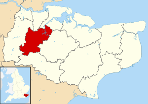
The Tonbridge and Malling area in Kent, England, is home to over 80 places where people have worshipped God. Many of these are in the old town of Tonbridge, which is the biggest town in this mostly countryside area. But lots of smaller villages and hamlets also have their own places of worship. These include old Anglican churches, chapels for other Christian groups called Nonconformists, and newer buildings for many different Christian faiths.
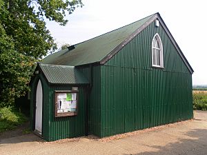
Right now, 63 places of worship are still in use. Another 21 old churches and chapels are no longer used for religious services, but they are still standing and are used for other things. Most people in Tonbridge and Malling say they are Christian. The area has almost 40 Anglican churches, which belong to the Church of England, the country's main church. These churches come in many shapes and sizes. Some are tiny "tin tabernacles" (churches made of corrugated iron) like those at Hadlow Stair and Golden Green. Others are large stone buildings in places like East Malling and Aylesford. Some churches are very old, built in Saxon or Norman times (like in Snodland and Wouldham). Others are from the 20th century, found in small villages or new housing areas.
People who are not Anglican worship in many different chapels and meeting rooms, mostly built in the 1800s and 1900s. Baptists, Methodists, and Roman Catholics each have several churches. Smaller groups like Open Brethren and Jehovah's Witnesses also have places of worship here.
English Heritage has given "listed status" to 37 places of worship in Tonbridge and Malling. A building gets listed status if it's very important because of its special design or history. This helps protect it. There are three levels of listed status:
- Grade I: For buildings of "exceptional interest" (the most important).
- Grade II*: For "particularly important buildings" that are more than just special.
- Grade II: For buildings of "special interest."
As of 2001, Tonbridge and Malling had 38 Grade I buildings, 74 Grade II* buildings, and 1,179 Grade II buildings.
Contents
Exploring Places of Worship
The Tonbridge and Malling area covers about 50,440 acres (20,410 hectares) of the Kentish Weald in western Kent. It shares borders with other areas in Kent, like Gravesham, Medway, Maidstone, Tunbridge Wells, and Sevenoaks.
Tonbridge, like many towns in Kent, grew along a main road where a river could be crossed. It grew very fast in the 1800s. Its old history can still be seen in its castle and the nearby parish church of Saints Peter and Paul. As the town grew in the Victorian times, especially with new railway lines, more Anglican churches were built. A famous church architect named Ewan Christian designed three new churches, which are still open today. One of these, St John the Evangelist's Church (built in 1841) in Hildenborough, was his first church. Christian was praised for his skill in the Gothic Revival style, which copied medieval church designs.
Besides the new St Saviour's and St Stephen's churches, three smaller "mission churches" were built for the growing population. Two of these still exist, but they are no longer used for religious services. The St Stephen's Mission at Lower Haysden is now in ruins. It was a "tin tabernacle"—a special and cheap type of church that could be bought from a catalogue and put up quickly. These tin churches were very popular around 1900. Two green-painted ones are still used for worship in the area: the Golden Green Mission Church (1914), which serves a small village and is a listed building, and St Andrew's Church, which serves the Hadlow Stair area of Tonbridge.
The building boom for Anglican churches in Tonbridge in the 1800s also happened because Protestant Nonconformist worship became more popular. Laws that limited these groups had been slowly removed since the 1600s. Independent Christians started a chapel in Tonbridge in 1791. By the 1850s, there were groups of Wesleyan Methodists, Congregationalists, Strict Baptists, Independent Calvinistic Baptists, and the United Methodist Free Church.
In the 1900s, new places of worship were built for Evangelical, Pentecostal, and Brethren Christians. The River Church, which doesn't belong to a specific denomination, started in 1998 and moved into its new building next to the River Medway in 2003. Other long-standing Nonconformist chapels in the area include a Reformed Baptist chapel at Ryarsh, an Evangelical Free church at Dunk's Green, a Brethren Gospel Hall in Hildenborough, and Strict Baptist, Salvation Army, and Methodist churches in East Peckham.
Methodism has been strong in Kent for many years, and several small countryside chapels still exist. However, after World War II, some closed, including the Grade II-listed chapels at Aylesford and Ightham. In Burham, the Methodist chapel welcomed Anglicans when their 1800s church had to be pulled down because of problems. It still serves both groups today. As Roman Catholic worship became more common in the 1800s (after old laws were removed), churches were built in Tonbridge and West Malling. In the 1900s, a badminton hall and an unused Gospel Hall were bought and turned into churches in Borough Green and Hadlow.
Outside of Tonbridge town, much of the area is rural, with many old Anglican churches. Some villages, like Addington, Trottiscliffe, and Offham, are quite far from their churches. In East Peckham, the main part of the village moved, and the old church, St Michael's Church, became unused because it was too far away. A new church was built closer to the village. The small town of Snodland still has two active Anglican churches. However, Roman Catholic, Methodist, United Reformed, and Swedenborgian churches there have all closed since the 1970s. The area around the old village of Larkfield has grown into a large residential and industrial suburb, including New Hythe, Leybourne, and Lunsford Park. Two Anglican churches already served this area, and a new Methodist church was built in 1964, replacing an older one in nearby East Malling.
Religious Beliefs
In 2001, a survey showed that 107,561 people lived in Tonbridge and Malling.
- 76.13% said they were Christian. This was higher than the average for England (71.74%).
- 15.01% said they had no religion. This was slightly higher than the national average (14.59%).
- Smaller numbers of people followed other religions: 0.3% were Muslim, 0.16% Hindu, 0.15% Buddhist, 0.12% Jewish, and 0.07% Sikh. These numbers were much lower than the averages for England as a whole.
How Churches are Organized
Anglican Churches
All Anglican churches in Tonbridge and Malling are managed by the Diocese of Rochester. This diocese has different areas called "archdeaconries," which are then divided into "deaneries." Each deanery looks after a group of churches.
The Archdeaconry of Rochester manages three churches in the area: the two churches in Snodland and the chapel at Blue Bell Hill Village. The Archdeaconry of Tonbridge looks after the other 35 Anglican churches.
Roman Catholic Churches
The four Roman Catholic churches in the area are in Borough Green, Hadlow, Tonbridge, and West Malling. They all belong to the Archdiocese of Southwark, which is based in London.
Other Christian Groups
About 150 Baptist churches in southeast England are part of the South Eastern Baptist Association. Tonbridge Baptist Church is in the Tonbridge Network, and West Malling Free Church is in the North Kent Network. Providence Strict Baptist Chapel at East Peckham is part of the Gospel Standard movement. Borough Green Baptist Church and Pembury Road Baptist Chapel in Tonbridge are Reformed Baptist churches and belong to GraceNet UK, a group of Reformed Evangelical Christian churches. Ryarsh Baptist Chapel is also part of this group.
In 2010, East Peckham and Tonbridge Methodist Churches were part of the Tonbridge Methodist Circuit. Other Methodist churches in the area were part of the Maidstone Circuit.
Tonbridge Evangelical Free Church is a member of the Fellowship of Independent Evangelical Churches (FIEC), a network of about 500 churches with an evangelical focus. It's also connected to Affinity, another group of conservative Evangelical churches. Borough Green Baptist Church is also part of Affinity.
Christ Church United Reformed Church in Tonbridge is a member of its denomination's Southern Synod.
Churches Open for Worship
| Name | Image | Location | Christian Group | Grade | Interesting Facts | Refs |
|---|---|---|---|---|---|---|
| St Margaret's Church |  |
Addington 51°18′18″N 0°22′16″E / 51.3050°N 0.3712°E |
Anglican | I | This church has an early Norman (around 1100) main part. Its tall west tower, built in the 1470s, is very noticeable. The church was repaired in 1858. | |
| St Peter and St Paul's Church |  |
Aylesford 51°18′15″N 0°28′46″E / 51.3041°N 0.4795°E |
Anglican | I | This church on a hilltop looks almost entirely Norman. Inside, you can see beautiful old features and grand monuments from the late medieval period. | |
| All Saints Church |  |
Birling 51°19′11″N 0°24′35″E / 51.3197°N 0.4098°E |
Anglican | I | Built between the 1300s and 1500s, mostly in the Perpendicular Gothic style. It has a wide 1500s chancel with unusual windows and a large, strong tower. | |
| St Alban's Church |  |
Blue Bell Hill 51°20′03″N 0°30′31″E / 51.3341°N 0.5085°E |
Anglican | – | This small chapel was built in 1931. Since 1997, it has been part of a larger church area that includes Anglican and Methodist places of worship. | |
| Church of the Good Shepherd |  |
Borough Green 51°17′29″N 0°18′14″E / 51.2913°N 0.3039°E |
Anglican | – | This brick church was designed by architects Monkton and Gillespie and built in 1905. | |
| Borough Green Baptist Church |  |
Borough Green 51°17′30″N 0°18′20″E / 51.2916°N 0.3055°E |
Baptist | – | This church started in 1809. The current chapel was built eight years later. It has been extended several times to make space for more people. | |
| St Joseph's Chapel |  |
Borough Green 51°17′34″N 0°18′20″E / 51.2928°N 0.3056°E |
Roman Catholic | – | This simple building was first a badminton hall in 1927. The Catholic Church bought it in 1957 and turned it into a small chapel. It has been renovated since then. | |
| The Church in Burham |  |
Burham 51°19′56″N 0°28′38″E / 51.3321°N 0.4771°E |
Anglican/Methodist | – | This Wesleyan Methodist church is now shared by Anglicans. It was built in 1847 and extended in 1873. | |
| St Philip's Church |  |
Cage Green, Tonbridge 51°12′30″N 0°17′07″E / 51.2083°N 0.2854°E |
Anglican | – | This church was built in 1969, replacing an old wooden school building that was used as a church from 1956. It was officially opened in April 1970. | |
| Tonbridge Pentecostal Church |  |
Cage Green, Tonbridge 51°12′26″N 0°16′38″E / 51.2073°N 0.2773°E |
Assemblies of God | – | This Pentecostal church has been in Tonbridge since 1929. The congregation has moved to different locations over the years. | |
| St Peter ad Vincula Church |  |
Ditton 51°17′45″N 0°27′04″E / 51.2959°N 0.4511°E |
Anglican | II* | This small church still looks very Norman, even after repairs in 1860. It has large windows and a two-stage tower from the 1300s and 1400s. | |
| Dunk's Green Evangelical Free Church |  |
Dunk's Green, Plaxtol 51°15′12″N 0°18′23″E / 51.2532°N 0.3065°E |
Evangelical | – | This chapel was built for Baptists in 1838. It later became a Congregational Church before becoming an Evangelical Free Church in 1972. | |
| St James the Great's Church |  |
East Malling 51°17′15″N 0°26′27″E / 51.2874°N 0.4407°E |
Anglican | I | While the outside looks like late Perpendicular Gothic, this church is much older. You can see Norman windows and materials inside. | |
| Holy Trinity Church |  |
East Peckham 51°13′02″N 0°22′54″E / 51.2172°N 0.3816°E |
Anglican | II | This church was built near the village center to replace the old St Michael's Church, which was far away. It has a bell tower and a multi-sided apse. | |
| Providence Strict Baptist Chapel |  |
East Peckham 51°12′46″N 0°23′15″E / 51.2129°N 0.3874°E |
Baptist | – | Strict Baptists have worshipped here since 1857. The outside is covered in roughcast, but the walls are brick. It has pointed-arch windows. | |
| East Peckham Methodist Church |  |
East Peckham 51°12′46″N 0°23′09″E / 51.2128°N 0.3858°E |
Methodist | – | Built in 1886–87, this chapel replaced a smaller building from 1823. It features red and white brickwork and pointed-arch windows. | |
| Salvation Army Hall |  |
East Peckham 51°12′46″N 0°23′20″E / 51.2129°N 0.3889°E |
Salvation Army | – | This simple red-brick building has been used continuously since 1885. It has round-arched windows. | |
| The Church in Eccles |  |
Eccles 51°19′07″N 0°28′34″E / 51.3186°N 0.4762°E |
Methodist | – | This Methodist chapel was shared with Anglicans for a while after the village's St Mark's Church was pulled down. It was officially registered for worship in 1933. | |
| Chapel of the Holy Innocents |  |
Fairseat 51°19′45″N 0°19′35″E / 51.3293°N 0.3264°E |
Anglican | – | This red brick church was originally a chapel for a nearby convalescent home. It opened in 1930 and is now part of the Stansted parish. | |
| Golden Green Mission Church |  |
Golden Green 51°12′36″N 0°20′35″E / 51.2100°N 0.3431°E |
Anglican | II | This timber-framed tin tabernacle was built in 1914. It has pointed-arch windows and has also been used as a community hall since 2003. | |
| St Mary the Virgin's Church | 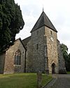 |
Hadlow 51°13′24″N 0°20′21″E / 51.2232°N 0.3393°E |
Anglican | II* | Much of this church was rebuilt in the 1840s and 1850s, but parts of it date back to the late 1000s. The tower is from the 1200s. | |
| St Peter's Chapel |  |
Hadlow 51°13′36″N 0°20′29″E / 51.2266°N 0.3415°E |
Roman Catholic | – | This building was originally an "Unsectarian Gospel Hall" in the 1880s. It was later bought by the Catholic Church and turned into a chapel. | |
| St Andrew's Church |  |
Hadlow Stair, Tonbridge 51°12′31″N 0°18′18″E / 51.2086°N 0.3049°E |
Anglican | – | This church started as an Anglican mission. A used tin tabernacle was bought from Brighton, moved here, and rebuilt. It became part of St Peter and St Paul Church's parish in 1940. | |
| Tonbridge Methodist Church |  |
Higham Wood, Tonbridge 51°12′43″N 0°17′42″E / 51.2119°N 0.2950°E |
Methodist | – | This church was built in 1965 and greatly extended in 1993. It replaced several earlier Methodist chapels in Tonbridge. | |
| St John the Evangelist's Church | 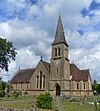 |
Hildenborough 51°13′03″N 0°14′21″E / 51.2174°N 0.2392°E |
Anglican | II | This was the first church designed by Ewan Christian, built in 1843–44. It uses local sandstone and has a shingled spire. It features stained glass windows by famous artists like Edward Burne-Jones. | |
| Hildenborough Gospel Hall |  |
Hildenborough 51°12′59″N 0°14′34″E / 51.2163°N 0.2427°E |
Brethren | – | This Brethren Gospel Hall was registered for marriages in February 1895. | |
| St Peter's Church |  |
Ightham 51°17′21″N 0°17′09″E / 51.2892°N 0.2858°E |
Anglican | I | This church was mostly rebuilt in the 1300s and 1400s. It is famous for its many old monuments and sculptures from the 1300s to the 1600s. | |
| Holy Trinity Church |  |
Larkfield 51°18′23″N 0°26′39″E / 51.3063°N 0.4441°E |
Anglican | II | Built in 1854, this large church has a unique west end with strong buttresses and a rose window. It is in the Early English Gothic Revival style. | |
| Larkfield and East Malling Methodist Church |  |
Larkfield 51°17′56″N 0°26′32″E / 51.2989°N 0.4422°E |
Methodist | – | This Methodist chapel replaced an older one built in 1844. The new church was registered for marriages in April 1964. | |
| St Peter and St Paul's Church |  |
Leybourne 51°18′16″N 0°25′20″E / 51.3044°N 0.4223°E |
Anglican | II* | A Norman church that was added to in the 1500s and repaired in the 1870s. It has old features inside, including a "heart shrine." | |
| St Lawrence's Church | 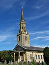 |
Mereworth 51°15′32″N 0°22′40″E / 51.2588°N 0.3778°E |
Anglican | I | The original 1100s church was pulled down and rebuilt in 1744–46. It is described as "the outstanding 18th-century church in the county" and is in the Palladian-style. | |
| St Michael and All Angels Church |  |
Offham 51°17′51″N 0°22′48″E / 51.2975°N 0.3801°E |
Anglican | I | This Norman church (around 1100) was extended and fixed many times over the next 300 years. It was also repaired in the Victorian era. | |
| Offham Methodist Church |  |
Offham 51°17′30″N 0°22′22″E / 51.2917°N 0.3727°E |
Methodist | – | This was originally a Primitive Methodist chapel, built in 1892. It is the second Methodist chapel in the village. | |
| St Mary's Church |  |
Platt 51°17′21″N 0°19′31″E / 51.2892°N 0.3253°E |
Anglican | II | Designed in 1841–42, this large church has a noticeable Perpendicular Gothic Revival tower. The rest of the stone building is in the Early English Gothic Revival style. | |
| Plaxtol Church |  |
Plaxtol 51°15′34″N 0°17′40″E / 51.2594°N 0.2945°E |
Anglican | II* | This church was built in the mid-1600s (a stone says 1649) and has been added to, especially in 1852 and 1894. | |
| St Martin's Church |  |
Ryarsh 51°18′24″N 0°23′52″E / 51.3068°N 0.3979°E |
Anglican | II* | The main parts of this church are from the early 1100s and still look Norman. The tower and west window are from the 1300s and 1400s. | |
| Ryarsh Baptist Chapel |  |
Ryarsh 51°18′56″N 0°23′37″E / 51.3156°N 0.3936°E |
Baptist | – | Built in 1863-64, this chapel has been both a Strict and a Reformed Baptist church. The outside is covered in stucco, but the walls are brick. | |
| St Giles' Church |  |
Shipbourne 51°14′50″N 0°16′43″E / 51.2471°N 0.2786°E |
Anglican | II | This small church was rebuilt in 1880. It is in the Early English Gothic Revival style. | |
| All Saints Church |  |
Snodland 51°19′48″N 0°26′59″E / 51.3299°N 0.4497°E |
Anglican | I | This church dates back to the 1100s, with additions made until the 1400s. It was repaired in 1870. It has 1300s wall paintings. | |
| Christ Church |  |
Snodland 51°19′29″N 0°26′26″E / 51.3246°N 0.4405°E |
Anglican | – | This church opened in 1893, replacing a tin tabernacle. It was designed in the Early English Gothic Revival style and does not have a tower or spire. | |
| Kingdom Hall |  |
Snodland 51°19′48″N 0°26′56″E / 51.3299°N 0.4489°E |
Jehovah's Witnesses | – | This Kingdom Hall was registered for marriages in February 1989. It is used by the Cuxton group of Jehovah's Witnesses. | |
| St Mary the Virgin's Church | 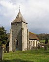 |
Stansted 51°20′08″N 0°18′22″E / 51.3355°N 0.3061°E |
Anglican | II* | Originally rebuilt around 1400, this church was heavily changed during the Victorian era. The inside, with its Perpendicular Gothic arches, has changed little. | |
| St Peter and St Paul's Church |  |
Tonbridge 51°11′52″N 0°16′36″E / 51.1978°N 0.2768°E |
Anglican | II* | Little remains from the 1100s church. The tower and arch are from the 1300s. Most of the building dates from 1877–79, when Ewan Christian repaired and enlarged it. | |
| St Eanswythe's Mission | 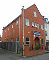 |
Tonbridge 51°11′24″N 0°16′36″E / 51.1899°N 0.2768°E |
Anglican | – | Opened in 1890 as a non-denominational mission in a tin tabernacle. It is now an Anglican church in a new building built after 2004. | |
| St Saviour's Church |  |
Tonbridge 51°12′14″N 0°16′30″E / 51.2040°N 0.2750°E |
Anglican | – | Opened in 1875, this church served people in north Tonbridge and offered services in a more "High Church" style. It was designed by Ewan Christian. | |
| St Stephen's Church | 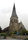 |
Tonbridge 51°11′24″N 0°16′08″E / 51.1899°N 0.2689°E |
Anglican | – | Ewan Christian designed this church between 1851 and 1854 in the Early English Gothic Revival style. It has a tall spire and stained glass by Morris & Co.. | |
| Pembury Road Baptist Chapel | 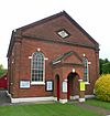 |
Tonbridge 51°11′17″N 0°16′20″E / 51.1880°N 0.2721°E |
Baptist | – | This chapel, once called Zion Chapel, was founded by people who left another church. It opened in 1867. | |
| Tonbridge Evangelical Free Church |  |
Tonbridge 51°11′26″N 0°15′59″E / 51.1906°N 0.2664°E |
Evangelical | – | This church was founded by people who left the town's Baptist church in the early 1900s. It has changed its name a few times. | |
| River Church |  |
Tonbridge 51°11′33″N 0°16′22″E / 51.1926°N 0.2727°E |
Non-denominational | – | This church was started in 1998. It moved into The River Centre building in 2003 and is now known as River Church. | |
| Corpus Christi Church | 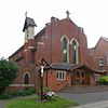 |
Tonbridge 51°11′47″N 0°16′43″E / 51.1963°N 0.2785°E |
Roman Catholic | – | The first Roman Catholic church in Tonbridge was a tin tabernacle from 1894. The current building replaced it in 1904. | |
| Christ Church | 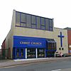 |
Tonbridge 51°11′33″N 0°16′22″E / 51.1926°N 0.2727°E |
United Reformed Church | – | This church was built in 1875. It was badly damaged in the Great Flood of 1968 and replaced by the current church in 1978. | |
| Tonbridge Baptist Church |  |
Trench Wood, Tonbridge 51°12′38″N 0°16′31″E / 51.2106°N 0.2753°E |
Baptist | – | A Baptist church was founded in Tonbridge in 1868. The original building was destroyed in the Great Flood of 1968, and a new church opened in 1973. | |
| Cornerstone Christian Fellowship Gospel Hall |  |
Trench Wood, Tonbridge 51°13′00″N 0°16′34″E / 51.2166°N 0.2760°E |
Brethren | – | This building from the 1970s replaced an earlier mission room built in 1874. The old building was pulled down for road widening. | |
| Church of St Peter and St Paul, Trottiscliffe |  |
Trottiscliffe 51°19′13″N 0°21′40″E / 51.3202°N 0.3612°E |
Anglican | I | This Norman church has changed very little. It has a "magnificent" tall pulpit from 1775 that was originally in Westminster Abbey. | |
| Walderslade Baptist Church | Walderslade Woods 51°20′00″N 0°31′15″E / 51.3332°N 0.5207°E |
Baptist | – | This church is in the small part of Walderslade that is in Tonbridge and Malling. It is part of a building with other uses and was registered for marriages in 1992. | ||
| St John the Baptist's Church |  |
Wateringbury 51°15′26″N 0°24′50″E / 51.2573°N 0.4138°E |
Anglican | II* | This church was repaired in 1856 and 1889. It has a stuccoed (covered in plaster) tower and a 1400s entrance porch. | |
| Barn Chapel at Pilsdon Community |  |
West Malling 51°17′31″N 0°24′36″E / 51.2920°N 0.4099°E |
Anglican | II* | This is a 1400s former tithe barn (a barn where taxes were paid in crops) at Ewell Monastery. The Pilsdon Community uses it for worship, which is open to the public. | |
| St Mary the Virgin's Church |  |
West Malling 51°17′32″N 0°24′24″E / 51.2922°N 0.4066°E |
Anglican | II* | The original Norman building was extended in the 1200s, 1300s, and 1400s. The main part of the church was replaced in 1901–03. The tall spire is from 1837. | |
| West Malling Free Church |  |
West Malling 51°17′39″N 0°24′41″E / 51.2943°N 0.4115°E |
Baptist | II | This brick chapel was built in 1836. It was renovated in 1894 with new windows and a stuccoed front. Later, a roughcast exterior was added. | |
| St Thomas More's Church |  |
West Malling 51°17′42″N 0°25′07″E / 51.2949°N 0.4187°E |
Roman Catholic | – | There was a small Catholic church here before. This new church and a Catholic school were built on the edge of the village and opened in 1972 and 1973. | |
| St Dunstan's Church |  |
West Peckham 51°14′55″N 0°21′17″E / 51.2486°N 0.3546°E |
Anglican | I | This mostly medieval church has a Saxon tower that is short and strong, with a pyramid-shaped spire. It has a north aisle and side chapel added in the 1300s. | |
| All Saints Church |  |
Wouldham 51°21′10″N 0°27′29″E / 51.3528°N 0.4581°E |
Anglican | I | This church has grown in unique ways since the 1000s, giving it a very distinct look. It has a strong tower with battlements. | |
| St George's Church |  |
Wrotham 51°18′32″N 0°18′40″E / 51.3090°N 0.3111°E |
Anglican | I | This large 1300s church overlooks the village. The tower, added a century later, has an unusual passageway through it, used for processions. |
Churches No Longer in Use
| Name | Image | Location | Christian Group | Grade | Interesting Facts | Refs |
|---|---|---|---|---|---|---|
| Aylesford Methodist Chapel |  |
Aylesford 51°18′15″N 0°28′59″E / 51.3041°N 0.4831°E |
Methodist | II | Built in 1851, this chapel was used for worship until November 1990. It was made of Kentish Ragstone and slate. | |
| St Mary's Church |  |
Burham 51°19′53″N 0°27′46″E / 51.3313°N 0.4627°E |
Anglican | I | This church by the river became unused as the village moved away. It was repaired from 1956 onwards and is now looked after by a special trust. | |
| Church of Our Lady of the Meadows |  |
Dode 51°20′53″N 0°23′41″E / 51.3481°N 0.3946°E |
Roman Catholic | II* | This isolated chapel was built in the Norman era. It stopped being used before the Reformation. It was later restored and used for occasional services, but is now a private wedding venue. | |
| St Michael's Church |  |
East Peckham 51°14′40″N 0°22′45″E / 51.2445°N 0.3792°E |
Anglican | II* | Like Burham, this church is in a remote spot far from where its village grew. It is owned by the Churches Conservation Trust. | |
| People's Hall |  |
Eccles 51°19′04″N 0°28′42″E / 51.3178°N 0.4782°E |
Non-denominational | – | This hall was registered for worship in 1934, but its registration was cancelled 37 years later. | |
| Hadlow Particular Baptist Chapel | 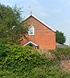 |
Hadlow 51°13′28″N 0°20′25″E / 51.2244°N 0.3403°E |
Baptist | – | This Strict Baptist chapel closed in 1982 and was turned into a house. It was built in 1830. | |
| Ightham Methodist Chapel |  |
Ightham 51°17′13″N 0°16′56″E / 51.2869°N 0.2821°E |
Methodist | II | Now a house, this former chapel dates from 1848. It is a large building with a classical style. | |
| Ivy Hatch Church |  |
Ivy Hatch 51°16′05″N 0°16′21″E / 51.2681°N 0.2725°E |
Anglican | – | ||
| St Stephen's Mission Church | 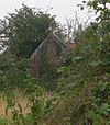 |
Lower Haysden 51°11′20″N 0°14′39″E / 51.1888°N 0.2442°E |
Anglican | – | The ruined remains of this tin tabernacle from 1878 still stand. It closed around 1956. | |
| St Benedict's Church |  |
Paddlesworth, Snodland 51°20′00″N 0°25′01″E / 51.3332°N 0.4170°E |
Anglican | II* | A tiny Norman chapel from the 1200s, located next to a remote farm. It stopped being used in 1678 but was restored in the early 1900s. | |
| Plaxtol Methodist Chapel |  |
Plaxtol 51°15′28″N 0°17′45″E / 51.2579°N 0.2959°E |
Methodist | – | Built in 1893, this building closed in the early 1980s and was sold to become a house. It still has its red-brick walls. | |
| Primitive Methodist Chapel |  |
Snodland 51°19′44″N 0°26′30″E / 51.3289°N 0.4417°E |
Methodist | – | This chapel, built in 1899–1900, closed in 1976 and is now a car showroom. | |
| Church of the New Jerusalem | 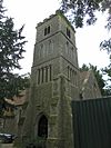 |
Snodland 51°19′48″N 0°26′59″E / 51.3299°N 0.4497°E |
Swedenborgian | II | This church, built in 1881, was used into the 1980s but is now a house. It had a prominent tower and cost £5,000 to build. | |
| United Church | 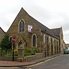 |
Snodland 51°19′48″N 0°26′37″E / 51.3301°N 0.4437°E |
United Reformed Church/Methodist | – | This church, built in 1888, became unsafe and closed in August 2011. | |
| St Saviour's Mission Room | 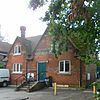 |
Tonbridge 51°12′09″N 0°16′40″E / 51.2024°N 0.2778°E |
Anglican | – | This small chapel was built in 1886. It was bought by the Red Cross in 1960 and is now a house. | |
| Tonbridge Wesleyan Church | 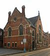 |
Tonbridge 51°11′47″N 0°16′34″E / 51.1965°N 0.2761°E |
Methodist | II | Tonbridge's main Wesleyan Methodist church was built in 1872. Its last service was in 1990. | |
| United Methodist Free Church | 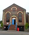 |
Tonbridge 51°11′22″N 0°16′23″E / 51.1894°N 0.2731°E |
Methodist | – | This colorful brick chapel was built in 1868. It was used for 51 years before being sold for business use. | |
| Wesleyan Mission Chapel |  |
Tonbridge 51°11′32″N 0°16′16″E / 51.1921°N 0.2710°E |
Methodist | – | This building, built in 1869, was mainly a school but also used as a mission church. By the 1980s, it was used for adult education. | |
| Independent Chapel | 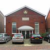 |
Tonbridge 51°11′52″N 0°16′29″E / 51.1977°N 0.2747°E |
Independent | – | This was Tonbridge's first Nonconformist place of worship, built in 1791. It was replaced by a new chapel in 1876. | |
| Ebenezer Chapel | 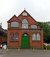 |
Tonbridge 51°11′39″N 0°16′23″E / 51.1941°N 0.2731°E |
Independent Calvinistic | – | This chapel was built in 1857 and rebuilt in 1898. It was used for worship until 1971 and has since been used for storage. | |
| Gospel Hall | Wouldham 51°20′55″N 0°27′28″E / 51.3486°N 0.4578°E |
Brethren | – | This Gospel Hall was registered for marriages in 1946 and deregistered in 1980. |
St Leonard's Tower
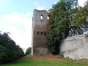
St Leonard's Tower in West Malling is a Grade I-listed building. It looks like a church tower, but it was actually built as the strong central part (called a keep) of a castle. It was built by Gundulf, who was the Bishop of Rochester between 1077 and 1108.
Some old writings say that the tower was part of a church dedicated to St Leonard, and that the rest of the church was pulled down for its stones to be used elsewhere. This left only the tower standing on a rocky hill. However, more recent studies disagree. A historian named John Newman wrote in 1969 that "this is no church tower, but a free-standing keep tower." English Heritage, which protects historic buildings, described it in 1993 as a "former castle... one of the best examples of an early Norman keep." They did not mention it ever being a church.
See also
 | Victor J. Glover |
 | Yvonne Cagle |
 | Jeanette Epps |
 | Bernard A. Harris Jr. |


