Meander, Tasmania facts for kids
Quick facts for kids MeanderTasmania |
|||||||||||||||
|---|---|---|---|---|---|---|---|---|---|---|---|---|---|---|---|

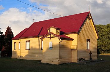
St Saviour's Anglican Church
|
|||||||||||||||
| Population | 328 (2016) | ||||||||||||||
| Established | 1907 | ||||||||||||||
| Postcode(s) | 7304 | ||||||||||||||
| Elevation | 291 m (955 ft) | ||||||||||||||
| Location |
|
||||||||||||||
| LGA(s) | Meander Valley Council | ||||||||||||||
| Region | Launceston | ||||||||||||||
| State electorate(s) | Lyons | ||||||||||||||
| Federal Division(s) | Lyons | ||||||||||||||
|
|||||||||||||||
|
|||||||||||||||
Meander is a small town and rural area in Tasmania, Australia. It's part of the Meander Valley Council area. The town is about 34 kilometers (21 miles) southwest of Westbury. In 2016, 328 people lived in Meander.
Back in 2011, Meander had 415 residents. About 40% of them worked in farming. They mainly raised sheep and cattle, and worked in the dairy industry. The land around Meander has been changed over time. First, Indigenous people turned forests into grasslands. Later, settlers built many channels for watering crops and draining land. The Meander River flows through the town. Meander is located between two mountains, Quamby Bluff and Mother Cummings Peak, which are part of the Great Western Tiers mountain range.
For thousands of years, the Pallittorre people lived in the Meander area. They were part of the Northern Tribe of Aboriginal Tasmanians. European settlers started arriving in the 1820s. This led to conflict with the Pallittorre people. Over time, the Pallittorre were forced off their land. This happened because of government policies, diseases, and fighting with the new settlers.
Europeans began receiving land grants in 1828. At first, these were very large areas. Later, smaller plots of land were also given out. The town of Meander was first planned in 1901 but was not built. It was officially established in a different spot in 1907. Industries in Meander have included sawmills, dairy farms, a cheese factory, and a meat processing plant.
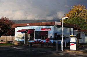
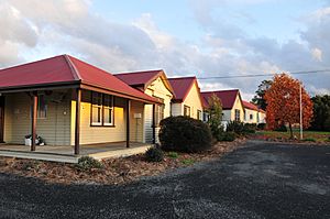
Meander Primary School was built around 1910–11. It includes buildings moved from other nearby schools that closed. The school and the nearby St Saviour's Anglican church are considered a "historic precinct" by the National Trust. Meander used to have a Methodist church and a Baptist church. Today, only the Anglican church is still used. The town has one store with a post office service, and a community hall.
Contents
Who lived here first?
The first people to live in the Meander area were the Pallittorre. They were a group within the Northern Tribe of Aboriginal Tasmanians. There are caves south of Meander in the Great Western Tiers mountains. These caves show signs that Aboriginal people lived there long ago. People believe Aboriginal people have lived in Tasmania for over 30,000 years.
The Pallittorre people kept the grassy plains clear by carefully burning the land. They also used this method to control plants in the forests. This helped them hunt and gather food more easily. After the Pallittorre were removed, European settlers noticed how quickly the forests grew back. The Pallittorre moved around the land with the seasons. They sometimes lived in villages of bark huts. They also mined ochre (a natural pigment) in the Gog Range. They traded this ochre with other Aboriginal groups across Tasmania.
Around 1824, European settlers and their farms began to move onto Pallittorre lands. This often led to fighting between the two groups. The conflict grew worse over time. European diseases, deliberate killings, and being forced off their land greatly reduced the Pallittorre population. By 1834, only one Pallittorre woman was found in the area. The removal of the Pallittorre from their land was largely planned. The government wanted to move the native people away so European settlers could have the land.
When Europeans settled
Europeans first settled in the Meander area in 1822. This was even before official land grants were given out. The first land grant in Meander was given to Robert Garrett in 1828. It was a large area of about 1,500 acres (607 hectares) near Quamby Bluff. From the 1830s, many land grants were made in the valley, mostly for grazing animals.
Most of these early grants were very big. But later, laws like the Waste Lands Act of 1858 encouraged smaller landholdings. This law allowed areas of crown land less than 320 acres (129 hectares) to be sold. By 1878, there were 16 landholdings smaller than 100 acres (40 hectares).
These smaller land grants led to more people moving to the area. In 1900, a town was planned near where Meander is today. About 125 acres (50 hectares) were set aside for it. This first town was officially named in 1901 but was never built. The area had been known as Meander informally since about 1888. The current town was planned and officially named in 1907, a short distance from the first planned site.
Life in Meander today
The land around Meander is mainly used for farming. People mostly raise sheep and cattle, and there's a big dairy industry. Since the 1970s, opium poppies have also been grown for making medicines.
An old irrigation system shows how the land was changed long ago. It covers about 65 square kilometers (25 square miles) with channels for watering crops and draining water. These channels were made in the late 1840s. They take water from the Meander River and return extra water further downstream. They are still used today. Meander is located on the Meander River, near the Great Western Tiers mountains. It sits between Quamby Bluff and Mother Cummings Peak.
St Saviour's Anglican church was built in 1898. It is still an active church today. Next to the church is the Meander Primary School. The school has several buildings that were moved from other nearby settlements. These include old school buildings from Montana, Jacky's Marsh, and Golden Valley. The school and St Saviour's Church were named a "historic precinct" by the National Trust in 1988.
Cheshunt is a historic home in the area. It belonged to the Bowman family, whose large estate once covered much of Meander. The house is a two-story Victorian building. It was designed and finished in 1852 by a famous architect named William Archer.
Meander is part of the Meander Valley Council area. For state and federal government, it's in the Division of Lyons.
Who lives in Meander?
In 2011, the Meander area had a population of 415 people. Farming is a major job here. Almost 40% of working people are in livestock, dairy farming, grain farming, and sawmills. Most residents were born in Australia. English is the main language spoken. More than 80% of residents have family roots from Australia or Great Britain.
The average age in Meander is 41 years old. This is similar to the rest of Tasmania. About 47% of residents reported having a religious belief. Most of these were Anglican. All homes in Meander are separate buildings. Most homes (81.3%) are owned outright or with a mortgage. The average household income in Meander is lower than the rest of Tasmania or Australia.
A famous person from Meander is Jean Stafford. She is a very successful country music singer. She spent some of her childhood on a farm in Meander. She went to Meander school and was married at the Meander Methodist Church. She has won "Golden Guitar" awards for being Australia's best female country singer.
Churches in Meander
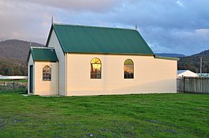
The first church in Meander was a Methodist chapel. It was built on land given by a local family and opened in 1886. Local Methodists likely paid for its construction. Before other churches were built, all Christian groups used this chapel. In 1976, Meander's Methodist church became part of the Uniting Church in Australia. The church was used by different groups until its last service on May 20, 1984. The building was then sold.
A Baptist church was also built on the main road. It opened in 1923. It was a timber building. The land for it was given by the son of the first Baptist minister, who was the local butcher. The last service at this church was on April 28, 1985. Before it closed, the Baptist and Uniting Church groups often held services together.
A Sunday School building, also called the Mission Church, was built in the late 1800s. The Anglican Church of England held services in this building from at least 1891. On September 22, 1897, the first stone for a new church, St Saviour's, was laid next to the Sunday School building. St Saviour's opened on February 3, 1898. The Sunday School continued in the old building until about 1980. The nearby cemetery had its first burial in 1891. St Saviour's was officially recognized as a church in November 1902. As of 2009, the church holds monthly services.
Town services
The first store in Meander opened in 1892. It was on East Meander Road and closed in 1902. Over the years, different stores in Meander have sold many types of goods. Some have been petrol stations, butchers, and grocers. At least six different stores have been open at various times. The only store open in the 21st century opened around 1951 and has had different owners.
Meander had a post office by 1888. Before that, locals ran an unofficial mail service. The post office was in its own building until the postmaster retired in 1977. After that, the local store provided post office services. There was also a manual telephone exchange in the post office building. This was replaced with an automatic system in June 1975.
The first community hall in Meander was built in 1914. It was built by a local resident, Fred Bowman. He looked after it until 1945, when a local committee took over. In 1952, locals decided to build a new hall. Money for the hall came from competitions, dances, and selling peas. The new hall opened on December 3, 1954. It was connected to the original hall around 1957.
The road from Deloraine to Meander was paved in 1964. This was a big event, celebrated with a fair. Mains electricity came to Meander in 1952. Power was switched on in the town area in December 1952. Meander's street lights were first turned on November 12, 1971.
The Meander volunteer fire brigade started in 1972. They got their first fire truck in 1973. For the first few years, the truck had to be kept at members' homes. In 1991, the brigade had about 15 members. This fire brigade was formed to help fight bushfires.
Weather in Meander
| Climate data for Meander (Station 091061 rainfall), Deloraine (Station 091000 temperature) | |||||||||||||
|---|---|---|---|---|---|---|---|---|---|---|---|---|---|
| Month | Jan | Feb | Mar | Apr | May | Jun | Jul | Aug | Sep | Oct | Nov | Dec | Year |
| Mean daily maximum °C (°F) | 21.3 (70.3) |
22.5 (72.5) |
19.6 (67.3) |
16.5 (61.7) |
13.2 (55.8) |
10.9 (51.6) |
10.4 (50.7) |
11.4 (52.5) |
13.3 (55.9) |
15.5 (59.9) |
17.7 (63.9) |
20.1 (68.2) |
16.1 (61.0) |
| Mean daily minimum °C (°F) | 7.7 (45.9) |
8.7 (47.7) |
6.3 (43.3) |
4.5 (40.1) |
2.7 (36.9) |
1.0 (33.8) |
0.9 (33.6) |
1.2 (34.2) |
3.1 (37.6) |
4.4 (39.9) |
5.4 (41.7) |
7.2 (45.0) |
4.4 (39.9) |
| Average rainfall mm (inches) | 55.7 (2.19) |
55.4 (2.18) |
59.6 (2.35) |
81.5 (3.21) |
99.2 (3.91) |
103 (4.1) |
136.2 (5.36) |
134.9 (5.31) |
101.9 (4.01) |
87.2 (3.43) |
75.7 (2.98) |
71.5 (2.81) |
1,061.8 (41.84) |
| Average rainy days (≥ 0.2 mm) | 5.9 | 5.8 | 7.2 | 8.4 | 8.8 | 11.5 | 12.8 | 14.4 | 12.4 | 9.8 | 8.1 | 7.5 | 112.6 |
| Source 1: Bureau of Meteorology, Meander Rainfall | |||||||||||||
| Source 2: Bureau of Meteorology, Deloraine (Athol) Temperature | |||||||||||||
Sports in Meander
Meander's Australian rules football club started in 1923. They played in the Chudleigh Association and won the championship in 1931. The club stopped playing during World War II. After the war, they joined other associations. The club closed in 1982 because they didn't have enough players or local support.
Some football players from Meander became very successful. Carl Watson played for Meander before moving to bigger clubs. He played for Richmond and Essendon in the Victorian Football League. Ron McGowan also played for Meander. He later played 92 games for Footscray.
The Meander cricket club started around 1896. It closed for some years but was restarted for competition in the 1980s. A new concrete pitch was built. In 1991, they played in the 'A' Grade of the Westmoreland Cricket Association. In 2012, Neil William Johnston, the club chairman, received an Order of Australia medal. This was for his service to the Meander community. He also helped start the fire brigade and was involved with other local sports clubs.
The Meander badminton club started in 1951. By 1991, they had four teams. A sheep dog club opened in the late 1970s. Meander has hosted the Tasmanian Championships four times. It also hosted the Australian Championships once in 1990. A Meander club member, Henry Homan, was the champion that year. Meander also had a basketball club from 1960 to about 1977. This club was mainly a Christian basketball club linked to the Baptist church.
Schools in Meander
Schooling in Meander began in 1891. The government rented a building from the Meander Church of England, which is now called the Sunday School. The first teacher, Miss Mary Johnson, taught at the "West Meander School" for 21 years. When it opened, the school taught only primary-aged children and had 19 students. In 1901, the education department bought land next to the church. A new school was built there around 1910–11. Meander's student numbers grew to 80–90 in 1926.
Schools also operated in nearby areas like Montana, Golden Valley, Western Creek, and Jacky's Marsh. Many of these school buildings were later moved to Meander Primary School. For example, the Montana school building was moved to Meander in 1947–48. The Golden Valley school building was also moved to Meander after it closed in 1945. Children from these areas started taking school buses to Meander's school from the 1940s.
From 1949 to 1968, Meander's school was a state school. This meant it taught both primary and secondary students (Grade 1 to Grade 9). In 1968, it became a primary-only school called "Meander Primary School." Secondary students then traveled by bus to Deloraine's high school. This change happened because there were only a small number of secondary students. In 1991, the school had 60 students. In 2009, it had 62 students. By the end of 2014, student numbers had dropped. The primary school began closing, with students expected to go to schools in Deloraine or Mole Creek.
Roads around Meander
Highland Lakes Road (Route A5) briefly touches the northern edge of Meander. Route C167 (Meander Road / Main Road / Huntsman Road) enters from the north. It runs through the area to Huntsman Lake in the southeast. Route C166 (Cheshunt Road) starts at an intersection with C167 and goes west.
Images for kids
 | Delilah Pierce |
 | Gordon Parks |
 | Augusta Savage |
 | Charles Ethan Porter |


