Mornington Island facts for kids
|
Native name:
Kunhanhaa
|
|
|---|---|

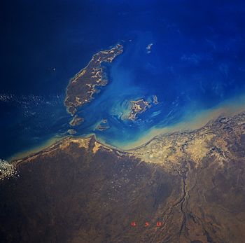
Mornington Island from space, September 1991
|
|
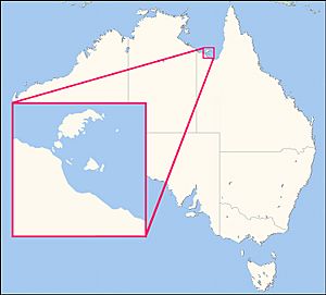
| Lua error in Module:Location_map at line 420: attempt to index field 'wikibase' (a nil value). | |
| Geography | |
| Location | Gulf of Carpentaria |
| Archipelago | Wellesley Islands |
| Total islands | 22 |
| Area | 1,018 km2 (393 sq mi) |
| Coastline | 302 km (187.7 mi) |
| Highest elevation | 150 m (490 ft) |
| Highest point | unnamed |
| Administration | |
|
Australia
|
|
| State | Queensland |
| Local Government Area | Shire of Mornington |
| Largest settlement | Gununa |
| Demographics | |
| Population | 1007 (2001) |
| Pop. density | 1 /km2 (3 /sq mi) |
| Ethnic groups | Aboriginal Australians |
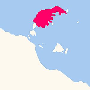
Mornington Island, also known as Kunhanhaa, is a large island in the Gulf of Carpentaria. It is part of Queensland, Australia. It is the biggest of 22 islands in the Wellesley Islands group. The island covers about 1,018 square kilometres (393 square miles).
The main town on the island is Gununa. It is located in the south-western part of the island. The Lardil people are the original inhabitants and traditional owners of Mornington Island. Other groups, like the Kaiadilt people, also live here. They moved from nearby Bentinck Island many years ago.
From 1914 to 1978, a special settlement called the Mornington Island Mission operated on the island. After that, the Queensland Government took over. Today, the Mirndiyan Gununa Aboriginal Corporation helps run an art centre called MIArt. They also manage a dance group, the Mornington Island Dancers.
Contents
Island Geography and Nature
Mornington Island is mostly flat. Its highest point is about 150 metres (492 feet) above sea level. The island is surrounded by mangrove forests. It also has 10 estuaries, which are places where rivers meet the sea. These areas are very natural and untouched.
About 40 kilometres (25 miles) northwest of Mornington Island is the Manowar and Rocky Islands Important Bird Area. This special place protects many different kinds of birds.
The town of Gununa is on the south-western side of the island. It looks out over the Appel Channel. This channel separates Mornington Island from Denham Island.
Island History
The Lardil language is an Aboriginal language spoken on Mornington Island. The Lardil people prefer to be called Kunhanaamendaa. This means "people of Kunhanhaa," which is the traditional name for the island. The Kaiadilt people moved to Mornington Island in 1947–1948. Other groups arrived later from the Doomadgee Mission in 1958.
Long ago, people called Macassan trepangers visited Mornington Island. They came from Sulawesi (now part of Indonesia) to collect sea cucumbers. These were used for food and trade.
A British explorer named Matthew Flinders named the island. He named it after Richard Wellesley, 1st Marquess Wellesley. Wellesley was also known as the Earl of Mornington.
In 1905, most of the Wellesley Islands became an Aboriginal reserve. This meant the land was set aside for Aboriginal people. The Queensland Government appointed a "Protector of Aborigines" to look after the area.
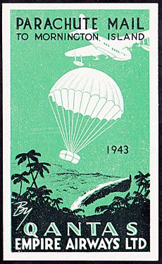
The Mornington Island Airport was used during World War II. It was a temporary airfield for the RAAF and other allied air forces. The Mornington Island State School opened in 1975.
Mornington Island is often hit by cyclones. These strong storms can cause damage to the island.
Mornington Island Mission
The Mornington Island Mission started in 1914. It was run by Robert Hall, a missionary. Other missionaries, including some from the Moravian church, also worked there.
During the Second World War, the mission staff had to leave the island for a while. Later, James McCarthy became the superintendent. He made strict rules for the people. During his time, the Kaiadilt people from Bentinck Island were moved to the Mornington Island Mission. Missionaries separated children from their parents. The children lived in special buildings called dormitories. Their parents built simple homes around the mission.
The Kaiadilt people were moved because a cyclone damaged their water supply on Bentinck Island. The Queensland Government helped with the move. One famous artist, Sally Gabori (born around 1924), was among those moved. She later created art that showed her traditional lands.
Later, Douglas Belcher became the superintendent in 1953. He was more understanding of the Lardil culture. Conditions at Mornington Island Mission were not as harsh as at some other missions. Because of this, many people from the Doomadgee Mission moved to Mornington Island in the late 1950s.
In 1978, the Queensland Government took over running the mission.
Island Population
In 2016, about 1,143 people lived on Mornington Island. Most of the people living there are Aboriginal. The majority of the islanders live in the town of Gununa.
In 2021, the population was 1,025 people. Most of them (over 80%) were Aboriginal or Torres Strait Islander people.
Island Facilities
Mornington Island is getting new buildings and services. Before late 2023, there were only about 30 rooms for visitors. Now, a new complex has 34 more rooms. An existing motel also added 10 new cabins. This means more places for tourists, medical staff, and tradespeople to stay. This also brings more money to the local council.
More homes for families are being built. There will also be a youth centre and a new library in Gununa. The local council is paying for most of these new buildings. The Australian and Queensland governments are also helping with funding.
Mirndiyan Gununa Aboriginal Corporation
The Mirndiyan Gununa Aboriginal Corporation (MGAC) was started in 1973. It helps manage important cultural activities on the island. In 2009, it changed its name to MGAC. It also created three main parts: MIDance, MIArt, and MI Festival. The buildings for these groups were improved in 2010–2011. This included a special studio for artists.
Art Centre
Mornington Island Art (MIArt) is one of the oldest Indigenous Australian art centres in Australia. It is owned and run by the Mirndiyan Gununa Aboriginal Corporation.
People on the islands started making art in the 1950s. They used natural colours from the earth, called ochres, to paint on tree bark. Later, they started using acrylic paint. In the 1970s, they began selling their artwork.
In the 1980s, a new art centre was set up. It helped artists create and sell their traditional crafts. The Kaiadilt community did not have two-dimensional art traditions before 2005. But then, artists like Sally Gabori started creating amazing paintings.
The art centre has a studio where artists work and a gallery to show their art. Both men and women artists create works that show their Lardil and Kaiadilt cultures. Their art has been shown in cities like Brisbane and Darwin. Famous artists like Sally Gabori and Dick Roughsey worked here. Their families still work at the centre today.
The art centre also works with Kaiadilt elders. They help to keep their language and culture alive.
Mornington Island Dancers
Mornington Island has a long history of traditional dance. The Mornington Island Dancers were one of the first Aboriginal performing arts groups in Australia. They performed in Cairns in 1964. They also danced at the opening of the Sydney Opera House in 1973. Since 2009, they have been part of the Mirndiyan Gununa Aboriginal Corporation.
The dancers share Lardil culture through their traditional dances and songs. They have travelled and performed in many countries. These include Italy, France, Germany, the United States, and the United Kingdom.
Education on the Island
Mornington Island State School is a school for students from early childhood up to Year 10. It is located on Lardil Street. In 2018, the school had 263 students. It also has a special education program. The school works with the art centre and Kaiadilt elders. They help students learn about and keep their language and culture.
There are no schools on the island that offer education up to Year 12. For older students, options include distance education (learning from home) or going to a boarding school away from the island.
Island in Books and Research
Mornington Island has been featured in books and studies. Writer Ernestine Hill visited the island. A photo she took in 1933 is kept at the University of Queensland's library.
A British anthropologist named David McKnight studied the Lardil people for many years. He wrote several books about their culture and way of life.
Books about Indigenous Australian art also feature Mornington Island. One book, The Heart of Everything, talks about the art and artists from Mornington and Bentinck Islands.
Some stories say that Indigenous people on Mornington Island have communicated with wild Indo-Pacific bottlenose dolphins for thousands of years. It is believed that a "medicine man" can talk to the dolphins. This helps keep the community happy and lucky.
Island Climate
Mornington Island has a tropical savanna climate. This means it has two main seasons. There is a hot, wet season from December to April. Then there is a long dry season from May to November. During the dry season, nights are cooler and the air is less humid.
Temperatures stay warm to hot all year. The average high temperature is about 25.8°C (78.4°F) in June and July. It can reach about 33.3°C (91.9°F) in November. The island gets about 1,198.7 millimetres (47.2 inches) of rain each year. The most rain in one day was 477.2 millimetres (18.8 inches) on March 1, 2011.
| Climate data for Mornington Island (16º39'36"S, 139º10'48"E, 9 m AMSL) (1972-2013 normals and extremes, rainfall to 1914) | |||||||||||||
|---|---|---|---|---|---|---|---|---|---|---|---|---|---|
| Month | Jan | Feb | Mar | Apr | May | Jun | Jul | Aug | Sep | Oct | Nov | Dec | Year |
| Record high °C (°F) | 38.3 (100.9) |
37.6 (99.7) |
37.7 (99.9) |
37.3 (99.1) |
34.9 (94.8) |
33.6 (92.5) |
32.2 (90.0) |
34.5 (94.1) |
38.0 (100.4) |
38.7 (101.7) |
39.0 (102.2) |
39.8 (103.6) |
39.8 (103.6) |
| Mean daily maximum °C (°F) | 32.2 (90.0) |
31.9 (89.4) |
31.9 (89.4) |
31.4 (88.5) |
28.8 (83.8) |
25.8 (78.4) |
25.8 (78.4) |
27.7 (81.9) |
30.4 (86.7) |
32.3 (90.1) |
33.3 (91.9) |
33.2 (91.8) |
30.4 (86.7) |
| Mean daily minimum °C (°F) | 25.5 (77.9) |
25.4 (77.7) |
24.6 (76.3) |
23.2 (73.8) |
20.2 (68.4) |
17.1 (62.8) |
16.2 (61.2) |
17.2 (63.0) |
20.5 (68.9) |
23.6 (74.5) |
25.7 (78.3) |
26.2 (79.2) |
22.1 (71.8) |
| Record low °C (°F) | 19.5 (67.1) |
20.0 (68.0) |
19.0 (66.2) |
12.8 (55.0) |
5.5 (41.9) |
7.0 (44.6) |
5.1 (41.2) |
7.2 (45.0) |
11.5 (52.7) |
12.6 (54.7) |
18.5 (65.3) |
20.0 (68.0) |
5.1 (41.2) |
| Average precipitation mm (inches) | 326.8 (12.87) |
307.0 (12.09) |
260.2 (10.24) |
54.0 (2.13) |
9.0 (0.35) |
6.5 (0.26) |
2.3 (0.09) |
0.8 (0.03) |
1.3 (0.05) |
12.7 (0.50) |
55.8 (2.20) |
157.7 (6.21) |
1,198.7 (47.19) |
| Average precipitation days (≥ 1.0 mm) | 13.0 | 11.8 | 10.0 | 3.3 | 0.9 | 0.6 | 0.2 | 0.2 | 0.1 | 0.9 | 3.5 | 7.6 | 52.1 |
| Average afternoon relative humidity (%) | 72 | 74 | 67 | 60 | 58 | 55 | 53 | 49 | 49 | 53 | 58 | 65 | 59 |
| Average dew point °C (°F) | 24.3 (75.7) |
24.5 (76.1) |
23.0 (73.4) |
21.1 (70.0) |
18.2 (64.8) |
14.5 (58.1) |
13.8 (56.8) |
14.2 (57.6) |
16.1 (61.0) |
19.1 (66.4) |
21.5 (70.7) |
23.6 (74.5) |
19.5 (67.1) |
| Source: Bureau of Meteorology (1972-2013 normals and extremes, rainfall to 1914) | |||||||||||||
Famous People from Mornington Island
- Sally Gabori, a well-known artist
- Dick Roughsey, another famous artist
- Charlie Cameron, an Australian rules footballer who plays for the Brisbane Lions
- Jarrod Cameron, a former Australian rules footballer
See also
 In Spanish: Isla Mornington (Australia) para niños
 | Emma Amos |
 | Edward Mitchell Bannister |
 | Larry D. Alexander |
 | Ernie Barnes |


