
National Register of Historic Places listings in St. Louis County, Missouri facts for kids
This article is about the cool historic places you can find in St. Louis County, Missouri! These places are so special that they've been added to a list called the National Register of Historic Places. It's like a hall of fame for buildings, areas, and sites that are important to American history, architecture, or culture.

There are over 180 amazing spots in St. Louis County on this list. Each one has a unique story to tell about the past. Remember, the city of St. Louis is a separate place from St. Louis County, so its historic sites are on a different list.
Contents
Discovering History in St. Louis County
What is the National Register?
The National Register of Historic Places is the official list of the nation's historic places worth saving. It's managed by the National Park Service. When a place is added to this list, it means it's recognized for its importance. It helps protect these places and often makes them eligible for special grants to help keep them in good shape.
Cool Historic Places to Explore
St. Louis County is full of interesting places that have been around for a long time. Let's look at some of them!
Schools and Learning
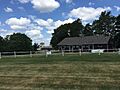
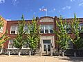
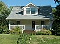
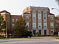
- Affton High School: This school in Affton was added to the list in 2010. Imagine all the students who have learned here over the years!
- Ferguson School Central School: Located in Ferguson, this old school building joined the list in 1984. It's a reminder of how education has grown in the area.
- J. Milton Turner School: In Kirkwood, this school was recognized in 2002. Schools like this are important parts of their communities' history.
- Nathaniel Hawthorne Elementary School: This school in University City became a historic place in 2017.
- Osage Hills School: Another Kirkwood school, added in 2007, showing the importance of local schools.
- Pond School: Found in Wildwood, this school building was listed in 2012.
- Rott School: In Sunset Hills, this school joined the list in 2005.
Homes with Stories
Many old houses in St. Louis County are on the list, each with its own history:
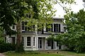
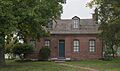
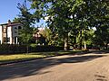
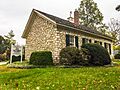
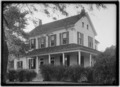
- Archambault House: A historic home in Florissant, listed in 1976.
- August Aubuchon House and Baptiste G. Aubuchon House: Two more old homes in Florissant, added in 1979 and 1976.
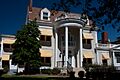
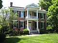
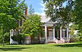
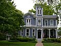
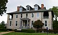
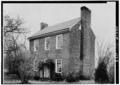
- Louis Auguste Benoist House: Also known as Oakland, this house in Affton was listed way back in 1969.
- Gen. Daniel Bissell House: This house in Bellefontaine Neighbors was added in 1978.
- William Bopp House: A historic home in Kirkwood, listed in 2006.
- Carney-Keightley House: This house in Fenton joined the list in 2010.
- Casa Alvarez: Another historic house in Florissant, listed in 1976.
- Martin Franklin Hanley House: Located in Clayton, this house was added in 1971.
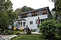
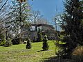
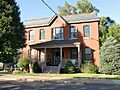
- Hawken House: A well-known historic home in Webster Groves, listed in 1970.
- Wilson Price Hunt House: This house in Normandy was added in 1980.
- Jarville: Found between Manchester and Town and Country, this house was listed in 1984.
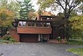
- Russell and Ruth Goetz Kraus House: A unique house in Kirkwood, added in 1997.
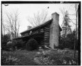
- William Long Log House: An old log house in Crestwood, listed in 1978.
- Joseph Sappington House and Thomas J. Sappington House: Two important Sappington family homes in Affton and Crestwood, listed in 1982 and 1974.
Parks and Outdoor Spots
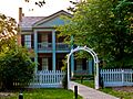
- Dr. Edmund A. Babler Memorial State Park Historic District: This beautiful park northwest of Grover was listed in 1985. It's a great place to explore nature and history.
- Coldwater Cemetery: A historic cemetery in Florissant, added in 2004. Cemeteries often hold important stories about the people who lived in an area.
- Greenwood Cemetery: This cemetery in Hillsdale was listed in 2004.
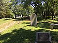
- Jefferson Barracks Historic District: A very important military site south of St. Louis, listed in 1972. It played a big role in American history.
- Jefferson Barracks National Cemetery: This cemetery in Green Park was added in 1998. Many brave soldiers are buried here.
- Rosalie Tilles Park: A lovely park in Ladue, listed in 2018.
Unique Buildings and Landmarks
- Assumption Greek Orthodox Church: A beautiful church in University City, listed in 1980.
- B'Nai Amoona Synagogue: This synagogue in University City was added in 1984.
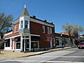
- Bank of St. Ann: An old bank building in St. Ann, listed in 2020.
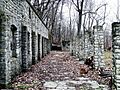
- Barretts Tunnels: These tunnels in Kirkwood were recognized in 1978. They are part of the area's transportation history.
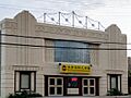
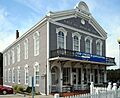
- Beverly Theater: An old movie theater in University City, listed in 2005. Imagine watching movies here long ago!
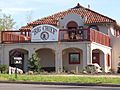
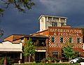
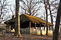
- Big Chief Restaurant: This unique restaurant in Wildwood was added in 2003. It's a cool example of roadside architecture.
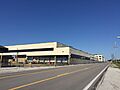
- Curtiss-Wright Aeroplane Factory: This factory in Hazelwood was listed in 2016. It played a part in building airplanes!
- Des Peres Presbyterian Church: A historic church in Frontenac, listed in 1978.
- Gorlock Building: A commercial building in Webster Groves, added in 1984.
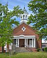
- Grace Episcopal Church: This church in Kirkwood was listed in 1982.
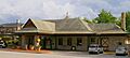
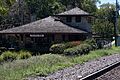
- Kirkwood Missouri Pacific Depot: The old train station in Kirkwood, added in 1985. Train stations are often important hubs in a town's development.
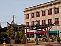
- Kreienkamp Store: An old store in Wildwood, listed in 2000.
- The Lyceum: A historic building in Manchester, added in 1979.
- Manchester United Methodist Church: This church in Manchester was listed in 1983.
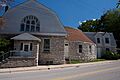
- Old Stone Church: A very old church in Chesterfield, listed in 1973.
- Red Cedar Inn: An inn in Pacific, listed in 2003.
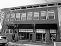
- Saratoga Lanes Building: A historic bowling alley building in Maplewood, listed in 2008.
- Seven Gables Building and Shanley Building: Two historic buildings in Clayton, listed in 1985 and 1982.
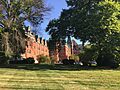
- St. Stanislaus Seminary: A seminary in Florissant, listed in 1972.
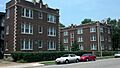
- St. Vincent's Hospital: A historic hospital in Normandy, added in 1982.
- Tuxedo Park Christian Church: This church in Webster Groves was listed in 2006.
- Tuxedo Park Station: A former train station in Webster Groves, added in 1984.
- U.S. Army Publications Distribution Center: This center in Overland was listed in 2015.
- White Haven; Ulysses S. Grant National Historic Site: This important site in Grantwood Village was the home of Ulysses S. Grant, a famous general and president. It was listed in 1979.
Historic Districts
Some areas have many historic buildings together, forming a "historic district."
- Ball-Essen Farmstead Historic District: A historic farm area in Wildwood, listed in 2001.
- Bennett Avenue Historic District: A neighborhood in Richmond Heights, added in 2008.
- Brentmoor Park, Brentmoor and Forest Ridge District: A historic neighborhood in Clayton, listed in 1982.
- Burkhardt Historic District: An area in Chesterfield, added in 2000.
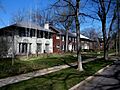
- Central Webster Historic District: A historic area in Webster Groves, listed in 1986.
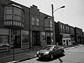
- Church Street Commercial District: A business area in Ferguson, added in 1984.
- Claverach Park: A historic park area in Clayton, listed in 2015.
- Delmar Loop-Parkview Gardens Historic District: A lively area in University City, listed in 1984.
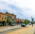
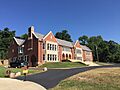
- Downtown Kirkwood Historic District: The historic downtown area of Kirkwood, added in 2009.
- Glen Echo Historic District: An area in Normandy and Glen Echo Park, listed in 2007.
- Hampton Park: A historic park in Richmond Heights, added in 2005.
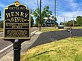
- Henry Avenue Historic District: An area in Manchester, listed in 2003.
- Hi-Pointe-De Mun Historic District: A historic area in Clayton, added in 2005.
- Maplewood Commercial Historic District at Manchester and Sutton: A business area in Maplewood, listed in 2006.
- Old Webster Historic District: The historic part of Webster Groves, added in 2004.
- Orrville Historic District: An area in Wildwood, listed in 2003.
- Pasadena Hills Historic District: The entire city of Pasadena Hills is a historic district, listed in 2004.
- St. Ferdinand Central Historic District: A central historic area in Florissant, listed in 1979.
- St. Ferdinand's Shrine Historic District: Another historic area in Florissant, added in 1979.
- Thornhill: A historic area in Chesterfield, listed in 1974.
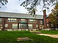
- University City Education District: An area in University City focused on education, listed in 1985.
- University City Plaza: A plaza in University City, listed in 1975.
- University Heights Subdivision Number One: A historic neighborhood in University City, added in 1980.
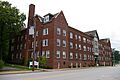
- Webster College-Eden Theological Seminary Collegiate District: An area in Webster Groves with historic college buildings, listed in 1982.
- Webster Park Residential Historic District: A historic neighborhood in Webster Groves, added in 2008.
- Wydown-Forsyth District: A historic area in Clayton, listed in 1988.
Archeological Sites
Some listings are important for what they tell us about ancient times.
- Bonhomme Creek Archeological District: An area in Chesterfield important for its ancient findings, listed in 1974.
- Crescent Quarry Archeological Site: A site south of the Meramec River in Crescent, listed in 1971. It's a large area that tells us about early human activity.
- Sioux Passage Park Archeological Site: A site in Florissant, listed in 1974.
- Williams Creek Archeological District: A site in St. Louis County, listed in 1977.
Images for kids
-

Affton High School
-

Archambault House
-

Assumption Greek Orthodox Church
-
John C. and Georgie Atwood House
-

August Aubuchon House
-

Baptiste G. Aubuchon House
-

B'Nai Amoona Synagogue
-
Ball-Essen Farmstead Historic District
-

Barretts Tunnels
-
Barteau House
-
Barton House
-

Dr. Samuel A. Bassett Office and Residence
-
Romanzo N. Bayley House
-
Bellecourt Apartments
-
Bennett Avenue Historic District
-

Louis Auguste Benoist House (Oakland)
-
Beverly Theater
-
Big Chief Restaurant
-

Gen. Daniel Bissell House
-

John P. and Dora Blake House
-
Bockwrath-Wiese House
-
William Bopp House
-

Bouas House
-
Brentmoor Park, Brentmoor and Forest Ridge District
-

Burkhardt Historic District
-
Dr. Leander W. Cape Buildings
-
Carney-Keightley House
-
Carrswold Historic District
-
Casa Alvarez
-
Central Webster Historic District
-
Charbonier Bluff
-
Church Street Commercial District
-
Judge Enos Clarke House
-
Claverach Park
-
Coldwater Cemetery
-

James H. and Marietta Comfort House
-
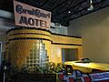
Coral Court Motel (Demolished)
-
Cori House
-
Cragwold
-
Curtiss-Wright Aeroplane Factory
-
Rudolph and Dorothy C. Czufin House
-
Delmar Loop-Parkview Gardens Historic District
-
Des Peres Presbyterian Church
-
Donaldson Court Apartments
-
Douglas House
-
Downtown Kirkwood Historic District
-
Dr. Edmund A. Babler Memorial State Park Historic District
-
East Monroe Historic District
-

Fairfax House
-

Farmers State Bank of Chesterfield
-

Ferguson School Central School
-
Charles W. Ferguson House
-

George W. and Virginia Fishback House
-
Fort Bellefontaine
-

Louisa Garrett House
-
Glen Echo Historic District
-
Goldbeck House
-
Gorlock Building
-

Grace Episcopal Church
-
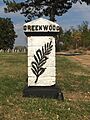
Greenwood Cemetery
-
Greenwood Historic District
-

Haarstick-Whittemore Houses
-

Egbert W. Halsey Cottage
-
Harry Hammerman House
-
Hampton Park
-
Martin Franklin Hanley House
-

Hanson House
-
Hawken House
-
Nathaniel Hawthorne Elementary School
-
Henry Avenue Historic District
-
Hi-Pointe-De Mun Historic District
-

Hubecky House
-

Wilson Price Hunt House
-
J. Milton Turner School
-
Jarville
-

Jefferson Barracks Historic District
-

Jefferson Barracks National Cemetery
-
Jefferson-Argonne Historic District
-

David Keith House
-
Kirkwood Missouri Pacific Depot
-
Robert Koch Hospital (Demolished)
-

Kramer House
-
Russell and Ruth Goetz Kraus House
-
Kreienkamp Store
-
Kuehn House
-
Ladue Estates
-
Lance House
-
Marcus Laramie House
-

Wilson Larimore House
-
Theodore Link Historic Buildings
-
William Long Log House
-
The Lyceum
-
Manchester United Methodist Church
-
Maplewood Commercial Historic District at Manchester and Sutton
-
Maplewood Historic Commercial District
-
Marshall Place Historic District
-
Maryland Terrace Historic District
-
McGarry House
-
Lizzie McLagan House
-
Patrick and Moire McMullen House
-
McPherson-Holland House
-
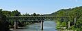
Meramec River U.S. 66 Bridge - J421
-

Meyer House
-

Frank Moellring House
-
Moller House
-
Moorlands Addition Apartment District
-

Mount Hope Cemetery
-
Mudd's Grove
-

Joseph and Ann Murphy Residence
-

John B. Myers House
-

Narrow Gauge Railroad Station
-

New Mount Sinai Cemetery
-

Nicolay House
-
Nims Mansion
-

Prof. Frances E. Nipher House
-
North Taylor Avenue Historic District
-
Norwood Hills Country Club
-

Old Ferguson West Historic District
-

Old Stone Church
-
Old Webster Historic District
-
Olive Chapel African Methodist Episcopal Church
-
Orrville Historic District
-
Osage Hills School
-
Theodore A. Pappas House
-
Parkview Historic District
-

Pasadena Hills Historic District
-
Elisha and Lucy Patterson Farmstead Historic District
-

Payne-Gentry House
-

Peters House
-
Samuel Plant House
-
Pond School
-
Charles S. and Mary Warder Rannells House
-

Red Cedar Inn
-

Reeb House
-

Theodore and Lena Richter House
-

Rickelman House
-

Otto Ripple Agency
-

George R. and Elsie Robinson House
-
Rock House, Edgewood Children's Center
-
Rockwood Court Apartments
-
Rott School
-

St. Ferdinand Central Historic District
-

St. Ferdinand's Shrine Historic District
-

St. Stanislaus Seminary
-
St. Vincent's Hospital
-

Joseph Sappington House
-
Thomas J. Sappington House
-
Saratoga Lanes Building
-

Schmidt House
-
Schoonover House
-

Seven Gables Building
-
Shanley Building
-
Smith House
-

Stroer House
-

Sutter-Meyer House
-

Taille de Noyer
-

Tebeau House
-

Marvin Tebeau House
-
Thornhill
-
Rosalie Tilles Park
-

G.W. Tolhurst House
-
Tuxedo Park Christian Church
-
Tuxedo Park Station
-
U.S. Army Publications Distribution Center
-
University City Education District
-
University City Plaza
-
University Heights Subdivision Number One
-
Elijah J. Unsell House
-
James W. and Mary Way House
-

Webster College-Eden Theological Seminary Collegiate District
-
Webster Park Residential Historic District
-
White Haven; Ulysses S. Grant National Historic Site
-
Wildwood House
-
Withington House
-
Wydown-Forsyth District


.jpg)


_House_NRHP_84002634_046.jpg)


.jpg)


.jpg)

.jpg)


