Near South Side, Chicago facts for kids
Quick facts for kids
Near South Side
|
|
|---|---|
| Community Area 33 - Near South Side | |
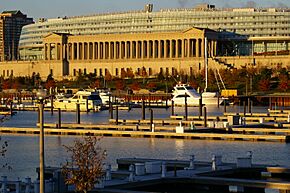
Soldier Field and Burnham Park Harbor
|
|
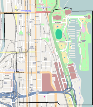
Streetmap
|
|
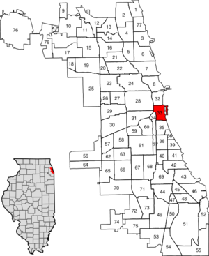
Location within the city of Chicago
|
|
| Country | United States |
| State | Illinois |
| County | Cook |
| City | Chicago |
| Neighborhoods |
List
South Loop
Prairie Avenue District Central Station Museum Campus Dearborn Park Southbridge (Ickes Prairie Homes) Bronzeville Prairie Shores |
| Area | |
| • Total | 1.75 sq mi (4.53 km2) |
| Elevation | 594 ft (181 m) |
| Population
(2020)
|
|
| • Total | 28,795 |
| • Density | 16,463/sq mi (6,357/km2) |
| population up 202.8% from 2000 | |
| Demographics 2020 | |
| • White | 51.4% |
| • Black | 22.5% |
| • Hispanic | 4.2% |
| • Asian | 19.1% |
| • Other | 2.9% |
| Time zone | UTC-6 (CST) |
| • Summer (DST) | UTC-5 (CDT) |
| ZIP Codes |
parts of 60605, 60607, 60616
|
| Median household income 2020 | $115,993 |
| Source: U.S. Census, Record Information Services | |
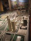
The Near South Side is a special area in Chicago, Illinois, United States. It sits just south of the city's main downtown area, known as the Loop. This community is famous for its important landmarks and lively neighborhoods.
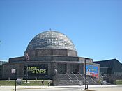
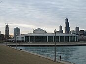
Its borders are: Roosevelt Road to the north, 26th Street to the south, Lake Michigan to the east, and the Chicago River and Clark Street to the west. Along the lakefront, you'll find some of Chicago's most well-known spots. These include Soldier Field, home to the NFL's Chicago Bears, and McCormick Place, a huge convention center. The Museum Campus is also here, with the Field Museum, Shedd Aquarium, and Adler Planetarium. The Near South Side is always growing, with new homes and buildings being built.
Contents
Discovering the Near South Side's Past
The Near South Side has changed a lot over time. It started as land for Native American tribes. Then, it became a place for workers, later a fancy neighborhood, and now it's a mix of homes and businesses.
How the Area Changed Over Time
This area was once known for wagon trails near Lake Michigan. In 1812, the Fort Dearborn Massacre happened on one of these trails. Early settlers worked for the Illinois & Michigan Canal and in the lumber industry. The railroads brought factories and shops to the area.
In 1853, Chicago grew to include this community. The Illinois Central Railroad was also built here. In 1859, a horse-drawn streetcar line connected the area to downtown. This made it popular for wealthy families. By the time of the Great Chicago Fire in 1871, it had many grand mansions.
Around 1900, people started moving further from downtown. Railroads brought more warehouses and factories. Michigan Avenue became a street for car dealerships. Burnham Park and museums were built in the 1910s and 1920s. After World War I, many African Americans moved here, creating a low-rent area. Later, new housing projects replaced some older buildings.
The Century of Progress World's Fair
From 1933 to 1934, the Near South Side hosted the Century of Progress International Exposition. This World's Fair celebrated Chicago's 100th birthday. It focused on new technology and innovation. Over 40 million people visited the fair. It gave people hope during the Great Depression.
The Near South Side Today
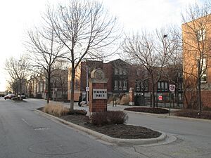
In the mid-1900s, much of the Near South Side was covered by railroad tracks. But in the 1960s, new homes were built. In 1977, George Halas helped turn 51 acres of railyards into Dearborn Park. This area now has apartments, townhouses, and tree-lined paths. More housing construction began in 1988. A big housing boom started in the 1990s and continues today. Many new condo and apartment towers have been built.
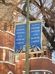
The Central Station development began in 1990. This project turned 72 acres of old rail yards into a mixed-use area. It includes homes, shops, and offices. Old warehouses and factories along Michigan, Indiana, and Wabash Avenues were also turned into homes. Famous buildings like One Museum Park and One Museum Park West are part of this new development.
| Historical population | |||
|---|---|---|---|
| Census | Pop. | %± | |
| 1930 | 10,416 | — | |
| 1940 | 7,306 | −29.9% | |
| 1950 | 11,317 | 54.9% | |
| 1960 | 10,350 | −8.5% | |
| 1970 | 8,712 | −15.8% | |
| 1980 | 7,243 | −16.9% | |
| 1990 | 6,828 | −5.7% | |
| 2000 | 9,653 | 41.4% | |
| 2010 | 21,390 | 121.6% | |
| 2020 | 28,795 | 34.6% | |
Parks and Museums to Explore
In the 1920s and 1930s, new land was created along Lake Michigan. This land became Burnham Park and Northerly Island. The Field Museum of Natural History, Soldier Field, Adler Planetarium, and John G. Shedd Aquarium were built on this new land. Later, Merrill C. Meigs Field Airport was added. Northerly Island connects to the Museum Campus by a narrow path. This path has sculptures of famous people like Kościuszko and Nicolaus Copernicus.
The new Central Station area also has three parks. Mark Twain Park is near Lake Shore Drive. Daniel Webster Park is surrounded by homes. The Grant Park Extension is east of One Museum Park. These parks add green spaces for everyone to enjoy.
McCormick Place Convention Center
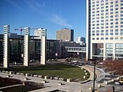
Because of all the fairs and shows, a large exhibition hall was needed. In 1960, McCormick Place was built. It's a huge convention center at 23rd Street and Lake Shore Drive. It's named after newspaper owner Robert R. McCormick. The first building burned down in 1967. But it was rebuilt and reopened in 1971.
McCormick Place has been expanded many times. It now includes the Arie Crown Theater. It also hosts the annual Chicago Auto Show.
Historic Buildings and Landmarks
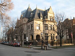
The Near South Side has many historic buildings. The Prairie Avenue Historic District is here. It includes the John J. Glessner House and the Henry B. Clarke House. The Glessner House is now a museum. The historic R. R. Donnelley & Sons printing building is also in this area. It now holds important network equipment for the city.
The Fort Dearborn Massacre sculpture is on the property of the George Pullman residence. It honors the historical event that happened in the neighborhood. Many families from Prairie Avenue attended the historic Second Presbyterian Church.
Many buildings in this area are listed on the National Register of Historic Places (NRHP). These include the Adler Planetarium, Field Museum of Natural History, Shedd Aquarium, and Soldier Field. Several historic districts, like the Motor Row District, are also largely within the Near South Side.
Modern Redevelopment and Growth
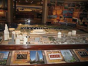
Since the mid-1990s, many old factories have been turned into loft apartments. This redevelopment continued into the early 2000s. The South Loop area has expanded with new homes. The Central Station neighborhood is a major new development. It includes One Museum Park, One Museum Park West, and many other homes. This project is built on 72 acres of former rail yards.
Old warehouses in areas like Printer's Row have also been turned into homes. This means streets like Michigan, Wabash, and Indiana Avenues are becoming residential again. In 2006, the Prairie District Neighborhood Alliance was formed. This group helps represent residents in the South Loop and Near South Side.
Understanding the Streets
Lake Shore Drive was rebuilt in 1996. Now, it no longer cuts through the Museum Campus. Before, the northbound lanes ran east of Soldier Field. Now, both northbound and southbound lanes run west of Soldier Field.
Roosevelt Road is the northern border of the Near South Side. North of Roosevelt Road, streets have names. South of Roosevelt, most streets use numbers, like 13th Street or 26th Street. Some named streets here are Cullerton Street (20th Street) and Cermak Road (22nd Street).
South Loop and Printer's Row Overlap
Sometimes, it can be confusing where the South Loop neighborhood begins and ends. The South Loop includes Printer's Row. Some people say its southern border is Cermak Street. The Prairie District Neighborhood Alliance supports residents in the South Loop and Near South Side.
The Greater South Loop Association represents residents between Congress Parkway and the Stevenson Expressway. South Loop Neighbors helps residents as far south as 15th Street. Fodor's defines the South Loop as the area between Cermak, Michigan Avenue, the Chicago River, and Congress Parkway.
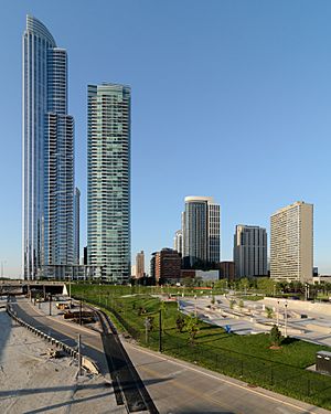
The South Loop is described as being just south of "the Loop." However, "the Loop" can mean different things. It can be the community area bounded by the Chicago River, Lake Michigan, and Roosevelt Road. Or it can refer to the area inside the circular Chicago "L" train tracks. This train-related area is the northern part of the Near South Side. So, the South Loop is part of the Near South Side community area.
Famous People from the Near South Side
- Philip Danforth Armour (1832–1901): A meatpacking business leader. He lived on South Prairie Avenue.
- Richard M. Daley (born 1942): The 54th Mayor of Chicago. He moved to the Near South Side in 1993 while he was mayor.
- William Kimball (1828–1904): A businessman who founded the Kimball Piano Company. He lived on South Prairie Avenue in the 1890s.
- Major Robert Henry Lawrence Jr. (1935–1967): An officer in the United States Air Force and the first African American astronaut. He grew up on West 23rd Street.
- Frank Leland (1869–1914): A baseball player and team owner in the Negro leagues. He lived on South Dearborn Avenue.
Schools in the Near South Side
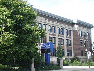
Students living in the Near South Side attend schools run by Chicago Public Schools. Elementary and middle schools in the area include Drake School, National Teacher Academy, and South Loop School. For high school, students in the Near South Side go to Phillips Academy High School.
 | William M. Jackson |
 | Juan E. Gilbert |
 | Neil deGrasse Tyson |


