Plum Island (Massachusetts) facts for kids
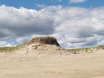
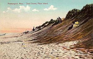
Sand dunes on Plum Island, Massachusetts.
|
|
| Lua error in Module:Location_map at line 420: attempt to index field 'wikibase' (a nil value).
Location of Plum Island in northeastern Massachusetts.
|
|
| Etymology | Named for the preponderance of beach plum thickets on the island. |
|---|---|
| Geography | |
| Location | Atlantic Ocean |
| Length | 11 mi (18 km) |
| Highest point | Sand dunes can reach 50 ft (15 m) in height above sea level |
| Administration | |
| State | |
| County | Essex |
| Towns and Cities | Newburyport (city), Newbury (town), Rowley (town), and Ipswich, Massachusetts (town) |
| Additional information | |
| Time zone | |
| • Summer (DST) | |
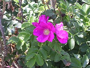
Plum Island is a long, narrow island located off the coast of Massachusetts, in the northeastern United States. It stretches about 11 miles (18 km) in length. The island gets its name from the wild beach plum bushes that grow on its sandy dunes. It's also known for its unique purple sand, which gets its color from tiny pink crystals called pyrope garnet.
Plum Island is part of four different towns in Essex County. These towns are Newburyport, Newbury, Rowley, and Ipswich.
Contents
Plum Island's History
Early Explorers and Maps
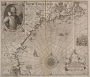
Plum Island first appeared on maps as an unnamed island in 1616. This map was created by Captain John Smith, a famous explorer. He described a harbor near "Angoam" (now Ipswich) with many sands at its entrance. He also mentioned an island nearby that was "two or three leagues in length."
Captain Smith wrote that half of the island was "plain morish grass fit for pasture." This means it had marshy grass, good for animals to eat. He also saw "many fair high groves of mulberry trees gardens." Today, we believe these "mulberry" trees were actually beach plum bushes, which love to grow on the tops of sand dunes.
Land Ownership and Division
In 1621, a group called the Council for New England tried to give the land, including Plum Island, to Captain John Mason. They wanted to name it the Isle of Mason. However, Mason never used the land. Later, the land was given to the Massachusetts Bay Colony.
By 1639, settlers were using Plum Island. People from Ipswich, Newbury, and Rowley wanted to use the island for their animals. A document from January 1639 shows that two men from Ipswich agreed to keep 48 hogs on Plum Island.
Other towns quickly reacted. Newbury asked the General Court of Massachusetts to own the whole island. They said they could drive wagons across to the island at low tide because "there is no channel betwixt us and it." But the court decided on October 17, 1649, to divide the island. Newbury and Ipswich each got two-fifths of the island, and Rowley received one-fifth. The name "Plum Island" was already being used locally because of the many plum bushes.
Plum Island Today
Plum Island is surrounded by water. To the north is the mouth of the Merrimack River. To the west are the Plum Island River and Plum Island Sound. These waters connect to other rivers like the Parker, Rowley, and Eagle Hill rivers. The Ipswich River flows into the sound at the south. The Atlantic Ocean is to the east. The sound is a tidal estuary, meaning it's where fresh river water mixes with salty ocean water.
The Village and Wildlife Refuge
The island has a developed area called the village of Plum Island, Massachusetts. Here you'll find public beaches, businesses, and homes. This village is mainly in Newburyport and Newbury.
The largest part of the island is a protected area called the Parker River National Wildlife Refuge. This refuge is managed by the United States Fish and Wildlife Service. It's a special place for birds and other wildlife. People can visit to swim, hike, surf, fish, and watch birds. In 1985, The Trust for Public Land helped add more land to the refuge.
Getting Around the Island
You can reach Plum Island by a single road from Newburyport. This road crosses a causeway and a drawbridge over the Plum Island River. This road was built in 1806 and became a public road in 1905.
Plum Island Drive runs along the island's inner side. In the north, it has many homes. In the wildlife refuge, part of it is paved, and part is a dirt road. Along this road, you'll find parking lots with boardwalks that lead to the beach. There are also places to observe nature and trails.
At the southern end of the island is Sandy Point State Reservation, a state park that is open for day visits. At the northern tip of the island stands the Plum Island Lighthouse. This lighthouse guides boats into the narrow mouth of the Merrimack River. Be careful when boating or swimming near the river mouths, as the strong tidal currents can be dangerous.
Visiting Plum Island
Plum Island has always been a popular spot for vacations. In the past, there were many large hotels. Today, you can find places to stay like bed and breakfasts, inns, and rental cottages. Many people also live on the island all year round.
During the summer, from Memorial Day to Labor Day, a shuttle bus runs from Plum Island Point to downtown Newburyport. This bus can connect you to the Newburyport commuter rail station, where you can take a train to Boston. The bus ride costs $1.25 for adults.
Plum Island's Nature
The Great Marsh
Plum Island acts like a natural wall, protecting the Plum Island River, Plum Island Sound, and the mouths of several other rivers. The entire area between the island and the mainland is a huge grassland with many tidal creeks. This area is called the "Great Marsh."
At high tide, the marsh grass is covered by a few inches of water. At other times, you can see vast stretches of grass. The creeks either dry up or become small channels in mud flats, where shellfish live. The lower parts of the rivers and Plum Island Sound are tidal estuaries, where fresh river water meets the ocean's salt water.
The Great Marsh is very important. Environmental groups work together to protect these marshes from being harmed.
The Beach and Dunes
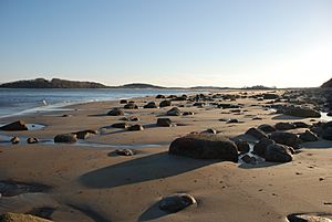
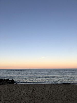
Plum Island Beach slopes gently into the sea. This means the waves are usually small and close to shore, making it easy to launch small boats. However, the gentle slope can also create strong undertow currents, which can be dangerous for swimmers. During big storms, the ocean waves can reach the sand dunes.
The Labrador Current flows south along the coast, moving sand in that direction. This sand movement can change the location of the Merrimack River's mouth, which has been kept in its current spot by human efforts. Several structures have been built along the north coast to protect the beach from erosion.
Plants of Plum Island
The sand dunes are covered by delicate plants like beach grass, beach pea, and beach heather. These plants help hold the sand in place. To protect them, visitors to the refuge must stay on boardwalks when crossing the dunes. In 1953, thousands of black pine trees were planted to help stabilize the sand.
You can also find groups of black pine, pitch pine, and eastern red cedar trees in the dips between the dunes. Thickets of beach plum, bayberry, and honeysuckle (which is not native) also grow here. The beach plum is why the island got its name!
Some dunes can be as high as 50 feet (15 meters). In deeper, more sheltered areas, there are vernal pools. Here, you might find black oak, red maple, and black cherry trees. Cranberry plants grow in the underbrush. The ferns, moss, and fallen leaves in these areas provide homes for salamanders and spadefoot toads.
The native salt-water marshes between Plum Island and the mainland are visible from the island's western side. Salt marsh hay, which grows there, was once harvested to feed farm animals. Closer to the water, you'll see smooth cordgrass and different types of sedge plants.
In the 1940s and 1950s, the wildlife service created two freshwater marshes, North and South Pools. These pools collect rainwater from the island and are important nesting and resting areas for migrating birds.
Animals of Plum Island
Mammals
The mammals on Plum Island are similar to those found in other Massachusetts woodlands. You might see striped skunks, raccoons, red foxes, white-tailed deer, and various small rodents like the meadow jumping mouse, meadow vole, and white-footed mouse.
Birds
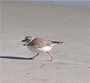
Plum Island and its surrounding waters are a very popular place for birders. The Plum Island Sound is on a major migratory route for many bird species. It's also a nesting area for piping plovers, which are protected birds. Because of this, much of the beach in the National Wildlife Refuge is closed during nesting season, which can last for most of the warmer months.
There are special spots with signs where you can watch birds. Some are hidden blinds, while others are just paved areas. Birds are often seen in the salt-water marshes, the freshwater marshes, and among the trees and bushes.
Some of the birds you might see include the greater yellowlegs, mallard duck, least sandpiper, great egret, snowy egret, herring gull, great black-backed gull, osprey, Canada goose, tree swallow, gray catbird, killdeer, glossy ibis, red-winged blackbird, northern mockingbird, least tern, piping plover, and peregrine falcon.
Staying Safe on the Island
Insects and Plants to Watch For
While enjoying Plum Island, it's good to be aware of some common insects and plants.
- Greenhead flies: These biting flies can be a nuisance in summer (June to September). Traps have helped reduce their numbers, but you might still get an occasional bite.
- Ticks: Dog ticks and deer ticks can attach to your clothes and skin. Deer ticks can carry Lyme disease, so it's important to check yourself carefully after being outdoors.
- Mosquitoes: Mosquitoes are common in Massachusetts. Control efforts have reduced their numbers in the Newbury area.
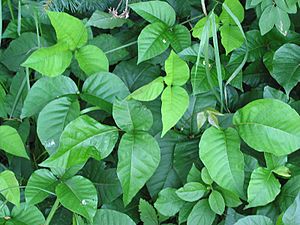
- Poison ivy:
Poison ivy grows everywhere in the woodlands of Massachusetts, especially along paths. On Plum Island, it's found in thickets and along the sand. The visitor center will remind you to learn how to identify its shiny leaves with three leaflets to avoid touching it.
See also
 In Spanish: Isla Plum (Massachusetts) para niños
 | Selma Burke |
 | Pauline Powell Burns |
 | Frederick J. Brown |
 | Robert Blackburn |


